Category:Rivers of Ontario
Salti al navigilo
Salti al serĉilo
Provincoj kaj Teritorioj de Kanado: Alberta · British Columbia · Manitoba · New Brunswick · Newfoundland and Labrador · Nova Scotia · Ontario · Prince Edward Island · Quebec · Saskatchewan · Northwest Territories · Nunavut · Yukon
kategorio en Vikimedio | |||||
| Alŝuti plurmedion | |||||
| Estas | |||||
|---|---|---|---|---|---|
| Kategorio kombinas temojn | |||||
| Kategorio enhavas | |||||
| |||||
Subkategorioj
Ĉi tiu kategorio havas la 158 jenajn subkategoriojn, el 158 entute.
- River banks in Ontario (7 D)
*
A
- Abitibi River (9 D)
- Agawa River (6 D)
- Amable du Fond River (8 D)
- Ashbridge's Creek (7 D)
- Attawapiskat River (4 D)
- Aubinadong River (4 D)
B
- Baldhead River (7 D)
- Barron River, Ontario (6 D)
- Bayfield River (4 D)
- Beaver River (Lake Simcoe) (4 D)
- Black Ash Creek (3 D)
- Black Creek (Ontario) (13 D)
- Black River (York Region) (3 D)
- Blanche River (3 D)
- Blind River (Ontario) (9 D)
- Bonar Creek (2 D)
- Burnt River (4 D)
C
- Carp River (Ottawa) (3 D)
- Carruthers Creek (Ontario) (2 D)
- Castle Frank Brook (3 D)
- Cataraqui River (6 D)
- Chippewa River (Ontario) (5 D)
- Clythe Creek (5 D)
- Crowe River (24 D)
D
- Duffins Creek (13 D)
E
- Eels Creek (3 D)
- Ekwan River (empty)
- Englehart River (6 D)
F
- Fort Creek (8 D)
- Frederick House River (2 D)
G
- Gananoque River (18 D)
- Ganaraska River (10 D)
- Garrison Creek (23 D)
- Go Home River (6 D)
- Goulais River (Ontario) (19 D)
- Gull River (Central Ontario) (4 D)
H
- Rivière Harricana (8 D)
- Harris River (Ontario) (9 D)
J
- Jackson Creek (Toronto) (6 D)
- Junction Creek (3 D)
K
- Kapuskasing River (3 D)
- Kenogami River (12 D)
- Kesagami River (3 D)
- Kettle Creek (4 D)
L
- Laurentian River (1 D)
- Little Pic River (4 D)
- Loyalist creek (1 D)
- Lynde Creek (1 D)
M
- Magpie River (Ontario) (5 D)
- Mattagami River (7 D)
- Mattawa River (9 D)
- Mattawishkwia River (3 D)
- McIntyre River (4 D)
- Michipicoten River (7 D)
- Mill Creek, Ontario (7 D)
- Misema River (3 D)
- Mississagi River (7 D)
- Moon River (Ontario) (7 D)
N
- Nagagami River (6 D)
- Napanee River (9 D)
- Nith River (6 D)
O
- Old Woman River (Canada) (5 D)
- Onaping River (2 D)
- Opasatika River (1 D)
- Oskondaga River (2 D)
P
- Petawawa River (48 D)
- Petticoat Creek (2 D)
- Pic River (1 D)
- Porcupine River (Ontario) (5 D)
R
- Raisin River (Ontario) (3 D)
- Rivière Rigaud (4 D)
- Roaring River (empty)
- Russell Creek (3 D)
S
- Salmon River (Ontario) (5 D)
- Sand River (Ontario) (34 D)
- Scugog River (11 D)
- Seguin River (3 D)
- Shebandowan River (3 D)
- Skootamatta River (6 D)
- South Nation River (2 D)
- Spanish River (Ontario) (6 D)
- Steel River (3 D)
- Styx River, Ontario (2 D)
- Superior Creek (2 D)
T
- Taddle Creek (15 D)
W
- Wabigoon River (5 D)
- Welland River (4 D)
- Winisk River (4 D)
Y
Dosieroj en kategorio “Rivers of Ontario”
La jenaj 182 dosieroj estas en ĉi tiu kategorio, el 182 entute.
-
 158. Mississauga River, Aug. 1909 (26430578282).jpg 2 816 × 2 093; 745 KB
-
 160. Missisauga River, Aug. 1909 (25920020693).jpg 2 974 × 2 025; 454 KB
-
 171a 365 - Green Pond (4985235160).jpg 2 592 × 1 936; 2,71 MB
-
 DENT(1881) 1.079 BRACEBRIDGE, MUSKOKA.jpg 2 009 × 1 417; 2,24 MB
-
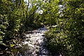
 1997-10-bruce-trail-river-r.jpg 723 × 500; 209 KB
-
 1997-12-bruce-trail-river.jpg 730 × 500; 144 KB
-

-
 Ausable River (I0015243).jpg 2 497 × 1 970; 3,59 MB
-
 Autumn tree (6317252330).jpg 1 024 × 680; 357 KB
-
 AuxSablesRiver23.jpg 250 × 144; 9 KB
-
 Awaken Stream (212265065).jpeg 2 048 × 1 365; 912 KB
-
 Balls Falls Gorge (6871695862).jpg 1 024 × 686; 336 KB
-
 Batchawana River.JPG 3 000 × 2 000; 1,19 MB
-
 Bayfield River - Egmondville, ON.jpg 6 000 × 3 376; 10,22 MB
-
 Beamers Conservation Area (7017845367).jpg 1 024 × 686; 318 KB
-
 Belfountain 2.jpg 3 264 × 2 448; 1,49 MB
-
 BIGchute-ontario.jpg 792 × 528; 170 KB
-
 Bighead River (10519864264).jpg 4 434 × 2 353; 6,18 MB
-
 Black Creek. Niagara - panoramio.jpg 4 096 × 3 040; 2,48 MB
-
 Boats in river (I0015616).jpg 2 494 × 1 974; 3,53 MB
-
 Boreal Stream (37490100262).jpg 5 312 × 2 988; 8,39 MB
-
 Boyne River at Earl Rowe Park.jpg 2 205 × 777; 203 KB
-
 Canadian Shield (36750930366).jpg 2 048 × 1 152; 613 KB
-
 Canadian Shield (36750932806).jpg 1 152 × 2 048; 605 KB
-
 Castor River.JPG 1 152 × 1 536; 495 KB
-
 Causeway between canal and river (I0013320).tif 5 052 × 3 623; 18,23 MB
-
 Chippawa River - panoramio.jpg 2 592 × 1 944; 1,24 MB
-
 City of Alberton with four freight barges on the Rainy River (I0053064).tif 7 008 × 5 012; 33,52 MB
-
 Cobalt, Ontario (22374266853).jpg 3 227 × 2 109; 3,26 MB
-
 Coldwater River Simcoe County.jpg 1 000 × 669; 117 KB
-
 Cooksville Creek.jpg 4 000 × 3 000; 7,06 MB
-
 Creek in Whitby Forest.jpg 4 032 × 3 024; 3,62 MB
-
 Current River From Black Bay Bridge.jpg 836 × 491; 382 KB
-
 Curve IMG 1263 1 (8511335805).jpg 3 456 × 2 304; 3,98 MB
-
 Downstream (36952092724).jpg 2 988 × 5 312; 3,82 MB
-
 Drag Creek Ontario 2009.jpg 1 000 × 667; 344 KB
-
 Elora Mill View of river.jpg 4 000 × 3 000; 3,05 MB
-
 Entering the River between Penelton and Opasatika Lakes - panoramio.jpg 3 264 × 2 448; 2,49 MB
-
 Fall Run (4015186851).jpg 1 280 × 850; 278 KB
-

-
 Fishing in the Whitesand River, Thunder Bay District (I0026401).jpg 4 253 × 3 272; 5,32 MB
-
 Fishing in the Whitesand River, Thunder Bay District (I0026402).jpg 4 148 × 3 316; 4,54 MB
-

-
 Foggy morning on Desbarats River.JPG 3 264 × 2 448; 3,65 MB
-
 Forestfalls tm (5020721726).jpg 2 048 × 1 363; 619 KB
-
 Fort Severn by air.jpg 4 608 × 3 456; 2,18 MB
-
 Fourth Falls, Larder River, Timiskaming, Ontario.jpg 1 995 × 1 950; 3,62 MB
-
 General view of Picton (I0012990).tif 5 160 × 3 678; 16,05 MB
-
 General views of Grand Bend (I0015617).jpg 2 490 × 1 970; 3,13 MB
-
 Groundhog River.JPG 3 000 × 2 000; 1,12 MB
-
 Gull River at Hwy 527.jpg 2 000 × 1 334; 1,01 MB
-
 Harmony River Ontario.JPG 4 000 × 2 667; 3 MB
-
 Highway in Myers Cave (I0015643).jpg 2 483 × 1 976; 4,15 MB
-
 Hoggs Falls.jpg 4 288 × 2 848; 5,26 MB
-
 Hudson's Bay Company trading post on the Rainy River (I0052844).tif 6 758 × 5 050; 32,57 MB
-
 Huron; Sparrow Lake Chute on the Severn River (I0006965).tif 2 058 × 1 247; 7,35 MB
-
 Hutchinson rowboat taxi service (I0052816).tif 6 432 × 4 756; 29,2 MB
-
 Indian River Mill of Kintail.jpg 1 280 × 960; 395 KB
-
 Indian River Pembroke.jpg 3 072 × 2 304; 3 MB
-
 Indianriver.jpg 640 × 480; 104 KB
-
 Jockriver.jpg 640 × 480; 86 KB
-
 Johnny Creek west.jpg 960 × 576; 160 KB
-
 Kagawong River 2005.jpg 2 560 × 1 920; 2,65 MB
-
 Kenogami River from Space.jpg 3 032 × 2 064; 2,03 MB
-
 KingsForestParkD.JPG 2 272 × 1 704; 1,81 MB
-
 Koochiching Falls (I0052847).tif 6 808 × 5 038; 32,74 MB
-
 Koochiching Falls from the United States side of Rainy River (I0052848).tif 6 904 × 5 009; 33 MB
-
 Koochiching Falls with the Alberton Hotel in background (I0052850).tif 6 904 × 5 000; 32,94 MB
-
 Koochiching Falls with the Alberton Hotel in background (I0052851).tif 6 774 × 5 006; 32,36 MB
-
 Koochiching Falls with the S. S. Majestic in the background (I0052845).tif 7 037 × 5 072; 34,06 MB
-
 Koochiching Falls with the S. S. Majestic in the background (I0052846).tif 6 872 × 5 053; 33,14 MB
-
 Koochiching Falls, from upriver, with the Alberton Hotel in background (I0052849).tif 6 768 × 5 093; 32,89 MB
-
 Kopka River.jpg 2 000 × 1 334; 1,51 MB
-
 Lady Evelyn River.JPG 1 406 × 971; 314 KB
-
 Limehouse Conservation Area (39745197795).jpg 5 687 × 3 791; 11,35 MB
-
 Little Pic River (29606696998).jpg 4 272 × 2 848; 7,28 MB
-
 Low river level, Oakville. - 1908 (21449798066).jpg 1 032 × 793; 279 KB
-
 Lynn River, Ontario.jpg 4 912 × 2 760; 3,87 MB
-
 Manitou River, Manitoulin Island, Ontario (93064907).jpg 485 × 307; 41 KB
-
 Map to accompany report of the Canadian Red River Expedition., 1858.png 1 000 × 514; 459 KB
-
 Men and women gathered around Mine Centre Hotel (I0053084).tif 6 995 × 5 048; 33,7 MB
-
 Men fishing near the Nottawasaga River area (I0026327).jpg 4 139 × 3 340; 4,33 MB
-
 Moira River and Belleville City Hall by Hyunjin Jang.jpg 960 × 540; 122 KB
-
 Moon River.JPG 3 072 × 1 728; 2,77 MB
-
 Mooseland River. - panoramio.jpg 640 × 480; 110 KB
-
 Mouth of North Creek, and the grounds of the Lakeshore Psychiatric Hospital, 1936.jpg 1 217 × 1 600; 314 KB
-
 Napanee River ON.JPG 2 000 × 1 333; 1,84 MB
-
 North Sydenham River.jpg 4 032 × 2 268; 3,04 MB
-
 Nottawasaga River area (I0026398).jpg 4 372 × 3 136; 5,19 MB
-
 Oastler Lake.jpg 1 280 × 853; 111 KB
-
 Ogoki River.JPG 1 944 × 2 431; 1,29 MB
-
 Ontario Sessional Papers, 1901, No.45-79 (1901) (14595703080).jpg 3 424 × 1 408; 555 KB
-
 Ontario Sessional Papers, 1904, No.27-32 (1904) (14758681746).jpg 2 864 × 1 998; 1,13 MB
-
 Ontario Sessional Papers, 1904, No.27-32 (1904) (14778530591).jpg 2 960 × 2 090; 1,26 MB
-
 Ontario Sessional Papers, 1913, No.49-113 (1913) (14594681398).jpg 3 088 × 1 912; 890 KB
-
 Ontario Sessional Papers, 1918, No.47-49 (1918) (14583495169).jpg 3 040 × 1 932; 797 KB
-
 Opeongo River.jpg 1 024 × 768; 467 KB
-
 Overlooking the Nottawasaga River (I0026319).jpg 4 377 × 3 131; 6,04 MB
-
 Overlooking the Nottawasaga River (I0026320).jpg 4 427 × 3 138; 5,78 MB
-
 Overlooking the Nottawasaga River area (I0026360).jpg 4 198 × 3 233; 4,4 MB
-
 P5279979.JPG 1 536 × 2 048; 377 KB
-
 Panorama of Cobalt Canada (22970090506).jpg 3 275 × 1 044; 8,2 MB
-
 Part of the River (22688873133).jpg 4 272 × 2 848; 8,04 MB
-
 Passenger boat cruising along the Nottawasaga River (I0026396).jpg 4 365 × 3 110; 5,74 MB
-
 People canoeing on the Bremner River (I0005527).tif 2 150 × 1 694; 10,42 MB
-
 People making a portage into Go Home Bay. Severn River (I0004167).jpg 3 750 × 2 870; 4,2 MB
-
 Perfect October day! (4023818690).jpg 1 600 × 1 200; 604 KB
-
 Perfect October day! (cropped).jpg 1 600 × 229; 149 KB
-
 Petro taxi ferrying passengers across the Rainy River (I0052814).tif 6 627 × 4 820; 30,48 MB
-
 Pigeon-River-Omemee-Ontario.jpg 2 959 × 2 067; 1,31 MB
-
 Prarie River , First Falls. - panoramio.jpg 3 072 × 2 304; 2,85 MB
-
 Prince Edward County (9775011143).jpg 3 847 × 2 565; 5,28 MB
-
 Prince Edward County (9775151231).jpg 3 697 × 2 465; 5,69 MB
-
 PrinceOfWalesCanoeing.jpg 640 × 449; 40 KB
-
 Pukaskwa National Park.jpg 728 × 1 024; 586 KB
-
 Rankin River.jpg 1 024 × 683; 402 KB
-
 Restoule River.jpeg 2 048 × 1 536; 700 KB
-
 River (27206684411).jpg 4 266 × 3 079; 2,45 MB
-
 River - Thunder Bay.jpg 1 983 × 2 644; 3,6 MB
-
 River in Lindsay (I0015848).jpg 2 499 × 1 971; 4,56 MB
-
 River in Napanee (I0014809).jpg 2 486 × 1 966; 3,23 MB
-
 River on the Boardwalk.jpg 3 264 × 2 448; 3,26 MB
-
 River Opening (8552333463).jpg 4 928 × 2 507; 3,61 MB
-
 River Run (37630382742).jpg 1 280 × 720; 172 KB
-
 River Shoreline.jpg 1 728 × 1 296; 588 KB
-
 River side gas station on the Severn River (I0004168).jpg 2 900 × 3 711; 3,71 MB
-
 River View (29379479987).jpg 4 608 × 3 456; 3,51 MB
-
 Riverside (50448270288).jpg 4 032 × 3 024; 5,55 MB
-
 Riverside (50448966696).jpg 4 032 × 3 024; 5,3 MB
-
 Riviere La Cloche.JPG 2 000 × 1 333; 1,77 MB
-
 Rushing River Park (I0015346).jpg 1 957 × 2 500; 3,53 MB
-
 S. S. Agwinde at the Big Fort Dock, south of Devlin (I0053062).tif 6 786 × 5 028; 32,57 MB
-
 Sauble Falls Ontario (21660252923).jpg 4 608 × 3 456; 2,94 MB
-
 Sault Ste Marie, Ontario and Michigan.JPG 2 848 × 4 288; 8,47 MB
-
 Shawmere River (29664264758).jpg 4 032 × 3 024; 3,37 MB
-
 Snowshoeing adventure in Dowling, ON.png 750 × 562; 723 KB
-
 Steamboat Algoma on the Rainy River (I0053060).tif 6 973 × 5 042; 33,55 MB
-
 Steamboat Algoma with group of musicians on its upper deck (I0053059).tif 6 876 × 5 072; 33,29 MB
-
 Steamboat docked on the Rainy River (I0053054).tif 6 960 × 5 085; 33,78 MB
-
 Steamboat Keenora arriving at Emo wharf (I0002394).tiff 6 918 × 5 124; 33,83 MB
-
 Steamboat on the Rainy River (I0053051).tif 6 947 × 5 008; 33,2 MB
-
 Steamboat on the Rainy River (I0053053).tif 6 928 × 4 980; 32,92 MB
-
 Steamboat on the Rainy River coming into port (I0053052).tif 6 992 × 5 012; 33,44 MB
-
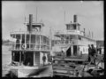
 Steamboats Clipper and Maple Leaf on the Rainy River (I0053065).tif 7 029 × 5 121; 34,35 MB
-
 Steamship "Keenora" at port (I0029868).tiff 7 637 × 5 472; 39,86 MB
-
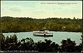 Steamship on Indian River Muskoka Lakes.jpg 655 × 421; 90 KB
-
 Steamship on the river, Northern Ontario (I0052753).tif 6 864 × 5 092; 33,35 MB
-
 Steamship S. S. Keenora coming into port (I0053055).tif 6 854 × 4 986; 32,61 MB
-
 Steamship S. S. Keenora coming into port (I0053057).tif 6 870 × 5 112; 33,52 MB
-
 Steamship S. S. Keenora in port (I0053063).tif 7 040 × 4 964; 33,35 MB
-
 Steamship, Northern Ontario (I0002393).tif 6 942 × 5 046; 33,43 MB
-
 Steamships Itasca and Agwinde at the Fort Frances wharf (I0053058).tif 6 736 × 5 012; 32,22 MB
-
 Summer Rapid Run - panoramio.jpg 2 578 × 1 667; 4,23 MB
-
 Swastika, Ontario (19790250833).jpg 3 008 × 2 000; 1,89 MB
-
 Swastika, Ontario (19790264393).jpg 3 008 × 2 000; 1,28 MB
-
 Swastika, Ontario (20384887946).jpg 3 008 × 2 000; 2,16 MB
-
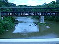 This Is Indian land 1.JPG 2 560 × 1 920; 814 KB
-
 This Is Indian land 2.JPG 2 560 × 1 920; 810 KB
-
 Top of Central Lake , Jackpine River. - panoramio.jpg 3 072 × 2 304; 1,58 MB
-
 Top of the Creek - panoramio.jpg 3 264 × 2 448; 3,5 MB
-
 Top of Zig Zag , Little Jackfish. - panoramio.jpg 3 072 × 2 304; 3,17 MB
-
 Two friends - panoramio.jpg 4 288 × 2 848; 2,81 MB
-
 Two women seated in the snow by a creek with buildings in the background (I0003933).tif 3 700 × 2 840; 6,59 MB
-
 Two women standing by a rushing stream (I0013521).tif 5 056 × 3 653; 17,58 MB
-
 Unidentified buildings next to flooding waters (I0013573).tif 4 489 × 3 476; 11,4 MB
-
 Vermillion River high water kayaking.jpg 1 030 × 697; 353 KB
-
 Victoria Park bench.JPG 4 000 × 3 000; 5,76 MB
-
 Victoria Park bridge, Kitchener.jpg 960 × 720; 141 KB
-
 Victoria Park bridge.JPG 4 000 × 3 000; 5,9 MB
-
 Victoria Park river.JPG 4 000 × 3 000; 5,75 MB
-
 View of river in Myers Cave (I0015640).jpg 2 493 × 1 971; 3,99 MB
-
 View of river in Myers Cave (I0015641).jpg 2 492 × 1 974; 3,55 MB
-
 View of river in Myers Cave (I0015642).jpg 2 492 × 1 974; 3,63 MB
-
 Views of cottages along the Nottawasaga River (I0026384).jpg 4 148 × 3 265; 4,33 MB
-
 Views of cottages along the Nottawasaga River (I0026385).jpg 4 242 × 3 251; 5,46 MB
-
 Views of the Nottawasaga River area (I0026349).jpg 4 218 × 3 273; 5,55 MB
-
 Views of the shoreline near the Nottawasaga River (I0026328).jpg 4 038 × 3 373; 4,68 MB
-
 Wanapitei River.JPG 1 280 × 960; 329 KB
-
 Welland River.jpg 990 × 1 000; 927 KB
-
 Wetlands along Desbarats R.JPG 2 560 × 1 920; 816 KB
-
 Whitefish River ON.JPG 2 400 × 1 600; 2,08 MB
-
 Zig Zag Rapid on the Little Jackfish - panoramio.jpg 3 072 × 2 304; 2,78 MB
.jpg)
.jpg)
.jpg)
_1.079_BRACEBRIDGE,_MUSKOKA.jpg)


.jpg)
.jpg)

.jpeg)
.jpg)


.jpg)


.jpg)

.jpg)
.jpg)
.jpg)
.jpg)


.jpg)


.jpg)
.jpg)


.jpg)
_(14771899183).jpg)
.jpg)
.jpg)


.jpg)


.jpg)


.jpg)


.jpg)
.jpg)
.jpg)

.jpg)

.jpg)


.jpg)


_(14758681746).jpg)
_(14778530591).jpg)
_(14594681398).jpg)
_(14583495169).jpg)

.jpg)
.jpg)
.jpg)

.jpg)
.jpg)
.jpg)
.jpg)


.jpg)
.jpg)


.jpg)

.jpg)
.jpg)

.jpg)
.jpg)

.jpg)
.jpg)
.jpg)
.jpg)

.jpg)
.jpg)

.jpg)


.jpg)
.jpg)
.jpg)


.jpg)
.jpg)
.jpg)
.jpg)
.jpg)
.jpg)
.jpg)


_(14595703080).jpg)
.jpg)
.jpg)