Category:Rotonde de Delémont
Jump to navigation
Jump to search
| Object location | | View all coordinates using: OpenStreetMap |
|---|
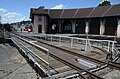
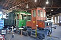
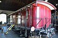
carriage house in Delémont in the canton of Jura, Switzerland  | |||||
| Upload media | |||||
| Instance of | |||||
|---|---|---|---|---|---|
| Part of | |||||
| Location | Delémont, Delémont District, Jura, Switzerland | ||||
| Street address |
| ||||
| Owned by | |||||
| Heritage designation | |||||
 | |||||
Media in category "Rotonde de Delémont"
The following 42 files are in this category, out of 42 total.
-
 A la Rotonde.jpg 4,608 × 3,072; 6.28 MB
-
 Cff c5-6 1.jpg 800 × 600; 213 KB
-
 Cff c5-6 2.jpg 800 × 600; 215 KB
-
 Cff c5-6 3.jpg 800 × 600; 178 KB
-
 Cff c5-6 4.jpg 800 × 600; 209 KB
-
 Cff c5-6 5.jpg 4,608 × 3,072; 5.24 MB
-
 Cff c5-6 6.jpg 4,608 × 3,072; 6.29 MB
-
 CFF E 2-2 Zephir 1.jpg 3,264 × 2,448; 3.69 MB
-
 CFF E 2-2 Zephir 2.jpg 3,264 × 2,448; 3.68 MB
-
 CFF E 2-2 Zephir 3.jpg 4,608 × 3,072; 6.26 MB
-
 Manche à eau.jpg 4,608 × 3,072; 5.34 MB
-
 Rotonde de Delémont 01.jpg 4,928 × 3,264; 5.77 MB
-
 Rotonde de Delémont 02.jpg 4,928 × 3,264; 5.77 MB
-
 Rotonde de Delémont 03.jpg 3,264 × 4,928; 5 MB
-
 Rotonde de Delémont 04.jpg 4,928 × 3,264; 5.92 MB
-
 Rotonde de Delémont 05.jpg 4,928 × 3,264; 5.89 MB
-
 Rotonde de Delémont 06.jpg 4,928 × 3,264; 6.56 MB
-
 Rotonde de Delémont 07.jpg 4,928 × 3,264; 5.53 MB
-
 Rotonde de Delémont 08.jpg 3,264 × 4,928; 6.13 MB
-
 Rotonde de Delémont 09.jpg 3,264 × 4,928; 5.09 MB
-
 Rotonde de Delémont 10.jpg 3,264 × 4,928; 6.6 MB
-
 Rotonde de Delémont 11.jpg 3,264 × 4,928; 5.48 MB
-
 Rotonde de Delémont 12.jpg 4,928 × 3,264; 5.09 MB
-
 Rotonde de Delémont 13.jpg 4,928 × 3,264; 5.79 MB
-
 Rotonde de Delémont 14.jpg 4,928 × 3,264; 5.12 MB
-
 Rotonde de Delémont 15.jpg 4,928 × 3,264; 6.14 MB
-
 Rotonde de Delémont 16.jpg 3,264 × 4,928; 5.92 MB
-
 Rotonde de Delémont 17.jpg 4,928 × 3,264; 5.97 MB
-
 Rotonde de Delémont 18.jpg 4,928 × 3,264; 5.69 MB
-
 Rotonde de Delémont 19.jpg 3,264 × 4,928; 5.65 MB
-
 Rotonde de Delémont 20.jpg 4,928 × 3,264; 6.08 MB
-
 Rotonde de Delémont 21.jpg 4,928 × 3,264; 5.96 MB
-
 Rotonde de Delémont 22.jpg 4,928 × 3,264; 6.41 MB
-
 Rotonde de Delémont 23.jpg 4,928 × 3,264; 6.43 MB
-
 Rotonde de Delémont 4.jpg 4,608 × 3,072; 6.14 MB
-
 Rotonde Delémont 1.jpg 3,264 × 2,448; 3.73 MB
-
 Rotonde Delémont 2.jpg 3,264 × 2,448; 3.9 MB
-
 Rotonde Delémont 3.JPG 4,608 × 3,072; 4.95 MB
-
 Rotonde Delémont.jpg 4,608 × 3,072; 6.68 MB
-
 Rotonde pour locomotives 2.JPG 4,000 × 3,000; 3.85 MB
-
 Rotonde pour locomotives 4.JPG 4,000 × 3,000; 3.17 MB
-
 Rotonde pour locomotives 5.JPG 4,000 × 3,000; 3.54 MB


