Category:Scott County, Missouri
Jump to navigation
Jump to search
Counties of Missouri: Adair · Andrew · Atchison · Audrain · Barry · Barton · Bates · Benton · Bollingern · Boone · Buchanan · Butler · Caldwell · Callaway · Camden · Cape Girardeau · Carroll · Carter · Cass · Cedar · Chariton · Christian · Clark · Clay · Clinton · Cole · Cooper · Crawford · Dade · Dallas · Daviess · DeKalb · Dent · Douglas · Dunklin · Franklin · Gasconade · Gentry · Greene · Grundy · Harrison · Henry · Hickory · Holt · Howard · Howell · Iron · Jackson · Jasper · Jefferson · Johnson · Knox · Laclede · Lafayette · Lawrence · Lewis · Lincoln · Linn · Livingston · Macon · Madison · Maries · Marion · McDonald · Mercer · Miller · Mississippi · Moniteau · Monroe · Montgomery · Morgan · New Madrid · Newton · Nodaway · Oregon · Osage · Ozark · Pemiscot · Perry · Pettis · Phelps · Pike · Polk · Pulaski · Putnam · Ralls · Randolph · Ray · Reynolds · Ripley · Saline · Schuyler · Scotland · Scott · Shannon · Shelby · St. Charles · St. Clair · St. Francois · St. Louis · Ste. Genevieve · Stoddard · Stone · Sullivan · Taney · Texas · Vernon · Warren · Washington · Wayne · Webster · Worth · Wright · Independent citiy: St. Louis
county in Missouri, United States   | |||||
| Upload media | |||||
| Instance of | |||||
|---|---|---|---|---|---|
| Named after |
| ||||
| Location | Missouri, Estados Unidos | ||||
| Capital | |||||
| Inception |
| ||||
| Population |
| ||||
| Area |
| ||||
| Different from | |||||
| official website | |||||
 | |||||
Mga ubos-nga-kaarangay
Ini nga kaarangay mayda han mga nasunod nga 9 nga mga ubos-nga-kaarangay, tikang hin 9 nga kabug-osan.
B
I
M
- Maps of Scott County, Missouri (15 F)
- Miner, Missouri (3 F)
O
- Oran, Missouri (3 F)
P
S
T
- Thebes Bridge (5 F)
Media ha kaarangay nga "Scott County, Missouri"
An mga nasunod nga 17 ka mga fayl aada han hini nga kaarangay, tikang hin 17 nga kabug-osan.
-
 Index to Aerial Photography of Scott County, Missouri 6 - DPLA - 5a5706cb2d8cd3736fb0f424cea113e7.jpg 5,992 × 7,161; 2.43 nga MB
-
 Map of Missouri highlighting Scott County.png 300 × 263; 13 nga KB
-
 Map of Missouri highlighting Scott County.svg 5,812 × 5,110; 112 nga KB
-
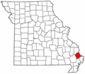
 MOMap-doton-Benton.png 300 × 263; 13 nga KB
-
 MOMap-doton-Blodgett.png 300 × 263; 13 nga KB
-
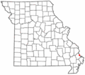
 MOMap-doton-Chaffee.png 300 × 263; 13 nga KB
-
 MOMap-doton-Commerce.png 300 × 263; 13 nga KB
-
 MOMap-doton-Diehlstadt.png 300 × 263; 13 nga KB
-
 MOMap-doton-Haywood City.png 300 × 263; 13 nga KB
-
 MOMap-doton-Kelso.png 300 × 263; 13 nga KB
-
 MOMap-doton-Lambert.png 300 × 263; 13 nga KB
-
 MOMap-doton-Morley.png 300 × 263; 13 nga KB
-
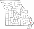
 MOMap-doton-Scott City.png 300 × 263; 13 nga KB
-
 MOMap-doton-Vanduser.png 300 × 263; 13 nga KB
-
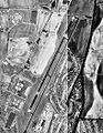 Sikeston Memorial Municipal Airport-MO-22Mar1996-USGS.jpg 405 × 523; 74 nga KB
-
 Train Wreck, Chaffee, MO, May 2013.jpg 1,833 × 1,108; 1.3 nga MB
-
 USA Scott County, Missouri age pyramid.svg 520 × 600; 8 nga KB


