Category:Seamill
Zur Navigation springen
Zur Suche springen
village in North Ayrshire, Scotland, UK  | |||||
| Medium hochladen | |||||
| Ist ein(e) | |||||
|---|---|---|---|---|---|
| Ort | North Ayrshire, Schottland | ||||
 | |||||
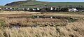
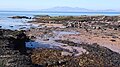
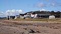
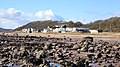
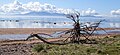
English: Seamill is a village in North Ayrshire on the west coast of Scotland, about 5 miles north of Ardrossan and 8 miles south of Largs.
Gàidhlig: 'S e baile ann an Comhairle Shiorrachd Àir a Tuath a tha ann an Seamill. Tha e faisg air Cille Bhrìghde an Iar agus mu 5 mìltean air àird a tuath Àird Rosain. Tha An Leargaidh Ghallda mu 8 mìltean tuath air.
Unterkategorien
Es werden 4 von insgesamt 4 Unterkategorien in dieser Kategorie angezeigt:
In Klammern die Anzahl der enthaltenen Kategorien (K), Seiten (S), Dateien (D)
Medien in der Kategorie „Seamill“
Folgende 82 Dateien sind in dieser Kategorie, von 82 insgesamt.
-
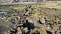 A dolerite dyke. Seamill beach. North Ayrshire.jpg 4.896 × 2.752; 5,42 MB
-
 Ann's Lodge, Boydston Brae, Seamill, North Ayrshire. View from the south.jpg 4.896 × 2.752; 3,41 MB
-
-
 Ardneil Bay and Hill - panoramio.jpg 1.280 × 898; 678 KB
-
 At The End Of The Day - panoramio.jpg 2.581 × 934; 1,54 MB
-
 Ayrshire Coastal Path - geograph.org.uk - 5636861.jpg 3.072 × 2.304; 3,17 MB
-
 Bastion Crag pond and fish trap, Seamill, North Ayrshire. View from the north-west.jpg 4.896 × 1.491; 1,22 MB
-
 Bastion Craig - geograph.org.uk - 5306619.jpg 4.247 × 3.135; 1,35 MB
-
 Beach at West Kilbride - geograph.org.uk - 5859452.jpg 2.784 × 1.568; 2,13 MB
-
 Beach at West Kilbride - geograph.org.uk - 5860403.jpg 2.784 × 1.568; 2,11 MB
-
 Chapelton Shore and South Inch, Seamill, North Ayrshire. Isle of Arran.jpg 4.875 × 2.274; 1,89 MB
-
 Chapelton Shore and South Inch, Seamill, North Ayrshire.jpg 4.270 × 2.741; 2,48 MB
-
 Chapelton Shore, Seamill, North Ayrshire. View west.jpg 4.593 × 2.736; 4,02 MB
-
 Cochlearia officinalis or Scurvy Grass, Seamill, North Ayrshire.jpg 3.009 × 2.083; 2,19 MB
-

-

-

-
 Eroded sandstone boulder, Chapelton Shore, Seamill, North Ayrshire.jpg 3.077 × 2.346; 2,13 MB
-
 Fish Pond, Chapelton, Seamill, North Ayrshire. View from the south.jpg 4.762 × 2.118; 2,97 MB
-
 Fish trap and natural features, Seamill, North Ayrshire.jpg 4.896 × 2.752; 4,52 MB
-
 Fish trap at South inch, Seamill, North Ayrshire.jpg 4.896 × 2.752; 3,76 MB
-
 Fish trap or yair site from near Glenhead, Seamill, North Ayrshire.jpg 4.896 × 2.752; 5,1 MB
-
 Fish Trap or yair site, Seamill, North Ayrshire.jpg 4.896 × 2.752; 4,36 MB
-
 Fish trap or yair, Seamill beach, North Ayrshire. View to the north.jpg 3.811 × 2.739; 3,49 MB
-
 Fish trap or yair, Seamill beach, North Ayrshire.jpg 3.588 × 2.211; 2,09 MB
-
 Fish Trap or yair, Seamill, Boydston Shore, North Ayrshire.jpg 4.075 × 2.008; 2,1 MB
-
 Fish trap ruins, Seamill, North Ayrshire. Trap at the end of a channel.jpg 4.896 × 2.752; 5,06 MB
-
 Glenfoot Brae and Largs Line. Seamill, North Ayrshire.jpg 3.814 × 2.122; 1,52 MB
-
 Glenfoot Brae, Seamill, North Ayrshire. View west.jpg 4.896 × 1.873; 1,26 MB
-
 Glenfoot Brae, Seamill, North Ayrshire.jpg 4.661 × 1.367; 1,11 MB
-
 Glenfoot House, Seamill, North Ayrshire.jpg 3.944 × 2.091; 1,58 MB
-
 Glenhead Double fort, Seamill. North Ayrshire. View from the south.jpg 4.817 × 2.300; 2,53 MB
-
 Goldenberry, Ardneil and Croek Hills from Seamill, North Ayrshire.jpg 4.848 × 1.764; 1,48 MB
-
 Isle of Arran - geograph.org.uk - 3920401.jpg 640 × 610; 49 KB
-
 Kilbride Burn at Outlet to the Beach, Seamill - geograph.org.uk - 5857369.jpg 2.784 × 1.568; 2,05 MB
-
 Kirktonhall Glen path.JPG 2.288 × 1.712; 1,38 MB
-
-
 Lower Boydston and the Loup from Boydston Beach, Seamill, North Ayrshire.jpg 4.896 × 2.752; 2,91 MB
-
 Lower Boydston and the Loup, Seamill, North Ayrshire.jpg 4.622 × 2.086; 1,82 MB
-
 Mouth of the Kilbride Burn, Seamill - geograph.org.uk - 4368777.jpg 3.648 × 2.736; 2,15 MB
-
 Natural features and fish trap ruins, Seamill, North Ayrshire.jpg 4.875 × 2.247; 3,66 MB
-
 North Inch. Natural basalt dyke. Seamill. North Ayrshire.jpg 4.814 × 2.195; 2,62 MB
-
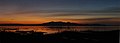
 October Sunset Arran Panorama - panoramio.jpg 4.711 × 1.274; 3,17 MB
-
 Old Fish Pond, Chapelton, Seamill, North Ayrshire. Canal.jpg 4.896 × 2.752; 5,79 MB
-
 Old Fish Pond, Chapelton, Seamill, North Ayrshire.jpg 4.825 × 1.899; 2,27 MB
-
 On the beach at West Kilbride - geograph.org.uk - 2406877.jpg 1.600 × 1.018; 334 KB
-

-
 Oyster Thief (Colpomenia peregrina). Seamill beach, North Ayrshire.jpg 4.144 × 1.943; 2,05 MB
-
 Rotting seaweed exudate, Chapelton Shore, Seamill, North Ayrshire.jpg 2.822 × 1.891; 1,67 MB
-
 Rotting storm driven seaweed exudate, Chapelton Shore, Seamill, North Ayrshire.jpg 4.896 × 2.752; 3,07 MB
-
 Sandstone cattle rubbing stone, Seamill, North Ayrshire. View from the east.jpg 4.896 × 2.752; 6,73 MB
-
 Sandstone cattle rubbing stone, Seamill, North Ayrshire.jpg 4.896 × 2.752; 6,77 MB
-
 Sea front at Seamill - geograph.org.uk - 4650053.jpg 640 × 480; 172 KB
-
 Sea Mill buildings and waterwheel, Seamill, North Ayrshire.jpg 4.896 × 2.752; 3,79 MB
-
 Sea Mill buildings, pond and waterwheel, Seamill, North Ayrshire.jpg 4.896 × 2.752; 4,38 MB
-
 Sea Mill's millstone, Seamill, North Ayrshire.jpg 3.355 × 2.117; 1,67 MB
-
 Seamill 381358.jpg 640 × 480; 92 KB
-
 Seamill and The Clubhouse West Kilbride Golf Club - panoramio.jpg 3.395 × 2.460; 2,13 MB
-
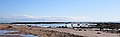
 Seamill Beach and the Isle of Arran, North Ayrshire.jpg 4.503 × 2.075; 2,31 MB
-
 Seamill Beach.JPG 2.288 × 1.712; 1,29 MB
-
 Seamill Hydro - geograph.org.uk - 5689181.jpg 1.600 × 1.067; 1,4 MB
-
 Seamill Hydro and beach. View north. North Ayrshire.jpg 4.896 × 2.752; 3,86 MB
-
 Seamill, Firth of Clyde.jpg 1.812 × 1.277; 205 KB
-
 South Inch old gun implacement, Chapelton Shore, Seamill, North Ayrshire. Detail.jpg 4.875 × 2.281; 3,51 MB
-
 South Inch old gun implacement, Chapelton Shore, Seamill, North Ayrshire. View west.jpg 4.896 × 2.752; 3,55 MB
-
 South Inch old gun implacement, Chapelton Shore, Seamill, North Ayrshire.jpg 4.429 × 1.875; 2,03 MB
-
 South Inch, Chapelton Shore, Seamill, North Ayrshire.jpg 4.833 × 1.536; 997 KB
-
 Tarbert Hill and Seamill, North Ayrshire. View from the south.jpg 4.483 × 2.266; 1,94 MB
-
 Tarbert Hill, Seamill Hydro and fish trap, North Ayrshire. View from the south.jpg 4.275 × 2.449; 2,97 MB
-
 The Bastion Craig pond and fish trap, Seamill, North Ayrshire. View from the north.jpg 4.896 × 2.487; 2,64 MB
-
 The beach, Seamill - geograph.org.uk - 4368791.jpg 3.648 × 2.736; 2,02 MB
-
 The Kilbride Burn, Sea Mill buildings, Seamill, North Ayrshire.jpg 3.741 × 2.739; 2,05 MB
-
 The Kilbride Burn, Seamill, North Ayrshire.jpg 4.549 × 2.741; 4,07 MB
-
 The South Inch old gun implacement, Chapelton Shore, Seamill, North Ayrshire. Detail.jpg 4.896 × 2.752; 3,39 MB
-
 Waterside and Chapelton Shore. Seamill, North Ayrshire.jpg 3.872 × 1.980; 1,41 MB
-
 Yair or fish trap. North Inch, Seamill, North Ayrshire.jpg 4.679 × 1.776; 1,45 MB
-

-
 Ploughed Field - geograph.org.uk - 381383.jpg 640 × 480; 132 KB
-
 Puddle - geograph.org.uk - 381400.jpg 640 × 480; 127 KB
-
 Seamill Hydro - geograph.org.uk - 353692.jpg 640 × 429; 99 KB
-

-
 West Kilbride Golf Club - geograph.org.uk - 81475.jpg 640 × 480; 89 KB


_attachment_depressions_on_red_sandstone,_Seamill,_North_Ayrshire.jpg)
_attachment_depressions_on_sandstone,_Seamill_beach,_North_Ayrshire.jpg)
_attachment_depressions_on_sandstone,_Seamill,_North_Ayrshire.jpg)


._Seamill_beach,_North_Ayrshire.jpg)


