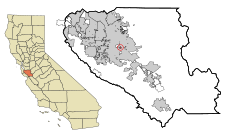
Category:Seven Trees, California
Jump to navigation
Jump to search
English: Media pertaining to Seven Trees, California, USA - which became a neighborhood of San José on 23 November 2009.
| Object location | | View all coordinates using: OpenStreetMap |
|---|
neighborhood of San Jose, California, United States | |||||
| Upload media | |||||
| Instance of | |||||
|---|---|---|---|---|---|
| Location |
| ||||
| Inception |
| ||||
| Replaces |
| ||||
 | |||||
Subcategories
This category has only the following subcategory.
S
- Seven Trees Branch Library (19 F)
Media in category "Seven Trees, California"
The following 2 files are in this category, out of 2 total.
-
CAMap-doton-Seven Trees.png 209 × 230; 4 KB


