Category:Shimotsuma, Ibaraki
Zur Navigation springen
Zur Suche springen
Ort in der Präfektur Ibaraki, Japan | |||||
| Medium hochladen | |||||
| Ist ein(e) | |||||
|---|---|---|---|---|---|
| Ort | Präfektur Ibaraki, Japan | ||||
| Rechtsform |
| ||||
| Datum der Gründung, Erstellung, Entstehung, Erbauung |
| ||||
| Einwohnerzahl |
| ||||
| Fläche |
| ||||
| Ersetzt |
| ||||
| offizielle Website | |||||
 | |||||
English: Shimotsuma City, Ibaraki prefecture
Unterkategorien
Es werden 8 von insgesamt 8 Unterkategorien in dieser Kategorie angezeigt:
In Klammern die Anzahl der enthaltenen Kategorien (K), Seiten (S), Dateien (D)
A
- AEON MALL Shimotsuma (1 D)
D
- Daiho Station (8 D)
K
S
- Shimotsuma Station (14 D)
- Sōdō Station (5 D)
T
- Tobanoe Station (10 D)
V
Medien in der Kategorie „Shimotsuma, Ibaraki“
Folgende 82 Dateien sind in dieser Kategorie, von 82 insgesamt.
-
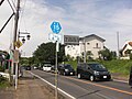
 Akamhama-Yatabe Line at Takasai.jpg 2.304 × 1.728; 347 KB
-
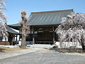
 Daiho Hachiman-gu Honden.jpg 1.200 × 840; 348 KB
-
 Emblem of Shimotsuma, Ibaraki.jpg 94 × 85; 2 KB
-
 Emblem of Shimotsuma, Ibaraki.svg 300 × 273; 2 KB
-
 End of Ibaraki pref. route 15 Yuki-Shimotsuma line.jpg 2.304 × 1.728; 413 KB
-
 Flag of Shimotsuma, Ibaraki.svg 900 × 600; 519 Bytes
-
 Flag of Shimotuma Ibaraki.JPG 283 × 213; 7 KB
-
 Flower beds at the Kokai river - panoramio.jpg 4.000 × 2.754; 2,66 MB
-
 Ibaraki kendo r131.jpg 2.048 × 1.536; 833 KB
-
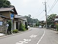
 Ibaraki pref road 129 in Ōsonoki.JPG 2.560 × 1.920; 1,05 MB
-
 Ibaraki prefectural 333 (Sodo-teishajo line) in Sodo,Shimotsuma city.JPG 2.272 × 1.704; 1,01 MB
-
 Ibaraki prefectural road route 217 (Minaba-Sakibusa line) in Goka,Koga ciyu.JPG 2.816 × 2.112; 1,16 MB
-
 Ibaraki prefectural road route 335 (Daiho station line) in Daiho,Shimotsuma city.JPG 2.272 × 1.704; 1,1 MB
-
 Ibaraki Prefectural Road Route 357 (Taniwahara Chikusai Line) at Honsodo, Shimotsuma City.jpg 5.568 × 3.712; 10,28 MB
-
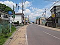
 Ibaraki prefectural route 233 (Sanno-Shimotsuma line) in Hanya,Shimotsuma city.JPG 2.272 × 1.704; 965 KB
-
-
 Ibaraki Tsukuba-gun 1889.png 270 × 330; 6 KB
-
 Ibaraki-ken Credit Cooperative Shimotsuma Branch.jpg 3.191 × 2.393; 1,44 MB
-
 JA Jyousou-Hikari Headquarters.JPG 2.560 × 1.920; 2,6 MB
-
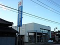
 Joyo Bank Shimotsuma Branch.jpg 3.260 × 2.445; 1,56 MB
-
 Kantetsu Purple Bus at Shimotsuma Station.jpg 2.785 × 2.088; 1,02 MB
-
 Kantetsu Purple Bus Shimotsuma depot.jpg 3.066 × 2.299; 1,16 MB
-
 Kojima souan ato.JPG 1.280 × 960; 423 KB
-
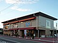
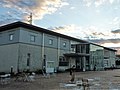
 Michinoeki shimotsuma.jpg 1.280 × 960; 552 KB
-
 Mito District Legal Affairs Bureau Shimotsuma Branch.jpg 2.948 × 2.211; 1,31 MB
-
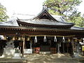
 Muneto Shrine (Shimotsuma City, Ibaraki Prefecture) 01.jpg 5.568 × 3.712; 8,59 MB
-
 Muneto Shrine (Shimotsuma City, Ibaraki Prefecture) 02.jpg 5.568 × 3.712; 8,55 MB
-
 Muneto Shrine (Shimotsuma City, Ibaraki Prefecture) 03.jpg 5.568 × 3.712; 11,3 MB
-
 Muneto Shrine (Shimotsuma City, Ibaraki Prefecture) 04.jpg 5.568 × 3.712; 8,12 MB
-
 Population distribution of Shimotsuma, Ibaraki, Japan.svg 512 × 256; 22 KB
-
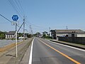
 Route 294 (Joso Bypass) in Shimotsuma city,Ibaraki,Japan.JPG 3.696 × 2.456; 4,66 MB
-
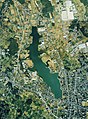 Sa-numa swamp Aerial photograph.1990.jpg 3.192 × 4.330; 11,66 MB
-
 San Sun Sanuma 01.jpg 2.689 × 2.016; 799 KB
-
 San Sun Sanuma 02.jpg 3.160 × 2.370; 1,74 MB
-
 Sanuma0022.JPG 1.280 × 960; 438 KB
-
 Shimotsuma 1st High.jpg 2.304 × 1.728; 486 KB
-
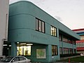
 Shimotsuma Citizen Cultural Center.jpg 3.263 × 2.447; 963 KB
-
 Shimotsuma city center area Aerial photograph.1990.jpg 5.357 × 5.074; 22,57 MB
-
 Shimotsuma City General Gymnasium.jpg 2.665 × 1.999; 917 KB
-
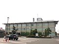
 Shimotsuma City Hall Chiyokawa Government building 1.jpg 4.522 × 3.296; 2,13 MB
-
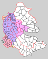
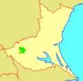
 Shimotsuma city Ibaraki prefecture Japan.svg 534 × 688; 18 KB
-
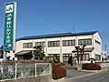
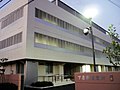
 Shimotsuma City Office.jpg 2.304 × 1.728; 455 KB
-
 Shimotsuma City Shimotsuma elementary school 01.jpg 2.762 × 2.072; 1,3 MB
-
 Shimotsuma City Shimotsuma elementary school 02.jpg 3.191 × 2.393; 1,34 MB
-
 Shimotsuma City Shoko Kaikan.jpg 2.700 × 2.025; 1,25 MB
-
 Shimotsuma Detention Branch.jpg 3.264 × 2.448; 1,57 MB
-
 Shimotsuma Fire station.jpg 3.144 × 2.358; 1,09 MB
-
 Shimotsuma in Ibaraki Prefecture Ja.svg 450 × 567; 17 KB
-
 Shimotsuma Kominkan.jpg 2.589 × 1.942; 642 KB
-
 Shimotsuma Police station 2010.jpg 2.304 × 1.728; 791 KB
-
 Shimotsuma Post Office.jpg 2.304 × 1.728; 335 KB
-
 Shimotsuma Public Library.jpg 2.728 × 2.046; 1,24 MB
-
 Shimotsuma Sanuma Post Office.jpg 2.461 × 1.846; 910 KB
-
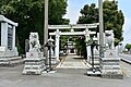
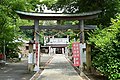
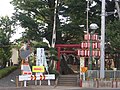 Shimotsuma Shrine 2010.JPG 2.304 × 1.728; 1,19 MB
-

-

-

-

-

-
 Shitamiya, Shimotsuma, Ibaraki Prefecture 304-0013, Japan - panoramio.jpg 4.608 × 3.456; 5,37 MB
-
 Tagaya Castle Site 01.JPG 2.304 × 1.728; 1,61 MB
-
 Tagaya Castle Site 02.JPG 2.304 × 1.728; 1,28 MB
-
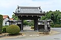 Tahoin Temple (Shimotsuma City, Ibaraki Prefecture) 01.jpg 5.568 × 3.712; 9,4 MB
-
 Tahoin Temple (Shimotsuma City, Ibaraki Prefecture) 02.jpg 5.568 × 3.712; 11,32 MB
-
 Taiho-Hatinangu-Shimotsuma.JPG 1.024 × 768; 224 KB
-
 The second High School of Shimotsuma.jpg 2.304 × 1.728; 895 KB
-
 Tobanoe Station - 関東鉄道常総線 大宝駅 - panoramio.jpg 640 × 480; 78 KB
-
 Tsukuba Bank Shimotsuma Department 2018.jpg 2.552 × 1.914; 976 KB
-
 Tsukuba Bank Shimotsuma Department.jpg 2.304 × 1.728; 1.005 KB
-
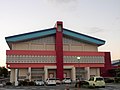
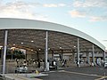 Waiwai Dome Shimotsuma.jpg 3.117 × 2.338; 1,76 MB
-
 Yuki Shinkin Bank Shimotsuma Branch.jpg 2.885 × 2.164; 810 KB
-
 ひとつもの神事・川.jpg 2.304 × 1.296; 907 KB
-
 ひとつもの神事・町内.jpg 2.304 × 1.296; 1,18 MB
-
 十七夜塔(無量院).jpg 3.648 × 5.472; 9,84 MB
-
 十七夜塔(赤須・薬師堂).jpg 3.648 × 5.472; 12,21 MB
-
 十七夜/十九夜塔(古沢公民館).jpg 3.648 × 5.472; 10,21 MB
-
 十三夜/二十三夜塔(古沢公民館).jpg 3.648 × 5.472; 10,25 MB
-
 地図-茨城県下妻市-2006.png 236 × 233; 6 KB
-
 多宝院 本堂.jpg 2.592 × 1.944; 1,74 MB
-
 小貝川のポピーと祝橋 - panoramio.jpg 2.736 × 1.824; 3,85 MB
-
 小貝川河川敷のコスモスと筑波山 - panoramio.jpg 5.472 × 3.648; 3,45 MB
-
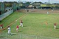 豊原橋の野球場 - panoramio.jpg 5.472 × 3.648; 5,23 MB


_in_Goka,Koga_ciyu.JPG)


_in_Sodo,Shimotsuma_city.JPG)
_in_Daiho,Shimotsuma_city.JPG)
_at_Honsodo,_Shimotsuma_City.jpg)
_in_Hanya,Shimotsuma_city.JPG)
_in_Shimotsuma-otu,Shimotsuma_city.JPG)
_01.jpg)
_02.jpg)
_03.jpg)
_04.jpg)
_in_Shimotsuma_city,Ibaraki,Japan.JPG)
.jpg)
.jpg)
.jpg)
.jpg)
_01.jpg)
_02.jpg)