Category:Slapton, Devon
Naar navigatie springen
Naar zoeken springen
English: Slapton is a coastal village in Devon, England. It is located on the A379 road between Kingsbridge and Dartmouth, and lies within the South Devon Area of Outstanding Natural Beauty (AONB).
Français : Slapton est un village dans le Devon, en Angleterre, situé entre Kingsbridge et Dartmouth
Devon  | |||||
| Media uploaden | |||||
| Is een | |||||
|---|---|---|---|---|---|
| Locatie | South Hams, Devon, Zuidwest-Engeland, Engeland | ||||
 | |||||
Ondercategorieën
Deze categorie bevat de volgende 6 subcategorieën, van de 6 in totaal.
Media in categorie "Slapton, Devon"
Deze categorie bevat de volgende 200 bestanden, van in totaal 926.
(vorige pagina) (volgende pagina)-
 1 - 2, Sands Rd - geograph.org.uk - 3037697.jpg 640 × 430; 71 kB
-
 1 - 2, Sands Rd - geograph.org.uk - 3037700.jpg 640 × 430; 69 kB
-
 1 ^ 2, Sands Rd - geograph.org.uk - 5340979.jpg 640 × 426; 75 kB
-
 1, Sands Rd - geograph.org.uk - 3094930.jpg 640 × 430; 54 kB
-
 A Devon lane - geograph.org.uk - 3016909.jpg 640 × 430; 73 kB
-
 A Devon Lane - geograph.org.uk - 3115785.jpg 640 × 430; 97 kB
-
 A field of Barley - geograph.org.uk - 3021092.jpg 640 × 430; 70 kB
-
 A narrow Devon lane - geograph.org.uk - 3258797.jpg 640 × 430; 57 kB
-
 A narrow Devon lane - geograph.org.uk - 3258825.jpg 640 × 430; 119 kB
-
 A narrow lane - geograph.org.uk - 3025132.jpg 640 × 430; 128 kB
-
 A place to hide - geograph.org.uk - 3028785.jpg 640 × 430; 59 kB
-
 A quiet Devon lane - geograph.org.uk - 3115788.jpg 640 × 430; 84 kB
-
 A sea of barley - geograph.org.uk - 3022965.jpg 640 × 430; 57 kB
-
 A379 - geograph.org.uk - 3306155.jpg 640 × 397; 56 kB
-
 A379 - geograph.org.uk - 5299791.jpg 640 × 426; 48 kB
-
 A379 - geograph.org.uk - 5299793.jpg 640 × 426; 46 kB
-
 A379 southsoutheast of Broadstone Point - geograph.org.uk - 3889002.jpg 3.995 × 2.398; 1,18 MB
-
 A379, Slapton Sands - geograph.org.uk - 3265467.jpg 640 × 430; 51 kB
-
 A379, Slapton Sands - geograph.org.uk - 5299872.jpg 640 × 462; 55 kB
-
 Across the reedbeds at Slapton - May 2015 - panoramio.jpg 4.000 × 3.000; 2,02 MB
-
 Alleyway to the church - geograph.org.uk - 5335166.jpg 640 × 426; 65 kB
-
 Along the coast towards Dartmouth - evening June 2012 - panoramio.jpg 4.000 × 3.000; 3,76 MB
-
 Anglers Hut, slapton - geograph.org.uk - 5348783.jpg 640 × 426; 121 kB
-
 Anglers hut, Slapton Ley - geograph.org.uk - 5299781.jpg 640 × 426; 119 kB
-
 Approaching Alston - geograph.org.uk - 4131616.jpg 4.000 × 3.000; 3,63 MB
-
 Approaching Deerbridge Mill - geograph.org.uk - 5326213.jpg 640 × 426; 83 kB
-
 Approaching Higher Green Cross - geograph.org.uk - 3119457.jpg 640 × 430; 56 kB
-
 Approaching Newton Cross - geograph.org.uk - 3025167.jpg 640 × 430; 106 kB
-
 Approaching Whitestone Cross - geograph.org.uk - 3115797.jpg 640 × 430; 67 kB
-
 Arable fields north of Higher Green Cross - geograph.org.uk - 3998589.jpg 3.648 × 2.736; 1,93 MB
-
 Autumn colours, Slapton Wood - geograph.org.uk - 5296208.jpg 426 × 640; 149 kB
-
 Banks of Slapton Ley - geograph.org.uk - 3269316.jpg 640 × 430; 148 kB
-
 Barley - geograph.org.uk - 3022964.jpg 640 × 430; 47 kB
-
 Barley - geograph.org.uk - 3022967.jpg 640 × 430; 51 kB
-
 Barley field - geograph.org.uk - 3021091.jpg 640 × 430; 61 kB
-
 Barn at Molton - geograph.org.uk - 3016921.jpg 640 × 430; 95 kB
-
 Barn at Newton - geograph.org.uk - 3025154.jpg 640 × 430; 81 kB
-
 Barn in Start - geograph.org.uk - 5326209.jpg 640 × 426; 89 kB
-
 Barn near Torr Farm - geograph.org.uk - 5956030.jpg 3.210 × 2.249; 943 kB
-
 Barn southeast of Dittiscombe Cross - geograph.org.uk - 6025530.jpg 4.282 × 2.329; 982 kB
-
 Barn, Brook St - geograph.org.uk - 3040216.jpg 640 × 430; 92 kB
-
 Barn, Brook Street - geograph.org.uk - 5340913.jpg 640 × 426; 80 kB
-
 Barn, Buckland Court - geograph.org.uk - 3023001.jpg 640 × 430; 73 kB
-
 Barn, Lower Coltscombe - geograph.org.uk - 5321305.jpg 640 × 426; 92 kB
-
 Barn, Middlegrounds Farm - geograph.org.uk - 5296062.jpg 640 × 426; 104 kB
-
 Barn, Thorn Farm - geograph.org.uk - 3023018.jpg 640 × 430; 74 kB
-
 Barns, Buckland - geograph.org.uk - 3111476.jpg 640 × 430; 102 kB
-
 Barns, Pollardscombe Farm - geograph.org.uk - 3021069.jpg 640 × 430; 65 kB
-
 Beach, Slapton Sands - geograph.org.uk - 3244654.jpg 640 × 430; 56 kB
-
 Beach, Slapton Sands - geograph.org.uk - 3244658.jpg 640 × 430; 49 kB
-
 Beginning of bridleway, Slapton - geograph.org.uk - 824193.jpg 640 × 430; 133 kB
-
 Beginning of bridleway, Slapton - geograph.org.uk - 824223.jpg 640 × 430; 88 kB
-
 Bench by Sands Rd - geograph.org.uk - 3244679.jpg 640 × 430; 97 kB
-
 Bench, Sands Rd - geograph.org.uk - 3176860.jpg 640 × 430; 51 kB
-
 Bench, Sands Rd - geograph.org.uk - 3255819.jpg 640 × 430; 51 kB
-
 Bench, Sands Rd - geograph.org.uk - 3265384.jpg 640 × 430; 64 kB
-
 Between high hedges - geograph.org.uk - 3258827.jpg 640 × 430; 125 kB
-
 Blackpool Sands from Slapton Sands (9951).jpg 4.288 × 2.848; 4,31 MB
-
 Boadwalk around Slapton Ley - geograph.org.uk - 3874491.jpg 640 × 425; 136 kB
-
 Board walk - geograph.org.uk - 3874466.jpg 640 × 425; 136 kB
-
 Boardwalk across the marsh near Slapton Ley - geograph.org.uk - 2899075.jpg 3.000 × 4.000; 3,77 MB
-
 Boardwalk, Slapton Ley - geograph.org.uk - 3271635.jpg 640 × 430; 123 kB
-
 Boardwalk, Slapton Ley - geograph.org.uk - 3271638.jpg 640 × 430; 139 kB
-
 Boardwalk, Slapton Nature Reserve - geograph.org.uk - 5321090.jpg 640 × 426; 127 kB
-
 Boardwalk, Slapton Nature Reserve - geograph.org.uk - 5321091.jpg 640 × 426; 129 kB
-
 Bridge at Higher North Mill - geograph.org.uk - 3261171.jpg 640 × 430; 96 kB
-
 Bridge near Slapton in the rain - geograph.org.uk - 824301.jpg 640 × 430; 108 kB
-
 Bridge near Stokenham - geograph.org.uk - 62742.jpg 640 × 480; 200 kB
-
 Bridleway to Higher Coltscombe - geograph.org.uk - 5321312.jpg 640 × 426; 115 kB
-
 Bridleways diverge - geograph.org.uk - 5321310.jpg 640 × 426; 90 kB
-
 Brook Cottage - geograph.org.uk - 3040212.jpg 640 × 410; 79 kB
-
 Brook Cottage - geograph.org.uk - 5340905.jpg 640 × 425; 57 kB
-
 Brook entering the marsh at Slapton - May 2015 - panoramio.jpg 4.000 × 3.000; 2,35 MB
-
 Brook St - geograph.org.uk - 5335077.jpg 640 × 426; 98 kB
-
 Brook Street - geograph.org.uk - 5340907.jpg 640 × 426; 87 kB
-
 Brook Street - geograph.org.uk - 5340926.jpg 640 × 426; 89 kB
-
 Brook Street - geograph.org.uk - 5340969.jpg 640 × 426; 106 kB
-
 Brook Street Corner - geograph.org.uk - 3040206.jpg 640 × 430; 105 kB
-
 Brook Street junction, Slapton - geograph.org.uk - 824184.jpg 430 × 640; 84 kB
-
 Brook Street, Slapton - geograph.org.uk - 3094905.jpg 640 × 430; 113 kB
-
 Buckland Court - geograph.org.uk - 2210426.jpg 640 × 426; 77 kB
-
 Buckland Court - geograph.org.uk - 3023004.jpg 640 × 430; 67 kB
-
 Buckland Court - geograph.org.uk - 3111468.jpg 640 × 430; 106 kB
-
 Buckland Court, Lower Courtyard - geograph.org.uk - 2210444.jpg 640 × 426; 70 kB
-
 Buckland Court, Upper Courtyard - geograph.org.uk - 2210439.jpg 640 × 426; 74 kB
-
 Buckland Cross - geograph.org.uk - 3115792.jpg 640 × 430; 56 kB
-
 Buckland Cross - geograph.org.uk - 3998580.jpg 3.500 × 2.511; 1,57 MB
-
 Buckland Cross - geograph.org.uk - 5953511.jpg 4.288 × 2.848; 1,7 MB
-
 Buckland Cross - geograph.org.uk - 6025446.jpg 4.288 × 2.848; 1,77 MB
-
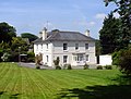 Buckland House - geograph.org.uk - 2210371.jpg 640 × 487; 109 kB
-
 Buckland House - geograph.org.uk - 3111465.jpg 640 × 430; 110 kB
-
 Bushes by the South West Coast Path - geograph.org.uk - 3306152.jpg 640 × 430; 68 kB
-
 By the Ley - geograph.org.uk - 3269319.jpg 640 × 430; 140 kB
-
 Byway to Battle Ford - geograph.org.uk - 5326207.jpg 640 × 426; 108 kB
-
 Car Park - Slapton Sands - geograph.org.uk - 2439938.jpg 4.000 × 3.000; 3,95 MB
-
 Car park on Slapton Sands - geograph.org.uk - 2457778.jpg 1.024 × 768; 233 kB
-
 Car park, Slapton Sands - geograph.org.uk - 3265465.jpg 640 × 430; 43 kB
-
 Car park, Slapton Sands - geograph.org.uk - 4161969.jpg 1.920 × 1.231; 582 kB
-
 Carlane Cottage - Slapton - geograph.org.uk - 2898857.jpg 3.000 × 4.000; 4,13 MB
-
 Carr Lane - geograph.org.uk - 3016273.jpg 640 × 430; 109 kB
-
 Carr Lane, Slapton - geograph.org.uk - 1363309.jpg 640 × 491; 96 kB
-
 Carr Lane, Slapton - geograph.org.uk - 2505741.jpg 3.872 × 2.592; 5,68 MB
-
 Carr Lane, Slapton - geograph.org.uk - 3346616.jpg 768 × 1.024; 131 kB
-
 Carr Lane, Slapton - geograph.org.uk - 4884569.jpg 640 × 427; 102 kB
-
 Cattle at Slapton - geograph.org.uk - 1361984.jpg 640 × 450; 79 kB
-
 Cattle feeder - geograph.org.uk - 3244678.jpg 640 × 430; 52 kB
-
 Cattle feeder by Sands Rd - geograph.org.uk - 3306167.jpg 640 × 430; 62 kB
-
 Cattle grazing - geograph.org.uk - 3016916.jpg 640 × 430; 85 kB
-
 Cattle on a hillside - geograph.org.uk - 3023036.jpg 640 × 430; 77 kB
-
 Chantry Tower - geograph.org.uk - 2210155.jpg 425 × 640; 78 kB
-
 Chest Tombs - geograph.org.uk - 5340683.jpg 640 × 426; 97 kB
-
 Church Hill - geograph.org.uk - 5335152.jpg 640 × 426; 73 kB
-
 Church Lane, Slapton (2) - geograph.org.uk - 1363206.jpg 480 × 640; 98 kB
-
 Church Lane, Slapton - geograph.org.uk - 1363186.jpg 640 × 382; 67 kB
-
 Church of St James - altar - geograph.org.uk - 5340689.jpg 640 × 426; 52 kB
-
 Church of St James - font - geograph.org.uk - 5340691.jpg 426 × 640; 54 kB
-
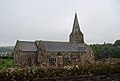
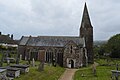
 Church of St James - geograph.org.uk - 3094912.jpg 640 × 430; 64 kB
-
 Church of St James - geograph.org.uk - 3094951.jpg 640 × 430; 46 kB
-
 Church of St James - geograph.org.uk - 3889332.jpg 3.522 × 2.819; 1,82 MB
-
 Church of St James - geograph.org.uk - 5335192.jpg 640 × 426; 59 kB
-
 Church of St James - geograph.org.uk - 5335197.jpg 640 × 426; 81 kB
-
 Church of St James - geograph.org.uk - 5335203.jpg 386 × 640; 50 kB
-
 Church of St James - geograph.org.uk - 5335312.jpg 640 × 426; 43 kB
-
 Church of St James - geograph.org.uk - 5335328.jpg 640 × 426; 59 kB
-
 Church of St James - geograph.org.uk - 5335337.jpg 640 × 426; 55 kB
-
 Church of St James - geograph.org.uk - 5335355.jpg 640 × 426; 56 kB
-
 Church of St James - geograph.org.uk - 5340685.jpg 426 × 640; 62 kB
-
 Church of St James - geograph.org.uk - 5340960.jpg 426 × 640; 56 kB
-
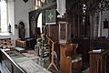 Church of St James - pulpit - geograph.org.uk - 5340687.jpg 640 × 426; 74 kB
-
 Church Road - geograph.org.uk - 1582954.jpg 640 × 480; 64 kB
-
 Climbing out of The Gara Valley - geograph.org.uk - 3107337.jpg 640 × 430; 63 kB
-
 Climbing out of The Gara Valley - geograph.org.uk - 3111433.jpg 640 × 430; 78 kB
-
 Coastal erosion, Slapton Sands - geograph.org.uk - 5299789.jpg 426 × 640; 95 kB
-
 Coltscombe - geograph.org.uk - 235839.jpg 640 × 480; 108 kB
-
 Composting toilet, Field Study Centre - geograph.org.uk - 5321076.jpg 640 × 426; 104 kB
-
 Conservation area, Slapton Sands - geograph.org.uk - 5299804.jpg 640 × 426; 85 kB
-
 Conversion at Merrifield - geograph.org.uk - 3258806.jpg 640 × 430; 74 kB
-
 Converted Farm Buildings - geograph.org.uk - 1449549.jpg 640 × 426; 73 kB
-
 Cottage at Newton - geograph.org.uk - 3025145.jpg 640 × 430; 50 kB
-
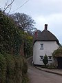
 Cottage in Slapton - geograph.org.uk - 5335281.jpg 640 × 426; 46 kB
-
 Cottage in Slapton - geograph.org.uk - 5340890.jpg 640 × 426; 51 kB
-
 Cottage, Brook St - geograph.org.uk - 3040207.jpg 640 × 430; 56 kB
-
 Cottage, Hansel - geograph.org.uk - 3261152.jpg 640 × 430; 84 kB
-
 Cottage, Start - geograph.org.uk - 5321300.jpg 640 × 426; 97 kB
-
 Cottage, Towns End Cross - geograph.org.uk - 3016288.jpg 640 × 430; 65 kB
-
 Cottage, Towns End Cross - geograph.org.uk - 3016289.jpg 640 × 430; 62 kB
-
 Cottages by the church at Slapton - geograph.org.uk - 4884555.jpg 640 × 427; 95 kB
-
 Cottages in Slapton (2) - geograph.org.uk - 1363144.jpg 480 × 640; 73 kB
-
 Cottages in Slapton - geograph.org.uk - 1363076.jpg 502 × 640; 75 kB
-
 Cottages, Prospect Hill - geograph.org.uk - 3094919.jpg 640 × 430; 85 kB
-
 Cottages, Slapton - geograph.org.uk - 5335101.jpg 640 × 426; 57 kB
-
 Countryside near Slapton - geograph.org.uk - 3271654.jpg 640 × 430; 91 kB
-
 Countryside near Thorn Farm - geograph.org.uk - 3023014.jpg 640 × 430; 60 kB
-
 Cows above Slapton Ley - geograph.org.uk - 2504494.jpg 3.872 × 2.592; 4,81 MB
-
 Crop, Heathfield - geograph.org.uk - 5953532.jpg 4.271 × 2.647; 2,06 MB
-
 Crossroads at Watergate Langford - geograph.org.uk - 3874624.jpg 640 × 425; 122 kB
-
 Deer Bridge - geograph.org.uk - 1582968.jpg 640 × 480; 105 kB
-
 Deer Bridge - geograph.org.uk - 3874574.jpg 640 × 425; 109 kB
-
 Deer Bridge - geograph.org.uk - 3889975.jpg 3.420 × 2.505; 2,4 MB
-
 Deer Bridge - geograph.org.uk - 5321149.jpg 640 × 426; 91 kB
-
 Deerbridge Mill - geograph.org.uk - 5326214.jpg 640 × 425; 81 kB
-
 Deerbridge Mill House - geograph.org.uk - 5321291.jpg 640 × 426; 77 kB
-
-

-
 Dense woodland, Slapton Ley - geograph.org.uk - 3271637.jpg 640 × 430; 145 kB
-
 Derelict barn - geograph.org.uk - 235165.jpg 480 × 640; 119 kB
-
 Derelict barn - geograph.org.uk - 5296353.jpg 640 × 426; 44 kB
-
 Descending into Slapton - geograph.org.uk - 5340954.jpg 640 × 426; 104 kB
-
 Descending into the Gara Valley - geograph.org.uk - 3261163.jpg 640 × 430; 109 kB
-
 Descending to Hansel - geograph.org.uk - 3261146.jpg 640 × 430; 106 kB
-
 Descending to Molton - geograph.org.uk - 3016919.jpg 640 × 430; 104 kB
-
 Devon bank, Heathfield - geograph.org.uk - 6025534.jpg 4.276 × 2.611; 978 kB
-
 Devon country lane - geograph.org.uk - 3023029.jpg 640 × 430; 102 kB
-
 Devon Countryside - geograph.org.uk - 3016304.jpg 640 × 430; 74 kB
-
 Devon countryside through a farm gate - geograph.org.uk - 3025140.jpg 640 × 430; 119 kB
-
 Devon lane - geograph.org.uk - 3016803.jpg 640 × 430; 69 kB
-
 Devon pasture near Start - geograph.org.uk - 5326206.jpg 640 × 426; 63 kB
-
 Disappearing car park at Slapton - geograph.org.uk - 4884590.jpg 640 × 427; 103 kB
-
 Dittiscombe Cross - geograph.org.uk - 235668.jpg 640 × 480; 86 kB
-
 Dittiscombe from above Alston Wash - geograph.org.uk - 236069.jpg 640 × 480; 91 kB
-
 Drive to Scarswell - geograph.org.uk - 5956044.jpg 3.459 × 2.528; 1,84 MB
-
 Ducks on The Ley - geograph.org.uk - 5348007.jpg 640 × 426; 51 kB
-
 Eastergrounds Farm - geograph.org.uk - 3258787.jpg 640 × 430; 50 kB
-
 Edenhurst - geograph.org.uk - 5335159.jpg 640 × 426; 57 kB
-
 Entering Slapton - geograph.org.uk - 3037661.jpg 640 × 430; 100 kB
-
 Entering Slapton - geograph.org.uk - 3094867.jpg 640 × 454; 137 kB
-
 Entering Slapton - geograph.org.uk - 3094891.jpg 640 × 430; 83 kB
-
 Entering Slapton - geograph.org.uk - 3119469.jpg 640 × 430; 97 kB
-
 Entering Slapton - geograph.org.uk - 3119522.jpg 640 × 430; 96 kB
-
 Entering Slapton - geograph.org.uk - 5299814.jpg 640 × 426; 114 kB
-
 Entering Slapton - geograph.org.uk - 5335074.jpg 640 × 426; 110 kB
-
 Entering Slapton Ley National Nature Reserve - geograph.org.uk - 2502855.jpg 3.872 × 2.592; 6,4 MB
-
 Entering Start - geograph.org.uk - 3875783.jpg 640 × 425; 100 kB
-
 Entrance drive, Clovelly - geograph.org.uk - 5434527.jpg 1.989 × 2.683; 1,47 MB
-
 Entrance to Buckland House - geograph.org.uk - 3111462.jpg 640 × 430; 138 kB
-
 Entrance to Fairweather - geograph.org.uk - 3875763.jpg 640 × 425; 86 kB
-
 Entrance to the Slapton Ley NNR - geograph.org.uk - 3874359.jpg 640 × 425; 122 kB
-
 Entrance to Torr Farm - geograph.org.uk - 3024979.jpg 640 × 430; 113 kB
-
 Entrance to Torr Farm - geograph.org.uk - 6025276.jpg 4.288 × 2.848; 2,7 MB
-


.jpg)


_-_geograph.org.uk_-_1363206.jpg)


_-_geograph.org.uk_-_1363144.jpg)


