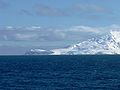
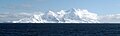
Category:Smith Island
Zur Navigation springen
Zur Suche springen
Insel der Antarktis   | |||||
| Medium hochladen | |||||
| Ist ein(e) | |||||
|---|---|---|---|---|---|
| Ist Teil von | |||||
| Benannt nach |
| ||||
| Ort | Gebiet des Antarktis-Vertrags | ||||
| Liegt am oder im Gewässer | |||||
| Breite |
| ||||
| Länge |
| ||||
| Höchster Punkt |
| ||||
| Einwohnerzahl |
| ||||
| Fläche |
| ||||
| Höhe über dem Meeresspiegel |
| ||||
 | |||||
Medien in der Kategorie „Smith Island“
Folgende 19 Dateien sind in dieser Kategorie, von 19 insgesamt.
-
 Antim-Peak.jpg 901 × 676; 352 KB
-
 Cape-James.jpg 925 × 694; 380 KB
-
 Evlogi-Peak.jpg 801 × 601; 277 KB
-
 Ivan-Asen-Point.jpg 2.004 × 1.504; 1,26 MB
-
 Livingston-Island-Map-2010-15.jpg 5.337 × 4.006; 3,26 MB
-
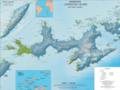 Livingston-Island-Map-2010-15.png 5.337 × 4.006; 9,65 MB
-
 Livingston-Island-Map-2010-BG.jpg 5.029 × 3.490; 6,8 MB
-
 Livingston-Island-Map-2010.jpg 5.027 × 3.487; 7,07 MB
-
 Mount-Foster.jpg 864 × 648; 328 KB
-
 Organa-Peak.jpg 757 × 568; 268 KB
-
 Riggs-Peak.jpg 920 × 690; 392 KB
-
 Slaveykov-Peak.jpg 2.004 × 1.504; 1,32 MB
-
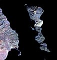 Smith Island, Gulf of California (ASTER).jpg 546 × 575; 29 KB
-
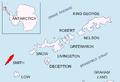
 Smith u map.png 656 × 518; 144 KB
-
 Smith-Cliff-Frohlich-wide.jpg 5.216 × 1.956; 4,3 MB
-
 Smith-Cliff-Frohlich.jpg 2.677 × 814; 1,13 MB
-
 Smith-Island-location-map.png 1.669 × 1.144; 150 KB
-
 Smith-Island-Map-2010.jpg 2.127 × 1.780; 822 KB
-
 Smith-Stub-Picture.PNG 1.260 × 1.510; 41 KB


.jpg)


