Category:Souldern
Jump to navigation
Jump to search
village and civil parish in Cherwell district, Oxfordshire, England  | |||||
| Upload media | |||||
| Instance of | |||||
|---|---|---|---|---|---|
| Location | Cherwell, Oxfordshire, South East England, England | ||||
| Population |
| ||||
| Area |
| ||||
| official website | |||||
 | |||||
Subcategories
This category has the following 2 subcategories, out of 2 total.
Media in category "Souldern"
The following 95 files are in this category, out of 95 total.
-
 68011 of Chiltern Mainline on Souldern No 1 Viaduct.jpg 3,583 × 1,816; 1.69 MB
-
 A narrowing on the Oxford Canal - geograph.org.uk - 5645105.jpg 1,024 × 768; 287 KB
-
 A small wood - geograph.org.uk - 4520951.jpg 640 × 426; 32 KB
-
-
 B4100 heading up Ploughley Hill - geograph.org.uk - 2736809.jpg 640 × 480; 71 KB
-
 B4100 near Souldern - geograph.org.uk - 2836390.jpg 640 × 481; 80 KB
-
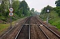
 Banbury to Oxford railway line - geograph.org.uk - 464115.jpg 640 × 480; 126 KB
-
 Bridge 191, Oxford Canal - geograph.org.uk - 3475400.jpg 4,000 × 3,000; 5.02 MB
-
 Bridge 192, Oxford Canal - geograph.org.uk - 3475404.jpg 4,000 × 3,000; 4.81 MB
-
 Bridge 192, Souldern Bridge - geograph.org.uk - 4516413.jpg 1,024 × 761; 286 KB
-
 Bridge 193, Chisnell Lift Bridge - geograph.org.uk - 4517489.jpg 1,024 × 814; 227 KB
-
 Bridge 193, Oxford Canal - geograph.org.uk - 3475413.jpg 4,000 × 3,000; 5.02 MB
-
 Bridge over the M40 South of Souldern - geograph.org.uk - 3555710.jpg 640 × 426; 205 KB
-
 Bridleway at Horwell Corner - geograph.org.uk - 2736796.jpg 640 × 480; 77 KB
-
 Bridleway to Fritwell - geograph.org.uk - 4384510.jpg 1,024 × 768; 110 KB
-
 Buttercup meadow next to the Oxford Canal - geograph.org.uk - 4517477.jpg 1,024 × 995; 352 KB
-

-
 Cow parsley and buttercups - geograph.org.uk - 4517453.jpg 1,024 × 778; 341 KB
-
 Farmland by the Chiltern Line - geograph.org.uk - 4520954.jpg 640 × 426; 28 KB
-
 Farmland near Upper Souldern Farm - geograph.org.uk - 3368773.jpg 640 × 430; 37 KB
-
 Field edge and Crook's Firs - geograph.org.uk - 4388174.jpg 1,024 × 768; 149 KB
-
 Field edge and radar domes - geograph.org.uk - 4388085.jpg 1,024 × 768; 138 KB
-
 Fox Hill Telecoms Mast - geograph.org.uk - 4454733.jpg 1,651 × 2,321; 1.79 MB
-
 Fox Lane, Souldern - geograph.org.uk - 1892252.jpg 1,600 × 1,200; 1,012 KB
-
 Gate by Ockley Brook - geograph.org.uk - 4388191.jpg 1,024 × 768; 319 KB
-
 Gate on the towpath - geograph.org.uk - 3373624.jpg 3,730 × 2,818; 4.86 MB
-
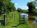 Gate on the towpath of the Oxford Canal - geograph.org.uk - 4517497.jpg 1,024 × 780; 329 KB
-
 Hay meadow by the Oxford Canal - geograph.org.uk - 5645117.jpg 1,024 × 768; 225 KB
-
 High Street, Souldern - geograph.org.uk - 1891565.jpg 1,600 × 1,200; 592 KB
-
 High Street, Souldern - geograph.org.uk - 1892270.jpg 1,600 × 1,200; 955 KB
-
 M40 about to cross a minor stream - geograph.org.uk - 3022761.jpg 640 × 480; 68 KB
-
 M40 Motorway - geograph.org.uk - 3530612.jpg 3,434 × 1,764; 1.18 MB
-
 M40 motorway - Wharf Lane bridge - geograph.org.uk - 3022760.jpg 640 × 480; 60 KB
-
 M40 motorway crossing Holtage Lane - geograph.org.uk - 3022759.jpg 640 × 480; 55 KB
-
 M40 nears Wharf Lane bridge - geograph.org.uk - 2829666.jpg 640 × 482; 32 KB
-
 M40 northbound - geograph.org.uk - 3224288.jpg 640 × 480; 43 KB
-
 M40 panorama north of Fritwell - geograph.org.uk - 3022746.jpg 640 × 480; 61 KB
-
 M40 south near Fritwell - geograph.org.uk - 2829667.jpg 640 × 481; 36 KB
-

-
 North along Fox Lane, Souldern - geograph.org.uk - 1892558.jpg 1,600 × 1,200; 1.25 MB
-
 North along the towpath and Oxford Canal - geograph.org.uk - 4516407.jpg 1,024 × 768; 247 KB
-
 North of Souldern - geograph.org.uk - 5333264.jpg 640 × 480; 48 KB
-
 Northbound M40 near Souldern - geograph.org.uk - 3610586.jpg 640 × 480; 238 KB
-
 Northbound M40, Wharf Lane Bridge - geograph.org.uk - 3296987.jpg 640 × 480; 372 KB
-
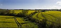
 Oil seed rape fields by Souldern Grounds - geograph.org.uk - 3931310.jpg 3,000 × 1,403; 962 KB
-
 Oil seed rape fields near Souldern Grounds - geograph.org.uk - 3931325.jpg 3,000 × 1,389; 827 KB
-
 Old milemarker (geograph 6095736).jpg 480 × 640; 115 KB
-
 Old Toll House, Souldern - geograph.org.uk - 6115059.jpg 640 × 480; 148 KB
-
 On Souldern Viaduct near Aynho - geograph.org.uk - 1266900.jpg 640 × 427; 94 KB
-
 Oxford Canal - geograph.org.uk - 125269.jpg 640 × 480; 74 KB
-
 Oxford Canal - geograph.org.uk - 2700334.jpg 640 × 480; 78 KB
-
 Oxford Canal Walk - geograph.org.uk - 5192249.jpg 640 × 480; 70 KB
-
 Oxford to Banbury railway line - geograph.org.uk - 464112.jpg 480 × 640; 112 KB
-
 Quad bike on the bridleway to Croughton - geograph.org.uk - 4388169.jpg 1,024 × 768; 118 KB
-
 Railway viaduct - geograph.org.uk - 464300.jpg 640 × 480; 119 KB
-
 Road bridge over the M40 - geograph.org.uk - 4962417.jpg 1,500 × 1,125; 149 KB
-
 Road passing Tower Fields - geograph.org.uk - 2736804.jpg 640 × 480; 79 KB
-
 Roadstone awaiting use - geograph.org.uk - 4388082.jpg 1,024 × 768; 132 KB
-
 Round Hill, Stoke Lyne - geograph.org.uk - 4384529.jpg 1,024 × 768; 141 KB
-
 Seven Shires Way - geograph.org.uk - 2700339.jpg 640 × 480; 96 KB
-
 Seven Shires Way - geograph.org.uk - 2700344.jpg 640 × 480; 80 KB
-
 Underneath the arches - geograph.org.uk - 464306.jpg 640 × 480; 154 KB
-
 Viaduct near Souldern - geograph.org.uk - 1092709.jpg 640 × 480; 93 KB
-
 Souldern Grounds - geograph.org.uk - 3368771.jpg 640 × 430; 34 KB
-
 Souldern Road Junction - geograph.org.uk - 6194407.jpg 1,600 × 1,200; 576 KB
-
 Souldern Viaduct - geograph.org.uk - 1266906.jpg 640 × 427; 65 KB
-
 Souldern Wesleyan Chapel - geograph.org.uk - 103819.jpg 640 × 480; 52 KB
-
 Souldern, Oxfordshire, St Mary the Virgin - geograph.org.uk - 4594962.jpg 4,608 × 3,456; 4 MB
-
 The bridleway from Croughton to Fritwell - geograph.org.uk - 4384481.jpg 1,024 × 768; 181 KB
-
 The bridleway to Croughton - geograph.org.uk - 4384485.jpg 1,024 × 768; 159 KB
-
 The bridleway to Croughton - geograph.org.uk - 4388165.jpg 1,024 × 768; 119 KB
-
 The Fox public house, Fox Lane, Souldern - geograph.org.uk - 1892259.jpg 1,600 × 1,199; 993 KB
-
 The Fox, Souldern - geograph.org.uk - 331494.jpg 640 × 480; 92 KB
-
 The M40 heading southbound - geograph.org.uk - 4962398.jpg 1,500 × 1,125; 126 KB
-
 The M40 heading southbound - geograph.org.uk - 4962405.jpg 1,500 × 1,125; 125 KB
-
 The Oxford Canal almost hidden by vegetation - geograph.org.uk - 5645122.jpg 1,024 × 768; 243 KB
-
 The Oxford Canal and Aynho Viaduct - geograph.org.uk - 5429122.jpg 1,024 × 768; 184 KB
-
 The Oxford Canal and towpath - geograph.org.uk - 4517364.jpg 1,024 × 727; 379 KB
-
 The Village Pond Souldern - geograph.org.uk - 103820.jpg 640 × 480; 43 KB
-
 Towards Aynho Park - geograph.org.uk - 5333265.jpg 640 × 480; 53 KB
-
 Towpath along the Oxford Canal - geograph.org.uk - 4516390.jpg 984 × 1,024; 504 KB
-
 View from the Souldern Viaduct - geograph.org.uk - 3368775.jpg 640 × 430; 31 KB
-
 View towards Tower Fields - geograph.org.uk - 4388087.jpg 1,024 × 768; 117 KB
-
 View west across the River Cherwell valley - geograph.org.uk - 4516401.jpg 1,024 × 800; 261 KB
-

-
 Water Tower by the M40 - geograph.org.uk - 2687441.jpg 640 × 430; 47 KB
-
 Wharf Farm Bridge - geograph.org.uk - 1325031.jpg 640 × 413; 65 KB
-
 Wharf Lane Overbridge, M40 - geograph.org.uk - 2461344.jpg 640 × 452; 34 KB
-
 Bridleway to Padbury's Bottom - geograph.org.uk - 453276.jpg 640 × 463; 96 KB
-
 Footpath to Souldern - geograph.org.uk - 453318.jpg 640 × 480; 135 KB
-
 Gateway to farm at Crook's Firs - geograph.org.uk - 453349.jpg 640 × 480; 136 KB
-
 Gateway to Upper Aynho Grounds - geograph.org.uk - 453243.jpg 640 × 454; 90 KB
-
 Sign in Padbury's Bottom - geograph.org.uk - 453288.jpg 480 × 640; 168 KB
-
 Tower Fields, Souldern - geograph.org.uk - 453361.jpg 640 × 302; 58 KB
-
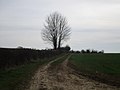
 Trees near Souldern - geograph.org.uk - 395177.jpg 640 × 426; 46 KB


.jpg)


