Category:St.-Bartholomäus-Kirche (Mannheim)
Jump to navigation
Jump to search
| Object location | | View all coordinates using: OpenStreetMap |
|---|
building in Mannheim, Grand Duchy of Baden, Germany  | |||||
| Upload media | |||||
| Instance of | |||||
|---|---|---|---|---|---|
| Location | Mannheim, Karlsruhe Government Region, Baden-Württemberg, Germany | ||||
| Architectural style | |||||
| Heritage designation | |||||
 | |||||
Media in category "St.-Bartholomäus-Kirche (Mannheim)"
The following 11 files are in this category, out of 11 total.
-
 Katholische Bartholomäuskirche - panoramio.jpg 1,782 × 1,668; 390 KB
-
 Mannheim Sandhofen St. Bartholomaeus 20120809.jpg 3,103 × 4,990; 5.07 MB
-
 Mannheim Sandhofen St. Bartholomäus 20100803.jpg 2,178 × 3,372; 1.7 MB
-
 Mannheim-Sandhofen-St-Bartholomaeus-Kirche-Grundriss.png 1,400 × 986; 2.48 MB
-
 Mannheim-Sandhofen-St-Bartholomaeus-Kirche-Josef.jpg 300 × 203; 36 KB
-
 Mannheim-Sandhofen-St-Bartholomaeus-Kirche-Maria.jpg 300 × 206; 40 KB
-
 Mannheim-Sandhofen-St-Bartholomaeus-Kirche-Mosaik.jpg 300 × 248; 52 KB
-
 Mannheim-Sandhofen-St-Bartholomaeus-Kirche-Portal.jpg 300 × 397; 72 KB
-
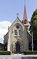
 Mannheim-Sandhofen-St-Bartholomaeus-Kirche.jpg 555 × 980; 184 KB
-
 Sandhofen 036.jpg 2,560 × 1,920; 2.33 MB
-
 Sandhofen 038.jpg 1,604 × 2,320; 467 KB


