Category:St. Aloysius School, Arnhem
Jump to navigation
Jump to search
| Object location | | View all coordinates using: OpenStreetMap |
|---|
 | |||||
| Upload media | |||||
| Instance of | |||||
|---|---|---|---|---|---|
| Location | Arnhem, Gelderland, Netherlands | ||||
| Street address |
| ||||
| Located on street | |||||
| Heritage designation |
| ||||
 | |||||
|
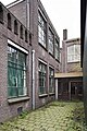
This is a category about rijksmonument number 516848
|
| Address |
|
Media in category "St. Aloysius School, Arnhem"
The following 21 files are in this category, out of 21 total.
-
 Arnhem - Weverstraat 39 - 1.jpg 1,944 × 2,592; 1.55 MB
-
 Arnhem - Weverstraat 39 - 2.jpg 2,592 × 1,944; 1.66 MB
-

-

-

-

-

-

-

-

-

-

-

-
 Overzicht van de voorgevel - Arnhem - 20531771 - RCE.jpg 800 × 1,200; 217 KB
-

-
 Overzicht van enkele vensters in de voorgevel - Arnhem - 20531772 - RCE.jpg 800 × 1,200; 292 KB
-

-

-

-

-
 Zicht op de achtergevel - Arnhem - 20531775 - RCE.jpg 800 × 1,200; 253 KB


