Category:St Nicholas' church, Knaptoft
Jump to navigation
Jump to search
| Object location | | View all coordinates using: OpenStreetMap |
|---|
church ruin in Knaptoft, Harborough, Leicestershire, UK  | |||||
| Upload media | |||||
| Instance of | |||||
|---|---|---|---|---|---|
| Location | Knaptoft, Harborough, Leicestershire, East Midlands, England | ||||
| Heritage designation |
| ||||
 | |||||
Media in category "St Nicholas' church, Knaptoft"
The following 16 files are in this category, out of 16 total.
-
 Benefactor tribute - geograph.org.uk - 224700.jpg 640 × 385; 64 KB
-
 Gravestones and snowdrops, Knaptoft.jpg 3,888 × 5,184; 7.12 MB
-
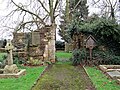
 Holy Ground - geograph.org.uk - 224701.jpg 333 × 640; 82 KB
-
 Knaptoft Church Ruins sign - geograph.org.uk - 224699.jpg 640 × 557; 114 KB
-
 Knaptoft-Ruined Church - geograph.org.uk - 2773351.jpg 640 × 480; 109 KB
-
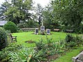 Peaceful garden - geograph.org.uk - 224695.jpg 640 × 480; 142 KB
-
 Silver Jubilee Commemoration sign - geograph.org.uk - 224702.jpg 528 × 640; 134 KB
-
 St Nicholas, Knaptoft 1.jpg 5,067 × 3,801; 5.68 MB
-
 St Nicholas, Knaptoft 2.jpg 3,888 × 5,184; 5.93 MB
-
 St Nicholas, Knaptoft 3.jpg 5,184 × 3,888; 5.94 MB
-
 St Nicholas, Knaptoft 4.jpg 5,067 × 3,801; 4.49 MB
-
 St Nicholas, Knaptoft 5.jpg 5,067 × 3,801; 5.19 MB
-
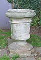 The Font - geograph.org.uk - 224694.jpg 444 × 640; 97 KB
-
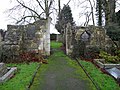
 The Lych Gate - geograph.org.uk - 224697.jpg 480 × 640; 120 KB
-
 The Nave - geograph.org.uk - 224692.jpg 640 × 480; 113 KB
-
 The South Door - geograph.org.uk - 224693.jpg 640 × 599; 175 KB


