Category:St Nicholas Kirk, Aberdeen
Jump to navigation
Jump to search
| Object location | | View all coordinates using: OpenStreetMap |
|---|
church in Aberdeen, Scotland, UK   | |||||
| Upload media | |||||
| Instance of | |||||
|---|---|---|---|---|---|
| Part of |
| ||||
| Named after | |||||
| Dedicated to | |||||
| Location |
| ||||
| Street address |
| ||||
| Heritage designation |
| ||||
| Inception |
| ||||
| Different from | |||||
| official website | |||||
 | |||||
|
This is a category about listed building number 19966. |
|
This is a category about listed building number 19967. |

Subcategories
This category has only the following subcategory.
S
Media in category "St Nicholas Kirk, Aberdeen"
The following 55 files are in this category, out of 55 total.
-
 17th Century monuments, St Nicholas' Kirkyard, Aberdeen - geograph.org.uk - 4294556.jpg 1,600 × 1,529; 857 KB
-
 18th Jan 2014- South & St. Nicholas Kirk Spires.JPG 4,608 × 3,456; 5.86 MB
-
 Aberdeen (38584880582).jpg 1,920 × 1,275; 558 KB
-

-

-
 Aberdeen Harbour, Victoria Dock - geograph.org.uk - 5926654.jpg 800 × 600; 563 KB
-
 Aberdeen Nicholas east end 6505691.jpg 768 × 1,024; 159 KB
-
 Aberdeen St Nicholas Kirk.jpg 2,196 × 3,344; 3.61 MB
-
 Aberdeen, St. Nicholas Kirk - geograph.org.uk - 598079.jpg 480 × 640; 53 KB
-
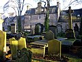
 Aberdeen-162-St Nicholas-Kirkyard-2009-gje.jpg 2,991 × 1,927; 2.77 MB
-
 Aberdeen-164-St Nicholas-Kirkyard-2009-gje.jpg 2,994 × 1,954; 3.3 MB
-
 Aberdeen-166-St Nicholas-Kirkyard-2009-gje.jpg 2,048 × 2,876; 2.16 MB
-
 Aberdeen-168-St Nicholas-Kirkyard-2009-gje.jpg 2,886 × 1,708; 1.62 MB
-
 Aberdeen-170-St Nicholas-Kirkyard-2009-gje.jpg 2,907 × 1,701; 1.83 MB
-
 Aberdeen-172-St Nicholas-Kirkyard-Moewe-2009-gje.jpg 2,808 × 1,807; 1.57 MB
-
 Aberdeen-174-St Nicholas-Kirkyard-2009-gje.jpg 3,072 × 2,048; 2.89 MB
-
 Aberdeen-176-St Nicholas-Kirkyard-2009-gje.jpg 3,072 × 2,048; 2.82 MB
-
 Aberdeen-178-St Nicholas-Kirkyard-2009-gje.jpg 2,032 × 2,796; 2.42 MB
-
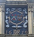
 Arms of George Wilson of Fingach (or Finzeauch) - geograph.org.uk - 4321779.jpg 1,430 × 1,600; 811 KB
-
-
 Carillon, Mither Kirk - geograph.org.uk - 3130669.jpg 3,216 × 4,288; 3.47 MB
-
 Churchyard at St.Nicholas - geograph.org.uk - 5485584.jpg 1,800 × 1,012; 2.13 MB
-
 Commemorative plaque to Scottish Parliament sitting in Aberdeen 2002.jpg 2,719 × 1,894; 3.2 MB
-

-
 Fire in St Nicholas Kirk - Artist Unknown - ABDAG012366.jpg 500 × 333; 25 KB
-
 Gravestone of James Blaikie, Aberdeen.jpg 1,960 × 4,032; 4.58 MB
-
 Gravestone of John Duffus.jpg 1,748 × 3,110; 4.35 MB
-
 Graveyard at St Nicholas Church - geograph.org.uk - 650093.jpg 600 × 450; 112 KB
-
 John Smith monument, St Nicholas Kirkyard, Aberdeen - geograph.org.uk - 4493893.jpg 1,596 × 1,600; 779 KB
-
 John Smith, Architect.jpg 798 × 798; 383 KB
-
 Kirk of St Nicholas, Aberdeen - geograph.org.uk - 1578878.jpg 428 × 640; 119 KB
-
 Memorials, St Nicholas Kirkyard - geograph.org.uk - 3875110.jpg 1,600 × 1,064; 667 KB
-
 Regent Quay, Aberdeen Harbour - geograph.org.uk - 5926306.jpg 800 × 533; 598 KB
-
 Screen of St Nicholas Churchyard, Union Street, Aberdeen.JPG 2,816 × 2,112; 2.93 MB
-
 Screen to St Nicholas' Churchyard, Union Street, Aberdeen.jpg 1,600 × 1,200; 690 KB
-

-
 St Nicholas (East) Church - geograph.org.uk - 4294205.jpg 1,600 × 1,447; 671 KB
-
 St Nicholas (the Mither Kirk), Aberdeen - geograph.org.uk - 3136252.jpg 1,031 × 1,600; 406 KB
-
 St Nicholas Carillon - geograph.org.uk - 3129666.jpg 4,288 × 3,216; 3.63 MB
-
 St Nicholas Church - George Washington Wilson - ABDMS018092.jpg 500 × 384; 26 KB
-
 St Nicholas Churchyard (19852291741).jpg 1,600 × 1,501; 2.77 MB
-
 St Nicholas Churchyard, Union Street, Aberdeen - geograph.org.uk - 4989535.jpg 1,024 × 682; 253 KB
-
 St Nicholas Kirk - geograph.org.uk - 1241540.jpg 480 × 640; 59 KB
-
 St Nicholas Kirk spire - geograph.org.uk - 1241592.jpg 480 × 640; 65 KB
-
 St Nicholas Kirk, Aberdeen.jpg 5,012 × 3,341; 7.17 MB
-
 St Nicholas Kirk.jpg 429 × 640; 145 KB
-
 St Nicholas Spire and Kirkyard Screen. - geograph.org.uk - 115875.jpg 640 × 437; 123 KB
-
 St Nicholas Uniting Church - geograph.org.uk - 3412973.jpg 1,600 × 1,064; 670 KB
-
 St Nicholas' Kirkyard - geograph.org.uk - 4294199.jpg 1,600 × 1,064; 634 KB
-
 St.Nicholas Uniting Spire - geograph.org.uk - 5485594.jpg 1,800 × 1,800; 2.05 MB
-
 Table Tombs, St Nicholas Churchyard - geograph.org.uk - 3391554.jpg 1,600 × 1,064; 495 KB
-
 The Mither Kirk - geograph.org.uk - 2927293.jpg 1,680 × 2,520; 475 KB
-
 The West Church - geograph.org.uk - 3391555.jpg 1,600 × 1,064; 639 KB
-

-
 William Rickart memorial, St Nicholas' Kirkyard, Aberdeen - geograph.org.uk - 4322481.jpg 1,503 × 2,495; 2.11 MB


.jpg)

.jpg)


_-_geograph.org.uk_-_4321779.jpg)


_Church_-_geograph.org.uk_-_4294205.jpg)
,_Aberdeen_-_geograph.org.uk_-_3136252.jpg)


.jpg)


