Category:Sunderlandwick
Jump to navigation
Jump to search
English: Sunderlandwick is a hamlet in the East Riding of Yorkshire, England. It is situated approximately 1.5 miles (2.4 km) south of Driffield and lies to the west of the A164 road.
village in United Kingdom | |||||
| Upload media | |||||
| Instance of | |||||
|---|---|---|---|---|---|
| Location | Hutton Cranswick, East Riding of Yorkshire, Yorkshire and the Humber, England | ||||
 | |||||
Media in category "Sunderlandwick"
The following 12 files are in this category, out of 12 total.
-
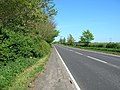 A164 towards Driffield - geograph.org.uk - 1302135.jpg 640 × 480; 110 KB
-
 Bridleway at TA022558 - geograph.org.uk - 82269.jpg 640 × 480; 111 KB
-
 Bridleway towards Skerne Leys - geograph.org.uk - 1302139.jpg 640 × 480; 155 KB
-
 Driffield Golf Club - geograph.org.uk - 82275.jpg 640 × 480; 152 KB
-
 Farmland at TA0013954011 - geograph.org.uk - 90118.jpg 640 × 480; 253 KB
-
 Farmland South of Driffield - geograph.org.uk - 82273.jpg 640 × 480; 127 KB
-
 Hedgerow and Field - geograph.org.uk - 1302137.jpg 640 × 480; 103 KB
-
 Power Lines at TA0028053884 - geograph.org.uk - 82310.jpg 480 × 640; 77 KB
-
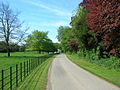
 Sunderland Wick Parkland - geograph.org.uk - 1301706.jpg 640 × 480; 87 KB
-
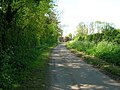 Track to Old Sunderlandwick - geograph.org.uk - 1301724.jpg 640 × 480; 102 KB
-
 Track to Old Sunderlandwick - geograph.org.uk - 1302126.jpg 640 × 480; 107 KB
-
 Track to Sunderlandwick Hall.jpg 640 × 480; 118 KB


