Category:Tankerton
Jump to navigation
Jump to search
English: A suburb of Whitstable, Tankerton was a commercial development by the Tankerton Estate Company in the late 19th century, and was designed with a grid of streets leading from the shoreline. It used to be known as Tankerton-on-Sea.
suburb of Whitstable, Kent, England, United Kingdom  | |||||
| Upload media | |||||
| Instance of | |||||
|---|---|---|---|---|---|
| Location | Canterbury, Kent, South East England, England | ||||
| Population |
| ||||
| Area |
| ||||
 | |||||
Subcategories
This category has the following 3 subcategories, out of 3 total.
T
- Tankerton Beach (42 F)
- Tankerton Slopes (9 F)
W
- Whitstable Castle (23 F)
Media in category "Tankerton"
The following 70 files are in this category, out of 70 total.
-
 Beach and groyne, Whitstable - geograph.org.uk - 1456878.jpg 640 × 430; 151 KB
-
 Beach houses, Tankerton - geograph.org.uk - 1334316.jpg 640 × 480; 82 KB
-
 Beach hut (4904028263).jpg 3,110 × 4,392; 6.44 MB
-
 Beach Huts Alley - geograph.org.uk - 502881.jpg 640 × 480; 114 KB
-
 Beach huts on Tankerton Slopes - geograph.org.uk - 1623705.jpg 640 × 418; 31 KB
-
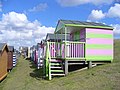
 Beach Huts, Tankerton (2) - geograph.org.uk - 1456900.jpg 640 × 430; 122 KB
-
 Beach Huts, Tankerton - geograph.org.uk - 1456897.jpg 640 × 430; 121 KB
-
 Beach Huts, Tankerton Esplanade (2) - geograph.org.uk - 1456987.jpg 640 × 430; 120 KB
-
 Beach Huts, Tankerton Esplanade (3) - geograph.org.uk - 1457010.jpg 640 × 430; 123 KB
-
 Beach Huts, Tankerton Esplanade - geograph.org.uk - 1456982.jpg 640 × 430; 123 KB
-
-
 Bridge over the Crab and Winkle - geograph.org.uk - 381808.jpg 640 × 480; 87 KB
-
 Cafe on the clifftop - geograph.org.uk - 1980627.jpg 640 × 480; 90 KB
-

-
 Commemorative Bench, Tankerton - geograph.org.uk - 1456998.jpg 640 × 430; 139 KB
-

-
 Graystone Road, Tankerton - geograph.org.uk - 1813411.jpg 3,072 × 2,304; 2.58 MB
-
 Lifeguard Hut, Tankerton - geograph.org.uk - 1456905.jpg 640 × 430; 121 KB
-

-
 Marine Crescent, Tankerton - geograph.org.uk - 3163640.jpg 640 × 427; 73 KB
-
 Marine Parade, Tankerton - geograph.org.uk - 1813443.jpg 3,072 × 2,304; 2.39 MB
-
 Marine Parade, Tankerton - geograph.org.uk - 1980554.jpg 640 × 480; 75 KB
-
 Marine Parade, Tankerton, Kent - geograph.org.uk - 2134041.jpg 800 × 600; 91 KB
-
 Roundabout, Tankerton Road, Tankerton - geograph.org.uk - 1813430.jpg 3,072 × 2,304; 2.41 MB
-

-
 Swalecliffe Road, Tankerton - geograph.org.uk - 478784.jpg 640 × 480; 96 KB
-
 Tankerton Bay Sailing Club - geograph.org.uk - 1123371.jpg 640 × 480; 62 KB
-
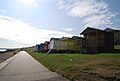
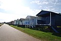
 Tankerton Beach - geograph.org.uk - 1426536.jpg 640 × 480; 59 KB
-
 Tankerton Beach - geograph.org.uk - 5128483.jpg 640 × 480; 72 KB
-
 Tankerton Esplanade - geograph.org.uk - 1169223.jpg 640 × 481; 74 KB
-
 Tankerton Esplanade - geograph.org.uk - 1320917.jpg 640 × 457; 244 KB
-
 Tankerton Esplanade - geograph.org.uk - 1320918.jpg 640 × 457; 255 KB
-
 Tankerton Esplanade - geograph.org.uk - 1425910.jpg 640 × 480; 35 KB
-
 Tankerton Esplanade - geograph.org.uk - 1457003.jpg 640 × 430; 121 KB
-
 Tankerton Promenade - geograph.org.uk - 2389607.jpg 1,280 × 960; 488 KB
-
 Tankerton Road, Tankerton - geograph.org.uk - 1813406.jpg 3,072 × 2,304; 2.56 MB
-
 Tankerton Road, Tankerton - geograph.org.uk - 1813423.jpg 3,072 × 2,304; 2.34 MB
-
 Tankerton Sailing Club - geograph.org.uk - 1456991.jpg 640 × 430; 113 KB
-
 Tankerton Sailing Club - geograph.org.uk - 2734706.jpg 1,024 × 768; 155 KB
-
 Tankerton sailing club building - geograph.org.uk - 1980629.jpg 640 × 480; 89 KB
-
 Tankerton shore - geograph.org.uk - 1320884.jpg 640 × 457; 322 KB
-

-
 Tankerton, Marine Parade - geograph.org.uk - 2509857.jpg 480 × 640; 46 KB
-
 Tesco Express, Tankerton - geograph.org.uk - 1813417.jpg 3,072 × 2,304; 2.62 MB
-
 The Esplanade at Tankerton - geograph.org.uk - 1277127.jpg 640 × 480; 83 KB
-
 The Lees Tankerton Kent.jpg 3,359 × 2,192; 7.46 MB
-
 The Lifeguard Unit, Tankerton - geograph.org.uk - 931933.jpg 640 × 480; 56 KB
-
 The Marine Hotel, Tankerton - geograph.org.uk - 1888531.jpg 3,488 × 2,616; 2.28 MB
-
 The Paddock (3) - geograph.org.uk - 5164269.jpg 640 × 480; 79 KB
-
 The Paddock - geograph.org.uk - 5128508.jpg 640 × 480; 68 KB
-

-
 The Royal at Tankerton - geograph.org.uk - 1980621.jpg 640 × 480; 93 KB
-
 The Royal, Tankerton - geograph.org.uk - 2437900.jpg 640 × 480; 97 KB
-
 The Street at Tankerton - geograph.org.uk - 5159778.jpg 4,608 × 3,456; 3.39 MB
-
 The Street at Tankerton - geograph.org.uk - 5159781.jpg 4,608 × 3,456; 3.32 MB
-
 The Street at Tankerton - geograph.org.uk - 5159785.jpg 4,608 × 3,456; 3.37 MB
-
 The Street at Tankerton - geograph.org.uk - 5159791.jpg 4,608 × 3,456; 3.41 MB
-
 The Street at Tankerton - geograph.org.uk - 5161029.jpg 4,455 × 3,341; 2.64 MB
-
 The Street at Tankerton - geograph.org.uk - 5161037.jpg 4,555 × 3,417; 2.64 MB
-
 Tower Parade, Tankerton - geograph.org.uk - 1426527.jpg 640 × 480; 41 KB
-
 Valente's Cafe, Tankerton - geograph.org.uk - 1813435.jpg 3,072 × 2,304; 2.31 MB
-
 Whitstable Street (9) - geograph.org.uk - 5164277.jpg 640 × 480; 59 KB
-
 Whitstable Street - geograph.org.uk - 5128497.jpg 640 × 480; 77 KB
-
 Beachfront Holiday Accommodation - geograph.org.uk - 502908.jpg 640 × 480; 118 KB
-
 Beacon and sandbar, Whitstable - geograph.org.uk - 31686.jpg 477 × 715; 63 KB
-
 Boats, Tankerton Sailing Club - geograph.org.uk - 1456994.jpg 640 × 430; 135 KB
-
 Dinghies at Tankerton Bay - geograph.org.uk - 502890.jpg 640 × 480; 114 KB
-
 Footbridge over A2990 - geograph.org.uk - 340220.jpg 483 × 640; 94 KB
-
 Graystone Road, Tankerton - geograph.org.uk - 478799.jpg 640 × 480; 87 KB
-
 Tesco, Millstrood Road - geograph.org.uk - 340228.jpg 640 × 486; 87 KB


.jpg)


_-_geograph.org.uk_-_1456900.jpg)

_-_geograph.org.uk_-_1456987.jpg)
_-_geograph.org.uk_-_1457010.jpg)


_-_geograph.org.uk_-_5164269.jpg)


_-_geograph.org.uk_-_5164277.jpg)


