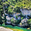
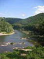
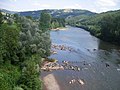
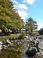
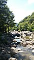
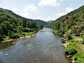
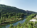
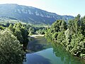
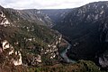
Category:Tarn River
Przejdź do nawigacji
Przejdź do wyszukiwania
river in southern France   .png) | |||||
| Prześlij plik multimedialny | |||||
| Nagranie wymowy | |||||
|---|---|---|---|---|---|
| Jest to | |||||
| Miejsce | Górna Garonna, Oksytania, Francja metropolitarna, Francja | ||||
| Długość |
| ||||
| Ujście cieku wodnego |
| ||||
| Dorzecze |
| ||||
| Dopływ |
| ||||
| Inne niż | |||||
 | |||||
Podkategorie
Poniżej wyświetlono 15 spośród wszystkich 15 podkategorii tej kategorii.
*
F
- Fluvial deposits in Tarn River (1 plik)
G
L
- Lac de Saint-Amans (4 pliki)
- Le Tarn à Gaillac - Georges Gaudion (3 pliki)
M
R
S
- Saut du Tarn (4 pliki)
Pliki w kategorii „Tarn River”
Poniżej wyświetlono 200 spośród wszystkich 207 plików w tej kategorii.
(poprzednia strona) (następna strona)-
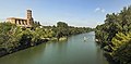
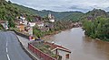
 (Albi) Le Tarn vu du vieux pont vers l'ouest.jpg 8256 × 4659; 37,24 MB
-
-
 31 - Buzet-sur-Tarn - Le Tarn vu du pont suspendu - les piles de l'ancien pont.jpg 12 692 × 6270; 47,22 MB
-
-
 81 - Rabastens - L'église Notre-Dame-du-Bourg - Exposition sud-est.jpg 8256 × 4508; 42,31 MB
-
 81 - Rabastens - Le centre historique au bord du tarn.jpg 8476 × 5504; 37,29 MB
-
 81 - Rabastens - Seuil (barrage) du moulin sur le Tarn, vue du pont de Rabastens.jpg 8951 × 5524; 34,63 MB
-
 Abbaye saint michel de gaillac.JPG 2048 × 1536; 1,34 MB
-
 Abbaye Saint-Michel a Gaillac - PA00132878 Centre.jpg 8501 × 8883; 54,79 MB
-
 Abbaye Saint-Michel a Gaillac - PA00132878.jpg 9530 × 7572; 60,93 MB
-
 Abbaye Saint-Michel.jpg 800 × 600; 178 KB
-
 Abbaye St Michel.jpg 1124 × 751; 233 KB
-
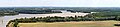
 Aerial-photo-Lagrave-Tarn.jpg 3872 × 2592; 4,06 MB
-

-
 Alrance River in Brousse-le-Chateau 02.jpg 3784 × 2523; 9,58 MB
-
 Ambialet 11.jpg 2560 × 1440; 1,27 MB
-
 Ambialet 13.jpg 2560 × 1440; 1,25 MB
-
 Ambialet 3.jpg 2560 × 1440; 1022 KB
-
 Ambialet vue2 (cropped).JPG 2100 × 300; 270 KB
-
 Ambialet vue2.JPG 2272 × 1704; 1,22 MB
-
 Ambialet.JPG 2013 × 1433; 318 KB
-
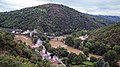
 Anglès (Tarn, Fr) vue du village.JPG 4000 × 3000; 3,68 MB
-
 Attempt Of Extreme Backlighting And Flare (213143671).jpeg 2048 × 1365; 698 KB
-
 Au bord du Tarn (Claude-Félix-Théodore d'Aligny).jpg 2529 × 2048; 717 KB
-
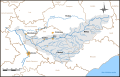 Bassin-versant-Tarn-entier.svg 1605 × 1029; 271 KB
-
 Blick vom Rocher de Capluc den Tarn abwärts.jpg 3888 × 2592; 6,13 MB
-
 Blick vom Rocher de Capluc hinab zum Tarn.jpg 3888 × 2592; 8,48 MB
-
 Bords du Tarn, Sapiac, Montauban, 16 juin 1899 (4811580399).jpg 454 × 315; 27 KB
-
 Boudou - Laurent Seignobos 1.jpg 4352 × 2904; 2,96 MB
-
 Boudou point of view on confluence Tarn-Garonne.JPG 3872 × 2592; 3,73 MB
-
 Brousse-Le-Chateau-2019-06-01-2405.jpg 4288 × 2848; 10,18 MB
-
 Brousse-Le-Chateau-2019-06-01-2408.jpg 4288 × 2848; 9,11 MB
-
 Brousse-Le-Chateau-2019-06-01-2453.jpg 4288 × 2848; 9,83 MB
-
 Brousse-Le-Chateau-2019-06-01-2455.jpg 2848 × 4288; 10,28 MB
-
 Buzet sur Tarn vu depuis le pont suspendu.JPG 1920 × 1080; 920 KB
-
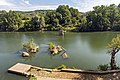
 Canoeing on Tarn River 01.jpg 6000 × 4000; 21,1 MB
-
 Canoeing on Tarn River 02.jpg 6000 × 4000; 17,88 MB
-
 Canoeing on Tarn River.jpg 6000 × 4000; 13,4 MB
-
 Centrale 1 intérieur.JPG 2658 × 1948; 950 KB
-
 Centrale des Avalats.JPG 2338 × 1772; 259 KB
-
 Chateau et clocher Florac.JPG 1280 × 960; 261 KB
-
 Château de Brousse 5.JPG 3648 × 2736; 3,18 MB
-
 Château de Reyniès -1.JPG 4896 × 3672; 2,52 MB
-
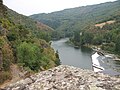
 Confluence Dourbie Tarn 268-269mod.jpg 3837 × 1706; 5,15 MB
-
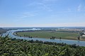
 Confluence Tarn Garonne 2023.jpg 9353 × 2098; 2,94 MB
-
 ConfluenceGaronneTarn.JPG 3072 × 2304; 2,83 MB
-
 De Tarn.jpg 1279 × 1279; 1,21 MB
-
 El riu Tarn al seu pas pel poble de Les Vignes.jpeg 1024 × 428; 75 KB
-
 Energie Hydraulique.jpg 3460 × 2452; 632 KB
-
-
-
 FR-12-Brousse-le-Château1.JPG 1600 × 1200; 394 KB
-
 FR-12-Brousse-le-Château2.JPG 1600 × 1200; 454 KB
-
 FR-12-Brousse-le-Château3.JPG 1600 × 1200; 425 KB
-
 FR-12-Le Truel.JPG 1200 × 1600; 373 KB
-
 FR-12-Les Raspes.JPG 1600 × 1200; 433 KB
-
 FR-12-Les Raspes1.JPG 1200 × 1600; 374 KB
-
 FR-12-Lincou1.JPG 1600 × 1200; 395 KB
-
 FR-12-Millau7.JPG 1600 × 1200; 409 KB
-
 FR-12-Pinet2.JPG 1200 × 1600; 402 KB
-
 FR-12-Pinet4.JPG 1600 × 1200; 389 KB
-
 FR-12-Saint-Rome-de-Tarn2.JPG 1200 × 1600; 404 KB
-
 FR-12-Saint-Rome-de-Tarn3.JPG 1600 × 1200; 451 KB
-
 FR-48-Florac13.JPG 1600 × 1200; 447 KB
-
 FR-81-Ambialet.JPG 1600 × 1200; 391 KB
-
 FR-81-Marssac2.JPG 1600 × 1200; 405 KB
-
 FR-81-Saint-Juéry1.JPG 1600 × 1200; 384 KB
-
 FR-81-Saint-Juéry2.JPG 1600 × 1200; 404 KB
-
 FR-81-Saint-Juéry3.JPG 1600 × 1200; 444 KB
-
 FR-81-Saint-Juéry4.JPG 1600 × 1200; 463 KB
-
 FR-81-Tarn.JPG 1200 × 1600; 395 KB
-
 FR-81-Tarn1.JPG 1200 × 1600; 349 KB
-
 FR-81-Tarn2.JPG 1600 × 1200; 445 KB
-
Fr-Paris--Tarn.ogg 0,4 s; 7 KB
-
 France Lozere Le Pont-de-Montvert 01.jpg 2193 × 1473; 1,09 MB
-
 France Lozère Parc national des Cévennes Tarn 5.jpg 2112 × 2816; 2,2 MB
-
 France Lozère Parc national des Cévennes Tarn 6.jpg 2816 × 2112; 2,12 MB
-
 France-Aveyron-Tarn et Dourdou.jpg 2048 × 1536; 473 KB
-
 Gaillac Abbaye St Michel.jpg 1485 × 1980; 929 KB
-
 Gaillac, église Saint-Michel-PM 17244.jpg 709 × 464; 290 KB
-
 Gaillac, église Saint-Michel-PM 17246.jpg 709 × 404; 223 KB
-
 Gorges du Tarn en Lozère.jpg 4159 × 3032; 3,32 MB
-
 La rivière du Tarn.jpg 6000 × 4000; 8,22 MB
-
 Le Tarn à Bédouès 2.jpg 3264 × 1836; 1,96 MB
-
 Le Tarn à Bédouès.jpg 1836 × 3264; 2,61 MB
-
 Le Tarn à Gaillac vue en amont du Pont Saint-Michel.jpg 8256 × 5504; 32,68 MB
-
 Le Tarn à villemur.jpg 7360 × 4912; 30,53 MB
-
 Le Truel-December 0665.JPG 3264 × 2448; 1,93 MB
-
 Le Truel-December 0666.JPG 3264 × 2448; 1,98 MB
-
 Le Truel-December 0667.JPG 4608 × 3456; 3,84 MB
-
 Le Truel-December 0668.JPG 4608 × 3456; 3,86 MB
-
 Le Truel-December 0669.JPG 3840 × 1080; 1,11 MB
-
 Le Truel-December 0670.JPG 4608 × 3456; 3,78 MB
-
 Le Truel-December 0672.JPG 3264 × 2448; 2 MB
-
 Les Fils d'Émile Deyrolle - Le Tarn (Lozère).jpg 1280 × 982; 314 KB
-
 MapTarn.jpg 668 × 600; 449 KB
-
 Meuniers descendant le Tarn (Paul Mirabaud, 1888).jpg 1871 × 1342; 431 KB
-
 MillauTarn8354.JPG 2016 × 1512; 997 KB
-
 Miroir (155788497).jpeg 2048 × 1042; 600 KB
-
 Moissac and Tarn river, France.jpg 5669 × 3780; 11,59 MB
-
 Moissac and Tarn river.jpg 1600 × 921; 567 KB
-
 Panorama rabastens.jpg 2691 × 800; 188 KB
-
 Panoramic view of Brousse-le-Chateau 02.jpg 11 438 × 2581; 23,97 MB
-
 Panoramic view of Brousse-le-Chateau 03.jpg 7767 × 2211; 11,18 MB
-
 Panoramic view of Brousse-le-Chateau 04.jpg 8728 × 2262; 12,56 MB
-
 Panoramic view of Brousse-le-Chateau 05.jpg 8807 × 2291; 12,56 MB
-
 Panoramic view of Brousse-le-Chateau 06.jpg 7984 × 2338; 13,95 MB
-
 Pont de Montbrun sur le Tarn.jpg 3648 × 2736; 3,41 MB
-
 Pont Vieux Albi FRA 001.jpg 2311 × 3471; 1,31 MB
-
 Rabastens - 8541.jpg 5184 × 3456; 8,25 MB
-
 Rabastens.JPG 962 × 729; 263 KB
-
 River-Tarn01.jpg 4746 × 2202; 5,51 MB
-
 Rock formations in the Tarn River gorge.jpg 6000 × 4000; 14,54 MB
-
 Small island seen from Vieux pont d'Albi.JPG 4896 × 3672; 6,57 MB
-
 St Rome de Tarn 5675.JPG 3264 × 2448; 3,33 MB
-
 St Rome de Tarn 5676.JPG 3264 × 2448; 3,64 MB
-
 St Rome de Tarn- beach 0915.JPG 3488 × 2616; 2,05 MB
-
 St Rome de Tarn- beach 0916.JPG 3488 × 2616; 2,19 MB
-
 St Rome de Tarn- beach 0920.JPG 3488 × 2616; 2,19 MB
-
 St Rome de Tarn- beach 0923.JPG 3488 × 2616; 2,19 MB
-
 St Rome de Tarn- camping 0924.JPG 3488 × 2616; 2,16 MB
-
 St Rome de Tarn-canoes 0922.JPG 3488 × 2616; 2,17 MB
-
 Tarn (155788509).jpeg 2048 × 587; 435 KB
-
 Tarn (rivière).png 665 × 325; 500 KB
-
 Tarn - Château Lastours -.jpg 3872 × 2592; 2,88 MB
-
 Tarn @ Arthès.jpg 3872 × 2592; 3,61 MB
-
 Tarn @ Les Avalats.jpg 3872 × 2592; 3,17 MB
-
 Tarn Broquiès le Navech amont.jpg 3264 × 2448; 1,98 MB
-
 Tarn Broquiès le Navech aval.jpg 3264 × 2448; 2,16 MB
-
 Tarn Brousse-le-Château amont.jpg 3264 × 2448; 1,84 MB
-
 Tarn Brousse-le-Château aval.jpg 3264 × 2448; 2,15 MB
-
 Tarn Comprégnac Peyre amont.jpg 3183 × 2387; 1,28 MB
-
 Tarn Comprégnac Peyre aval.jpg 3264 × 2448; 1,99 MB
-
 Tarn la Cresse pont D512 aval.jpg 3131 × 2349; 1,97 MB
-
 Tarn Le Rozier D996 aval.jpg 3105 × 2329; 1,64 MB
-
 Tarn Le Rozier pont ruiné D996 amont.jpg 3191 × 2393; 2,46 MB
-
 Tarn Millau pont Lerouge aval.jpg 3183 × 2387; 1,54 MB
-
 Tarn P1010049mod.jpg 2560 × 1725; 3,37 MB
-
 Tarn Paulhe D506 amont.jpg 3264 × 2448; 2,27 MB
-
 Tarn Paulhe D506 aval.jpg 3264 × 2448; 2,25 MB
-
 Tarn River (France).jpg 2048 × 1536; 866 KB
-
 Tarn River and Castle Peyrelade.jpg 4000 × 6000; 12,89 MB
-
 Tarn River in Brousse-le-Chateau 01.jpg 2464 × 1643; 3,44 MB
-
 Tarn River in Brousse-le-Chateau 02.jpg 3615 × 2410; 7,73 MB
-
 Tarn River in Castelbouc 01.jpg 2999 × 1999; 6,79 MB
-
 Tarn River in Castelbouc 02.jpg 1650 × 2523; 4,23 MB
-
 Tarn river in Gaillac (1).jpg 4249 × 2833; 10,04 MB
-
 Tarn river in Gaillac (2).jpg 5754 × 3836; 17,55 MB
-
 Tarn river in Gaillac (3).jpg 4141 × 2761; 10,98 MB
-
 Tarn river in Gaillac (4).jpg 5410 × 3607; 17,71 MB
-
 Tarn river in Les Vignes (1).jpg 5612 × 3695; 15,96 MB
-
 Tarn river in Les Vignes (2).jpg 5231 × 3411; 15,6 MB
-
 Tarn river in Les Vignes (3).jpg 5090 × 3292; 12,13 MB
-
 Tarn river in Les Vignes (4).jpg 5296 × 3331; 12,43 MB
-
 Tarn River in Les Vignes 01.jpg 4000 × 6000; 21,09 MB
-
 Tarn River in Les Vignes 02.jpg 6000 × 4000; 21,26 MB
-
 Tarn River in Les Vignes 03.jpg 6000 × 4000; 22,88 MB
-
 Tarn River in Les Vignes 04.jpg 6000 × 4000; 13,46 MB
-
 Tarn River in Les Vignes 05.jpg 2440 × 3660; 8,69 MB
-
 Tarn River in Les Vignes 06.jpg 3882 × 2461; 9,35 MB
-
 Tarn River in Les Vignes 07.jpg 2995 × 1997; 6,18 MB
-
 Tarn River in Les Vignes.jpg 5657 × 3377; 16,38 MB
-
 Tarn River in Lincou 01.jpg 4198 × 2799; 8,84 MB
-
 Tarn River in Lincou 02.jpg 3067 × 2116; 4,53 MB
-
 Tarn River in Lincou 03.jpg 2878 × 1919; 5,24 MB
-
 Tarn river in Millau (1).jpg 5480 × 2934; 13,77 MB
-
 Tarn River in Millau.jpg 4200 × 2800; 8,68 MB
-
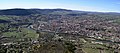
 Tarn River in Montauban.jpg 11 133 × 2709; 15,07 MB
-
 Tarn River in Mostuejouls.jpg 6000 × 4000; 14,41 MB
-
 Tarn River in Peyre.jpg 4975 × 3016; 9,92 MB
-
 Tarn River in Prades 01.jpg 2983 × 1989; 5,66 MB
-
 Tarn River in Prades 02.jpg 2965 × 1977; 4,7 MB
-
 Tarn River in Riviere-sur-Tarn 01.jpg 6000 × 4000; 10,81 MB
-
 Tarn River in Riviere-sur-Tarn 02.jpg 4000 × 6000; 11,97 MB
-
 Tarn river in St-Chely (1).jpg 6039 × 3630; 17,83 MB
-
 Tarn river in St-Chely (2).jpg 4573 × 3039; 12,44 MB
-
 Tarn river in St-Chely (3).jpg 2371 × 4028; 8,56 MB
-
 Tarn river in St-Chely (4).jpg 3767 × 2960; 10,39 MB
-
 Tarn Viala-du-Tarn Pinet barrage aval.jpg 3157 × 2367; 2,24 MB
-
 Tarn à Montauban.jpg 4032 × 3024; 1,91 MB
-
 Tarn, autoroute A68.JPG 2592 × 1944; 2,29 MB
-
 Tarn-Garonne confluence.jpg 3896 × 2616; 4,38 MB
-
 Tarn-River04.jpg 1600 × 1200; 415 KB
-
 Tarn-River05.jpg 2048 × 1536; 773 KB
-
 Tarn-Viaur.svg 1024 × 768; 34 KB
-
 Tarn.jpg 2048 × 1536; 1,6 MB
-
 Tarnfluss.jpg 768 × 512; 55 KB
-
 Valley of Tarn River 01.jpg 5782 × 3844; 15,28 MB
-
 Valley of Tarn River 02.jpg 6000 × 4000; 20,24 MB
-
 Valley of Tarn river from Pouncho d'Agast (1).jpg 4675 × 1731; 6,66 MB
-
 Valley of Tarn River.jpg 6000 × 4000; 19,7 MB
-
 Viala-du-Tarn Pinet village (2).jpg 3264 × 2448; 2,33 MB
-
 View of Ambialet.jpg 2000 × 3008; 1,01 MB
-
 View of Brousse-le-Chateau 01.jpg 3918 × 2612; 10,46 MB
-
 View of Brousse-le-Chateau 02.jpg 3855 × 2570; 8,04 MB
-
 View of Brousse-le-Chateau 03.jpg 4034 × 2244; 8,24 MB
-
 View of Les Vignes 01.jpg 1958 × 2937; 5,87 MB
-
 View of Les Vignes 02.jpg 2875 × 1917; 5,75 MB
-
 View of Les Vignes 04.jpg 4210 × 2807; 11,73 MB
-
 View of Tarn river from Chateau de Blanquefort.jpg 4650 × 3615; 14,88 MB
_Le_Tarn_vu_du_vieux_pont_vers_l%27ouest.jpg)


_du_moulin_sur_le_Tarn,_vue_du_pont_de_Rabastens.jpg)


_vue_du_village.JPG)
.jpeg)
.jpg)


.jpg)


.f44.cropped.Gorges_de_la_Jonte,_jonction_du_Tarn_et_de_la_Jonte.jpg)
.f44.Gorges_de_la_Jonte,_jonction_du_Tarn_et_de_la_Jonte.jpg)


.jpg)
.jpg)

.jpeg)


.jpg)


.jpg)
.jpg)
.jpg)
.jpg)
.jpg)
.jpg)
.jpg)
.jpg)


.jpg)


.jpg)
.jpg)
.jpg)
.jpg)


.jpg)


.JPG)
.jpeg)
.jpg)