Category:Theodore Roosevelt Island
Zur Navigation springen
Zur Suche springen
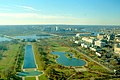
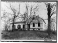
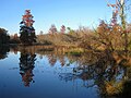
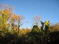
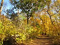
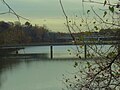
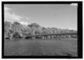
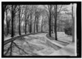
English: Theodore Roosevelt Island is an island in the Potomac River opposite Georgetown, Washington, D.C. and across the city of Rosslyn, Virginia. It is separated from Georgetown by Georgetown Channel; the channel between the island and the Virginia shoe is known as the Little River. Before it was bought in 1931 by Theodore Roosevelt Memorial Association, the island was known as Mason's Island and used for farming. The association hired Frederick Law Olmsted, Jr., a landscape architect, in 1932 to transform a 90-acre island into a natural primeval forest preserve with three ecological zones (upland forest, swamp, and tidal marsh) and 2.5 miles of trails as a tribute to Theodore Roosevelt's conservationism and love of nature.
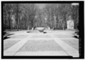
35,736 native hardwood trees (including elm, oak, beech, maple, locust, and tulip poplars), shrubs, ferns, and various small plants were planted on the island.[1] In 1963-1967, a formal memorial to the 26th President of the United States was built on the northern part of the island.
|
Diese Kategorie enthält Dateien zu einem Objekt, das im National Register of Historic Places der Vereinigten Staaten verzeichnet ist. Die Referenznummer lautet 66000869. |
Insel im Potomac River  | |||||
| Medium hochladen | |||||
| Ist ein(e) | |||||
|---|---|---|---|---|---|
| Ist Teil von | |||||
| Benannt nach | |||||
| Ort | Washington, D.C., District of Columbia | ||||
| Liegt am oder im Gewässer | |||||
| Eigentümer/Besitzer |
| ||||
| Betreiber | |||||
| Schutzkategorie |
| ||||
| Schutzgebietkategorie der IUCN | |||||
| Datum der Gründung, Erstellung, Entstehung, Erbauung |
| ||||
| Breite |
| ||||
| Länge |
| ||||
| Einwohnerzahl |
| ||||
| Fläche |
| ||||
| offizielle Website | |||||
 | |||||
Unterkategorien
Es werden 3 von insgesamt 3 Unterkategorien in dieser Kategorie angezeigt:
In Klammern die Anzahl der enthaltenen Kategorien (K), Seiten (S), Dateien (D)
T
Medien in der Kategorie „Theodore Roosevelt Island“
Folgende 188 Dateien sind in dieser Kategorie, von 188 insgesamt.
-
 Washington - West from Washington Monument (1965) (4383150483).jpg 1.250 × 655; 399 KB
-

-
 Washington - Looking West from Washington Monument (1988) (4383150543).jpg 1.200 × 799; 489 KB
-
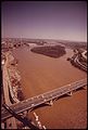
 Aerial view of Rosslyn, Virginia 14565a.tiff 2.318 × 1.530; 20,32 MB
-
 Aerial view of Rosslyn, Virginia.jpg 1.024 × 676; 385 KB
-
 AnalostanMansion.jpg 912 × 588; 116 KB
-
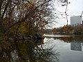
 Area under the bridge, Theodore Roosevelt Island.jpg 2.560 × 1.920; 1,08 MB
-
 Barren Trunks - Winter Forest.jpg 4.000 × 6.000; 9,86 MB
-

-
 Bridge seen from Theodore Roosevelt Island.jpg 2.560 × 1.920; 1,74 MB
-

-

-
 Causeway marker and river, Theodore Roosevelt Island.jpg 2.560 × 1.920; 2,62 MB
-
 Causeway marker, Theodore Roosevelt Island.jpg 1.920 × 2.560; 2,41 MB
-

-

-
-
 Description of the Mason family property, Theodore Roosevelt Island.jpg 2.560 × 1.920; 2,96 MB
-

-
-

-

-

-

-

-

-

-

-
 Entering TR island.jpg 2.560 × 1.920; 1,47 MB
-
 Fallen Truck.jpg 4.000 × 6.000; 10,29 MB
-
 Footbridge to Theodore Roosevelt Island (3685299164).jpg 2.048 × 1.536; 818 KB
-

-

-
 George Washington Parkway Rosslyn.JPG 2.048 × 1.536; 1,49 MB
-
 Georgetown 1861.jpg 3.701 × 2.519; 6,3 MB
-
 Georgetown ferry-boat carrying wagons 00932v.jpg 1.024 × 782; 160 KB
-
 Georgetown waterfront in 1865.jpg 6.659 × 5.122; 7,19 MB
-
 Georgetown, Washington, D.C. HDR.jpg 3.194 × 2.311; 3,56 MB
-
 Graffiti under the bridge, Theodore Roosevelt Island.jpg 2.560 × 1.920; 1,72 MB
-
 Grasses and trees, Theodore Roosevelt Island.jpg 2.560 × 1.920; 2,81 MB
-
 Guards at ferry landing on Mason's Island00930v.jpg 1.024 × 873; 224 KB
-

-
 Harper's weekly (1865) (14578728620).jpg 2.008 × 3.012; 1,57 MB
-
 Heart and other things on the bridge, Theodore Roosevelt Island.jpg 1.920 × 2.560; 1,81 MB
-

-

-

-

-

-
-

-

-

-

-
-

-

-
-

-
-

-

-

-

-

-

-

-

-

-

-

-
-

-

-
-

-

-

-

-
-
-

-

-

-

-

-
 Kennedy Center behind Barren Winter Vegetation 1.jpg 6.000 × 4.000; 9,19 MB
-
 Kennedy Center behind Barren Winter Vegetation 2.jpg 6.000 × 4.000; 9,6 MB
-
 Kennedy Center behind Barren Winter Vegetation 3.jpg 6.000 × 4.000; 9,38 MB
-
 Kennedy Center behind Barren Winter Vegetation 5.jpg 6.000 × 4.000; 10,2 MB
-
 Kennedy Center behind Barren Winter Vegetation.jpg 6.000 × 4.000; 11 MB
-
 Little Island from the other side of the bridge.jpg 2.560 × 1.920; 1,83 MB
-
 Little Island under the bridge.jpg 2.560 × 1.920; 1,86 MB
-
 Little River Potomac Back Channel.JPG 800 × 600; 548 KB
-
 Little River Potomac channel.JPG 2.048 × 1.536; 2,29 MB
-
-

-
 Markers along the Potomac, Theodore Roosevelt Island.jpg 1.920 × 2.560; 2,44 MB
-
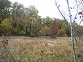
 Marsh and trees, Theodore Roosevelt Island.jpg 2.560 × 1.920; 2,73 MB
-
 Marsh area, Theodore Roosevelt Island.jpg 2.560 × 1.920; 1,95 MB
-
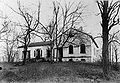 Mason House.jpg 951 × 655; 538 KB
-

-

-

-

-

-

-
 Mud, Theodore Roosevelt Island.jpg 2.560 × 1.920; 1,57 MB
-
 Mural by Auriel Bessemer, "Early Indian Life on Analostan Island".jpg 3.264 × 2.448; 2,06 MB
-
-

-

-

-

-

-

-

-
 Path on TR island.jpg 2.560 × 1.920; 1,31 MB
-

-
 PR Georgetown or City of Washington 1801 by Beck.jpg 3.556 × 2.000; 2,8 MB
-

-

-
-

-
 Reeds during Winter 1.jpg 4.000 × 6.000; 8,53 MB
-
 Reeds during Winter 2.jpg 4.000 × 6.000; 5,82 MB
-
 Remains of a former causeway, Theodore Roosevelt Island.jpg 2.560 × 1.920; 2,55 MB
-
 Rock outcropping TR island.JPG 2.048 × 1.536; 2,58 MB
-
 Rosslyn skyline 2016.jpg 3.264 × 2.448; 2,32 MB
-
 Schist outcropping at TR island.JPG 2.048 × 1.536; 2,36 MB
-
 Teddy Roosevelt Island Bridge.jpg 1.280 × 851; 584 KB
-

-
-
 The Water Gate (6077267562).jpg 2.592 × 1.936; 1,52 MB
-
 Theodore Roosevelt Island bedrock.JPG 2.048 × 1.536; 3,06 MB
-
 Theodore Roosevelt Island cattail marsh (32806262906).jpg 4.288 × 2.848; 12,18 MB
-
 Theodore Roosevelt Island DC - IMG 7124.JPG 3.264 × 2.448; 3,92 MB
-
 Theodore Roosevelt Island DC - IMG 7164.JPG 3.264 × 2.448; 5,08 MB
-
 Theodore Roosevelt Island DC - IMG 7167.JPG 3.264 × 2.448; 2,42 MB
-
 Theodore Roosevelt Island DC - IMG 7171.JPG 3.264 × 2.448; 3,35 MB
-
 Theodore Roosevelt Island DC - IMG 7173.JPG 3.264 × 2.448; 4,22 MB
-
 Theodore Roosevelt Island DC - IMG 7193.JPG 3.264 × 2.448; 3,17 MB
-
 Theodore Roosevelt Island DC - IMG 7195.JPG 3.264 × 2.448; 5,22 MB
-
 Theodore Roosevelt Island DC - IMG 7198.JPG 2.448 × 3.264; 4,64 MB
-
 Theodore Roosevelt Island entrance clearing.jpg 2.048 × 1.536; 3,2 MB
-
 Theodore Roosevelt Island footbridge.jpg 2.048 × 1.536; 1,47 MB
-
 Theodore Roosevelt Island parking lot.JPG 2.048 × 1.536; 1,56 MB
-
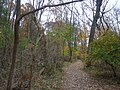
 Theodore Roosevelt Island trails (1).JPG 2.048 × 1.536; 1,41 MB
-
 Theodore Roosevelt Island trails (2).JPG 2.048 × 1.536; 1,91 MB
-
 Theodore Roosevelt Island trails (3).JPG 2.048 × 1.536; 1,78 MB
-
 Theodore Roosevelt Island trails (4).JPG 2.048 × 1.536; 1,86 MB
-
 Theodore Roosevelt Island trails (5).JPG 2.048 × 1.536; 1,85 MB
-
 Theodore Roosevelt Island trails.JPG 2.048 × 1.536; 2,24 MB
-
 Theodore Roosevelt Island.svg 2.026 × 1.769; 71 KB
-
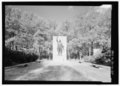
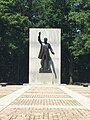
 Theodore Roosevelt Statue by Paul Manship.jpg 3.407 × 5.111; 8,56 MB
-
 TR Island footbridge.jpg 2.048 × 1.536; 1,81 MB
-
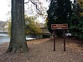 TR Island welcome sign.JPG 2.048 × 1.536; 2,58 MB
-
 TR marsh.jpg 2.560 × 1.920; 1,72 MB
-

-
-
-

-

-

-

-

-

-

-

-

-

-

-
-
-

-

-

-

-

-

-

-

-
 Virginia and Maryland by Augustine Herman, 1736.jpg 3.112 × 5.228; 2,82 MB
-
 Walking trail, Theodore Roosevelt Island.jpg 2.560 × 1.920; 2,43 MB
-
 Washington, D.C. - Theodore Roosevelt Island - 20170819141015.jpg 2.448 × 3.264; 1,61 MB
-
 Chelone glabra - White Turtlehead 2 (cropped).jpg 1.677 × 1.058; 1,25 MB
-
 Chelone glabra - White Turtlehead 2.jpg 2.835 × 2.126; 3,47 MB
-
 Chelone glabra - White Turtlehead.jpg 2.683 × 2.011; 2,88 MB
_(4383150483).jpg)
_(4383150441).jpg)
_(4383150543).jpg)


.png)


_Island,_Washington,_D.C._(Ground_plan,_view_and_cross_section_of_one_of_the..._-_NARA_-_305820.jpg)


.png)


.jpg)


.png)
_(14578728620).jpg)


.png)
.png)
.png)


.png)
.jpg)

.jpg)


.JPG)
.JPG)
.JPG)
.JPG)
.JPG)


.jpg)

