Category:Tilsworth
Jump to navigation
Jump to search
English: Tilsworth is a small village in Bedfordshire. It lies to the north west of Dunstable, and the Roman Watling Street (A5) forms the north east boundary of the parish of 1200 acres (4.8 km²). The village lies on the gault clay, where springs well up just south of a gentle gravelly ridge. A large proportion of the area is still farmland.
a village located in Central Bedfordshire, United Kingdom  | |||||
| Upload media | |||||
| Instance of | |||||
|---|---|---|---|---|---|
| Location | Central Bedfordshire, Bedfordshire, East of England, England | ||||
| official website | |||||
 | |||||
Subcategories
This category has only the following subcategory.
T
- All Saints church, Tilsworth (3 F)
Media in category "Tilsworth"
The following 31 files are in this category, out of 31 total.
-
 All Saints Church, Tilsworth - geograph.org.uk - 2181784.jpg 2,272 × 1,704; 779 KB
-
 All Saints Tilsworth - geograph.org.uk - 3411433.jpg 1,600 × 1,068; 536 KB
-
 All Saints Tilsworth - geograph.org.uk - 3411436.jpg 1,600 × 1,067; 449 KB
-
 Bench by the village notices - geograph.org.uk - 3411520.jpg 1,600 × 1,069; 521 KB
-
 Central Bedfordshire , The A5 - geograph.org.uk - 5733073.jpg 6,000 × 4,000; 5.87 MB
-
 Central Bedfordshire , The A5 - geograph.org.uk - 5733074.jpg 6,000 × 4,000; 5.64 MB
-
 Central Bedfordshire , The A5 - geograph.org.uk - 5733075.jpg 6,000 × 4,000; 6.48 MB
-
 Direct Pallets, Hockliffe - geograph.org.uk - 6143479.jpg 1,920 × 1,280; 883 KB
-
 Dunstable Road leaves Tilsworth - geograph.org.uk - 4666838.jpg 640 × 480; 131 KB
-

-
 Electricity cables across the field - geograph.org.uk - 3411496.jpg 1,600 × 1,068; 365 KB
-
 Farmland near Tilsworth - geograph.org.uk - 4160454.jpg 640 × 480; 215 KB
-
 Field and trough - geograph.org.uk - 3411415.jpg 1,600 × 1,068; 618 KB
-
 Fields by the A5, Tilsworth - geograph.org.uk - 2882662.jpg 1,600 × 1,200; 635 KB
-
 Footpath between the houses - geograph.org.uk - 3411510.jpg 1,600 × 1,067; 454 KB
-
 Footpath toward Hockliffe - geograph.org.uk - 3411449.jpg 1,200 × 1,600; 565 KB
-
 Gatehouse to Manor Farm Tilsworth Geograph-3411443-by-Philip-Jeffrey.jpg 1,200 × 1,600; 567 KB
-
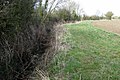 Hedge and ditch by the field edge - geograph.org.uk - 3411492.jpg 1,600 × 1,068; 651 KB
-
 Hidden stile - geograph.org.uk - 2741264.jpg 1,024 × 768; 376 KB
-
 New roundabout on the A5, Houghton Regis - geograph.org.uk - 5279824.jpg 2,304 × 1,728; 980 KB
-
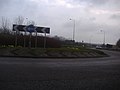 Roundabout on the A5 and A505, Tilsworth - geograph.org.uk - 2882634.jpg 1,600 × 1,200; 584 KB
-
 Stream flowing to Ouzel Brook - geograph.org.uk - 3411501.jpg 1,200 × 1,600; 726 KB
-
 The A5, Hockliffe - geograph.org.uk - 5279823.jpg 2,304 × 1,728; 881 KB
-
 The A5, Tilsworth - geograph.org.uk - 2882659.jpg 1,600 × 1,200; 550 KB
-
 The A5, Tilsworth - geograph.org.uk - 2882660.jpg 1,600 × 1,200; 591 KB
-
 The A505 north of Totternhoe - geograph.org.uk - 5279842.jpg 2,200 × 1,578; 1.02 MB
-
 The Anchor, Tilsworth - geograph.org.uk - 4666828.jpg 640 × 480; 163 KB
-
 The Anchor, Tilsworth - geograph.org.uk - 637861.jpg 640 × 480; 90 KB
-
 The Dunstable Downs from the A5, Tilsworth - geograph.org.uk - 2882667.jpg 1,600 × 1,200; 573 KB
-
 Tilsworth from the air - geograph.org.uk - 3189002.jpg 640 × 480; 89 KB
-
 Tilsworth Golf Centre - geograph.org.uk - 2633302.jpg 4,000 × 3,000; 4.56 MB


