Category:Tremeirchion
Jump to navigation
Jump to search
town and community in Denbighshire, Wales ,_Cymru_ym_Mryniau_Clwyd_11.jpg) | |||||
| Upload media | |||||
| Instance of | |||||
|---|---|---|---|---|---|
| Location | Denbighshire, Wales | ||||
| Population |
| ||||
| Area |
| ||||
 | |||||
Cymraeg: Pentref yn Sir Ddinbych wrth odrau gorllewinol Bryniau Clwyd yw Tremeirchion. Fe'i lleolir tua 5 milltir i'r gogledd-ddwyrain o dref Dinbych a 4 milltir i'r de-ddwyrain o Lanelwy, ar lôn heb gategori rhwng Rhuallt yn y gogledd a Bodfari yn y de. Mae'n tua milltir a hanner o Afon Clwyd gyda golygfeydd braf dros rannau isaf Dyffryn Clwyd a bryniau Rhos.
English: Tremeirchion ( previously known as Lleweni) is a small residential community in Denbighshire, Wales. It is located on the B5429 road, to the north east of Denbigh and to the west of St Asaph.
Subcategories
This category has the following 6 subcategories, out of 6 total.
A
- Aerial images of Tremeirchion (19 F)
B
C
F
- Ffynnon Beuno, Tremeirchion (1 F)
L
- Lleweni Hall (20 F)
S
Media in category "Tremeirchion"
The following 200 files are in this category, out of 209 total.
(previous page) (next page)-
 'Noson Lawen' Concert at Lleweni Uchaf, Bodfari (5410383615).jpg 597 × 447; 79 KB
-

-
 A55 crosses old road near Rhuallt - geograph.org.uk - 2231266.jpg 640 × 480; 67 KB
-
-
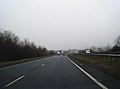
 A55 eastbound near Rhuallt - geograph.org.uk - 2344744.jpg 640 × 480; 38 KB
-
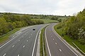
 A55 Expressway - geograph.org.uk - 3954040.jpg 3,264 × 2,448; 3.77 MB
-
 A55 junction near Pen-y-Cefn - geograph.org.uk - 2231244.jpg 640 × 480; 53 KB
-
 A55 layby heading east - geograph.org.uk - 4610571.jpg 1,024 × 697; 111 KB
-
 A55 westbound - geograph.org.uk - 2787678.jpg 640 × 475; 29 KB
-
 A55 westbound - geograph.org.uk - 2787684.jpg 640 × 480; 43 KB
-
 A55 westbound from the Rhuallt footbridge - geograph.org.uk - 6202056.jpg 1,024 × 768; 230 KB
-
 A55, foot of Rhuallt Hill - geograph.org.uk - 3157293.jpg 640 × 430; 51 KB
-
 A55, Junction 29 - geograph.org.uk - 3157198.jpg 640 × 377; 46 KB
-
 A55, North Wales Expressway - geograph.org.uk - 4447154.jpg 640 × 480; 348 KB
-
 A55, Rhuallt Hill - geograph.org.uk - 3157221.jpg 640 × 430; 50 KB
-
 A55, westbound - geograph.org.uk - 3157131.jpg 640 × 430; 51 KB
-
 B5429 West of Rhuallt - geograph.org.uk - 6155355.jpg 1,024 × 683; 204 KB
-
 B5429 west of Rhuallt village - geograph.org.uk - 2231270.jpg 640 × 480; 45 KB
-
 Bach-y-Graig 2.png 380 × 239; 144 KB
-
 Bach-y-Graig.png 357 × 214; 125 KB
-
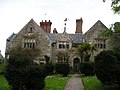
 Bachegraig House, Tremeichion. Home of Richard Clough.jpg 1,554 × 1,042; 1.29 MB
-
 Bachegraig house, Tremeichion.jpg 1,552 × 972; 1.2 MB
-
 Bachegrig House in the county of Flint.jpeg 1,467 × 985; 1.35 MB
-

-
 Bridge crossing the B5429 near Rhuallt - geograph.org.uk - 6053683.jpg 4,000 × 3,000; 2.48 MB
-
 Bridge over the A55 - geograph.org.uk - 3157138.jpg 640 × 430; 45 KB
-
 Bridge over the A55 near Pant-y-dulath - geograph.org.uk - 5615730.jpg 640 × 427; 340 KB
-
 Bridleway To Rhos or Bryngwyn Hall - geograph.org.uk - 6058022.jpg 4,000 × 3,000; 2.88 MB
-
 Cambwll bridge - geograph.org.uk - 2276671.jpg 4,000 × 3,000; 4.76 MB
-
 Capel Libanus - geograph.org.uk - 6053677.jpg 4,000 × 3,000; 2.69 MB
-
 Capel Libanus, Rhuallt - geograph.org.uk - 6155330.jpg 1,024 × 683; 206 KB
-
 Cefn Du - geograph.org.uk - 3955012.jpg 3,264 × 2,448; 3.45 MB
-
 Cefn Du - geograph.org.uk - 3955163.jpg 3,264 × 2,448; 3.57 MB
-
 Cefn Du - geograph.org.uk - 3955173.jpg 3,264 × 2,448; 3.87 MB
-
 Cennin Pedr - Daffodils - geograph.org.uk - 3921395.jpg 480 × 640; 79 KB
-
 Cennin Pedr 2 - Daffodils 2 - geograph.org.uk - 3921402.jpg 640 × 491; 70 KB
-
 Dead end on the old Roman road, Rhuallt - geograph.org.uk - 6154512.jpg 1,024 × 683; 247 KB
-
 Descending Rhuallt Hill - geograph.org.uk - 3157216.jpg 640 × 371; 48 KB
-
 Eglwys y Garreg-fawr St Mary's (The Rock Chapel), Sant Beuno, Tremeichion 29.jpg 4,272 × 2,848; 4.14 MB
-
 Eglwys y Garreg-fawr St Mary's (The Rock Chapel), Sant Beuno, Tremeichion 31.jpg 4,272 × 2,848; 4.33 MB
-
 Eglwys y Garreg-fawr St Mary's (The Rock Chapel), Sant Beuno, Tremeichion 32.jpg 4,272 × 2,848; 6.01 MB
-
 Eglwys y Garreg-fawr St Mary's (The Rock Chapel), Sant Beuno, Tremeichion 33.jpg 4,272 × 2,848; 6.28 MB
-
 Farmers Arms - geograph.org.uk - 27733.jpg 512 × 384; 33 KB
-
 Farmland near to Pen-y-Cefn - geograph.org.uk - 4447160.jpg 640 × 480; 297 KB
-
 Farmland to the south of the A55 Expressway - geograph.org.uk - 6058027.jpg 4,000 × 3,000; 2.32 MB
-
 Felled tree stacks - geograph.org.uk - 6058016.jpg 4,000 × 3,000; 4.28 MB
-
 Fenced In - geograph.org.uk - 2276650.jpg 4,000 × 3,000; 4.87 MB
-
 Fferm Pistyll - Pistyll Farm - geograph.org.uk - 3954049.jpg 3,264 × 2,448; 3.76 MB
-
 Ffermdy Cae Rhys Farmhouse - geograph.org.uk - 6058035.jpg 4,000 × 3,000; 2.87 MB
-
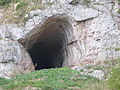
 Ffynnon Beuno Cave, Tremeirchion - geograph.org.uk - 627574.jpg 640 × 480; 94 KB
-
 Ffynnon Beuno Retreat - geograph.org.uk - 6053688.jpg 4,000 × 3,000; 2.77 MB
-
 Ffynnon Beuno Retreat - geograph.org.uk - 6053987.jpg 4,000 × 3,000; 2.69 MB
-
 Fields near Rhuallt - geograph.org.uk - 124.jpg 640 × 480; 175 KB
-
 Foot bridge over the A55, Rhuallt - geograph.org.uk - 6154305.jpg 1,024 × 683; 190 KB
-
 Footbridge crosses the A55 - geograph.org.uk - 3157212.jpg 640 × 430; 47 KB
-
 Footbridge over the A55 near to Rhuallt - geograph.org.uk - 5615753.jpg 640 × 427; 374 KB
-
 Footpath beside Pant Glas - geograph.org.uk - 1335761.jpg 640 × 480; 106 KB
-
 Forestry near Sodom Covert - geograph.org.uk - 346576.jpg 640 × 480; 249 KB
-
 Former Roman Road, Rhuallt - geograph.org.uk - 6154304.jpg 1,024 × 683; 176 KB
-
 Former school, Rhuallt - geograph.org.uk - 6053679.jpg 4,000 × 3,000; 2.27 MB
-
 Gate and stile on the Offa's Dyke path - geograph.org.uk - 6154292.jpg 1,024 × 683; 270 KB
-
 Gate and track to Aelwyd Uchaf - geograph.org.uk - 6058009.jpg 4,000 × 3,000; 2.87 MB
-
 Gate and track to Mynydd Bychan - geograph.org.uk - 6057802.jpg 4,000 × 3,000; 2.42 MB
-
 Gate on the Offa's Dyke path - geograph.org.uk - 6154294.jpg 1,024 × 683; 154 KB
-
 Gate on the Offa's Dyke path - geograph.org.uk - 6154303.jpg 1,024 × 683; 164 KB
-
 Gateway and drive to Nantlys - geograph.org.uk - 6054026.jpg 3,717 × 2,787; 1.45 MB
-
 Gorse on the flank of Moel Maenefa - geograph.org.uk - 1332504.jpg 640 × 480; 107 KB
-
 Grazing cattle - geograph.org.uk - 6053983.jpg 4,000 × 3,000; 2.94 MB
-

-
 Henblas - geograph.org.uk - 1855339.jpg 2,048 × 1,536; 588 KB
-
 Heol-Y-Brenin, Tremeirchion - geograph.org.uk - 2763784.jpg 640 × 480; 77 KB
-
 Hillock in a field - geograph.org.uk - 6058006.jpg 4,000 × 3,000; 2.49 MB
-
 House at Tremeirchion, Flint.jpg 2,002 × 1,415; 699 KB
-
 House on the Nantlys estate - geograph.org.uk - 6054033.jpg 4,000 × 3,000; 2.59 MB
-
 House under wraps - geograph.org.uk - 6054031.jpg 4,000 × 3,000; 2.9 MB
-
 Junction of minor roads near Graig Tremeirchion - geograph.org.uk - 5985679.jpg 4,000 × 3,000; 4.28 MB
-
 Lane junction with bridleway - geograph.org.uk - 6154287.jpg 1,024 × 683; 166 KB
-
 Lane to Sychdyn Farm - geograph.org.uk - 6057790.jpg 4,000 × 3,000; 2.82 MB
-
 Lane under the power lines near Pant Glas - geograph.org.uk - 6154286.jpg 1,024 × 683; 155 KB
-
 Layby on the North Wales Expressway - geograph.org.uk - 4447162.jpg 640 × 480; 319 KB
-
 Llannerch Hall - geograph.org.uk - 27739.jpg 512 × 384; 35 KB
-
 Lletty'r Crudd, Tremeirchion - geograph.org.uk - 6054013.jpg 4,000 × 3,000; 2.2 MB
-
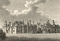 Llewenni Hall - the seat of the honble Thos Fitzmaurice, Denbighshire (1133124).jpg 1,289 × 880; 1.12 MB
-
 Llwybr Clawdd Offa - Offa's Dyke Path - geograph.org.uk - 3954901.jpg 3,264 × 2,448; 3.81 MB
-
 Llwybr Clawdd Offa - Offa's Dyke Path - geograph.org.uk - 3954980.jpg 3,264 × 2,448; 3.93 MB
-
 Lodge and gateway to Brynbella - geograph.org.uk - 6054016.jpg 4,000 × 3,000; 2.85 MB
-
 Long drive - geograph.org.uk - 2276663.jpg 4,000 × 3,000; 6.01 MB
-
 Maen Efa - geograph.org.uk - 3954882.jpg 3,264 × 2,448; 3.88 MB
-
 Minor road approaching Tan Y Graig - geograph.org.uk - 5985687.jpg 4,000 × 3,000; 4.06 MB
-
 Minor road at Summer Hill, Tremeirchion - geograph.org.uk - 5985706.jpg 4,000 × 3,000; 4.05 MB
-
 Moel Maenefa (Eve's Tomb Hill) - geograph.org.uk - 1945359.jpg 2,592 × 1,728; 1.02 MB
-
 Moel Maenefa - geograph.org.uk - 3362862.jpg 1,600 × 1,200; 1.08 MB
-
 Nant Gwilym Farm - geograph.org.uk - 6054032.jpg 4,000 × 3,000; 2.7 MB
-

-

-
 Offa's Dyke Footpath - geograph.org.uk - 34135.jpg 512 × 384; 36 KB
-
 Offa's Dyke path and a field of sheep - geograph.org.uk - 6154301.jpg 1,024 × 683; 166 KB
-
 Offa's Dyke Path approaching A55 - geograph.org.uk - 1335836.jpg 640 × 480; 103 KB
-
 Offa's Dyke Path north of Tremeirchion - geograph.org.uk - 6057807.jpg 4,000 × 3,000; 2.88 MB
-
 Offa's Dyke Path off to Sodom - geograph.org.uk - 6057843.jpg 4,000 × 3,000; 2.89 MB
-
 Offa's Dyke Path on Cefn Du - geograph.org.uk - 1335750.jpg 640 × 480; 97 KB
-
 Offa's Dyke Path on Cefn Du - geograph.org.uk - 6202052.jpg 1,024 × 768; 263 KB
-
 Offa's Dyke Path towards St Beuno's - geograph.org.uk - 1332456.jpg 640 × 480; 101 KB
-
 Ogofâu Cae Gwyn a Ffynnon Beuno 2014 01.JPG 4,896 × 3,672; 6.73 MB
-
 Ogofâu Cae Gwyn a Ffynnon Beuno 2014 02.JPG 4,896 × 3,672; 6.62 MB
-
 Ogofâu Cae Gwyn a Ffynnon Beuno 2014 03.JPG 4,896 × 3,672; 6.87 MB
-
 Ogofâu Cae Gwyn a Ffynnon Beuno 2014 04.JPG 4,896 × 3,672; 6.82 MB
-
 Ogofâu Cae Gwyn a Ffynnon Beuno 2014 05.JPG 4,896 × 3,672; 7.2 MB
-
 Ogofâu Cae Gwyn a Ffynnon Beuno 2014 06.JPG 4,896 × 3,672; 6.79 MB
-
 Ogofâu Cae Gwyn a Ffynnon Beuno 2014 07.JPG 4,896 × 3,672; 6.88 MB
-
 Ogofâu Cae Gwyn a Ffynnon Beuno 2014 08.JPG 4,896 × 3,672; 6.84 MB
-
 Ogofâu Cae Gwyn a Ffynnon Beuno 2014 09.JPG 4,896 × 3,672; 6.5 MB
-
 Ogofâu Cae Gwyn a Ffynnon Beuno 2014 10.JPG 4,896 × 3,672; 6.91 MB
-
 Ogofâu Cae Gwyn a Ffynnon Beuno 2014 11.JPG 4,896 × 3,672; 6.51 MB
-
 On the flanks of Moel Maenefa - geograph.org.uk - 1335797.jpg 640 × 480; 65 KB
-
 Overbridge at Pant-y-Dulath - geograph.org.uk - 6144145.jpg 640 × 427; 77 KB
-
 Parallel Lines - geograph.org.uk - 2181537.jpg 4,000 × 3,000; 4.82 MB
-

-
 Pen Isa'r Waen - geograph.org.uk - 6057797.jpg 4,000 × 3,000; 2.58 MB
-
 Red Smudge - geograph.org.uk - 2181533.jpg 4,000 × 3,000; 5.88 MB
-

-
 Rhuallt - geograph.org.uk - 3954020.jpg 3,264 × 2,448; 3.55 MB
-
 Rhuallt Hill - geograph.org.uk - 2181535.jpg 4,000 × 3,000; 5.73 MB
-
 Rhuallt junction on A55 westbound - geograph.org.uk - 2231248.jpg 640 × 480; 62 KB
-
 Rhuallt village school (closed) - geograph.org.uk - 6155351.jpg 1,024 × 683; 175 KB
-
 River Clwyd at Lleweni - geograph.org.uk - 1153331.jpg 640 × 480; 102 KB
-
 Road (B4529) leaving Rhuallt for Trmeirchion and Bodfari - geograph.org.uk - 5987235.jpg 4,000 × 3,000; 3.1 MB
-
 Salusbury Arms, Tremeirchion - geograph.org.uk - 627716.jpg 640 × 480; 86 KB
-
 Shut gate - geograph.org.uk - 2276654.jpg 4,000 × 3,000; 6.06 MB
-
 Smooth road - geograph.org.uk - 2276660.jpg 4,000 × 3,000; 5.01 MB
-
 Static caravans in the hills above Tremeirchion - geograph.org.uk - 6057841.jpg 4,000 × 3,000; 2.36 MB
-
 Steep and narrow hill down to Tremeirchion - geograph.org.uk - 6057804.jpg 4,000 × 3,000; 2.9 MB
-
 Steps and playground Rhuallt village school - geograph.org.uk - 6155390.jpg 1,024 × 683; 245 KB
-
 Stile on Moel Maenefa - geograph.org.uk - 1335813.jpg 640 × 480; 88 KB
-
 The A55 - geograph.org.uk - 3157137.jpg 640 × 430; 57 KB
-
 The B5429 going through Rhuallt - geograph.org.uk - 6053681.jpg 4,000 × 3,000; 2.32 MB
-
 The B5429 leaving Rhuallt - geograph.org.uk - 6155342.jpg 1,024 × 683; 162 KB
-
 The Church of Corpus Christi at Tremeirchion - geograph.org.uk - 5985694.jpg 4,000 × 3,000; 3.2 MB
-
 The Travellers Inn, Pen-y-Cefn - geograph.org.uk - 4686713.jpg 3,184 × 2,123; 1.11 MB
-
 The Travellers Inn, Pen-y-Cefn - geograph.org.uk - 4686719.jpg 3,184 × 2,123; 1.1 MB
-
 The White House Restaurant with rooms - geograph.org.uk - 6155360.jpg 1,024 × 683; 138 KB
-
 Track to Plas Coch Farm - geograph.org.uk - 5985713.jpg 4,000 × 3,000; 3.8 MB
-
 Traveller's Inn - geograph.org.uk - 6058038.jpg 4,000 × 3,000; 2.35 MB
-
 Travellers Inn from A55 - geograph.org.uk - 6144100.jpg 640 × 427; 72 KB
-
 Tree Way - geograph.org.uk - 2238507.jpg 4,000 × 3,000; 4.86 MB
-
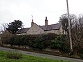
 Tremeirchion Methodist Church - geograph.org.uk - 6054022.jpg 4,000 × 3,000; 2.2 MB
-
 Tremeirchion Methodist Church. - geograph.org.uk - 627571.jpg 640 × 480; 55 KB
-
 Tremeirchion village - Corff Crist - Church of Corpus Christi, Denbighshire, Wales 13.jpg 4,272 × 2,848; 4.64 MB
-
 Tremeirchion village - Corff Crist - Church of Corpus Christi, Denbighshire, Wales 15.jpg 4,272 × 2,848; 4.14 MB
-
 Tremeirchion village - Corff Crist - Church of Corpus Christi, Denbighshire, Wales 18.jpg 4,272 × 2,848; 6.02 MB
-
 Tremeirchion village - Corff Crist - Church of Corpus Christi, Denbighshire, Wales 19.jpg 4,272 × 2,848; 6.29 MB
-
 Tremeirchion village - Corff Crist - Church of Corpus Christi, Denbighshire, Wales 47.jpg 5,969 × 2,836; 1.29 MB
-
 Tremeirchion village sign on B5429 - geograph.org.uk - 2763767.jpg 640 × 480; 82 KB
-
 Tremeirchion, Dinbych, Denbigh inc St Beuno 12.jpg 5,969 × 2,836; 1.29 MB
-
 Uchaf Track - geograph.org.uk - 2238517.jpg 4,000 × 3,000; 5.89 MB
-
 Uphill bend - geograph.org.uk - 2276656.jpg 4,000 × 3,000; 4.8 MB
-

-
 View south from Cefn Du - geograph.org.uk - 1332382.jpg 640 × 480; 75 KB
-
 Wales Denbighshire Community Tremeirchion map.svg 512 × 773; 560 KB
-
 Westbound A55 - geograph.org.uk - 5615731.jpg 640 × 427; 341 KB
-
 White Gate - geograph.org.uk - 2181539.jpg 4,000 × 3,000; 4.98 MB
-
 Wind turbine, Cefn Du - geograph.org.uk - 6154283.jpg 1,024 × 683; 119 KB
-
 Winding road to Brynbella - geograph.org.uk - 6054020.jpg 4,000 × 3,000; 2.98 MB
-
 Young trees by the lane - geograph.org.uk - 6154280.jpg 1,024 × 683; 181 KB
-

-

-
 Afon Chwiler - geograph.org.uk - 1153520.jpg 640 × 480; 137 KB
-
 Ancient agricultural equipment near Graig - geograph.org.uk - 278868.jpg 640 × 480; 325 KB
-
 Bridleway - geograph.org.uk - 184558.jpg 640 × 480; 154 KB
-

-
 Bridleway by Ty-newydd - geograph.org.uk - 346552.jpg 640 × 480; 202 KB
-
 Cottages at Graig - geograph.org.uk - 29542.jpg 448 × 336; 31 KB
-
 Country Lane - geograph.org.uk - 346471.jpg 640 × 480; 254 KB
-
 Farm at Pen y Cefn - geograph.org.uk - 184553.jpg 640 × 480; 54 KB
-
 Farm house and outbuildings - geograph.org.uk - 29541.jpg 448 × 336; 20 KB
-
 Farmbuildings near Tremeirchion - geograph.org.uk - 30509.jpg 474 × 355; 24 KB
-
 Farmland and hillside at Ruallt - geograph.org.uk - 28294.jpg 384 × 288; 16 KB
-
 Farmland at Waen - geograph.org.uk - 29575.jpg 448 × 336; 29 KB
-
 Farmland near Waen - geograph.org.uk - 29570.jpg 448 × 336; 35 KB
-
 Field and Forestry Boundary - geograph.org.uk - 346566.jpg 480 × 640; 229 KB
-
 Field Gate and Coed Cochion - geograph.org.uk - 346543.jpg 640 × 480; 113 KB
-
 Field Gate and Forestry - geograph.org.uk - 337515.jpg 640 × 480; 236 KB
-
 Fields and woods near Waen - geograph.org.uk - 29573.jpg 640 × 480; 139 KB
-

-
 Lane and ruin near Ruallt - geograph.org.uk - 29552.jpg 448 × 336; 23 KB
-
 Lodge gates at Graig - geograph.org.uk - 29544.jpg 448 × 336; 48 KB
-

-
 Mynydd Bychan - geograph.org.uk - 627729.jpg 640 × 480; 58 KB
-
 Offa's Dyke path coming down off Cefn Du - geograph.org.uk - 278863.jpg 480 × 640; 307 KB
-
 Offa's Dyke Path near Cefn Du - geograph.org.uk - 627838.jpg 640 × 480; 45 KB
-
 Old School, Tremeirchion - geograph.org.uk - 627719.jpg 640 × 480; 98 KB
-
 Pen y Cefn crossroads - geograph.org.uk - 184547.jpg 640 × 480; 74 KB
-
 Pen y Cefn fields - geograph.org.uk - 184551.jpg 640 × 480; 53 KB
-
 Rhuallt hill - geograph.org.uk - 99897.jpg 640 × 421; 56 KB
-
 Rhuallt hill and the Vale of Clwyd - geograph.org.uk - 99898.jpg 640 × 421; 52 KB
-
 River Clwyd - geograph.org.uk - 28298.jpg 448 × 336; 42 KB
-
 River Clwyd - geograph.org.uk - 606614.jpg 640 × 480; 102 KB
-
 River Clwyd from Pont Llannerch - geograph.org.uk - 606604.jpg 640 × 480; 109 KB
-
 Road junction below Moel Maenefa - geograph.org.uk - 29558.jpg 448 × 336; 26 KB
-
 Road to Tremeirchion - geograph.org.uk - 29565.jpg 448 × 336; 19 KB
.jpg)


,_Sant_Beuno,_Tremeichion_29.jpg)
,_Sant_Beuno,_Tremeichion_31.jpg)
,_Sant_Beuno,_Tremeichion_32.jpg)
,_Sant_Beuno,_Tremeichion_33.jpg)


.jpg)


_-_geograph.org.uk_-_1945359.jpg)


_near_Pen-y-Cefn_-_geograph.org.uk_-_4447150.jpg)


_-_geograph.org.uk_-_6155351.jpg)

_leaving_Rhuallt_for_Trmeirchion_and_Bodfari_-_geograph.org.uk_-_5987235.jpg)


