Category:Tuolumne River
Zur Navigation springen
Zur Suche springen
Nebenfluss des San Joaquin River  | |||||
| Medium hochladen | |||||
| Ist ein(e) | |||||
|---|---|---|---|---|---|
| Liegt in Schutzgebiet | |||||
| Ort | Kalifornien, Pacific States Region | ||||
| Länge |
| ||||
| Mündet in | |||||
| Einzugsgebiet |
| ||||
| Anrainerstaat | |||||
| Nebenfluss |
| ||||
 | |||||
English: The Tuolumne River is a major river of the Sierra Nevada, flowing from Yosemite National Park to the San Joaquin Valley in California. The Tuolumne is a tributary of the San Joaquin River.
Unterkategorien
Es werden 10 von insgesamt 10 Unterkategorien in dieser Kategorie angezeigt:
In Klammern die Anzahl der enthaltenen Kategorien (K), Seiten (S), Dateien (D)
B
C
- Cherry Lake, California (14 D)
G
- Grand Canyon of the Tuolumne (16 D)
H
L
- Lyell Fork of the Tuolumne River (15 D)
P
- Pine Mountain Lake (2 D)
R
- Rapids of the Tuolumne River (3 D)
S
T
Seiten in der Kategorie „Tuolumne River“
Diese Kategorie enthält nur die folgende Seite.
Medien in der Kategorie „Tuolumne River“
Folgende 34 Dateien sind in dieser Kategorie, von 34 insgesamt.
-
 117.TuolumneRiver.JPG 4.000 × 3.000; 3,45 MB
-
 123.TuolumneRiver.JPG 4.524 × 2.902; 4,37 MB
-

-
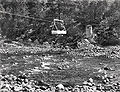
 47. River mining on the Tuolumne.jpg 1.000 × 709; 320 KB
-
 California - Modesto - NARA - 23934545.jpg 1.984 × 1.584; 834 KB
-
 California Falls, Tuolumne River, California (1921).jpg 1.968 × 1.147; 1,34 MB
-
 Chinook salmon moving upstream.jpg 3.504 × 2.336; 2,54 MB
-
 Creekside Path with Snow, Yosemite NP 5-20-15 (17511212404).jpg 2.800 × 2.100; 3,51 MB
-
 Dawn on Tuolumne River, Yosemite 5-29-15 (18291134816).jpg 2.800 × 2.279; 3,6 MB
-

-

-
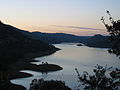
 La Grange Reservoir from the top of the New Don Pedro Dam.jpg 6.000 × 4.000; 15,4 MB
-
 Lembert Dome and Tuolumne River from Parsons Lodge bridge - panoramio.jpg 1.024 × 768; 171 KB
-

-
 Lumsden Bridge over the Tuolumne River (8414759080).jpg 3.888 × 2.592; 5,68 MB
-
 Tuolumne River (5931918584).jpg 1.764 × 1.309; 686 KB
-
 Tuolumne River (8411075439).jpg 3.072 × 2.304; 7 MB
-
 Tuolumne River Modesto.jpg 800 × 456; 145 KB
-
 Tuolumne River near Wards Ferry.jpg 5.261 × 3.946; 13,81 MB
-
 Tuolumne River San Joaquin River Confluence.jpg 6.000 × 4.000; 14,75 MB
-
 Tuolumne river-south fork 1.jpeg 1.600 × 1.200; 353 KB
-
 Tuolumne river-south fork 2.jpeg 1.200 × 1.600; 322 KB
-
 Tuolumne river-south fork 4.jpeg 1.200 × 1.600; 157 KB
-
 Tuolumne river-south fork 5.jpeg 1.200 × 1.600; 311 KB
-
 Tuolumne River.PNG 800 × 456; 704 KB
-
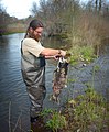 Tuolumne Snorkel Survey-Adult Mortatlity (16231741641).jpg 2.801 × 3.388; 6,43 MB
-
 Tuolumne Snorkel Survey-Almost Ready (16207703776).jpg 2.593 × 3.645; 7,97 MB
-
 Tuolumne Snorkel SurveySnorkeling (16233598335).jpg 2.400 × 2.747; 4,49 MB
-
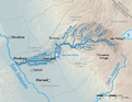 Tuolumnemap-01.png 1.875 × 1.458; 760 KB
-
 TuolumneMeadowsFromWest.jpg 3.868 × 2.730; 5,55 MB
-
 TuolumneRiver (19099383301).jpg 1.430 × 804; 929 KB
-
 TuolumneRiverBeloveDam.jpg 4.188 × 3.210; 11,06 MB
-
 Tuolumnerivermap.jpg 754 × 573; 206 KB
-
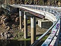 Wards Ferry Bridge 2016.jpg 5.333 × 4.000; 15,43 MB


.jpg)

.jpg)
.jpg)

.jpg)


.jpg)
.jpg)
.jpg)


.jpg)
.jpg)
.jpg)


.jpg)


Kategorien:
- Rivers of California
- Rivers of the Sierra Nevada (USA)
- Tributaries of the San Joaquin River
- Geography of Mariposa County, California
- Geography of Stanislaus County, California
- Geography of Tuolumne County, California
- Stanislaus National Forest
- San Joaquin Valley
- Biosphere reserves in the United States
- Rivers of the United States by name
- Visitor attractions in Tuolumne County, California