Category:Upton Cheyney
Jump to navigation
Jump to search
village in Gloucestershire, England, UK  | |||||
| Upload media | |||||
| Instance of | |||||
|---|---|---|---|---|---|
| Location | Bitton, South Gloucestershire, Gloucestershire, South West England, England | ||||
 | |||||
Subcategories
This category has the following 2 subcategories, out of 2 total.
Media in category "Upton Cheyney"
The following 15 files are in this category, out of 15 total.
-
 Brewery Hill - geograph.org.uk - 357023.jpg 640 × 480; 124 KB
-
 Cottages at Upton Cheyney - geograph.org.uk - 1856085.jpg 640 × 420; 85 KB
-
 Dead tree near Upton Cheyney - geograph.org.uk - 1755402.jpg 640 × 488; 87 KB
-

-
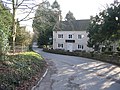
 Madrigal Cottage - Lansdown Lane - geograph.org.uk - 550899.jpg 429 × 640; 159 KB
-
 Monarch's Way in Upton Cheyney - geograph.org.uk - 1856133.jpg 640 × 480; 123 KB
-
 Side road at Upton Cheyney - geograph.org.uk - 1758718.jpg 1,024 × 750; 332 KB
-
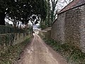
 The old route of Lansdown Lane - geograph.org.uk - 550916.jpg 640 × 511; 120 KB
-
 Upton Cheyney from Clay Lane. - panoramio.jpg 2,394 × 1,795; 1.07 MB
-
 Upton Coach House - geograph.org.uk - 357028.jpg 640 × 480; 72 KB
-
 Bales in a field - geograph.org.uk - 251006.jpg 640 × 480; 73 KB
-
 Footpath off Brewery Hill - geograph.org.uk - 357041.jpg 640 × 480; 122 KB
-
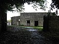 Old Outbuildings - geograph.org.uk - 251140.jpg 640 × 480; 97 KB
-
 Pipley Bottom - geograph.org.uk - 598543.jpg 640 × 427; 93 KB
-


