Category:Warragul
Jump to navigation
Jump to search
town in Victoria, Australia  | |||||
| Upload media | |||||
| Instance of | |||||
|---|---|---|---|---|---|
| Part of |
| ||||
| Location |
| ||||
| Population |
| ||||
| Area |
| ||||
| Elevation above sea level |
| ||||
 | |||||
English: Warragul is a rural centre with a population of 12,943 people east-southeast of Melbourne in Victoria. Warragul lies between the Strzelecki Ranges to the south and the Mount Baw Baw Plateau of the Great Dividing Range to the north. The town is named after an Aboriginal word meaning "wild dog". (→Warragul)
Français : Warragul est une ville de l' État du Victoria, en Australie. Elle est située à habitants en 2006. (→Warragul)
Nederlands: Warragul is een plaats in de Australische deelstaat Victoria en telt 12.943 inwoners (2006). (→Warragul)
Norsk bokmål: Warragul (Victoria) er et tettsted i det østlige Victoria i Australia. Det ligger 104 kilometer sør-øst for delstatshovedstaden Melbourne. Warragul ligger mellom fjellkjeden Strzelecki Ranges og Mount Baw Bawdelen av Great Dividing Range. Byen har fått navnet sitt etter det aborginske ordet for villhund.
Subcategories
This category has the following 10 subcategories, out of 10 total.
A
B
- Bills horse trough, Warragul (3 F)
L
- Lionel Rose statue, Warragul (2 F)
P
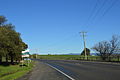
- Princes Highway in Warragul (empty)
W
- Warragul War Memorial (8 F)
- Warragul Show (2 F)
- West Gippsland Gazette (1 F)
- Western Park, Warragul (1 F)
Media in category "Warragul"
The following 11 files are in this category, out of 11 total.
-
 13 Toorongo Court Warragul 2022-03-08.jpg 4,032 × 3,024; 2.94 MB
-

-

-

-
 Double headed coal train passing westbound through Warragul station ~1920.jpg 2,244 × 1,590; 444 KB
-
 Maffra v Warragul in 2009 WGLFL 3rds SF.JPG 1,024 × 768; 273 KB
-
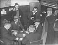 Playing euchre in the Drouin Hotel, Victoria (6173555293).jpg 1,024 × 801; 177 KB
-
 Three men at the Warragul cattle sales, Victoria (6173563565).jpg 1,024 × 829; 206 KB
-
 Warragul Football Club Jumper Colour Design.JPG 120 × 120; 4 KB
-
 Warragul Town Entry Sign.JPG 6,016 × 4,000; 9.11 MB
-
 Warragul wikivoyage pagebanner.jpg 6,016 × 859; 2.88 MB

_(6173562751).jpg)
_(6173563047).jpg)
_(6174090732).jpg)


.jpg)
.jpg)

