Category:Warwickshire
Перейти до навігації
Перейти до пошуку

Ceremonial counties of England: Bedfordshire · Berkshire · Buckinghamshire · Cambridgeshire · Cheshire · Cornwall · Cumbria · Derbyshire · Devon · Dorset · Durham · East Riding of Yorkshire · East Sussex · Essex · Gloucestershire · Greater London · Greater Manchester · Hampshire · Herefordshire · Hertfordshire · Isle of Wight · Kent · Lancashire · Leicestershire · Lincolnshire · Merseyside · Norfolk · North Yorkshire · Northamptonshire · Northumberland · Nottinghamshire · Oxfordshire · Rutland · Shropshire · Somerset · South Yorkshire · Staffordshire · Suffolk · Surrey · Tyne and Wear · Warwickshire · West Midlands · West Sussex · West Yorkshire · Wiltshire · Worcestershire
City-counties: Bristol · City of London
Історичні графства: Cumberland · Huntingdonshire · London · Middlesex · North Riding of Yorkshire · Sussex · West Riding of Yorkshire · Westmorland · Yorkshire
Other former counties: Avon · Cambridgeshire and Isle of Ely · Cleveland · East Suffolk · Hereford and Worcester · Hexhamshire · Humberside · Huntingdon and Peterborough · Isle of Ely · Parts of Holland · Parts of Kesteven · Parts of Lindsey · Soke of Peterborough · West Suffolk

ceremonial and non-metropolitan county in England, UK     | |||||
| Завантажити медіафайл | |||||
| Є одним із |
| ||||
|---|---|---|---|---|---|
| Місце розташування |
| ||||
| Столиця | |||||
| Законодавчий орган |
| ||||
| Кількість населення |
| ||||
| Площа |
| ||||
| Не плутати з | |||||
| Ймовірно те саме | Варвікшир (Історичні графства Англії, церемоніальне графство Англії, 1844) | ||||
| офіційний сайт | |||||
 | |||||
Підкатегорії
Показано 41 підкатегорію з 41.
!
- Valued images of Warwickshire (79 F)
*
- Videos from Warwickshire (4 F)
A
C
- Campsites in Warwickshire (7 F)
D
E
F
G
H
I
L
M
N
O
P
S
- Street lights in Warwickshire (35 F)
T
V
W
- Water wells in Warwickshire (4 F)
Файли в категорії «Warwickshire»
Показано 200 файлів цієї категорії (із 507).
(попередня сторінка) (наступна сторінка)-
 A herd of bullocks approaching rapidly - geograph.org.uk - 1901691.jpg 2000 × 1501; 227 КБ
-
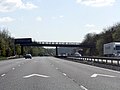
 A45 at the Grandborough Road junction - geograph.org.uk - 1219359.jpg 640 × 480; 214 КБ
-
 A45 London Road - geograph.org.uk - 1820574.jpg 640 × 480; 89 КБ
-
 Aerial photograph UK.jpg 4000 × 2250; 4,01 МБ
-
 Alwyn Road Playing Field - geograph.org.uk - 1811737.jpg 640 × 480; 73 КБ
-
 Anthony Kersting ledger Courtauld institute of Art.jpg 3699 × 644; 246 КБ
-
 Approach to Bridge 68, Oxford Canal - geograph.org.uk - 5339705.jpg 5472 × 3648; 6,41 МБ
-
-
 Approaching Ashlawn Road bridge - geograph.org.uk - 5320669.jpg 4715 × 3049; 4,53 МБ
-
 Aqueduct over Old Leicester Road - geograph.org.uk - 6000895.jpg 640 × 480; 45 КБ
-
 Arable field near Ryton Heath Farm - geograph.org.uk - 1901705.jpg 2000 × 1500; 212 КБ
-
 Ashlawn House - geograph.org.uk - 5322008.jpg 4332 × 2835; 2,13 МБ
-
 Ashlawn Road (A428) - geograph.org.uk - 3908985.jpg 640 × 480; 65 КБ
-
 Ashlawn Road at the junction of Onley Lane - geograph.org.uk - 5398989.jpg 1936 × 1372; 994 КБ
-
 Ashlawn Road bridge from the south - geograph.org.uk - 5320681.jpg 5202 × 3465; 5,3 МБ
-
 Ashlawn Road Speed Cameras - geograph.org.uk - 2035778.jpg 480 × 640; 86 КБ
-
 Ashlawn Road, Bilton Fields - geograph.org.uk - 5401576.jpg 1990 × 1454; 1011 КБ
-
 Avocet Close, north of Rugby - geograph.org.uk - 2151911.jpg 640 × 480; 83 КБ
-
 B4429 heading west - geograph.org.uk - 3908486.jpg 640 × 480; 84 КБ
-
 Ba ba brown sheep - geograph.org.uk - 893017.jpg 640 × 400; 50 КБ
-
 Banbury Road A425, looking SE - geograph.org.uk - 1196294.jpg 640 × 480; 99 КБ
-
 Barby Road - geograph.org.uk - 3908489.jpg 640 × 480; 82 КБ
-
 Bilton Fields - geograph.org.uk - 1845632.jpg 640 × 480; 66 КБ
-
 Bilton Fields - geograph.org.uk - 2851839.jpg 640 × 480; 141 КБ
-
 Bilton Fields Farm - geograph.org.uk - 5322113.jpg 4655 × 2934; 3,66 МБ
-
 Bilton Fields Sunrise - geograph.org.uk - 2438550.jpg 640 × 535; 26 КБ
-
 Bilton-Alwyn Road - geograph.org.uk - 2747145.jpg 640 × 461; 59 КБ
-
 Bilton-Alwyn Road - geograph.org.uk - 2809726.jpg 640 × 480; 71 КБ
-
 Bilton-Alwyn Road Recreation Ground - geograph.org.uk - 3417065.jpg 1024 × 768; 202 КБ
-
 Bilton-Bawnmore Road - geograph.org.uk - 2734056.jpg 640 × 480; 88 КБ
-
 Bilton-Bawnmore Road - geograph.org.uk - 2734060.jpg 640 × 480; 111 КБ
-
 Bilton-Beswick Gardens - geograph.org.uk - 1811750.jpg 640 × 480; 91 КБ
-
 Bilton-Scots Close - geograph.org.uk - 2729078.jpg 640 × 480; 113 КБ
-
 Bilton-Scots Close - geograph.org.uk - 3417083.jpg 640 × 480; 117 КБ
-
 Bird In The Hand Cottage - geograph.org.uk - 4478245.jpg 1024 × 746; 240 КБ
-
 Brandon Marsh (27089743505).jpg 3249 × 2095; 3,87 МБ
-
 Bridge 53A, Brownsover Footbridge - geograph.org.uk - 4475348.jpg 1024 × 732; 269 КБ
-
 Bridge 54, Old Leicester Road Aqueduct - geograph.org.uk - 4475332.jpg 1024 × 768; 272 КБ
-
 Bridge 55, River Swift Aqueduct - geograph.org.uk - 4475337.jpg 1024 × 768; 331 КБ
-
 Bridge 58, Masters Bridge - geograph.org.uk - 4475358.jpg 1024 × 806; 281 КБ
-
 Bridge 68, Clifton Bridge - geograph.org.uk - 4477217.jpg 1024 × 729; 297 КБ
-
 Bridge 68, Clifton Bridge - geograph.org.uk - 4477219.jpg 1024 × 768; 385 КБ
-

-

-
 Bridge 69, Kent Road Bridge - geograph.org.uk - 4477236.jpg 1024 × 703; 257 КБ
-
 Bridge 69, Kent Road Bridge - geograph.org.uk - 4477259.jpg 1024 × 841; 186 КБ
-
 Bridge 72, Moors Bridge - geograph.org.uk - 4478375.jpg 1024 × 755; 249 КБ
-
 Bridge 72, Moors Bridge - geograph.org.uk - 4478393.jpg 1024 × 708; 186 КБ
-
 Bridge over entry to Rugby Branch - geograph.org.uk - 3460894.jpg 1323 × 1000; 1,27 МБ
-

-
 Bridge ^53a, Oxford Canal - geograph.org.uk - 6251760.jpg 1600 × 1065; 671 КБ
-
 Bridge ^58 Masters Bridge, Oxford Canal - geograph.org.uk - 6251767.jpg 1600 × 1065; 484 КБ
-
 Bridleway to Hillside Estate - geograph.org.uk - 1821262.jpg 1280 × 856; 226 КБ
-
 Broken Bokeh (21510251562).jpg 5456 × 3632; 7,17 МБ
-
 Brownsover Hall Hotel - geograph.org.uk - 2661197.jpg 640 × 480; 119 КБ
-
 Brownsover Hall Hotel - geograph.org.uk - 2661244.jpg 640 × 480; 119 КБ
-
 Brownsover Lane - geograph.org.uk - 2661232.jpg 640 × 480; 140 КБ
-
 Brownsover-Oxford Canal - geograph.org.uk - 1890510.jpg 640 × 480; 82 КБ
-
 Burnthurst Lane - geograph.org.uk - 1913791.jpg 480 × 640; 130 КБ
-
 Cafe by the Oxford Canal - geograph.org.uk - 2433955.jpg 1024 × 768; 192 КБ
-
 Camera over M42 in Warwickshire - geograph.org.uk - 1264365.jpg 640 × 480; 183 КБ
-

-

-
 Canal signpost - Hillmorton Locks - geograph.org.uk - 3990040.jpg 851 × 1280; 488 КБ
-
 Canal Wharf Tarry's Bridge - geograph.org.uk - 2067236.jpg 640 × 360; 67 КБ
-
 Carving in Cock Robin wood - geograph.org.uk - 5323907.jpg 5202 × 3465; 3,78 МБ
-
 Centenary Way footpath near Ryton Lodge - geograph.org.uk - 1901670.jpg 2000 × 1504; 170 КБ
-
 Clematis of the Day (49779854453).jpg 3648 × 2736; 6,02 МБ
-
 Clifton Brook - geograph.org.uk - 4363063.jpg 640 × 430; 55 КБ
-
 Clifton-Dismantled Railway - geograph.org.uk - 2005354.jpg 640 × 480; 97 КБ
-
 Cock Robin Wood - geograph.org.uk - 2814846.jpg 640 × 480; 137 КБ
-
 Cock Robin Wood - geograph.org.uk - 2814857.jpg 640 × 480; 93 КБ
-
 Cock Robin wood pond - geograph.org.uk - 5323910.jpg 5202 × 3465; 6,75 МБ
-
 Cock Robin wood pond and water plants - geograph.org.uk - 5323912.jpg 5202 × 3465; 6,62 МБ
-
 Cosford Lane, Swift Park Industrial Estate - geograph.org.uk - 1964069.jpg 4592 × 3056; 3,7 МБ
-
 Cotswold village street scene (460475711).jpg 1280 × 853; 260 КБ
-
 Country lane near Ryton Heath Farm - geograph.org.uk - 1901717.jpg 2000 × 1493; 186 КБ
-
 Countryside and city collide - geograph.org.uk - 1725874.jpg 922 × 692; 119 КБ
-
 Crick Road (A428) - geograph.org.uk - 3909008.jpg 640 × 480; 85 КБ
-
 Crick Road at the corner of Kilsby Lane - geograph.org.uk - 5401636.jpg 1992 × 1458; 913 КБ
-
 Dark and light - geograph.org.uk - 1221911.jpg 640 × 428; 35 КБ
-
 December 14th. Christmas Tree (8272866027).jpg 2464 × 2464; 1,5 МБ
-

-
 Double Bridge - geograph.org.uk - 3908968.jpg 640 × 480; 74 КБ
-
 Double Bridge - Now disused canal bridge - geograph.org.uk - 1368458.jpg 640 × 425; 216 КБ
-
 Earlswood Lakes - Canal Feeder - geograph.org.uk - 81363.jpg 640 × 480; 129 КБ
-
 Earlswood Lakes - dividing causeway - geograph.org.uk - 81366.jpg 640 × 480; 68 КБ
-
 Earlswood Lakes - Engine House - geograph.org.uk - 81358.jpg 640 × 480; 94 КБ
-
 Entering Warwickshire - geograph.org.uk - 3908476.jpg 640 × 480; 62 КБ
-
 Fall's Bridge (no 48), from the south-east - geograph.org.uk - 5611895.jpg 1024 × 768; 247 КБ
-
 Fall's Bridge, Oxford Canal - geograph.org.uk - 5625641.jpg 1280 × 851; 432 КБ
-
 Fall's Bridge-Oxford Canal - geograph.org.uk - 2792854.jpg 640 × 480; 55 КБ
-
 Farmland and water tower - geograph.org.uk - 3908483.jpg 640 × 478; 34 КБ
-
 Farmland east of Onley Lane - geograph.org.uk - 3908471.jpg 640 × 480; 55 КБ
-
 Farmland near Fall's Bridge - geograph.org.uk - 5627816.jpg 1280 × 851; 557 КБ
-
 Farmland next to the Oxford Canal - geograph.org.uk - 4477223.jpg 1024 × 762; 238 КБ
-
 Feeding troughs on the grazing land - geograph.org.uk - 461690.jpg 640 × 477; 88 КБ
-
 Field and water tower from Ashlawn Road - geograph.org.uk - 5321740.jpg 5202 × 3465; 3,58 МБ
-
 Field by the WCML - geograph.org.uk - 3645925.jpg 640 × 326; 26 КБ
-
 Field of Gold (17046360337).jpg 4592 × 2341; 7,33 МБ
-
 Fields near Newton - geograph.org.uk - 2151915.jpg 640 × 480; 69 КБ
-
 Fineacre Lane - geograph.org.uk - 1913800.jpg 640 × 480; 123 КБ
-
 Footbridge along the Oxford Canal - geograph.org.uk - 4475223.jpg 1024 × 728; 280 КБ
-
 Footbridge along the Oxford Canal - geograph.org.uk - 4475249.jpg 1024 × 745; 307 КБ
-
 Footpath towards Onley - geograph.org.uk - 5322013.jpg 5202 × 3465; 3,17 МБ
-
 Former Glendossill psychiatric home - geograph.org.uk - 1346480.jpg 640 × 428; 105 КБ
-

-
 Fosse Way-B4112 junction - geograph.org.uk - 2080061.jpg 640 × 480; 57 КБ
-
 From green to brown - geograph.org.uk - 1220543.jpg 640 × 428; 57 КБ
-
 From pic to brick - geograph.org.uk - 1204416.jpg 640 × 428; 59 КБ
-
 G ^ P Training Park Ltd, motocross track - geograph.org.uk - 1891521.jpg 2000 × 1501; 189 КБ
-
 Gate to Wag n Train school for dogs - geograph.org.uk - 5320736.jpg 5202 × 3465; 5,03 МБ
-
 Gently decaying - geograph.org.uk - 1605386.jpg 640 × 427; 57 КБ
-
 George greville.jpg 288 × 380; 40 КБ
-
 Good day for a ride - geograph.org.uk - 1633113.jpg 640 × 427; 65 КБ
-
 Grazing west of Onley Lane - geograph.org.uk - 3908473.jpg 640 × 480; 54 КБ
-
 Grazing west of Onley Lane - geograph.org.uk - 3908479.jpg 640 × 480; 57 КБ
-
 Great Central Walk - geograph.org.uk - 6000361.jpg 640 × 480; 51 КБ
-
 Great Central Walk at Onley Lane - geograph.org.uk - 1819346.jpg 1280 × 856; 293 КБ
-
 Great Central Way looking south - geograph.org.uk - 5320727.jpg 5202 × 3465; 4,43 МБ
-
 Green doesn't go - geograph.org.uk - 1627938.jpg 640 × 427; 159 КБ
-
 Hillmorton Lane - geograph.org.uk - 2235817.jpg 640 × 375; 61 КБ
-
-
 Ho ho ho.... - geograph.org.uk - 1069268.jpg 640 × 326; 48 КБ
-
 Horses near Ryton Lodge - geograph.org.uk - 1901653.jpg 2000 × 1505; 195 КБ
-
 Houses on Constable Rd - geograph.org.uk - 2499760.jpg 640 × 413; 55 КБ
-
 Houses on Waverley Rd - geograph.org.uk - 2499762.jpg 640 × 430; 50 КБ
-
 How long...^ - geograph.org.uk - 1212336.jpg 640 × 428; 79 КБ
-
 In Formation (27170513492).jpg 3966 × 2473; 1,93 МБ
-
 In Need Of Repair (17990886303).jpg 5456 × 3257; 9,34 МБ
-
 Instant heritage - geograph.org.uk - 1185801.jpg 640 × 428; 83 КБ
-
 Inwoods Farm - geograph.org.uk - 5322109.jpg 5202 × 3465; 3,77 МБ
-
 Iron horses put out to grass^ - geograph.org.uk - 1225194.jpg 640 × 480; 58 КБ
-
 It's frothy, man - geograph.org.uk - 1242234.jpg 640 × 480; 103 КБ
-
 Join the Volunteers - WWI Warwickshire Volunteer Regiment poster.jpg 750 × 1197; 1,05 МБ
-
 Junction with A425 - geograph.org.uk - 893073.jpg 640 × 415; 58 КБ
-
 Keeper's Spinney - geograph.org.uk - 2230964.jpg 640 × 430; 106 КБ
-
 Kent Road Bridge (No 69), from the east - geograph.org.uk - 5611835.jpg 1024 × 768; 182 КБ
-
 Kent Road Bridge, Oxford Canal - geograph.org.uk - 2782966.jpg 1280 × 856; 128 КБ
-
 Kilsby Lane (B4038) - geograph.org.uk - 3909009.jpg 640 × 480; 80 КБ
-
 Kingfisher Pool, Myton Fields - geograph.org.uk - 1196614.jpg 640 × 480; 71 КБ
-
 Little Chef London Road - geograph.org.uk - 1820567.jpg 640 × 480; 60 КБ
-
 Little Morton development site - geograph.org.uk - 5320713.jpg 4420 × 2924; 3,34 МБ
-
 Look, Grandpa! (23411140774).jpg 4576 × 2898; 1,68 МБ
-
 Looking south along the Oxford Canal - geograph.org.uk - 4477225.jpg 1024 × 717; 188 КБ
-

-
 Looking to the water tower - geograph.org.uk - 5207604.jpg 640 × 480; 52 КБ
-
 Looking westwards - geograph.org.uk - 1532121.jpg 640 × 379; 53 КБ
-
 Lostitch gypsy family England.jpg 1536 × 2048; 309 КБ
-
 Lower Hillmorton-School Street - geograph.org.uk - 2493881.jpg 640 × 454; 72 КБ
-
 Lower Rainsbrook Farm - geograph.org.uk - 3469177.jpg 1024 × 768; 239 КБ
-
 M6 Motorway - B4027 overbridge - geograph.org.uk - 1818361.jpg 640 × 480; 80 КБ
-
 M6 Motorway - B4455 overbridge - geograph.org.uk - 1818369.jpg 640 × 480; 79 КБ
-
 Malpass Farm Quarry - geograph.org.uk - 1925839.jpg 640 × 480; 143 КБ
-
 Marie Foxon.jpg 1535 × 2152; 698 КБ
-
 Marina and boatyard along the Oxford Canal - geograph.org.uk - 4478477.jpg 1024 × 664; 137 КБ
-
 Martin's Farm - geograph.org.uk - 5322010.jpg 5202 × 3465; 5,01 МБ
-
 Meal-break for ewes - geograph.org.uk - 1756452.jpg 640 × 427; 454 КБ
-
 Mercote Mill Farm - Kenilworth Rd.jpg 2592 × 1944; 2,22 МБ
-
 Mid-day Stroll by the River Arrow, Warwickshire (14986061453).jpg 2536 × 1760; 2,37 МБ
-
 Middle Earth - geograph.org.uk - 1219414.jpg 640 × 428; 105 КБ
-
 Modern housing - geograph.org.uk - 1480044.jpg 640 × 428; 51 КБ
-
 Molehills - geograph.org.uk - 147304.jpg 480 × 640; 359 КБ
-
 Morning sun illuminates the Mothership (5096336436).jpg 2716 × 938; 1,37 МБ
-
 Motorway Crossing - geograph.org.uk - 1636352.jpg 640 × 480; 66 КБ
-
 Mucked out^ - geograph.org.uk - 1572274.jpg 640 × 427; 110 КБ
-
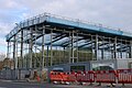
 New buildings going up on Lawford Road - geograph.org.uk - 6141965.jpg 1920 × 1280; 1004 КБ
-
 New buildings going up on Lawford Road - geograph.org.uk - 6141966.jpg 1920 × 1280; 1,24 МБ
-
 New furniture^ - geograph.org.uk - 1526919.jpg 640 × 480; 155 КБ
-
 Newbold-River Avon - geograph.org.uk - 1925821.jpg 640 × 480; 103 КБ
-
 Newly harrowed - geograph.org.uk - 1543828.jpg 640 × 480; 85 КБ
-
 No access to the quarry - geograph.org.uk - 812181.jpg 640 × 371; 63 КБ
-
 No entry into this field - geograph.org.uk - 1069259.jpg 640 × 371; 48 КБ
-
 No longer wanted - geograph.org.uk - 1344819.jpg 640 × 428; 76 КБ
-
-
 Normandy Farm near the Oxford Canal - geograph.org.uk - 4478407.jpg 1024 × 768; 280 КБ
-
 Northampton Line by the WCML - geograph.org.uk - 3645928.jpg 640 × 430; 54 КБ
-
 Northampton Line by the WCML - geograph.org.uk - 3645931.jpg 640 × 430; 73 КБ
-
 Northampton Line joining the WCML - geograph.org.uk - 3645927.jpg 640 × 430; 69 КБ
-
 Not for tourists - geograph.org.uk - 1463404.jpg 640 × 428; 57 КБ
-
 Not needed today^ - geograph.org.uk - 1802486.jpg 480 × 640; 111 КБ
-
 Not quite a tunnel - geograph.org.uk - 1735670.jpg 4000 × 3000; 5,59 МБ
-
 Not the bridleway - geograph.org.uk - 1706128.jpg 4000 × 3000; 3,59 МБ
-
 Not-so-glorious mud - geograph.org.uk - 1139053.jpg 640 × 481; 223 КБ
-
 November Skies (22230015383).jpg 3648 × 2736; 7,72 МБ
-
 November Skies (22458930099).jpg 3648 × 2736; 7 МБ
-
 November Skies (22662789510).jpg 3648 × 2736; 8,53 МБ
-
 November Skies (22837173692).jpg 3648 × 2736; 7,99 МБ
-
 Nuneaton School for Girls in first 10- years of opening.jpg 885 × 580; 92 КБ
-
 Oakley Wood Camp 1875.png 619 × 674; 429 КБ
-
 Oil seed rape crop along the Oxford Canal - geograph.org.uk - 4477229.jpg 1024 × 818; 353 КБ
-
 Old and new - geograph.org.uk - 1230122.jpg 640 × 428; 87 КБ
-
 Old and New - geograph.org.uk - 1468538.jpg 640 × 428; 69 КБ
-
 Old Leicester Road Aqueduct - geograph.org.uk - 4475285.jpg 824 × 1024; 336 КБ
-
 Old Thatched Cottage. Warwickshire (9194006616).jpg 2505 × 2013; 525 КБ
-
 Onley Lane - geograph.org.uk - 1820660.jpg 1280 × 856; 324 КБ
-
 Onley Lane - geograph.org.uk - 1824722.jpg 3872 × 2592; 3,52 МБ
-
 Onley Lane - geograph.org.uk - 3908480.jpg 640 × 480; 83 КБ
-
 Onley Lane Embankment - geograph.org.uk - 1974839.jpg 640 × 480; 124 КБ
-
 Onley Lane, approaching Ashlawn Road - geograph.org.uk - 5321731.jpg 5202 × 3465; 4,75 МБ


_-_geograph.org.uk_-_3908985.jpg)


.jpg)


.jpg)


.jpg)


.jpg)


_-_geograph.org.uk_-_3909008.jpg)


.jpg)


,_from_the_south-east_-_geograph.org.uk_-_5611895.jpg)


.jpg)


_(14784251713).jpg)


.jpg)
.jpg)


,_from_the_east_-_geograph.org.uk_-_5611835.jpg)

_-_geograph.org.uk_-_3909009.jpg)


.jpg)


.jpg)


.jpg)
.jpg)
.jpg)
.jpg)


.jpg)


.jpg)