Category:Wednesbury
Aller à la navigation
Aller à la recherche
localité britannique  | |||||
| Téléverser des médias | |||||
| Nature de l’élément | |||||
|---|---|---|---|---|---|
| Lieu | Sandwell, Midlands de l'Ouest, Angleterre | ||||
 | |||||
English: Wednesbury is a market town in England's Black Country, part of the Sandwell metropolitan borough in the West Midlands, near the source of the River Tame. At the 2011 Census the town has a population of 37,817.(→Wednesbury)
Français : Wednesbury est une ville anglaise, située dans le district métropolitain de Sandwell, dans les Midlands de l'Ouest. Au moment du recensement de 2001, elle comptait habitants. (→Wednesbury)
Nederlands: Wednesbury is een plaats in het bestuurlijke gebied Sandwell, in het Engelse graafschap West Midlands. De plaats telt 24.337 inwoners en ligt in de streek Black Country. (→Wednesbury)
Norsk nynorsk: Wednesbury er ein marknadsby i grevskapet West Midlands i England. Han har kring 24 500 innbyggjarar og ligg i Black Country nær elva Tame. (→Wednesbury)
Polski: Wednesbury - miasto w Wielkiej Brytanii, w Anglii, w hrabstwie West Midlands. W 2001r. miasto to zamieszkiwało 24 337 osób. (→Wednesbury)
Română: Wednesbury este un oraș în comitatul West Midlands, regiunea omonimă, Anglia. Orașul se află în districtul metropolitan Sandwell. (→Wednesbury)
اردو: چرچ ہل، ویسٹ مڈلینڈز ( انگریزی: Wednesbury) انگلستان کا ایک رہائشی علاقہ جو West Midlands میں واقع ہے۔ (→چرچ ہل، ویسٹ مڈلینڈز)

Sous-catégories
Cette catégorie comprend 20 sous-catégories, dont les 20 ci-dessous.
B
- Brunswick Park, Wednesbury (3 F)
C
- Caryatid Gateway, Wednesbury (8 F)
I
- IKEA Birmingham (3 F)
K
- John Ashley Kilvert (6 F)
P
R
- Russell House, Wednesbury (2 F)
W
- Wednesbury enamels (10 F)
- Wednesbury Old Post Office (7 F)
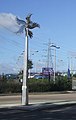
- Wednesbury Parkway windmill (4 F)
- Wednesbury Police Station (4 F)
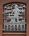
- Wednesbury reliefs (17 F)
- Wednesbury Town Hall (8 F)
- Wednesbury Town railway station (12 F)
- St Paul's Church, Wood Green (3 F)
Média dans la catégorie « Wednesbury »
Cette catégorie comprend 199 fichiers, dont les 199 ci-dessous.
-
 Access to the Tame Valley Canal - geograph.org.uk - 1037829.jpg 480 × 640 ; 328 kio
-
 Aer Lingus plane seen from Albert Street in Wednesbury (26772359099).jpg 4 608 × 3 456 ; 5,46 Mio
-
 Aer Lingus plane seen from Albert Street in Wednesbury (26772360389).jpg 838 × 606 ; 83 kio
-
 Amazon - Patent Drive, Wednesbury (24656162428).jpg 4 608 × 3 456 ; 6,04 Mio
-
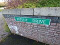
 Amazon - Patent Drive, Wednesbury - sign (37813020024).jpg 4 608 × 3 456 ; 5,69 Mio
-
 Amazon - Patent Drive, Wednesbury - signs - HGV Only - Staff & Visitors (24656112508).jpg 3 456 × 4 608 ; 5,65 Mio
-
 BCN canal map Wednesbury Oak.svg 330 × 390 ; 75 kio
-
 Bescot Walsall - Wednesbury freight geograph-2784752-by-Ben-Brooksbank.jpg 2 102 × 1 448 ; 1,18 Mio
-
 Bill and Ben, waste transfer men - geograph.org.uk - 863969.jpg 640 × 480 ; 164 kio
-
 Bisset's Magnificent Guide - James Bisset - 1808 - 39 - plate 3 - 120-0-673x1024.jpg 673 × 1 024 ; 191 kio
-
 Bradley Branch Lock 1 beneath Midland Metro bridge QF.jpg 3 648 × 2 736 ; 2,99 Mio
-
 Bradley Branch Lock 2 QF.jpg 3 648 × 2 736 ; 3,41 Mio
-
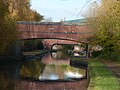
 Crankhall Lane Bridge - geograph.org.uk - 2670.jpg 640 × 480 ; 62 kio
-
 Darlaston - The Black Horse pub - geograph.org.uk - 1853865.jpg 640 × 480 ; 167 kio
-
 Derelict industrial building near Darlaston - geograph.org.uk - 3264470.jpg 1 024 × 768 ; 188 kio
-
 Diamond Buses Wright Streetlite DF 32316.jpg 5 184 × 3 456 ; 4,45 Mio
-
 Duright Engineering Ltd - Portway Road, Wednesbury (26773957799).jpg 4 608 × 3 456 ; 1,98 Mio
-
 Facrtura 01.JPG 1 812 × 2 340 ; 2,51 Mio
-
 Factura 02.JPG 2 052 × 2 508 ; 2,93 Mio
-

-
-

-
 Gospel Oak PH at Gospel Oak - geograph.org.uk - 254898.jpg 640 × 480 ; 243 kio
-
 Guns Village Metro Station - geograph.org.uk - 1423113.jpg 640 × 426 ; 315 kio
-
 Guns Village Station - geograph.org.uk - 369672.jpg 640 × 480 ; 155 kio
-
 Frederick William Hackwood 1851-1926.jpg 150 × 205 ; 24 kio
-
 Hall End Methodist Church - geograph.org.uk - 198720.jpg 640 × 480 ; 56 kio
-
 Hall End Tavern - geograph.org.uk - 198688.jpg 640 × 480 ; 50 kio
-
 Hallens Drive, Wednesbury - MECCA (24656299908).jpg 4 608 × 3 456 ; 5,76 Mio
-
 Hallens Drive, Wednesbury - road sign (37813055554).jpg 4 608 × 3 456 ; 6,29 Mio
-

-
 Hallens Drive, Wednesbury - Wanted HGV Drivers (37641362435).jpg 4 608 × 3 456 ; 5,46 Mio
-
 Heath Lane Hospital - geograph.org.uk - 198690.jpg 640 × 480 ; 54 kio
-
 High School (27172108451).jpg 3 116 × 4 674 ; 11,17 Mio
-
 Holyhead Primary Academy - Holyhead Road, Wednesbury (24675097068).jpg 4 608 × 3 456 ; 6,33 Mio
-
 Holyhead Primary Academy - Holyhead Road, Wednesbury (37659614565).jpg 4 608 × 3 456 ; 6,4 Mio
-
 Holyhead Primary Academy - Holyhead Road, Wednesbury (38491144666).jpg 4 608 × 3 456 ; 6,44 Mio
-
 Holyhead Primary Academy - Holyhead Road, Wednesbury - school sign (37831320424).jpg 4 608 × 3 456 ; 6,33 Mio
-
 Holyhead Road, Wednesbury - sign - Metro Gt. Western St 325 yds (37653747885).jpg 4 608 × 3 456 ; 5,89 Mio
-
 Horse and Jockey.jpg 6 000 × 4 000 ; 6,11 Mio
-
 Inside Tipton Sports Academy at Gospel Oak - geograph.org.uk - 254886.jpg 640 × 480 ; 307 kio
-
 King's Hill - Old Park Road - geograph.org.uk - 1853866.jpg 640 × 480 ; 185 kio
-
 Lea Brook Methodist Church, Wednesbury - geograph.org.uk - 254860.jpg 640 × 480 ; 260 kio
-
 Lower Ocker Branch - geograph.org.uk - 2685.jpg 640 × 480 ; 71 kio
-
 Map of Staffordshire OS Map name 063-SW, Ordnance Survey, 1883-1894.jpg 5 339 × 3 593 ; 5,78 Mio
-
 Map of Staffordshire OS Map name 063-SW, Ordnance Survey, 1883-1894.tiff 5 339 × 3 593 ; 54,88 Mio
-
 Midland Metro in a snowstorm.jpg 1 632 × 1 224 ; 329 kio
-
 Morrisons Wednesbury Cafe - Noel (24646711248).jpg 3 968 × 2 240 ; 2,66 Mio
-
 Morrisons, Wednesbury - geograph.org.uk - 863535.jpg 640 × 480 ; 190 kio
-
 NewMetroLivery.jpg 800 × 600 ; 113 kio
-
 No through road under the Midland Metro - geograph.org.uk - 255388.jpg 550 × 437 ; 185 kio
-
 Oakeswell, Wednesbury - geograph.org.uk - 41573.jpg 610 × 385 ; 46 kio
-
 Old Blue Ball Public House.jpg 6 000 × 4 000 ; 9,24 Mio
-
 Open ground, Wednesbury Oak - geograph.org.uk - 1483621.jpg 640 × 480 ; 127 kio
-
 Patent Drive, Wednesbury - Esso petrol station (37641192365).jpg 4 608 × 3 456 ; 5,87 Mio
-
 Patent Drive, Wednesbury - mouse (38472848776).jpg 4 608 × 3 456 ; 6,04 Mio
-
 Patent Drive, Wednesbury - road sign (37813089364).jpg 4 608 × 3 456 ; 6,03 Mio
-
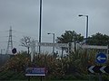
 Patent Drive, Wednesbury - roundabout near Hallens Drive (38528497581).jpg 4 608 × 3 456 ; 6,06 Mio
-
 Patent Drive, Wednesbury - Trident Drive - Britannia Park - Folkes (38472700586).jpg 4 608 × 3 456 ; 3,26 Mio
-
 Patent Drive, Wednesbury - Trident Drive - road sign - Britannia Park - Folkes (38496892732).jpg 4 608 × 3 456 ; 3,03 Mio
-
 Playing fields where the canal used to be - geograph.org.uk - 1483626.jpg 640 × 480 ; 113 kio
-
 Pro Clean - Victoria Street and Stafford Street, Wednesbury (38516322822).jpg 4 608 × 3 456 ; 2,68 Mio
-
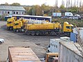 Pro Clean - Victoria Street and Stafford Street, Wednesbury - tankers (26772111959).jpg 4 608 × 3 456 ; 6,46 Mio
-
 Pro Clean - Victoria Street and Stafford Street, Wednesbury - tankers (37660170195).jpg 4 608 × 3 456 ; 6,17 Mio
-
 Pro Clean - Victoria Street and Stafford Street, Wednesbury - tankers (38491679646).jpg 4 608 × 3 456 ; 6,06 Mio
-
 Queen Anne - Holyhead Road, Wednesbury (24675036818).jpg 4 608 × 3 456 ; 6,11 Mio
-
 Ricardo tank.jpg 427 × 193 ; 8 kio
-
 Ridgeacre Branch Canal - geograph.org.uk - 39400.jpg 640 × 480 ; 152 kio
-
 Rocket Pool - geograph.org.uk - 589727.jpg 640 × 480 ; 124 kio
-
 Rocket Pool Bradley - geograph.org.uk - 589736.jpg 480 × 640 ; 154 kio
-
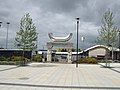
 Sant Nirankari Satsang Bhawan - Great Western Street, Wednesbury - road sign (37831669844).jpg 4 608 × 3 456 ; 6,4 Mio
-

-

-
 Shockers Wines - Holyhead Road, Wednesbury (38515743662).jpg 4 608 × 3 456 ; 6,01 Mio
-

-
 St Luke, Mesty Croft, Wednesbury - geograph.org.uk - 1608592.jpg 640 × 473 ; 64 kio
-
 St Mary on the Hill - geograph.org.uk - 589802.jpg 640 × 480 ; 107 kio
-
 St Mary's Wednesbury.JPG 2 272 × 3 200 ; 1,37 Mio
-

-
 Swanpool Medical Centre - geograph.org.uk - 299968.jpg 629 × 478 ; 90 kio
-
 T.H. Cooper, Wednesbury - record sleeve.jpg 2 648 × 2 547 ; 2,15 Mio
-
 Tame near Hill Top Wednesbury.JPG 1 715 × 1 286 ; 446 kio
-
 The beginnings of Wednesbury - geograph.org.uk - 864957.jpg 480 × 585 ; 235 kio
-
 The Bellwether - A J.D. Wetherspoon's house - geograph.org.uk - 991934.jpg 640 × 480 ; 69 kio
-
 The former St James Schools - St James Street, Wednesbury (37671592225).jpg 4 608 × 3 456 ; 6,31 Mio
-
 The former St James Schools - St James Street, Wednesbury (37671621145).jpg 4 608 × 3 456 ; 6,11 Mio
-
 The former St James Schools - St James Street, Wednesbury (37671638535).jpg 4 608 × 3 456 ; 1,77 Mio
-
 The former St James Schools - St James Street, Wednesbury (37842733234).jpg 4 608 × 3 456 ; 2,89 Mio
-
 The former St James Schools - St James Street, Wednesbury (38503045346).jpg 4 608 × 3 456 ; 6,28 Mio
-

-
 The Parish Church of St. James the Great - St James Street, Wednesbury (37842909144).jpg 4 608 × 3 456 ; 6,47 Mio
-
 The Parish Church of St. James the Great - St James Street, Wednesbury (37842947614).jpg 4 608 × 3 456 ; 5,94 Mio
-

-

-
 The Parish Church of St. James the Great - St James Street, Wednesbury - road sign (24687367758).jpg 4 608 × 3 456 ; 6,12 Mio
-
 The Patent Shaft Gates - roundabout on Dudley Street, Wednesbury (44616635204) (cropped).jpg 3 408 × 1 917 ; 3,09 Mio
-
 The Patent Shaft Gates - roundabout on Dudley Street, Wednesbury (44616635204).jpg 4 608 × 3 456 ; 6,06 Mio
-
 The Vintage Life Gift Shop - Holyhead Road, Wednesbury (38473569626).jpg 3 456 × 4 608 ; 6,34 Mio
-
 The Vintage Life Gift Shop - Holyhead Road, Wednesbury (38497588112).jpg 4 608 × 3 456 ; 6,35 Mio
-
 The world is not enough. - geograph.org.uk - 999760.jpg 640 × 480 ; 69 kio
-
 Vicarage Road, Hall End - geograph.org.uk - 198721.jpg 640 × 480 ; 51 kio
-
 Walsall Canal - Wednesbury (26768943179).jpg 4 608 × 3 456 ; 2,94 Mio
-
 Walsall Canal - Wednesbury (37657308895).jpg 4 608 × 3 456 ; 6,42 Mio
-
 Walsall Canal - Wednesbury - Canada geese (26768908119).jpg 4 608 × 3 456 ; 5,74 Mio
-
 Walsall Canal - Wednesbury - gate (37657338935).jpg 4 608 × 3 456 ; 6,02 Mio
-
 Walsall Canal - Wednesbury - gate to Hallens Drive (38513254512).jpg 4 608 × 3 456 ; 6,04 Mio
-
 Walsall Canal - Wednesbury - Midland Metro bridge (26768953139).jpg 4 608 × 3 456 ; 2,78 Mio
-
 Walsall Canal - Wednesbury - Monway Bridge (26769580359).jpg 4 608 × 3 456 ; 6,41 Mio
-
 Walsall Canal - Wednesbury - Monway Bridge (37657877715).jpg 4 608 × 3 456 ; 6,37 Mio
-
 Walsall Canal - Wednesbury - Monway Bridge (38488972386).jpg 4 608 × 3 456 ; 5,81 Mio
-
 Walsall Canal - Wednesbury - Monway Bridge - electricity pylon (38545263021).jpg 4 608 × 3 456 ; 6,08 Mio
-
 Walsall Canal - Wednesbury - Monway Bridge - sign (37657848065).jpg 4 608 × 3 456 ; 6,21 Mio
-
 Walsall Canal - Wednesbury - Monway Bridge - steps (38513820822).jpg 4 608 × 3 456 ; 2,29 Mio
-
 Walsall Canal - Wednesbury - sign (38513377902).jpg 4 608 × 3 456 ; 6,27 Mio
-
 Walsall Canal - Wednesbury - sign - Private Fishing - No fishing (38544730791).jpg 3 456 × 4 608 ; 6,23 Mio
-
 Walsall Canal - Wednesbury - Willingsworth Hall Bridge (24673212648).jpg 4 608 × 3 456 ; 6,23 Mio
-
 Walsall Canal - Wednesbury - Willingsworth Hall Bridge (37658104755).jpg 4 608 × 3 456 ; 6,14 Mio
-
 Walsall Canal - Wednesbury - Willingsworth Hall Bridge (37829725744).jpg 4 608 × 3 456 ; 6 Mio
-
 Walsall Canal - Wednesbury - Willingsworth Hall Bridge (38489517616).jpg 4 608 × 3 456 ; 6,18 Mio
-
 Walsall Canal - Wednesbury - Willingsworth Hall Bridge (38545655301).jpg 4 608 × 3 456 ; 5,96 Mio
-

-

-
 Walsall Canal - Wednesbury - Willingsworth Hall Bridge - sign (37829648934).jpg 4 608 × 3 456 ; 6,3 Mio
-

-
 Walsall Canal - Wednesbury - Willingsworth Hall Bridge - steps (26769801889).jpg 4 608 × 3 456 ; 6,49 Mio
-
 Warburtons, Wednesbury - Big Spring Clean 2010 (4763849530).jpg 733 × 463 ; 145 kio
-
 Wednesbury - the High Street.jpg 640 × 426 ; 82 kio
-
 Wednesbury 2010..jpg 1 781 × 1 063 ; 168 kio
-
 Wednesbury as a manufacturing and commercial centre (1918) (14586560228).jpg 2 752 × 1 752 ; 679 kio
-
 Wednesbury as a manufacturing and commercial centre (1918) (14770851254).jpg 1 536 × 2 324 ; 481 kio
-
 Wednesbury as a manufacturing and commercial centre (1918) (14772879572).jpg 1 896 × 3 428 ; 480 kio
-
 Wednesbury Bus Station - geograph.org.uk - 863432.jpg 640 × 480 ; 227 kio
-
 Wednesbury Bus Station Clock.jpg 2 600 × 4 448 ; 3,93 Mio
-
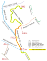 Wednesbury Canal Map SO99SE.svg 700 × 900 ; 130 kio
-
 Wednesbury Community Fire Station - Holyhead Road and Dudley Street, Wednesbury (24687511568).jpg 4 608 × 3 456 ; 2,05 Mio
-
 Wednesbury Fire Station - geograph.org.uk - 589830.jpg 640 × 480 ; 107 kio
-
 Wednesbury Great Western Street Tram Stop - sign (38540921771).jpg 4 608 × 3 456 ; 5,38 Mio
-

-
 Wednesbury Herald advertising.jpg 760 × 309 ; 293 kio
-
 Wednesbury industry - geograph.org.uk - 864986.jpg 480 × 596 ; 248 kio
-
 Wednesbury Market - geograph.org.uk - 589754.jpg 640 × 480 ; 145 kio
-
 Wednesbury Museum - 2016-11-30 - Andy Mabbett - 10.jpg 3 872 × 2 592 ; 4,7 Mio
-
 Wednesbury Museum - 2016-11-30 - Andy Mabbett - 11.jpg 3 872 × 2 592 ; 4,68 Mio
-
 Wednesbury Museum - 2016-11-30 - Andy Mabbett - 12.jpg 3 872 × 2 592 ; 4,87 Mio
-
 Wednesbury Museum - 2016-11-30 - Andy Mabbett - 13.jpg 3 872 × 2 592 ; 4,82 Mio
-
 Wednesbury Museum - 2016-11-30 - Andy Mabbett - 14.jpg 3 872 × 2 592 ; 4,85 Mio
-
 Wednesbury Museum - 2016-11-30 - Andy Mabbett - 15.jpg 3 872 × 2 592 ; 4,76 Mio
-
 Wednesbury Museum - 2016-11-30 - Andy Mabbett - 16.jpg 3 872 × 2 592 ; 4,81 Mio
-
 Wednesbury Museum - 2016-11-30 - Andy Mabbett - 18.jpg 3 872 × 2 592 ; 4,79 Mio
-
 Wednesbury Museum - 2016-11-30 - Andy Mabbett - 40.jpg 3 872 × 2 592 ; 4,87 Mio
-
 Wednesbury Oak Canal demolished GKN works.jpg 3 648 × 2 736 ; 3,65 Mio
-
 Wednesbury Oak Canal Loxdale Sidings.jpg 3 648 × 2 736 ; 3,72 Mio
-
 Wednesbury Oak Canal rural.jpg 3 648 × 2 736 ; 3,63 Mio
-
 Wednesbury Old Canal narrow.jpg 2 736 × 3 648 ; 3,58 Mio
-
 Wednesbury Old Canal wide.jpg 3 648 × 2 736 ; 3,46 Mio
-
 Wednesbury Parkway Tram Stop - path (24669382658).jpg 4 608 × 3 456 ; 6,51 Mio
-
 Wednesbury Parkway Tram Stop - sign (38541573381).jpg 4 608 × 3 456 ; 5,91 Mio
-
 Wednesbury Parkway Tram Stop - sign - A bit more Metro ... A lot less stressful! (37654095595).jpg 3 456 × 4 608 ; 6,32 Mio
-
 Wednesbury Parkway Tram Stop - sign - Leabrook Road (26765747219).jpg 4 608 × 3 456 ; 6,19 Mio
-
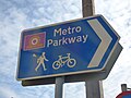 Wednesbury Parkway Tram Stop - sign - Metro Parkway (24669317578).jpg 4 608 × 3 456 ; 5,85 Mio
-
 Wednesbury Parkway tram stop in 2006.jpg 640 × 480 ; 282 kio
-
 Wednesbury Parkway, Park and Ride - geograph.org.uk - 255390.jpg 407 × 640 ; 188 kio
-
 Wednesbury railway geograph-2168617.jpg 1 024 × 630 ; 287 kio
-
 Wednesbury Stores - geograph.org.uk - 1265739.jpg 640 × 480 ; 94 kio
-
 Wednesbury Town Centre Clock - geograph.org.uk - 991935.jpg 480 × 640 ; 86 kio
-
 Wednesbury Windmill - geograph.org.uk - 717936.jpg 640 × 506 ; 94 kio
-
 Wednesfield Cenotaph - geograph.org.uk - 803661.jpg 640 × 480 ; 115 kio
-
 Wendsbury- 2014-04-19 15-00.jpg 640 × 426 ; 105 kio
-

-
 WS10 - Holyhead Road, Wednesbury (37659580645).jpg 4 608 × 3 456 ; 2 Mio
-
 'Each footprint marks a step in time' - geograph.org.uk - 863475.jpg 640 × 480 ; 307 kio
-
 Approaching Hallens Lane roundabout - geograph.org.uk - 999823.jpg 640 × 480 ; 74 kio
-
 Aqueduct View - geograph.org.uk - 369711.jpg 640 × 480 ; 95 kio
-
 Black Lake - geograph.org.uk - 13614.jpg 640 × 426 ; 90 kio
-
 Bridge on the West Mids tramline - geograph.org.uk - 1483226.jpg 640 × 480 ; 138 kio
-
 Canal and Station at Dudley Port - geograph.org.uk - 361470.jpg 600 × 450 ; 184 kio
-
 Canal at Moxley - geograph.org.uk - 1483196.jpg 640 × 480 ; 149 kio
-
 Charlemont Cemetery - geograph.org.uk - 1424344.jpg 640 × 426 ; 379 kio
-
 Crossing the Metro Line - geograph.org.uk - 1423104.jpg 640 × 426 ; 340 kio
-
 Footpath at Gospel Oak - geograph.org.uk - 1439238.jpg 640 × 426 ; 453 kio
-
 Footpath to Sheepwash Urban Park - geograph.org.uk - 361564.jpg 600 × 450 ; 354 kio
-
 Heath Lane Cemetery - geograph.org.uk - 198727.jpg 640 × 480 ; 70 kio
-
 Industrial Units on the Black Country Spine Road - geograph.org.uk - 254859.jpg 640 × 485 ; 221 kio
-
 Looking east across the Sandwell Valley - geograph.org.uk - 41545.jpg 610 × 458 ; 49 kio
-
 Ryland Aqueduct - geograph.org.uk - 361456.jpg 640 × 480 ; 233 kio
-
-
 Shops and Library, St Marks Road - geograph.org.uk - 299964.jpg 640 × 480 ; 87 kio
-
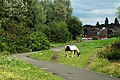
 Skewbald showjumper - geograph.org.uk - 361578.jpg 600 × 450 ; 276 kio
-
 Stone Cross - geograph.org.uk - 20056.jpg 610 × 458 ; 50 kio
-
 Stonemasons - geograph.org.uk - 198731.jpg 640 × 480 ; 53 kio
-
 Storm Clouds Over Tame Valley - geograph.org.uk - 369623.jpg 640 × 480 ; 105 kio
-
 Tame Valley Aqueduct - geograph.org.uk - 369700.jpg 640 × 480 ; 117 kio
-
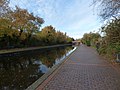
 Tame Valley Canal - geograph.org.uk - 369739.jpg 640 × 480 ; 102 kio
-
 The Gough Arms, Hateley Heath - geograph.org.uk - 41603.jpg 610 × 458 ; 52 kio
-
 The Miners Arms - geograph.org.uk - 274635.jpg 600 × 450 ; 182 kio
-
 The View from Lidl - geograph.org.uk - 41568.jpg 609 × 387 ; 41 kio
-
 Tipton Sports Academy - geograph.org.uk - 254877.jpg 640 × 480 ; 196 kio
-
 Wellington Bridge, Great Bridge - geograph.org.uk - 410536.jpg 640 × 427 ; 114 kio
-
 Wood Green Pumping Station - geograph.org.uk - 206926.jpg 640 × 427 ; 84 kio

.jpg)
.jpg)
.jpg)
.jpg)
.jpg)


.jpg)


.jpg)
.jpg)
.jpg)


.jpg)
.jpg)
.jpg)
.jpg)

.jpg)
.jpg)
.jpg)
.jpg)
.jpg)
.jpg)


.jpg)


.jpg)
.jpg)
.jpg)
.jpg)
.jpg)
.jpg)

.jpg)
.jpg)
.jpg)
.jpg)
.jpg)


.jpg)
.jpg)
.jpg)
.jpg)
.jpg)


.jpg)


.jpg)
.jpg)
.jpg)
.jpg)
.jpg)
.jpg)
.jpg)
.jpg)
.jpg)
.jpg)
.jpg)
_(cropped).jpg)
.jpg)
.jpg)
.jpg)


.jpg)
.jpg)
.jpg)
.jpg)
.jpg)
.jpg)
.jpg)
.jpg)
.jpg)
.jpg)
.jpg)
.jpg)
.jpg)
.jpg)
.jpg)
.jpg)
.jpg)
.jpg)
.jpg)
.jpg)
.jpg)
.jpg)
.jpg)
.jpg)
.jpg)

_(14586560228).jpg)
_(14770851254).jpg)
_(14772879572).jpg)


.jpg)

.jpg)
.jpg)


.jpg)
.jpg)
.jpg)
.jpg)
.jpg)


.jpg)


