Category:Werneth Low
Jump to navigation
Jump to search
hill in Tameside, Greater Manchester, UK  | |||||
| Upload media | |||||
| Instance of | |||||
|---|---|---|---|---|---|
| Location | Tameside, Greater Manchester, North West England, England | ||||
| Mountain range | |||||
| Elevation above sea level |
| ||||
 | |||||
Subcategories
This category has the following 5 subcategories, out of 5 total.
H
- Hare and Hounds, Werneth Low (18 F)
- Hyde War Memorial (25 F)
W
- Werneth Low Golf Club (15 F)
Media in category "Werneth Low"
The following 200 files are in this category, out of 224 total.
(previous page) (next page)-
 Access to Werneth Low - geograph.org.uk - 1722097.jpg 640 × 477; 137 KB
-
 Alder High School - geograph.org.uk - 1581026.jpg 640 × 503; 133 KB
-
 Ancient holloway - geograph.org.uk - 6207407.jpg 5,152 × 3,864; 6.27 MB
-
 Apple Street - geograph.org.uk - 3220803.jpg 640 × 481; 499 KB
-
 Apple Street - geograph.org.uk - 3220804.jpg 640 × 481; 494 KB
-
 Apple Street - geograph.org.uk - 3240604.jpg 2,739 × 2,739; 3.49 MB
-
 Apple Street - geograph.org.uk - 3323236.jpg 853 × 1,280; 224 KB
-
 Apple Street - geograph.org.uk - 3323239.jpg 1,280 × 853; 235 KB
-
 Approaching Birches Farm - geograph.org.uk - 3372603.jpg 640 × 480; 79 KB
-
 Approaching Lumn Farm - geograph.org.uk - 4123193.jpg 1,600 × 1,200; 722 KB
-
 April snow - geograph.org.uk - 2883042.jpg 640 × 360; 116 KB
-
 Autumn Footpath - geograph.org.uk - 888893.jpg 640 × 481; 165 KB
-
 Back o' th' Hill - geograph.org.uk - 1715732.jpg 640 × 480; 139 KB
-
 Back Wood - geograph.org.uk - 2754002.jpg 2,736 × 3,648; 5.47 MB
-
 Beacon Lane - geograph.org.uk - 4514918.jpg 3,648 × 2,736; 4.57 MB
-
 Birches Farm - geograph.org.uk - 1080433.jpg 640 × 394; 93 KB
-
 Charles Acre - geograph.org.uk - 972942.jpg 640 × 459; 114 KB
-
 Cock Brow - geograph.org.uk - 1063026.jpg 640 × 442; 89 KB
-
 Cock Brow - geograph.org.uk - 1722723.jpg 640 × 480; 126 KB
-
 Cock Brow - geograph.org.uk - 3207018.jpg 3,648 × 2,736; 4.27 MB
-
 Cock Brow - geograph.org.uk - 3373972.jpg 2,736 × 3,648; 4.01 MB
-
 Cock Brow - geograph.org.uk - 4663003.jpg 3,648 × 2,736; 5.95 MB
-
 Communications Masts - geograph.org.uk - 3052368.jpg 2,519 × 3,390; 2.08 MB
-
 Cowlishaw Road, Werneth Low - geograph.org.uk - 1947022.jpg 640 × 463; 100 KB
-
 Croft Field - geograph.org.uk - 1022774.jpg 640 × 480; 118 KB
-

-
 Cyclist and Horse-riders This Way - geograph.org.uk - 835009.jpg 640 × 480; 138 KB
-
 Cylindrical Hay Bales - geograph.org.uk - 6274516.jpg 5,152 × 3,864; 6.92 MB
-
 Daffodils at Hanging Bank - geograph.org.uk - 1213978.jpg 640 × 502; 190 KB
-
 Daffodils at Hanging Bank - geograph.org.uk - 1213985.jpg 640 × 506; 208 KB
-
 Deep Water Pool - geograph.org.uk - 1141421.jpg 640 × 352; 103 KB
-
 Derelict site at Windy Harbour - geograph.org.uk - 1820891.jpg 3,872 × 2,592; 1.36 MB
-
 Early Daffodil - geograph.org.uk - 1121647.jpg 640 × 514; 173 KB
-
 Edmunds View - geograph.org.uk - 3228024.jpg 640 × 481; 494 KB
-
 Entrance to Werneth Hall Farm - geograph.org.uk - 3371484.jpg 640 × 480; 118 KB
-
 Fairview nears completion by Werneth Low - geograph.org.uk - 6082831.jpg 5,120 × 3,840; 3.6 MB
-
 Farmland northeast of Lowend - geograph.org.uk - 3746321.jpg 640 × 480; 71 KB
-
 Farmland on top of Cowlishaw Brow - geograph.org.uk - 3371577.jpg 640 × 480; 72 KB
-
 Farmland west of Birches Farm - geograph.org.uk - 3372626.jpg 640 × 480; 83 KB
-
 Farmland, east of Cowlishaw Farm - geograph.org.uk - 3371030.jpg 640 × 480; 79 KB
-
 Feeding Time on Werneth Low - geograph.org.uk - 1080417.jpg 640 × 337; 91 KB
-
 Field at Greenside - geograph.org.uk - 1129816.jpg 640 × 480; 124 KB
-
 Field near Green Lane - geograph.org.uk - 1213930.jpg 640 × 480; 134 KB
-
 Field of Sheep - geograph.org.uk - 972751.jpg 640 × 480; 104 KB
-
 Five Bar Gate - geograph.org.uk - 3882696.jpg 3,648 × 2,736; 2.98 MB
-
 Foggy Footpath - geograph.org.uk - 1063428.jpg 640 × 480; 116 KB
-
 Footpath across Lowend Farm land - geograph.org.uk - 5572530.jpg 3,648 × 2,736; 4.58 MB
-
 Footpath behind Alder School - geograph.org.uk - 1141373.jpg 528 × 640; 161 KB
-
 Footpath from Hacking Knife - geograph.org.uk - 1444814.jpg 640 × 512; 55 KB
-
 Footpath on Werneth Low - geograph.org.uk - 1507885.jpg 640 × 480; 315 KB
-
 Footpath to Gee Cross - geograph.org.uk - 972681.jpg 640 × 480; 113 KB
-
 Footpath to Hanging Bank - geograph.org.uk - 1022787.jpg 640 × 480; 167 KB
-
 Footpath to The Low - geograph.org.uk - 1011482.jpg 640 × 481; 149 KB
-
 Four Lane Ends - geograph.org.uk - 972706.jpg 640 × 510; 146 KB
-
 Four Lane Ends, Werneth Low - geograph.org.uk - 3227774.jpg 640 × 481; 512 KB
-
 From Idle Hill - geograph.org.uk - 1007692.jpg 640 × 480; 153 KB
-
 From Werneth Low - geograph.org.uk - 1007667.jpg 640 × 480; 152 KB
-
 Frozen Web detail - geograph.org.uk - 1063449.jpg 494 × 640; 110 KB
-
 Frozen Webs - geograph.org.uk - 1063437.jpg 640 × 480; 121 KB
-
 Furness Field - geograph.org.uk - 972902.jpg 640 × 480; 139 KB
-
 Furness Field - geograph.org.uk - 972923.jpg 640 × 483; 139 KB
-
 Garden Wall, Springwood Farm, - geograph.org.uk - 3370881.jpg 640 × 480; 111 KB
-
 Gate to Rye Field - geograph.org.uk - 972647.jpg 640 × 480; 137 KB
-
 Grazing cattle at Werneth Low - geograph.org.uk - 4336590.jpg 1,000 × 750; 751 KB
-
 Greater Manchester from Werneth Low - geograph.org.uk - 2302020.jpg 1,024 × 768; 487 KB
-
 Greater Manchester, from Werneth Low - geograph.org.uk - 2302022.jpg 1,024 × 768; 493 KB
-
 Greenside and Hattersley Viaduct - geograph.org.uk - 1121697.jpg 640 × 480; 127 KB
-
 Hacking Knife - geograph.org.uk - 1009650.jpg 640 × 481; 141 KB
-
 Hackingknife - geograph.org.uk - 4648093.jpg 5,184 × 3,456; 1.61 MB
-
 Hanging Bank - geograph.org.uk - 1213973.jpg 640 × 518; 150 KB
-
 Hanging Bank Wood - geograph.org.uk - 1022749.jpg 640 × 480; 162 KB
-
 Hare ^ Hounds on Werneth Low - geograph.org.uk - 6235693.jpg 1,280 × 936; 688 KB
-
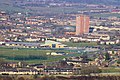
 Hattersley & Mottram in Longdendale from Werneth Low (1) Feb 2008.jpg 2,048 × 1,206; 1.75 MB
-
 Hattersley & Mottram in Longdendale from Werneth Low (2) Feb 2008.jpg 2,048 × 1,107; 1.67 MB
-
 Hattersley.jpg 1,024 × 681; 649 KB
-
 Heading Up The Low - geograph.org.uk - 835000.jpg 640 × 480; 96 KB
-
 Higher Higham - geograph.org.uk - 972976.jpg 640 × 480; 161 KB
-
 Hillside path - geograph.org.uk - 1820918.jpg 3,872 × 2,592; 2.08 MB
-
 Holly lined footpath - geograph.org.uk - 3136976.jpg 4,048 × 3,040; 6.02 MB
-
 Holly lined footpath - geograph.org.uk - 3428385.jpg 3,500 × 2,625; 7.46 MB
-
 Holly lined footpath - geograph.org.uk - 3749787.jpg 4,048 × 3,040; 2.69 MB
-
 Horses and Cyclists - geograph.org.uk - 972995.jpg 640 × 480; 149 KB
-
 Hyde & Ashton from Werneth Low, Feb 2008.jpg 2,048 × 1,074; 1.7 MB
-
 Hyde Cenotaph, Werneth Low - geograph.org.uk - 3749857.jpg 4,102 × 3,112; 3.66 MB
-
 Hyde from Werneth Low (crop) Feb 2008.jpg 2,048 × 834; 1.49 MB
-
 Hyde from Werneth Low, Feb 2008.jpg 2,048 × 1,137; 1.81 MB
-
 Hyde from Werneth Low.jpg 640 × 480; 90 KB
-
 Idle Hill - geograph.org.uk - 2934068.jpg 640 × 480; 64 KB
-
 Idle Hill - geograph.org.uk - 3163762.jpg 1,600 × 1,064; 264 KB
-
 If the Queen could see it now - geograph.org.uk - 4920258.jpg 1,000 × 839; 1,004 KB
-
 Information Plaque - geograph.org.uk - 3371610.jpg 640 × 480; 135 KB
-
 Jason's bench - geograph.org.uk - 4920313.jpg 1,000 × 750; 774 KB
-
 Journey's End - geograph.org.uk - 1722114.jpg 640 × 480; 98 KB
-
 Kite flying on Werneth Low - geograph.org.uk - 3461095.jpg 640 × 542; 166 KB
-
 Little Stone Low - geograph.org.uk - 1213963.jpg 640 × 446; 118 KB
-
 Logs left to rot - geograph.org.uk - 6079943.jpg 5,152 × 3,864; 6.93 MB
-
 Looking down Cockbrow - geograph.org.uk - 6082810.jpg 3,648 × 2,736; 2.14 MB
-
 Looking over the Etherow Valley - geograph.org.uk - 6080655.jpg 640 × 480; 130 KB
-
 Lord Derby Road - geograph.org.uk - 3372640.jpg 640 × 480; 82 KB
-
 Low End Farm - geograph.org.uk - 766344.jpg 640 × 480; 98 KB
-
 Lowend Farm - geograph.org.uk - 4123198.jpg 1,600 × 1,200; 621 KB
-
 Lowend Farm - geograph.org.uk - 4202082.jpg 3,648 × 2,736; 2.56 MB
-
 Lower Cliff - geograph.org.uk - 3227990.jpg 640 × 481; 451 KB
-
 Lumn and Lower Cliff - geograph.org.uk - 1722122.jpg 640 × 480; 154 KB
-
 Lumn Farm - geograph.org.uk - 2860427.jpg 3,700 × 2,805; 4.07 MB
-
 Morning clouds over the Low - geograph.org.uk - 3756911.jpg 1,000 × 1,000; 269 KB
-
 Morning contrails - geograph.org.uk - 4262749.jpg 1,000 × 1,000; 629 KB
-
 Morning mist clearing - geograph.org.uk - 4291502.jpg 1,000 × 687; 622 KB
-
 Morning sky over Werneth Low - geograph.org.uk - 3803026.jpg 1,000 × 750; 203 KB
-
 Mottram Church from Werneth Low - geograph.org.uk - 1515998.jpg 640 × 359; 118 KB
-
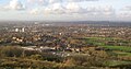
 Mottram in Longdendale.jpg 3,008 × 2,000; 4.05 MB
-
 Mottram Old Road - geograph.org.uk - 1077031.jpg 640 × 474; 104 KB
-
 Mottram Old Road - geograph.org.uk - 4231294.jpg 3,474 × 2,610; 2.83 MB
-
 Mottram Old Road - geograph.org.uk - 888867.jpg 640 × 481; 115 KB
-
 Mount Road - geograph.org.uk - 3228027.jpg 640 × 481; 498 KB
-
 Mount Road, Edmunds View - geograph.org.uk - 3228028.jpg 640 × 480; 497 KB
-
 New swing gate - geograph.org.uk - 3372667.jpg 640 × 480; 94 KB
-

-
 Old paved path - geograph.org.uk - 1536947.jpg 640 × 480; 355 KB
-
 Over School Roofs - geograph.org.uk - 1077062.jpg 640 × 481; 120 KB
-
 Over School Roofs - geograph.org.uk - 1077800.jpg 640 × 469; 107 KB
-
 Past Journey's End - geograph.org.uk - 1722832.jpg 640 × 532; 121 KB
-
 Path at the side of Werneth Low Road - geograph.org.uk - 3227943.jpg 640 × 480; 572 KB
-
 Path behind Alder School - geograph.org.uk - 952192.jpg 640 × 480; 169 KB
-
 Path crosses track near Lumn - geograph.org.uk - 3622928.jpg 1,600 × 1,200; 767 KB
-
 Path to Gee Cross - geograph.org.uk - 3227935.jpg 640 × 480; 417 KB
-
 Path towards Uplands Road - geograph.org.uk - 972884.jpg 640 × 480; 170 KB
-
 Pipers Clough - geograph.org.uk - 2934078.jpg 640 × 480; 85 KB
-
 Plinth at Windy Harbour - geograph.org.uk - 1722954.jpg 640 × 536; 149 KB
-
 Pointing the Way - geograph.org.uk - 3227931.jpg 480 × 640; 440 KB
-
 Rainbow out of Werneth Low - geograph.org.uk - 1765818.jpg 640 × 580; 99 KB
-
 Rye Field - geograph.org.uk - 972960.jpg 640 × 533; 134 KB
-
 Sheep grazing - geograph.org.uk - 3489257.jpg 5,056 × 3,971; 5.33 MB
-
 Signpost - geograph.org.uk - 3371623.jpg 640 × 480; 59 KB
-
 Site of Alder Community School - geograph.org.uk - 807372.jpg 640 × 480; 49 KB
-
 Snowy Roofs - geograph.org.uk - 1628128.jpg 640 × 455; 123 KB
-
 Spring Footpath - geograph.org.uk - 1005792.jpg 640 × 480; 152 KB
-
 Steep hill to Lumn - geograph.org.uk - 6082033.jpg 640 × 480; 98 KB
-
 Summer Footpath - geograph.org.uk - 888584.jpg 640 × 480; 166 KB
-
 Sunrise over Swains Valley ^ Werneth Low - geograph.org.uk - 3822272.jpg 1,000 × 680; 176 KB
-
 Sunrise over Werneth Low Road - geograph.org.uk - 4778806.jpg 1,000 × 582; 336 KB
-
 Sycamore corner - geograph.org.uk - 6082841.jpg 2,535 × 2,367; 2.7 MB
-
 Sycamore Cottage - geograph.org.uk - 3075498.jpg 3,477 × 2,632; 2.28 MB
-
 Sycamore trees on corner at Werneth Low - geograph.org.uk - 6082839.jpg 3,519 × 2,402; 2.32 MB
-
 Tameside Trail at Werneth Low - geograph.org.uk - 1007659.jpg 640 × 480; 151 KB
-
 Telecoms mast on Werneth Low - geograph.org.uk - 1947086.jpg 480 × 640; 44 KB
-
 The last sunrise of 2015 - geograph.org.uk - 4778798.jpg 1,000 × 870; 561 KB
-
 The path on Idle Hill - geograph.org.uk - 3173649.jpg 1,600 × 1,198; 476 KB
-
 The Queen's sycamore - geograph.org.uk - 4920295.jpg 1,000 × 1,333; 1.44 MB
-
 The Slopes of Werneth Low - geograph.org.uk - 1213949.jpg 640 × 511; 169 KB
-
 The southern slopes of Werneth Low - geograph.org.uk - 2005623.jpg 3,872 × 2,592; 2.36 MB
-
 The trig point on the western end of Werneth Low - geograph.org.uk - 2093449.jpg 3,667 × 2,499; 3.35 MB
-
 The View from Werneth Low - geograph.org.uk - 1444771.jpg 640 × 518; 31 KB
-
 Through a web - geograph.org.uk - 1063471.jpg 576 × 640; 114 KB
-
 Top of Cowlishaw Brow, Werneth Low - geograph.org.uk - 3371543.jpg 640 × 480; 74 KB
-
 Toposcope, Werneth Low - geograph.org.uk - 3323505.jpg 1,280 × 853; 178 KB
-
 Towards the war memorial at Werneth Low Country Park - geograph.org.uk - 4122720.jpg 1,600 × 1,200; 504 KB
-
 Towards Werneth Low - geograph.org.uk - 1129858.jpg 640 × 480; 129 KB
-
 Towards Werneth Low - geograph.org.uk - 2319500.jpg 640 × 480; 117 KB
-
 Towards Windy Harbour - geograph.org.uk - 1444756.jpg 640 × 526; 33 KB
-

-
 Track to Compstall - geograph.org.uk - 3227979.jpg 640 × 480; 499 KB
-
 Track towards Beacon Houses - geograph.org.uk - 3228013.jpg 640 × 480; 526 KB
-
 Track towards Compstall - geograph.org.uk - 1820910.jpg 3,872 × 2,592; 2.16 MB
-
 Track towards Compstall - geograph.org.uk - 3227969.jpg 640 × 480; 487 KB
-
 Track towards Werneth Low - geograph.org.uk - 3228015.jpg 640 × 480; 540 KB
-
 Tree on Idle Hill - geograph.org.uk - 5934249.jpg 5,152 × 3,864; 5.77 MB
-
 Trig point on Werneth Low - geograph.org.uk - 4122743.jpg 1,600 × 1,200; 514 KB
-
 Tunnel of holly at Lumn - geograph.org.uk - 3622912.jpg 1,600 × 1,200; 549 KB
-
 Uplands Road - geograph.org.uk - 3227947.jpg 640 × 481; 664 KB
-
 Uplands Road - geograph.org.uk - 3228022.jpg 640 × 480; 554 KB
-
 Uplands Road - geograph.org.uk - 4122726.jpg 1,600 × 1,200; 979 KB
-
 View across Werneth Low - geograph.org.uk - 1723021.jpg 640 × 480; 126 KB
-
 View ENE from Hyde War Memorial - geograph.org.uk - 3323475.jpg 1,280 × 853; 201 KB
-
 View from Mottram Old Road - geograph.org.uk - 3740532.jpg 3,648 × 2,736; 1.67 MB
-
 View from Werneth Low - geograph.org.uk - 1075158.jpg 640 × 481; 106 KB
-
 View from Werneth Low - geograph.org.uk - 1121709.jpg 640 × 480; 101 KB
-
 View of Hattersley from Werneth Low - geograph.org.uk - 5911472.jpg 5,152 × 3,864; 5.83 MB
-
 View of Oldham from Werneth - geograph.org.uk - 2483480.jpg 4,000 × 2,248; 1.21 MB
-
 View of the Greater Manchester County.jpg 4,000 × 3,000; 14.38 MB
-
 View over a field of daisies - geograph.org.uk - 4920458.jpg 1,000 × 750; 575 KB
-
 View over Back Wood - geograph.org.uk - 3323232.jpg 1,280 × 853; 170 KB
-
 View over rooftops - geograph.org.uk - 3461038.jpg 640 × 480; 154 KB
-
 View to Werneth Low Memorial from Idle Hill - geograph.org.uk - 3743563.jpg 1,024 × 768; 125 KB
-
 View towards Lumn - geograph.org.uk - 3163748.jpg 1,600 × 1,064; 467 KB
-
 View towards Lumn - geograph.org.uk - 3228006.jpg 640 × 480; 400 KB
-
 View towards the Hare ^ Hounds - geograph.org.uk - 4799730.jpg 1,000 × 750; 744 KB
-
 View towards Werneth Low - geograph.org.uk - 4253499.jpg 1,000 × 750; 497 KB
-
 Viewpoint Indicator - geograph.org.uk - 1121675.jpg 640 × 480; 159 KB
-
 Werneth Brook - geograph.org.uk - 1213909.jpg 640 × 480; 189 KB
-
 Werneth Brook Valley - geograph.org.uk - 1800486.jpg 640 × 480; 100 KB
-
 Werneth Hall Cottages - geograph.org.uk - 3371516.jpg 640 × 480; 84 KB
-
 Werneth Low - geograph.org.uk - 1009686.jpg 640 × 503; 106 KB
-
 Werneth Low - geograph.org.uk - 1116085.jpg 640 × 480; 253 KB
-
 Werneth Low - geograph.org.uk - 1116138.jpg 640 × 439; 402 KB
-
 Werneth Low - geograph.org.uk - 1116152.jpg 640 × 480; 398 KB
-
 Werneth Low - geograph.org.uk - 1141434.jpg 1,280 × 960; 884 KB
-
 Werneth Low - geograph.org.uk - 12995.jpg 640 × 480; 103 KB
-
 Werneth Low - geograph.org.uk - 1409412.jpg 640 × 471; 113 KB
-
 Werneth Low - geograph.org.uk - 3461044.jpg 640 × 571; 148 KB


_Feb_2008.jpg)
_Feb_2008.jpg)


_Feb_2008.jpg)