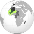
Category:West Africa
Zur Navigation springen
Zur Suche springen
Deutsch: Westafrika
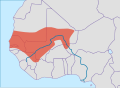
English: West Africa
Español: África Occidental
Français : Afrique de l'Ouest, anciennement Afrique occidentale
Latina: Africa occidentalis
日本語: 西アフリカ
العربية : غرب أفريقيا
Kontinentalteil   | |||||
| Medium hochladen | |||||
| Aussprache (Audiodatei) | |||||
|---|---|---|---|---|---|
| Ist ein(e) | |||||
| Ist Teil von | |||||
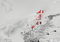
| Ort | Afrika, Südhalbkugel | ||||
| Besteht aus | |||||
 | |||||
Unterkategorien
Es werden 24 von insgesamt 24 Unterkategorien in dieser Kategorie angezeigt:
In Klammern die Anzahl der enthaltenen Kategorien (K), Seiten (S), Dateien (D)
Medien in der Kategorie „West Africa“
Folgende 200 Dateien sind in dieser Kategorie, von 211 insgesamt.
(vorherige Seite) (nächste Seite)-
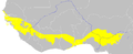
 West Africa map.gif 1.500 × 977; 120 KB
-

-
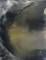
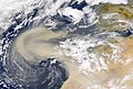 2000-Feb-26 NASA SeaWiFS African Dust Storm.jpg 2.880 × 1.944; 1,76 MB
-
 African bloomery furnace types.png 1.578 × 2.251; 319 KB
-
 African Clay molding.jpg 4.032 × 3.024; 2,59 MB
-
 Airport @ Roberts-Field Monrovia, Liberia - panoramio.jpg 730 × 486; 281 KB
-
 Anti-domestic violence sign in Liberia panoramio (193).jpg 1.024 × 759; 400 KB
-
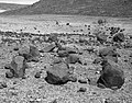
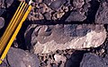
 Archaeological site of Koumbi Saleh.jpg 580 × 460; 199 KB
-
 Assemblée Nationale du Bénin en construction.jpg 9.216 × 6.912; 15,46 MB
-
 AT0707 map.png 1.342 × 544; 40 KB
-
 AWMT Community Banner.png 1.024 × 520; 62 KB
-
 Babatu Sword - weapon used by Babatu a famous slave master in Northern Ghana.jpg 1.800 × 4.000; 981 KB
-
 Bags of rice.JPG 1.676 × 1.200; 1,34 MB
-
-
-
-
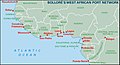 Bolloré ports in West Africa.jpg 1.373 × 747; 171 KB
-
 Central Mausoleum of the Column Tomb.jpg 580 × 521; 251 KB
-
 Central Mausoleum.jpg 580 × 251; 178 KB
-

-
 Chili girl.JPG 1.800 × 1.200; 759 KB
-
 Clay moldings.jpg 3.024 × 4.032; 2,59 MB
-
 Cluster 9 funerary monuments in their landscape context.jpg 2.128 × 1.479; 396 KB
-
 Complex compound subdivisions in the central area of Akreijit.webp 1.865 × 1.110; 163 KB
-

-
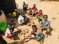
 Creative Arts lesson.jpg 4.032 × 3.024; 2,95 MB
-
-
 Côte d'Ivoire 1889.jpg 816 × 1.038; 587 KB
-
 Dee Moneey.jpg 5.760 × 3.840; 1,55 MB
-
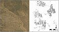
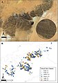
 Densities of sites, permanent water, and impermanent water.webp 969 × 1.204; 179 KB
-

-
 Documented site locations, permanent water, and impermanent water.webp 1.854 × 1.313; 184 KB
-
 Dogon Mask.jpg 2.144 × 1.635; 827 KB
-
 Dupuis-Yacouba-Maxar map and satellite image.png 1.652 × 1.555; 1.010 KB
-
 Dust off West Africa (MODIS 2018-10-30).jpg 8.239 × 6.988; 5,32 MB
-
 Dust off West Africa (MODIS 2019-02-10).jpg 7.993 × 6.468; 5,14 MB
-
 Dust off West Africa (MODIS 2019-02-28).jpg 7.895 × 6.507; 2,01 MB
-
 Dust off West Africa (MODIS 2019-06-11).jpg 7.071 × 5.398; 4,9 MB
-
 Dust off West Africa (MODIS 2019-06-30).jpg 7.218 × 5.077; 6,48 MB
-
 Dust storm off West Africa (MODIS 2015-01-05).jpg 2.400 × 3.200; 609 KB
-
 Dust storm off West Africa (MODIS 2015-01-10).jpg 2.800 × 3.600; 899 KB
-
 Dust storm off West Africa (MODIS 2015-01-18).jpg 5.600 × 7.800; 7,47 MB
-
 Dust storm off West Africa (MODIS 2015-03-12).jpg 5.600 × 7.200; 4,9 MB
-
 Dust storm off West Africa (MODIS 2015-06-25).jpg 5.600 × 7.200; 3,65 MB
-
 Dust storm off West Africa (MODIS 2015-06-28).jpg 5.600 × 7.200; 3,5 MB
-
 Dust storm off West Africa (MODIS 2015-07-26).jpg 5.000 × 6.400; 3,59 MB
-
 Dust storm off West Africa (MODIS 2016-03-10).jpg 2.800 × 3.600; 1,12 MB
-
 Dust storm off West Africa (MODIS 2017-01-07).jpg 7.200 × 9.400; 8,83 MB
-
 Dust storm off West Africa (MODIS 2017-02-04).jpg 2.800 × 3.600; 951 KB
-
 Dust storm off West Africa (MODIS 2017-03-19).jpg 3.400 × 4.400; 1,08 MB
-
 Dust storm off West Africa (MODIS 2017-05-14).jpg 6.000 × 7.800; 4,26 MB
-
 Dust storm off West Africa (MODIS 2017-10-19).jpg 5.000 × 6.400; 3,46 MB
-
 Dust storm off West Africa (MODIS 2018-01-24).jpg 5.600 × 7.200; 5,89 MB
-
 Dust storms off West Africa (MODIS 2016-07-31).jpg 7.200 × 9.400; 8,63 MB
-
 Dust storms off West Africa (MODIS 2017-01-15).jpg 2.200 × 2.800; 693 KB
-

-

-

-

-

-

-

-

-

-
 Entrance of St Andrews Catholic Cathedral in Wa.jpg 607 × 1.080; 74 KB
-
 Field boundary on the western shore of Lake Fati.png 1.652 × 1.105; 652 KB
-
 Figure 1. Tamanrasset River. Hydrological context of Africa.jpg 926 × 630; 120 KB
-

-

-

-
 Fires and Poor Air Quality in West Africa (MODIS 2020-01-23).jpg 7.857 × 6.102; 2,9 MB
-
 Fires in West Africa (MODIS 2021-12-27).jpg 3.855 × 2.730; 719 KB
-

-
 French Sudan map.png 2.000 × 2.000; 330 KB
-
 Fufu con pollo y vino.png 604 × 477; 365 KB
-
 Gapaver.png 1.121 × 1.100; 496 KB
-
 GHANA empire map BLANK.png 1.580 × 988; 36 KB
-
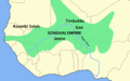
 Ghana empire map.png 984 × 864; 51 KB
-
 Ghana reich karte-es.svg 706 × 721; 781 KB
-
 Ghana reich karte.png 2.321 × 2.475; 438 KB
-
 Glass beads of different colors and shapes from Ile-Ife, Nigeria.webp 850 × 1.472; 229 KB
-
-
-
 Gridded site complex in Dhar Tagant.jpg 2.128 × 1.171; 407 KB
-
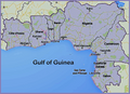 Gulf of Guinea Nations.png 5.100 × 3.709; 11,69 MB
-
 Hausa People (map).png 6.300 × 7.000; 1,7 MB
-
 Hausa People map.png 6.300 × 7.000; 1,95 MB
-
How to create a wikipedia account - Ghanaian Sign Language version.webm 2 min 6 s, 854 × 480; 9,72 MB
-
 Imam Abdul Ghaniyy Agbotomokekere (grand Imam of Ibadan).jpg 864 × 1.080; 72 KB
-
 Individual Burial from the Column Tomb.jpg 580 × 435; 358 KB
-
 Katja-Werthmann.Studioline.de.©Katja Werthmann.2019.jpg 3.008 × 2.008; 1,57 MB
-
 Kaworen townen pulaaku.png 600 × 200; 75 KB
-
 Kaworen townen pulaaku¹.png 600 × 200; 60 KB
-
 Landscape and excavations at the Nok site Ido.webp 989 × 1.378; 528 KB
-
 Leonhard-Harding.2010.jpg 2.336 × 3.504; 2,08 MB
-
 Les roches du quartier yagma a Ouagadougou.jpg 2.016 × 4.592; 4,27 MB
-
 Lunar Umbra (solar eclipse shadow) over western Africa (10673117984).jpg 11.200 × 9.000; 23,18 MB
-
 Mafa down-draught type of low-shaft furnaces.png 1.865 × 1.294; 589 KB
-
 Main one phase 1.png 213 × 211; 36 KB
-
 MALI empire BLANK.PNG 1.580 × 988; 60 KB
-
 MALI empire BLANK.svg 1.668 × 1.214; 43 KB
-
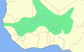
 Map of West AFrica.gif 1.227 × 1.044; 109 KB
-
 Map Population of Fula Fulani people west africa.png 617 × 421; 78 KB
-
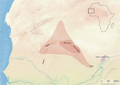
 Map showing the highlands of southeastern Mauritania.jpg 746 × 646; 121 KB
-
 Mapa ghana-pt.svg 512 × 442; 14 KB
-
 Massive Dust Storm off West Africa (MODIS 2020-06-10).jpg 8.114 × 7.420; 5,97 MB
-

-
 Meule sur un site du Baten de Tichitt.jpg 580 × 430; 236 KB
-
 Molded clay cake.jpg 4.032 × 3.024; 2,68 MB
-
 Molded Items.jpg 4.032 × 3.024; 3,01 MB
-
 Monteils Journey.png 850 × 483; 873 KB
-
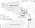
 Monuments that were visible in four different visualisation types.jpg 535 × 535; 223 KB
-

-
-
 Nauclea latifolia modern fruit and seed collected in Burkina Faso.webp 990 × 1.351; 333 KB
-
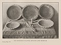
 Negro Culture in West Africa plate 1.jpg 1.331 × 1.880; 1,13 MB
-
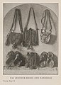
 Negro Culture in West Africa plate 10.jpg 1.782 × 1.338; 1,2 MB
-
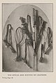
 Negro Culture in West Africa plate 11.jpg 1.635 × 1.359; 1,1 MB
-
 Negro Culture in West Africa plate 12.jpg 1.180 × 1.971; 1,17 MB
-
 Negro Culture in West Africa plate 13.jpg 1.763 × 1.292; 1,2 MB
-
 Negro Culture in West Africa plate 14.jpg 1.722 × 1.336; 1,07 MB
-
 Negro Culture in West Africa plate 15.jpg 1.147 × 1.828; 923 KB
-
 Negro Culture in West Africa plate 16.jpg 1.204 × 1.648; 1.009 KB
-
 Negro Culture in West Africa plate 17.jpg 1.800 × 1.316; 1,2 MB
-
 Negro Culture in West Africa plate 18.jpg 1.190 × 1.922; 1,1 MB
-
 Negro Culture in West Africa plate 19.jpg 1.600 × 1.349; 1,12 MB
-
 Negro Culture in West Africa plate 2.jpg 1.113 × 1.867; 889 KB
-
 Negro Culture in West Africa plate 20.jpg 1.785 × 1.350; 1,19 MB
-
 Negro Culture in West Africa plate 21.jpg 1.903 × 1.378; 1,06 MB
-
 Negro Culture in West Africa plate 22.jpg 1.871 × 1.299; 1,27 MB
-
 Negro Culture in West Africa plate 23.jpg 1.829 × 1.354; 1,31 MB
-
 Negro Culture in West Africa plate 24.jpg 1.776 × 1.324; 1,23 MB
-
 Negro Culture in West Africa plate 25.jpg 1.769 × 1.451; 1,17 MB
-
 Negro Culture in West Africa plate 3.jpg 1.768 × 1.314; 1,12 MB
-
 Negro Culture in West Africa plate 4.jpg 1.804 × 1.336; 1,18 MB
-
 Negro Culture in West Africa plate 5.jpg 1.187 × 1.652; 1,05 MB
-
 Negro Culture in West Africa plate 6.jpg 1.165 × 1.718; 1,02 MB
-
 Negro Culture in West Africa plate 7.jpg 1.163 × 1.943; 909 KB
-
 Negro Culture in West Africa plate 8.jpg 1.802 × 1.404; 1,09 MB
-
 Negro Culture in West Africa plate 9.jpg 1.166 × 1.694; 846 KB
-
 Oblique false-colour 3D rendering of an example tumulus.jpg 624 × 992; 184 KB
-
 OFWA TOT Workshop 2023 012.jpg 3.024 × 4.032; 2,26 MB
-
 P Hall.png 218 × 271; 58 KB
-
 Percentage of items per taxon of Nok culture.webp 1.521 × 716; 48 KB
-
 Pesticide workshop in West Africa.jpg 4.592 × 3.448; 5,71 MB
-
 Petite jarre du village v.72 (échelle - 10 cm).jpg 428 × 500; 112 KB
-
 Plan of the entire funerary complex of the Column Tomb.jpg 580 × 509; 155 KB
-
 Poids de filet en grès (échelle - 3 cm), Dhar Tichitt-Oualata.jpg 580 × 228; 110 KB
-
 Pointes de flèches, Dhar Tichitt-Oualata.jpg 580 × 457; 212 KB
-
 Political map of West Africa according UN mk.svg 1.200 × 1.230; 65 KB
-
 Political map of West Africa mk.svg 1.200 × 1.230; 63 KB
-
 Possible pillar structures in village sites of the Mali Lakes Region.webp 1.652 × 2.314; 565 KB
-
 Poste de transformation électrique à Womey, Abomey-calavi, Bénin.jpg 9.216 × 6.912; 16,13 MB
-

-
 Prof Honorat Aguessy (cropped).jpg 1.445 × 1.070; 399 KB
-
 Prof Honorat Aguessy.jpg 1.920 × 1.080; 231 KB
-
 Rained again 01.jpg 3.968 × 2.976; 2,98 MB
-
 Rained again 03.jpg 2.976 × 3.968; 2,76 MB
-
 Reich von ghana.png 1.580 × 988; 41 KB
-
-
 Round the black man's garden (1893) (14773097011).jpg 1.520 × 2.288; 711 KB
-
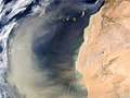 Saharan Dust off West Africa.jpg 514 × 385; 51 KB
-

-

-

-
 Satellite view of Tumuli Cluster 8 from Dhar Tagant.jpg 2.128 × 1.402; 495 KB
-
 Schematic plan of the central mausoleum.jpg 580 × 486; 132 KB
-
 SEM illustration of archaeobotanical material from Pangwari.png 991 × 1.060; 742 KB
-
 Sites with archaeobotanical analysis of pearl millet and Nok culture.png 1.520 × 1.924; 591 KB
-
-
 Size-based distribution of funerary tumuli.jpg 802 × 954; 163 KB
-
 SONGHAI empire map BLANK.PNG 1.580 × 988; 62 KB
-
 SONGHAI empire map-HE.PNG 1.580 × 988; 48 KB
-
 SONGHAI empire map.PNG 1.580 × 988; 73 KB
-
 SONGHAI reich karte.PNG 1.580 × 988; 51 KB
-

-
 Statuettes zoomorphes du village, Dhar Tichitt.jpg 580 × 438; 129 KB
-
 Stone pillar structure at Fati 6.webp 1.652 × 1.108; 421 KB
-
 Stop gender based violence sign in Liberia - panoramio (196).jpg 722 × 750; 330 KB
-
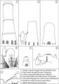
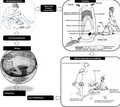
 Structural diagram of burial.jpg 543 × 945; 61 KB
-
 Studies in primitive looms (1918) (14784096942).jpg 3.056 × 1.460; 317 KB
-

-
 The forest of parakou, Benin.jpg 768 × 1.024; 202 KB
-
 The ship holds exactly the straight course.png 1.018 × 1.489; 946 KB
-
 The zoology of the voyage of the H.M.S. Erebus and Terror (6258372718).jpg 1.703 × 1.323; 171 KB
-
 Tichitt culture and the Malian Lakes Region.webp 1.866 × 1.322; 126 KB
-
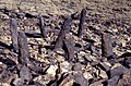
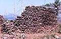
 Tichitt Tradition drystone tumulus.jpg 388 × 214; 112 KB
-
 Tombouctou cercles.png 1.056 × 816; 32 KB
-
 Topographic map of project area showing locations and rivers of Western Africa.webp 1.299 × 1.832; 781 KB
-
 TOpoku.png 198 × 183; 38 KB
-
 TopoWestAfr.jpg 2.285 × 2.392; 700 KB
-
 Travel times based on the generation of isochrones.jpg 811 × 916; 344 KB
-
 Tuareg with a sword in Timbuktu, Mali.jpg 2.849 × 4.379; 6,53 MB
-

-
 Typical bloomery iron production operational sequence.webp 1.865 × 1.656; 278 KB
-
 Tête de boviné du village v.62, Dhar Tichitt.jpg 580 × 565; 173 KB
-
 Ubiquity of the five main species of Nok culture.webp 1.511 × 1.074; 56 KB
-
 Un aspect du village v.72, Dhar Tichitt-Oualata.jpg 580 × 388; 243 KB
-
-
 1005-WesternAfricafromplane.jpg 2.112 × 2.816; 713 KB


.jpg)


,_Dhar_Tichitt.jpg)


.jpg)


.jpg)
.jpg)
.jpg)
.jpg)
.jpg)
.jpg)
.jpg)
.jpg)
.jpg)
.jpg)
.jpg)
.jpg)
.jpg)
.jpg)
.jpg)
.jpg)
.jpg)
.jpg)
.jpg)
.jpg)
.jpg)


.jpg)
.jpg)


.png)

.jpg)


_over_western_Africa_(10673117984).jpg)


.jpg)


.jpg)


.jpg)


_(402137881).jpg)
_(14773097011).jpg)

.jpg)

.jpg)


.jpg)

_(14784096942).jpg)


.jpg)


,_Dhar_Tichitt-Oualata.jpg)
-to-transmit-Zika-virus-12879_2015_1231_Fig1_HTML.jpg)