Category:West Stour
Jump to navigation
Jump to search
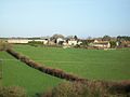
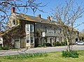
English: West Stour is a small village situated in the Blackmore Vale area of North Dorset, England. The village has a population of 187 (2001). It is one of a group of villages known as The Stours, located in the River Stour Valley, five miles south of Gillingham. West Stour has a village hall, one public house and a service station on the main A30 road.
village and civil parish in Dorset, United Kingdom  | |||||
| Upload media | |||||
| Instance of | |||||
|---|---|---|---|---|---|
| Location | Dorset, South West England, England | ||||
 | |||||
Subcategories
This category has the following 2 subcategories, out of 2 total.
S
W
Media in category "West Stour"
The following 50 files are in this category, out of 50 total.
-
 "Bunny" field from Coombe Lane - geograph.org.uk - 1589650.jpg 640 × 480; 106 KB
-
 A30 entering West Stour - geograph.org.uk - 4045586.jpg 640 × 480; 98 KB
-
 A30 Shaftsbury Road - geograph.org.uk - 550167.jpg 640 × 430; 242 KB
-
 A30 towards Sherborne - geograph.org.uk - 550174.jpg 640 × 430; 255 KB
-
 Book exchange phone box in West Stour - geograph.org.uk - 6200730.jpg 1,600 × 1,200; 913 KB
-
 Bridge over the River Stour - geograph.org.uk - 1595148.jpg 640 × 480; 134 KB
-
 Communications hotspot, West Stour - geograph.org.uk - 4529505.jpg 640 × 480; 114 KB
-
 Coombe Lane - geograph.org.uk - 1589654.jpg 640 × 480; 99 KB
-
 Crossroads at Stour Hill - geograph.org.uk - 4045580.jpg 640 × 452; 66 KB
-

-
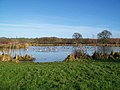 Fishing lake at Coking Farm - geograph.org.uk - 1613788.jpg 640 × 480; 79 KB
-
 Flytip beside the A30 - geograph.org.uk - 1155610.jpg 640 × 480; 130 KB
-

-
 Footbridge over the river Stour - geograph.org.uk - 2795240.jpg 2,048 × 1,536; 2.82 MB
-
-
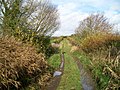
 Footpath, West Stour - geograph.org.uk - 1155514.jpg 640 × 480; 185 KB
-
 Footpath, West Stour - geograph.org.uk - 1155590.jpg 640 × 480; 207 KB
-

-
 Green Lane north of West Stour - geograph.org.uk - 1584072.jpg 640 × 480; 126 KB
-
 Harpitts Lane looking south west - geograph.org.uk - 1584004.jpg 640 × 480; 109 KB
-
 Little Ashley Cottage - West Stour - geograph.org.uk - 390857.jpg 640 × 525; 148 KB
-
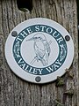 Logo for the Stour Valley Way - geograph.org.uk - 1155599.jpg 479 × 640; 162 KB
-
 Manor Farm, West Stour - geograph.org.uk - 1614250.jpg 640 × 480; 50 KB
-
 Old Wooden Cross - geograph.org.uk - 1155559.jpg 480 × 640; 169 KB
-
 Petrol station on Lotmoor Hill, West Stour - geograph.org.uk - 5704228.jpg 2,048 × 1,536; 1.51 MB
-

-
 Road north from Fifehead Magdalen - geograph.org.uk - 5644416.jpg 640 × 480; 126 KB
-
 Small weir at East Stour - geograph.org.uk - 3062597.jpg 2,048 × 1,536; 3.18 MB
-
 Stile on the Stour Valley Way - geograph.org.uk - 1583968.jpg 640 × 480; 132 KB
-
 Stour Hill cross-roads - geograph.org.uk - 1615304.jpg 640 × 480; 59 KB
-
 Stour Hill Farm and Stour Hill House - geograph.org.uk - 1615244.jpg 640 × 480; 88 KB
-
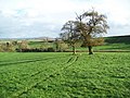
 Stour Valley above West Stour - geograph.org.uk - 1584024.jpg 640 × 480; 130 KB
-
 Stour Valley and Bugley - geograph.org.uk - 1584048.jpg 640 × 480; 63 KB
-
 Telephone box, West Stour - geograph.org.uk - 1155508.jpg 640 × 480; 218 KB
-
 The A30 at West Stour - geograph.org.uk - 3490762.jpg 800 × 600; 157 KB
-
 The Cale at Five Bridges - geograph.org.uk - 1155644.jpg 640 × 480; 209 KB
-
 The River Cale at Five Bridges - geograph.org.uk - 1155657.jpg 640 × 480; 201 KB
-
 The Riverside Cafe, West Stour - geograph.org.uk - 5704227.jpg 2,048 × 1,536; 1.61 MB
-
 The Ship Inn West Stour - geograph.org.uk - 390837.jpg 640 × 476; 172 KB
-
 The Ship Inn, West Stour - geograph.org.uk - 3490760.jpg 800 × 600; 128 KB
-
 The Ship Inn, West Stour - geograph.org.uk - 475216.jpg 640 × 480; 80 KB
-
 The Ship Inn, West Stour - geograph.org.uk - 6200740.jpg 1,600 × 1,200; 546 KB
-
 Townsend Farm, West Stour - geograph.org.uk - 1570411.jpg 640 × 480; 72 KB
-

-

-
 Village Hall, West Stour - geograph.org.uk - 1155523.jpg 640 × 480; 146 KB
-
 Village Hall, West Stour - geograph.org.uk - 4529506.jpg 480 × 640; 76 KB
-
 Weather vane, West Stour - geograph.org.uk - 1155528.jpg 640 × 481; 55 KB
-

-
 Footpath and Stile - geograph.org.uk - 475229.jpg 640 × 480; 150 KB


