Category:Wetlands in Angus
Jump to navigation
Jump to search
Media in category "Wetlands in Angus"
The following 20 files are in this category, out of 20 total.
-
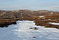
 Bog on Burnt Hill - geograph.org.uk - 1773904.jpg 640 × 480; 105 KB
-
 Bog, Shank of Barns - geograph.org.uk - 1573013.jpg 640 × 359; 86 KB
-
 Bog, west of Burnt Hill - geograph.org.uk - 1773901.jpg 640 × 480; 148 KB
-
 Bogs, Head of the Mayar Burn - geograph.org.uk - 1196607.jpg 640 × 359; 64 KB
-
 Col between Ruragh and Dog Hillock - geograph.org.uk - 343572.jpg 640 × 480; 94 KB
-
 End of a bog - geograph.org.uk - 441851.jpg 640 × 480; 106 KB
-
 Eroded peat - geograph.org.uk - 222709.jpg 640 × 480; 74 KB
-
 Eroding peat - geograph.org.uk - 12566.jpg 640 × 419; 76 KB
-
 Flood Plain in Glen Prosen. - geograph.org.uk - 203053.jpg 640 × 427; 69 KB
-
 Head of Duskintry - geograph.org.uk - 439111.jpg 640 × 480; 111 KB
-
 North of Lair of Aldararie. - geograph.org.uk - 118333.jpg 640 × 455; 98 KB
-
 On Wester Hill - geograph.org.uk - 344128.jpg 640 × 433; 67 KB
-
 The Snub. - geograph.org.uk - 118216.jpg 640 × 480; 75 KB
-
 Tussocks on Benty Roads - geograph.org.uk - 118212.jpg 640 × 480; 88 KB
-
 Wetland under Duchray Hill - geograph.org.uk - 8562.jpg 640 × 449; 62 KB
-
 Birkentree - geograph.org.uk - 222704.jpg 640 × 480; 87 KB
-
 Bogs near the Latch of Whitestone. - geograph.org.uk - 118469.jpg 640 × 480; 102 KB
-
 Bogs, Head of Duskintry - geograph.org.uk - 442266.jpg 640 × 480; 85 KB
-
 Peat and bogpool, Castle Hill - geograph.org.uk - 422215.jpg 640 × 480; 122 KB
-
 Reflections at Kinnordy - geograph.org.uk - 531099.jpg 426 × 640; 113 KB


