Category:Wollaton, Nottinghamshire
Jump to navigation
Jump to search
suburb in Nottingham, UK | |||||
| Upload media | |||||
| Instance of |
| ||||
|---|---|---|---|---|---|
| Location | City of Nottingham, Nottinghamshire, East Midlands, England | ||||
 | |||||
Subcategories
This category has the following 4 subcategories, out of 4 total.
Media in category "Wollaton, Nottinghamshire"
The following 157 files are in this category, out of 157 total.
-
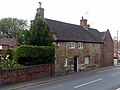
 1 To 4, Bramcote Lane, Wollaton Village, Notts (1).jpg 4,032 × 3,024; 2.85 MB
-
 1 To 4, Bramcote Lane, Wollaton Village, Notts (2).jpg 4,032 × 3,024; 4.34 MB
-
 1-4 Bramcote Lane, Wollaton.jpg 1,280 × 960; 296 KB
-
 1930s suburbia, Wollaton - geograph.org.uk - 1040735.jpg 640 × 469; 123 KB
-
 2, 2A And 4, The Square, Wollaton Village, Notts (1).jpg 4,032 × 3,024; 2.57 MB
-
 2, 2A And 4, The Square, Wollaton Village, Notts (2).jpg 4,032 × 3,024; 2.01 MB
-
 A609 Trowell Road in Nottingham - geograph.org.uk - 6273868.jpg 1,024 × 768; 227 KB
-
 Access to the Tottle Brook on Woodbank Drive - geograph.org.uk - 5123320.jpg 1,280 × 798; 425 KB
-
 Admiral Rodney, Wollaton village - geograph.org.uk - 3281014.jpg 1,024 × 768; 147 KB
-
 Beaumont Square, Wollaton - geograph.org.uk - 5033073.jpg 640 × 480; 74 KB
-
 Bench mark, 137 Wollaton Vale - geograph.org.uk - 5123310.jpg 480 × 640; 165 KB
-
 Birchwood Road, Wollaton - geograph.org.uk - 5033078.jpg 640 × 480; 50 KB
-
 Boundary Wall At Ivy Cottage, Wollaton Village, Notts (1).jpg 4,032 × 3,024; 3.35 MB
-
 Boundary Wall At Ivy Cottage, Wollaton Village, Notts (2).jpg 4,032 × 3,024; 2.44 MB
-
 Bramcote Lane - geograph.org.uk - 1040314.jpg 640 × 480; 106 KB
-
 Bramcote Lane bus stop - geograph.org.uk - 5123396.jpg 1,280 × 960; 360 KB
-
 Bramcote Lane Shops - geograph.org.uk - 3938661.jpg 1,280 × 960; 211 KB
-
 Bramcote Lane, Wollaton - geograph.org.uk - 1564071.jpg 640 × 415; 103 KB
-
 Bridge 14A, Wollaton - geograph.org.uk - 3281007.jpg 1,024 × 768; 263 KB
-

-

-
 Caxmere Drive - geograph.org.uk - 1040825.jpg 640 × 480; 87 KB
-
 Cemetery on Bramcote Lane, Wollaton - geograph.org.uk - 919164.jpg 640 × 480; 109 KB
-
 Church on Glenwood Avenue, Wollaton - geograph.org.uk - 919159.jpg 640 × 480; 66 KB
-

-
 Deer Park - geograph.org.uk - 1040319.jpg 640 × 481; 100 KB
-
 Dovecote, Wollaton, Nottingham - geograph.org.uk - 4776927.jpg 2,647 × 2,491; 1.28 MB
-
 Elvaston Road, Wollaton - geograph.org.uk - 1592205.jpg 640 × 476; 100 KB
-
 Eton Grove, Wollaton Park.png 536 × 483; 212 KB
-
 Farndale Drive, Wollaton - geograph.org.uk - 3281011.jpg 1,024 × 768; 149 KB
-
 Firbeck Rd - geograph.org.uk - 4303241.jpg 640 × 430; 49 KB
-
 Firbeck Rd - geograph.org.uk - 4303242.jpg 640 × 369; 43 KB
-
 Gateway And Boundary Wall At Wollaton House, Wollaton Village, Notts (2).jpg 3,024 × 4,032; 10.64 MB
-
 George V postbox on Trowell Road - geograph.org.uk - 5033717.jpg 1,753 × 2,653; 1,002 KB
-
 Have you paid and displayed^ - geograph.org.uk - 1650373.jpg 640 × 475; 139 KB
-
 Hemlock Stone roundabout - geograph.org.uk - 3938680.jpg 1,280 × 960; 247 KB
-
 Highcroft Drive, Wollaton - geograph.org.uk - 5033068.jpg 640 × 480; 67 KB
-
 Hollinwell Avenue, Wollaton - geograph.org.uk - 876261.jpg 640 × 480; 114 KB
-
 Houses on Birchwood Road, Wollaton - geograph.org.uk - 5033076.jpg 640 × 480; 55 KB
-
 Houses on Plantation Road, Wollaton - geograph.org.uk - 5033079.jpg 640 × 480; 57 KB
-
 Houses, Bridge Road, Wollaton - geograph.org.uk - 1001357.jpg 640 × 480; 77 KB
-
 Inn sign with a difference - geograph.org.uk - 3938677.jpg 1,280 × 960; 339 KB
-
 Ivy Cottage, Wollaton Village, Notts.jpg 3,983 × 2,866; 2.34 MB
-

-

-
 Kingswood Methodist Church - geograph.org.uk - 1040838.jpg 640 × 480; 67 KB
-
 Lambourne Drive - geograph.org.uk - 1040836.jpg 640 × 473; 83 KB
-
 Lambourne Drive, Wollaton - geograph.org.uk - 1592201.jpg 640 × 480; 128 KB
-
 Linsdale Close, Bilborough - geograph.org.uk - 3722664.jpg 1,024 × 768; 213 KB
-
 Local shops at Bramcote Hills - geograph.org.uk - 2299240.jpg 2,048 × 1,536; 1.51 MB
-
 Martin's Pond, Wollaton - geograph.org.uk - 1742607.jpg 1,560 × 1,170; 915 KB
-
 Middletons public house, Wollaton - geograph.org.uk - 5033089.jpg 640 × 480; 72 KB
-
 Model Cottage, Bramcote Lane - geograph.org.uk - 5123372.jpg 1,280 × 960; 408 KB
-
 Moorsholm Drive, Wollaton - geograph.org.uk - 991281.jpg 640 × 480; 64 KB
-

-
 Number 5 And Attached Outbuildings, Wollaton Village, Notts (1).jpg 3,840 × 3,022; 3.73 MB
-
 Number 5 And Attached Outbuildings, Wollaton Village, Notts (2).jpg 4,032 × 3,024; 3.85 MB
-
 Number 5 And Attached Outbuildings, Wollaton Village, Notts (3).jpg 4,032 × 3,024; 5.77 MB
-
 Number 5 And Attached Outbuildings, Wollaton Village, Notts (4).jpg 4,032 × 3,024; 3.41 MB
-
 Number 5 And Attached Outbuildings, Wollaton Village, Notts (5).jpg 4,032 × 3,024; 3.52 MB
-
 Old Coach Road - geograph.org.uk - 1001372.jpg 640 × 480; 148 KB
-
 Old Coach Road - geograph.org.uk - 1040800.jpg 640 × 480; 144 KB
-
 Old Coach Road - geograph.org.uk - 1040802.jpg 480 × 640; 131 KB
-
 Old Rectory, Wollaton Village, Notts (1).jpg 3,024 × 4,032; 9.76 MB
-
 Old Rectory, Wollaton Village, Notts (2).jpg 3,024 × 4,032; 5.74 MB
-
 Old Rectory, Wollaton.jpg 1,280 × 960; 448 KB
-
 Orangery and Gardens, Wollaton Hall - geograph.org.uk - 541678.jpg 640 × 427; 73 KB
-
 Parkside - geograph.org.uk - 1040302.jpg 640 × 480; 82 KB
-
 Parkside - geograph.org.uk - 1040311.jpg 640 × 480; 107 KB
-
 Pillar box, Wollaton Village - geograph.org.uk - 1040323.jpg 480 × 640; 85 KB
-
 Plantation Road - geograph.org.uk - 5853613.jpg 1,024 × 683; 218 KB
-
 Pond, Harrison's Plantation - geograph.org.uk - 1001365.jpg 640 × 480; 140 KB
-
 Railway towards Nottingham - geograph.org.uk - 5033083.jpg 640 × 474; 77 KB
-
 Raleigh Pond - geograph.org.uk - 1040827.jpg 480 × 640; 105 KB
-
 Raleigh Pond - geograph.org.uk - 1040829.jpg 480 × 640; 141 KB
-
 Rectory Avenue - geograph.org.uk - 1040338.jpg 640 × 480; 83 KB
-
 Rectory Avenue, Wollaton - geograph.org.uk - 1008685.jpg 480 × 640; 134 KB
-
 Redwood Avenue, Wollaton - geograph.org.uk - 2280674.jpg 600 × 390; 111 KB
-
 Rivergreen Crescent - geograph.org.uk - 2299221.jpg 2,048 × 1,536; 1.82 MB
-
 Road through Wollaton Vale - geograph.org.uk - 1810858.jpg 640 × 480; 101 KB
-
 Road through Wollaton Vale - geograph.org.uk - 1810864.jpg 640 × 480; 68 KB
-
 Robin Hood Way - geograph.org.uk - 1478148.jpg 479 × 640; 100 KB
-
 Russell Drive, Wollaton - geograph.org.uk - 1592198.jpg 640 × 462; 110 KB
-
 Service station off Trowell Road - geograph.org.uk - 5033086.jpg 640 × 480; 66 KB
-
 Sheraton Drive - geograph.org.uk - 1040298.jpg 640 × 480; 83 KB
-
 Shops on Bramcote Lane - geograph.org.uk - 2299248.jpg 2,048 × 1,536; 1.52 MB
-

-

-
 Sydney Road, Wollaton - geograph.org.uk - 1592206.jpg 640 × 495; 84 KB
-
 The Beechdale - geograph.org.uk - 1067924.jpg 640 × 480; 46 KB
-
 The Chantry, Wollaton Village, Notts (2).jpg 4,032 × 3,024; 7.05 MB
-
 The Chantry, Wollaton Village, Notts (3).jpg 4,032 × 3,024; 7.34 MB
-
 The Chantry, Wollaton Village, Notts (4).jpg 4,032 × 3,024; 4.38 MB
-
 The Chantry, Wollaton.jpg 1,280 × 960; 358 KB
-
 The Cottages, Wollaton Village, Notts (1).jpg 3,410 × 3,040; 2.64 MB
-
 The Cottages, Wollaton Village, Notts (2).jpg 3,515 × 3,026; 2.56 MB
-
 The Cottages, Wollaton Village, Notts (3).jpg 3,024 × 4,032; 2.8 MB
-
 The Cottages, Wollaton Village, Notts (4).jpg 3,024 × 4,032; 9.39 MB
-
 The Cottages, Wollaton Village, Notts (5).jpg 3,024 × 4,032; 8.68 MB
-
 The Cottages, Wollaton Village, Notts (6).jpg 4,032 × 3,024; 2.88 MB
-
 The Hemlock Stone and Dragon - geograph.org.uk - 3938666.jpg 1,280 × 960; 262 KB
-
 Tottle Brook at Woodbank Drive - geograph.org.uk - 5123314.jpg 960 × 1,280; 430 KB
-
 Trowell Road (A609) - geograph.org.uk - 5033720.jpg 640 × 480; 70 KB
-
 Trowell Road.(A609) - geograph.org.uk - 5033074.jpg 640 × 480; 62 KB
-
 Ugly House - geograph.org.uk - 912468.jpg 640 × 480; 84 KB
-
 Vale Community Centre - geograph.org.uk - 612627.jpg 640 × 472; 78 KB
-
 Village Pump And Shelter, Wollaton Village, Nottngham (1).jpg 3,024 × 4,032; 2.62 MB
-
 Village Pump And Shelter, Wollaton Village, Nottngham (2).jpg 4,032 × 3,024; 2.35 MB
-
 Village Pump And Shelter, Wollaton Village, Nottngham (3).jpg 3,024 × 4,032; 2.19 MB
-
 Waitrose at Wollaton - geograph.org.uk - 6109735.jpg 4,032 × 3,024; 2.77 MB
-
 Waitrose supermarket, Wollaton - geograph.org.uk - 5033088.jpg 640 × 480; 43 KB
-

-
 Willoughby Arms - geograph.org.uk - 1040846.jpg 640 × 475; 113 KB
-
 Wollaton - geograph.org.uk - 232617.jpg 640 × 480; 96 KB
-
 Wollaton Cemetery - geograph.org.uk - 1040309.jpg 640 × 480; 79 KB
-
 Wollaton Colliery Park and Ride Site - geograph.org.uk - 2290273.jpg 600 × 389; 102 KB
-
 Wollaton Cricket Ground - geograph.org.uk - 3535715.jpg 1,200 × 900; 1.18 MB
-
 Wollaton Dovecote - geograph.org.uk - 689336.jpg 640 × 428; 113 KB
-
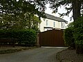 Wollaton House, Wollaton.jpg 1,280 × 960; 394 KB
-
 Wollaton Methodist Church - geograph.org.uk - 940990.jpg 640 × 480; 77 KB
-
 Wollaton Park Medical Centre.JPG 2,816 × 2,112; 1.5 MB
-
 Wollaton Park wall - geograph.org.uk - 1040850.jpg 640 × 480; 125 KB
-
 Wollaton Road - geograph.org.uk - 1040843.jpg 640 × 480; 120 KB
-
 Wollaton Road - geograph.org.uk - 5033094.jpg 640 × 480; 83 KB
-
 Wollaton Road - Nottingham - geograph.org.uk - 623628.jpg 640 × 427; 136 KB
-
 Wollaton Road - Nottingham - geograph.org.uk - 623639.jpg 640 × 427; 145 KB
-
 Wollaton Road and the Park wall - geograph.org.uk - 1040852.jpg 640 × 480; 154 KB
-
 Wollaton Road, Wollaton - geograph.org.uk - 876245.jpg 640 × 480; 104 KB
-
 Wollaton School - geograph.org.uk - 1040321.jpg 640 × 472; 83 KB
-
 Wollaton telephone exchange - geograph.org.uk - 1040839.jpg 480 × 640; 89 KB
-
 Wollaton Vale - geograph.org.uk - 1810849.jpg 640 × 480; 57 KB
-
 Wollaton Village - geograph.org.uk - 1040327.jpg 640 × 470; 82 KB
-
 Wollaton Village - geograph.org.uk - 1040331.jpg 640 × 468; 71 KB
-
 Wollaton Village - geograph.org.uk - 1040334.jpg 640 × 480; 70 KB
-
 Wollaton Village - geograph.org.uk - 1040337.jpg 640 × 469; 68 KB
-
 Wollaton Village Club and Institute - geograph.org.uk - 1040721.jpg 480 × 640; 129 KB
-
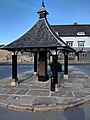
 Wollaton Village pump - geograph.org.uk - 1040329.jpg 480 × 640; 82 KB
-
 Wollaton Village Tennis Club - geograph.org.uk - 689239.jpg 640 × 428; 104 KB
-
 Wollaton, ancient cottage (detail) - geograph.org.uk - 1590785.jpg 640 × 480; 117 KB
-
 Wollaton, ancient cottage - geograph.org.uk - 1590783.jpg 640 × 501; 85 KB
-

-
 Wollaton, Doctor's Corner - geograph.org.uk - 3513622.jpg 1,200 × 1,200; 1.64 MB
-
 Wollaton, near the centre of the village - geograph.org.uk - 5921957.jpg 819 × 1,024; 876 KB
-
 Wollaton, Nottingham - geograph.org.uk - 4776813.jpg 3,619 × 3,021; 2.33 MB
-
 Wollaton, Nottingham - geograph.org.uk - 4776823.jpg 2,435 × 3,007; 1.71 MB
-
 Wollaton, Nottingham - geograph.org.uk - 4776827.jpg 2,482 × 3,015; 1.4 MB
-
 Wollaton, Nottingham - geograph.org.uk - 4776876.jpg 2,845 × 1,729; 1.02 MB
-
 Wollaton, on the corner of Bramcote Lane - geograph.org.uk - 5922066.jpg 1,024 × 1,024; 1.21 MB
-
 Wollaton, The Admiral Rodney and St Leonard's spire - geograph.org.uk - 5921961.jpg 1,024 × 1,024; 1,006 KB
-
 Wollaton, the centre of the village - geograph.org.uk - 1606147.jpg 640 × 493; 77 KB
-
 Wollaton, the view from the bus stop - geograph.org.uk - 1592192.jpg 640 × 480; 150 KB
-

-
 Woodbank Drive looking towards Wollaton Vale - geograph.org.uk - 5123332.jpg 1,280 × 960; 307 KB
-
 Woodbank Drive postbox NG8 478 - geograph.org.uk - 5123343.jpg 1,280 × 960; 326 KB
-
 Woodyard Lane - geograph.org.uk - 1040832.jpg 480 × 640; 140 KB
-
 Dovecote Drive, Wollaton - geograph.org.uk - 689351.jpg 640 × 428; 111 KB
-
 Old Pump, Wollaton - geograph.org.uk - 689390.jpg 640 × 428; 98 KB
.jpg)
.jpg)


.jpg)
.jpg)


.jpg)
.jpg)


_beside_Trowell_Road_-_geograph.org.uk_-_5033081.jpg)


.jpg)


.jpg)
.jpg)
.jpg)
.jpg)
.jpg)


.jpg)
.jpg)


.jpg)
.jpg)
.jpg)

.jpg)
.jpg)
.jpg)
.jpg)
.jpg)
.jpg)


_-_geograph.org.uk_-_5033720.jpg)
_-_geograph.org.uk_-_5033074.jpg)


.jpg)
.jpg)
.jpg)


_-_geograph.org.uk_-_1590785.jpg)


