Category:Ystrad Meurig
Jump to navigation
Jump to search
village and community in Ceredigion, Wales, UK  | |||||
| Upload media | |||||
| Pronunciation audio | |||||
|---|---|---|---|---|---|
| Instance of | |||||
| Location | Ceredigion, Wales | ||||
| Population |
| ||||
| Area |
| ||||
 | |||||
Cymraeg: Pentref bychan, Cymuned a phlwyf uwchben Dyffryn Teifi yng Ngheredigion yw Ystrad Meurig (neu Ystradmeurig). Fe'i lleolir ar y B4340 ar y ffordd rhwng Pontrhydfendigaid i'r dwyrain a Lledrod i'r gorllewin, tua 12 milltir i'r de-ddwyrain o Aberystwyth.
English: Ystrad Meurig (or Ystradmeurig) is a village and community in Ceredigion, Wales. It lies on the B4340 road northeast of the town of Tregaron.
Subcategories
This category has the following 4 subcategories, out of 4 total.
Media in category "Ystrad Meurig"
The following 200 files are in this category, out of 446 total.
(previous page) (next page)-
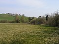
 A view across Cwm Ystwyth - geograph.org.uk - 6242968.jpg 1,024 × 576; 442 KB
-
 Access to Talfryn Farm - geograph.org.uk - 6252944.jpg 1,024 × 768; 483 KB
-
 Afon ... River (28645286765).jpg 3,456 × 5,184; 9.83 MB
-
 Afon Meurig - geograph.org.uk - 41768.jpg 640 × 480; 127 KB
-

-
 Afon Teifi and Cors Caron in Ceredigion - geograph.org.uk - 6210366.jpg 1,440 × 1,080; 1.64 MB
-
 Afon Teifi and Cors Caron in Ceredigion - geograph.org.uk - 6210370.jpg 1,600 × 900; 1.72 MB
-
 Afon Teifi and Cors Caron in Ceredigion - geograph.org.uk - 6224525.jpg 1,440 × 960; 1.48 MB
-
 Afon Teifi meander on Cors Caron in Ceredigion - geograph.org.uk - 6209550.jpg 1,280 × 960; 1.5 MB
-
 Afon Teifi meander on Cors Caron in Ceredigion - geograph.org.uk - 6227934.jpg 1,280 × 960; 1.57 MB
-

-
 Afon Teifi on Cors Caron in Ceredigion - geograph.org.uk - 6210273.jpg 1,440 × 960; 1.51 MB
-
 Afon Teifi on Cors Caron in Ceredigion - geograph.org.uk - 6210283.jpg 1,440 × 960; 1.56 MB
-
 Afon Teifi on Cors Caron in Ceredigion - geograph.org.uk - 6210372.jpg 960 × 1,280; 1.59 MB
-
 Afon Teifi on Cors Caron in Ceredigion - geograph.org.uk - 6225240.jpg 1,440 × 960; 1.69 MB
-
 Afon Teifi on Cors Caron in Ceredigion - geograph.org.uk - 6225284.jpg 1,280 × 960; 1.76 MB
-
 Afon Teifi on Cors Caron in Ceredigion - geograph.org.uk - 6225450.jpg 1,440 × 1,080; 1.58 MB
-
 Afon Teifi on Cors Caron in Ceredigion - geograph.org.uk - 6227328.jpg 1,440 × 960; 1.47 MB
-
 Afon Teifi on Cors Caron near Swyddffynnon in Ceredigion - geograph.org.uk - 6227510.jpg 1,440 × 1,080; 1.84 MB
-
 Afon Teifi on Cors Caron near Swyddffynnon in Ceredigion - geograph.org.uk - 6227518.jpg 1,080 × 1,440; 1.61 MB
-

-

-

-

-
 Afon Teifi south of Swyddffynnon in Ceredigion - geograph.org.uk - 6227344.jpg 1,440 × 960; 1.95 MB
-
 Afon Teifi south of Swyddffynnon in Ceredigion - geograph.org.uk - 6227395.jpg 1,440 × 960; 1.67 MB
-
 Afon Teifi south of Swyddffynnon in Ceredigion - geograph.org.uk - 6227492.jpg 960 × 1,280; 1.36 MB
-
 Afon Ystwyth - geograph.org.uk - 6242727.jpg 1,024 × 576; 553 KB
-

-

-
-

-
 B4340 south of Tynygraig, Ceredigion - geograph.org.uk - 2728154.jpg 800 × 570; 268 KB
-

-
 Bend on the B4340 - geograph.org.uk - 2164713.jpg 640 × 480; 152 KB
-

-
 Boardwalk at Grogwynion Nature Reserve - geograph.org.uk - 2731215.jpg 800 × 600; 269 KB
-

-
 Bridge over the Camddwr - geograph.org.uk - 1118271.jpg 640 × 428; 139 KB
-
 Bridle way near Disgwylfa - geograph.org.uk - 508817.jpg 480 × 640; 105 KB
-
 Bridleway across open farmland - geograph.org.uk - 6252250.jpg 1,024 × 768; 532 KB
-
 Bridleway climbing above Nant-byr-uchaf farm - geograph.org.uk - 6252549.jpg 1,024 × 768; 633 KB
-
 Bridleway on the approach to Nant-byr-uchaf farm - geograph.org.uk - 6252543.jpg 1,024 × 768; 529 KB
-
 Bryn Myherin - geograph.org.uk - 1003277.jpg 640 × 480; 91 KB
-

-
 Ceredigion farmland south-west of Swyddffynnon - geograph.org.uk - 4635730.jpg 1,280 × 758; 663 KB
-
 Ceredigion farmland south-west of Swyddffynnon - geograph.org.uk - 4635740.jpg 1,280 × 871; 809 KB
-
 Ceredigion farmland south-west of Swyddffynnon - geograph.org.uk - 4635754.jpg 1,024 × 712; 400 KB
-
 Ceredigion farmland south-west of Swyddffynnon - geograph.org.uk - 4635926.jpg 1,280 × 668; 795 KB
-
 Cluster of houses at Penderlwynwen Farm - geograph.org.uk - 6252939.jpg 1,024 × 768; 417 KB
-
 Coed Tynybedw - geograph.org.uk - 4517363.jpg 640 × 480; 129 KB
-
 Cors Caron by the Afon Teifi in Ceredigion - geograph.org.uk - 6225199.jpg 1,440 × 960; 1.49 MB
-
 Cors Caron north of the bird hide, Ceredigion - geograph.org.uk - 5942710.jpg 1,600 × 900; 1.35 MB
-
 Cors Caron north of Tregaron in Ceredigion - geograph.org.uk - 6225269.jpg 1,440 × 960; 1.4 MB
-
 Cors Caron north-west of the bird hide, Ceredigion - geograph.org.uk - 5942766.jpg 1,440 × 960; 1.77 MB
-

-
 Cors Caron seen from the bird hide, Ceredigion - geograph.org.uk - 5942847.jpg 1,440 × 960; 1.41 MB
-
 Cors Caron south of Ystrad Meurig - geograph.org.uk - 1158286.jpg 640 × 475; 123 KB
-
 Cors Caron, looking east over Cors Dôl-fawr - geograph.org.uk - 6147404.jpg 1,000 × 659; 836 KB
-

-

-
 Craig Goch - geograph.org.uk - 6252983.jpg 1,024 × 768; 416 KB
-
 Craig Goch mine building - geograph.org.uk - 6250567.jpg 768 × 1,024; 685 KB
-
 Cwm Camddwr - geograph.org.uk - 1184747.jpg 640 × 480; 78 KB
-
 Cwm Ystwyth near Grogwynion - geograph.org.uk - 1076227.jpg 640 × 480; 158 KB
-
 Cwm Ystwyth near Grogwynion - geograph.org.uk - 1081918.jpg 480 × 640; 159 KB
-

-
 Despite all - geograph.org.uk - 1076316.jpg 480 × 640; 245 KB
-

-

-

-

-

-

-

-

-

-

-

-

-

-

-

-

-

-

-

-

-

-

-

-

-
 Display board for the Ystwyth Trail - geograph.org.uk - 6147384.jpg 1,024 × 948; 1.53 MB
-
 Diverging forestry roads - geograph.org.uk - 6242700.jpg 1,024 × 576; 245 KB
-
 Dwy afon yn cwrdd - Two rivers meet - geograph.org.uk - 6160171.jpg 1,024 × 768; 192 KB
-
 Dyffryn Ystwyth - The Ystwyth Valley - geograph.org.uk - 5456033.jpg 640 × 484; 137 KB
-
 Entering Swyddffynnon from the west, Ceredigion - geograph.org.uk - 4630607.jpg 1,024 × 768; 527 KB
-

-
 Escaped at last^ - geograph.org.uk - 2796370.jpg 640 × 480; 152 KB
-
 Ever had the feeling that you are being watched^ - geograph.org.uk - 6252252.jpg 1,024 × 768; 471 KB
-

-

-
 Farm track near Swyddffynnon, Ceredigion - geograph.org.uk - 4631288.jpg 768 × 1,024; 413 KB
-
 Farm track near Swyddffynnon, Ceredigion - geograph.org.uk - 4637615.jpg 1,024 × 768; 359 KB
-
 Farm track south of Swyddffynnon, Ceredigion - geograph.org.uk - 4630655.jpg 768 × 1,024; 483 KB
-

-

-

-

-

-
 Farm track south-west of Swyddfynnon, Ceredigion - geograph.org.uk - 4637767.jpg 1,024 × 703; 439 KB
-
 Farm track towards Swyddffynnon, Ceredigion - geograph.org.uk - 4631264.jpg 863 × 1,024; 405 KB
-
 Farm track towards Swyddffynnon, Ceredigion - geograph.org.uk - 4631269.jpg 768 × 1,024; 367 KB
-
 Farmland around Ystradmeurig, Ceredigion - geograph.org.uk - 4700827.jpg 1,280 × 816; 678 KB
-
 Farmland around Ystradmeurig, Ceredigion - geograph.org.uk - 4700832.jpg 768 × 1,024; 527 KB
-
 Farmland at Talfryn - geograph.org.uk - 6252943.jpg 1,024 × 768; 338 KB
-
 Farmland east of Swyddffynnon, Ceredigion - geograph.org.uk - 4630545.jpg 1,024 × 768; 483 KB
-
 Farmland east of Swyddffynnon, Ceredigion - geograph.org.uk - 4630550.jpg 1,280 × 775; 551 KB
-
 Farmland near Swyddffynnon, Ceredigion - geograph.org.uk - 4637199.jpg 1,280 × 750; 531 KB
-
 Farmland near Swyddffynnon, Ceredigion - geograph.org.uk - 4637202.jpg 1,280 × 831; 695 KB
-
 Farmland near Tynygraig, Ceredigion - geograph.org.uk - 2728622.jpg 800 × 539; 353 KB
-
 Farmland north-west of Swyddffynnon, Ceredigion - geograph.org.uk - 4700686.jpg 1,280 × 794; 636 KB
-
 Farmland north-west of Swyddffynnon, Ceredigion - geograph.org.uk - 4700694.jpg 1,024 × 708; 424 KB
-

-
 Farmland south-west of Swyddffynnon, Ceredigion - geograph.org.uk - 4631303.jpg 1,280 × 805; 583 KB
-
 Farmland south-west of Swyddffynnon, Ceredigion - geograph.org.uk - 4634934.jpg 1,280 × 835; 702 KB
-
 Farmland south-west of Swyddffynnon, Ceredigion - geograph.org.uk - 4636089.jpg 1,280 × 831; 655 KB
-
 Farmland south-west of Swyddffynnon, Ceredigion - geograph.org.uk - 4636169.jpg 1,280 × 783; 691 KB
-
 Farmland west of Swyddffynnon, Ceredigion - geograph.org.uk - 4631029.jpg 1,280 × 891; 652 KB
-
 Farmland west of Swyddffynnon, Ceredigion - geograph.org.uk - 4631033.jpg 1,280 × 534; 490 KB
-
 Farmland west of Swyddffynnon, Ceredigion - geograph.org.uk - 4631060.jpg 1,024 × 768; 553 KB
-
 Farmland west of Swyddffynnon, Ceredigion - geograph.org.uk - 4631066.jpg 1,280 × 723; 619 KB
-
 Farmland west of Swyddffynnon, Ceredigion - geograph.org.uk - 4700730.jpg 1,024 × 768; 306 KB
-
 Farmland west of Ystradmeurig, Ceredigion - geograph.org.uk - 2726036.jpg 1,024 × 768; 512 KB
-
 Ffair Rhos, Pontrhydfendigaid, Ceredigion, Wales (22206680370).jpg 3,888 × 2,592; 5.16 MB
-

-

-
 Field near The Hollies - geograph.org.uk - 1600642.jpg 640 × 428; 120 KB
-
 Field west of Penlan farm - geograph.org.uk - 884644.jpg 640 × 428; 86 KB
-
 Fields near Pontargamddwr - geograph.org.uk - 1600652.jpg 640 × 428; 110 KB
-
 Fields north of Castell farm - geograph.org.uk - 1157993.jpg 640 × 428; 101 KB
-
 Fields south of Pen-bryn farm - geograph.org.uk - 1118249.jpg 640 × 428; 74 KB
-

-
 Fields south-west of Swyddffynnon, Ceredigion - geograph.org.uk - 4635943.jpg 1,280 × 860; 657 KB
-
 Fields south-west of Swyddffynnon, Ceredigion - geograph.org.uk - 4636100.jpg 1,280 × 764; 604 KB
-
 Fields west of the Camddwr - geograph.org.uk - 884595.jpg 640 × 428; 91 KB
-
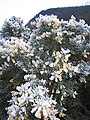
 Flowering gorse covered in frost - geograph.org.uk - 1076286.jpg 480 × 640; 244 KB
-

-
 Footbridge over Afon Ystwyth - geograph.org.uk - 6250560.jpg 1,024 × 768; 668 KB
-
 Footbridge over the Afon Ystwyth - geograph.org.uk - 2145671.jpg 640 × 480; 202 KB
-

-

-

-

-

-

-

-

-

-

-

-

-

-
-
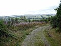
 Footpath and Cycleway near Ystrad Meurig - geograph.org.uk - 1118231.jpg 640 × 428; 142 KB
-
 Footpath in Coed Craigyrogof - geograph.org.uk - 6252978.jpg 1,024 × 768; 638 KB
-
 Footpath leading down through Coed Tynybedw - geograph.org.uk - 6252514.jpg 1,024 × 768; 599 KB
-

-
 Foraging guinea fowl near Swyddffynnon, Ceredigion - geograph.org.uk - 4637097.jpg 1,024 × 1,024; 643 KB
-
 Forest path in Coed Tynybedw - geograph.org.uk - 2796249.jpg 480 × 640; 183 KB
-
 Forest path in Coed Tynybedw - geograph.org.uk - 6252244.jpg 1,024 × 768; 653 KB
-
 Forest road junction in Coed Craigyrogof - geograph.org.uk - 6252973.jpg 1,024 × 768; 479 KB
-
 Forest track in Coed Craigyrogof - geograph.org.uk - 2796343.jpg 640 × 480; 158 KB
-

-
 Forestry entrance - geograph.org.uk - 4453935.jpg 640 × 480; 482 KB
-
 Forestry road above Afon Ystwyth - geograph.org.uk - 6242716.jpg 1,024 × 576; 599 KB
-
 Forestry road above Geufron - geograph.org.uk - 6253266.jpg 1,024 × 768; 470 KB
-
 Forestry road above Nant-byr-chaf - geograph.org.uk - 6252554.jpg 1,024 × 768; 661 KB
-
 Forestry road beneath Craig yr Ogof - geograph.org.uk - 6242704.jpg 1,024 × 576; 441 KB
-
 Forestry road climbing towards Craig yr Ogof - geograph.org.uk - 6252510.jpg 1,024 × 768; 434 KB
-
 Forestry road emerging onto a public road - geograph.org.uk - 6252932.jpg 1,024 × 768; 661 KB
-
 Forestry road in Coed Craigyrogof - geograph.org.uk - 6242987.jpg 1,024 × 576; 521 KB
-
 Forestry road in Coed Tynybedw - geograph.org.uk - 2796264.jpg 480 × 640; 81 KB
-
 Forestry road in Coed Tynybedw - geograph.org.uk - 6242701.jpg 1,024 × 576; 595 KB
-
 Forestry road in Cwm Ystwyth - geograph.org.uk - 6243622.jpg 1,024 × 576; 428 KB
-
 Forestry road in Cwm Ystwyth - geograph.org.uk - 6243793.jpg 768 × 768; 523 KB
-

-
 Forestry road junction - geograph.org.uk - 6252561.jpg 1,024 × 768; 584 KB
-
 Forestry road on Banc y Geufron - geograph.org.uk - 6253254.jpg 1,024 × 768; 605 KB
-
 Forestry road on Mynydd Bach - geograph.org.uk - 6253252.jpg 1,024 × 768; 419 KB
-
 Forestry stand - Tan-geulan - geograph.org.uk - 6250578.jpg 1,024 × 768; 792 KB
-
 Forestry track leaves to the left - geograph.org.uk - 972010.jpg 640 × 480; 143 KB
-
 Forestry worker on a quad bike - geograph.org.uk - 6252245.jpg 1,024 × 768; 536 KB
-
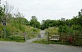
 Gate at the edge of the forest - geograph.org.uk - 6253003.jpg 1,024 × 768; 556 KB
-
 Gate into pastures near Swyddffynnon, Ceredigion - geograph.org.uk - 4634951.jpg 1,024 × 768; 410 KB
-
 Gate on a forestry track - geograph.org.uk - 6252987.jpg 1,024 × 576; 392 KB
-
 Gate on the path - geograph.org.uk - 6252256.jpg 1,024 × 768; 452 KB
-
 Geufron farmland - geograph.org.uk - 6253260.jpg 1,024 × 768; 616 KB
-
 Gorse trees, Grogwynion - geograph.org.uk - 1076338.jpg 480 × 640; 181 KB
-


.jpg)

_south_of_Swyddffynnon_in_Ceredigion_-_geograph.org.uk_-_6227396.jpg)


.jpg)


