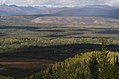
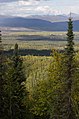
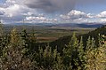
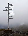
Category:Yukon
Springe nei navigaasje
Springe nei sykjen
Provinces and territories of Canada: Alberta · British Columbia · Manitoba · New Brunswick · Newfoundland and Labrador · Nova Scotia · Ontario · Prince Edward Island · Quebec · Saskatchewan · Northwest Territories · Nunavut · Yukon
territory of Canada .jpg) someja dfa satełite in łujo     | |||||
| Media oplade | |||||
| Is in |
| ||||
|---|---|---|---|---|---|
| Ûnderdiel fan | |||||
| Neamd nei | |||||
| Lokaasje | Kanada | ||||
| Capital | |||||
| Basic form of government |
| ||||
| Legislative body |
| ||||
| Executive body |
| ||||
| Offisjele taal | |||||
| Head of government |
| ||||
| Inception |
| ||||
| Heechste punt |
| ||||
| Population |
| ||||
| Area |
| ||||
| Replaces |
| ||||
| Different from | |||||
| Minimum temperature record |
| ||||
| offisjele webstee | |||||
 | |||||

Deutsch: Yukon
English: Media related to Yukon, a territory on the western edge of Canada.
Français : Yukon
Latina: Yukon
Македонски: Јукон
Subkategoryen
Dizze kategory hat de neikommende 35 ûnderkategoryen, fan yn totaal 35.
?
A
- Yukon in art (1 F)
C
E
- Electoral district of Yukon (2 F)
F
G
H
I
N
- NARA images of Yukon (7 F)
O
- Otter Falls Cutoff (2 F)
P
Q
- Quality images of Yukon (183 F)
S
T
- Takhini Hot Springs (7 F)
U
- Uncategorized images of Yukon (76 F)
V
- Videos from Yukon (3 F)
Y
- Yukon Field Force (9 F)
Media yn de kategory "Yukon"
Dizze kategory befettet 200 de folgjende bestannen, fan yn totaal 233.
(foarige side) (folgjende side)-
 - panoramio - Lub0t.jpg 4.381 × 2.979; 1,36 MB
-
 A hard pull LCCN2005680667.jpg 4.402 × 3.805; 1,85 MB
-
 After the rain (48680927821).jpg 1.536 × 2.048; 651 KB
-

-
 Alpine between Becker Creek and the Wheaton River (9606330520).jpg 2.400 × 1.600; 1,52 MB
-
 Anything is possible.jpg 960 × 720; 72 KB
-
 ArcticPlains-From-DempsterHwy.jpg 910 × 607; 105 KB
-
 Bacon and coffee for breakfast (13672611175).jpg 2.400 × 1.600; 1,11 MB
-
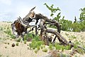
 Big Thing mine near Carcross, Yukon (10568439064).jpg 2.133 × 1.600; 1,15 MB
-
 Big Thing mine near Carcross, Yukon (10568441224).jpg 2.133 × 1.600; 1,28 MB
-
-
-
 Browncreek yukon alaska.jpg 808 × 1.077; 1,12 MB
-
 Carcross desert 1 (1189914050).jpg 1.600 × 1.200; 334 KB
-
 Carcross desert 2 (1189913080).jpg 1.600 × 1.200; 312 KB
-
 Caribou Mountain near Carcross, Yukon (16653338318).jpg 1.600 × 1.600; 1,3 MB
-
 Caribou Whisperer (6808744968).jpg 1.910 × 1.433; 820 KB
-
 Charley Rivers National Preserve banner.jpg 1.760 × 251; 289 KB
-
 CO patrol cabin at Rose Lake, Yukon (13672837105).jpg 2.133 × 1.600; 851 KB
-
 Cruising to Laberge (14203759481).jpg 4.000 × 3.000; 5,19 MB
-
 Dave and Dylan in the alpine on the Rose Lake Trail (16642853378).jpg 1.600 × 1.067; 1.017 KB
-
 Dead Spruce with lens flare - panoramio.jpg 4.608 × 3.072; 1,81 MB
-
 Deep Autumn Colors - panoramio.jpg 640 × 480; 58 KB
-
 DSC 0003 (11751259954).jpg 4.288 × 2.848; 909 KB
-
 DSC 0004 (11751261214).jpg 4.288 × 2.848; 987 KB
-
 DSC 0005 (11751608356).jpg 4.288 × 2.848; 1,06 MB
-
 DSC 0006 (11750851005).jpg 4.288 × 2.848; 927 KB
-
 DSC 0007 (11750852995).jpg 2.848 × 4.288; 728 KB
-
 DSC 0008 (11751613066).jpg 2.569 × 3.695; 568 KB
-
 DSC 0009 (11751103623).jpg 4.288 × 2.848; 1,16 MB
-
 DSC 0010 (11751268054).jpg 4.288 × 2.848; 726 KB
-
 DSC 0011 (11750857205).jpg 4.288 × 2.848; 737 KB
-
 DSC 0012 (11751269654).jpg 4.288 × 2.848; 505 KB
-
 DSC 0013 (11751107153).jpg 4.288 × 2.848; 753 KB
-
 DSC 0014 (11751108103).jpg 4.288 × 2.848; 752 KB
-
 DSC 0015 (11750860075).jpg 4.288 × 2.848; 943 KB
-
 DSC 0016 (11750860855).jpg 4.288 × 2.848; 812 KB
-
 DSC 0017 (11750861575).jpg 4.288 × 2.848; 823 KB
-
 DSC 0018 (11750861995).jpg 4.288 × 2.848; 907 KB
-
 DSC 0019 (11750863145).jpg 4.288 × 2.848; 1,09 MB
-
 DSC 0020 (11751275614).jpg 4.288 × 2.848; 906 KB
-
 DSC 0021 (11751112993).jpg 4.288 × 2.848; 1,26 MB
-
 DSC 0022 (11751624576).jpg 4.288 × 2.848; 1,23 MB
-
 DSC 0023 (11751278464).jpg 4.288 × 2.848; 1,2 MB
-
 DSC 0025 (11751116993).jpg 4.288 × 2.848; 964 KB
-
 DSC 0026 (11751628296).jpg 4.288 × 2.848; 659 KB
-
 DSC 0027 (11750870475).jpg 4.288 × 2.848; 919 KB
-
 DSC 0028 (11751629896).jpg 4.288 × 2.848; 1,11 MB
-
En-us-Yukon.oga 0,9 s; 30 KB
-
 Fireweed (1189041465).jpg 1.137 × 1.383; 446 KB
-
 Follow @kalenemsley on ig (Unsplash eHpYD4U5830).jpg 4.198 × 2.799; 2,93 MB
-
 Fresh Tracks (6336157704).jpg 4.000 × 2.248; 2,46 MB
-
 Fresh Tracks (6928788081).jpg 4.000 × 3.000; 3,75 MB
-
 From Egg Island (14200142242).jpg 4.000 × 1.877; 2 MB
-
 Frontal Mountain is looked like "Ninjya-turtle" - panoramio.jpg 640 × 480; 60 KB
-

-
 Grey Mountain (8203146995).jpg 1.067 × 800; 360 KB
-
 Grey sky & trees -- Yukon.jpg 3.000 × 4.000; 7,26 MB
-
 Guardrail (6325221332).jpg 4.000 × 2.248; 2,72 MB
-
 Haines highway (1189040191).jpg 1.600 × 1.200; 256 KB
-
 Haines Junction area (16190853861).jpg 5.335 × 3.557; 18,44 MB
-
 Haines Junction areaa - a tad crass, perhaps.!!! (16166907196).jpg 5.335 × 3.557; 12,99 MB
-
 Headed home after dinner. Amazing light. (14016018360).jpg 4.000 × 3.000; 2,41 MB
-
 Hiking up Skukum Creek (9235233839).jpg 2.400 × 1.600; 1,5 MB
-
 Hills between Keno City and Mayo, Yukon (3894726853).jpg 3.264 × 2.448; 2,25 MB
-
 Hills between Keno City and Mayo, Yukon (3894728721).jpg 3.264 × 2.448; 1,52 MB
-
 Hills between Keno City and Mayo, Yukon (3895509112).jpg 3.264 × 2.448; 2,14 MB
-
 Historic Railroad (3733015124).jpg 3.888 × 2.592; 4,7 MB
-
 Hwy 5 to Inuvik - the Dempster Hwy. (16005148570).jpg 5.209 × 3.337; 19,12 MB
-
 Hwy 5 to Inuvik - the Dempster Hwy. (16190648461).jpg 4.421 × 2.947; 8,2 MB
-
 Hwy 5 to Inuvik - the Dempster Hwy. (16191698912).jpg 3.188 × 4.238; 8,37 MB
-
 Hwy 5 to Inuvik - the Dempster Hwy. (5857524002).jpg 5.616 × 3.744; 18,41 MB
-
 Hwy 5 to Inuvik - the Dempster Hwy. Richardson Mtns. (15572674873).jpg 5.616 × 3.744; 13,6 MB
-
 Hwy 5 to Inuvik - the Dempster Hwy. The beginning of 740 km of gravel road. (5856970729).jpg 4.851 × 3.244; 15,45 MB
-

-
 I hope you find someone to lose. (28846286003).jpg 2.000 × 1.333; 591 KB
-
 Interior of old truck near Mendenhall, Yukon (14326841295).jpg 1.600 × 1.112; 591 KB
-
 Isa in Watsonlake.jpg 4.000 × 3.000; 4,31 MB
-
 K5 11458 (6112948482).jpg 4.513 × 2.989; 8,72 MB
-
 K5 11459 (6112417549).jpg 4.928 × 3.264; 11,75 MB
-
 K5 11464 (6112970270).jpg 4.928 × 3.264; 11,54 MB
-
 K5 11466 (6112437769).jpg 4.686 × 3.104; 10,09 MB
-
 K5 11470 (6113000036).jpg 3.175 × 4.793; 10,81 MB
-
 K5 11492 (6113036852).jpg 4.550 × 3.013; 7,69 MB
-
 K5 11494 (6112502591).jpg 3.175 × 4.794; 8,63 MB
-
 K5 11495 (6112512735).jpg 3.264 × 4.928; 10,45 MB
-
 K5 11500 (6112520105).jpg 4.667 × 3.091; 8,08 MB
-
 K5 11520 (6112528735).jpg 4.928 × 3.264; 9,09 MB
-
 K5 11524 (6113091016).jpg 4.928 × 3.264; 10,09 MB
-
 K5 11530 (6112572745).jpg 4.928 × 3.264; 8,8 MB
-
 Kathleen lake 2 (1189905632).jpg 1.600 × 1.200; 329 KB
-
 Keno Sign Post.jpg 1.500 × 1.869; 1,57 MB
-
 Klondike Routes Map.png 644 × 769; 361 KB
-
 Klondike Routes Map.svg 636 × 676; 1,02 MB
-
 Kwalin Dun (14015983878).jpg 4.000 × 3.000; 1,85 MB
-
 Late Cretaceous Coast Mountains plate tectonics.jpg 437 × 178; 27 KB
-
 Look at that sparkle! (48686578351).jpg 2.048 × 1.536; 626 KB
-
 Looking down on a climb from Moraine Lake, Yukon, Canada (5512518277) (2).jpg 1.024 × 679; 648 KB
-
-
 Looking over whitehorse (1189033025).jpg 1.600 × 1.200; 223 KB
-

-

-
 Minature monster (16006409709).jpg 2.776 × 2.094; 2,61 MB
-

-
 Mountains near Tutshi Lake, Yukon (10720822856).jpg 2.385 × 1.600; 1,51 MB
-
 Mushing 0032 (4310242809).jpg 1.536 × 1.020; 867 KB
-
 Mushing 0042 (4310243421).jpg 1.536 × 1.020; 1,07 MB
-
 Mushing 0092 (4310980828).jpg 1.536 × 1.020; 1,25 MB
-
 Mushing 0124 (4310981406).jpg 1.536 × 1.020; 1,13 MB
-
 Mushing 0133 (4310981714).jpg 1.536 × 1.020; 581 KB
-
 Mushing 0163 (4310982084).jpg 1.536 × 1.020; 785 KB
-
 Nahaniroad2010.jpg 992 × 744; 772 KB
-
 Neossos tombstonensis holotype.jpg 4.121 × 2.089; 2,77 MB
-
 New Year's Eve 2011 (6613867961).jpg 3.005 × 1.689; 939 KB
-
 New Year's Eve 2011 (6613878949).jpg 4.000 × 2.248; 1,51 MB
-
 Norcom.jpg 1.536 × 1.024; 576 KB
-
 Nutter (1189030781).jpg 1.589 × 1.023; 350 KB
-
 Old Cabin on the Watson River (6954856705).jpg 4.000 × 3.000; 3,37 MB
-
 Old Cat (6782663500).jpg 4.000 × 3.000; 2,52 MB
-
 Old Paddlewheel Steamer (SS Keno) on the Yukon River.jpg 3.264 × 2.448; 2,32 MB
-
 On Hwy 4 between Watson lake & Faro (5856969933).jpg 2.016 × 1.487; 1,63 MB
-
 On the Marge (14015972329).jpg 3.968 × 1.128; 1,91 MB
-
 On the marge (14204579752).jpg 4.000 × 2.341; 4,61 MB
-

-
 Panorama of Hamlet of Teslin - Yukon Territory - Canada.jpg 4.912 × 1.080; 2,5 MB
-

-

-
 Paul skiing in Dalton Pass (17089612056).jpg 1.600 × 1.600; 1,11 MB
-
 Permafrost bush very green.jpg 1.110 × 832; 426 KB
-
 Picea mariana (Black Spruce) (3898372747).jpg 2.448 × 3.264; 3,2 MB
-
 Picea mariana (Black Spruce) (3899151744).jpg 2.448 × 3.264; 3,59 MB
-
 Picea mariana (Black Spruce) (3899156564).jpg 3.888 × 2.592; 3,48 MB
-
 Picea mariana (Black Spruce) (3899161898).jpg 3.888 × 2.592; 3,64 MB
-
-
 Pond, Cloud, and Forest - Hidden Valley - Near Whitehorse - Yukon Territory - Canada.jpg 2.736 × 3.648; 3,65 MB
-
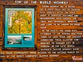
 Poste frontiere Topoftheworld highway.jpg 2.560 × 1.920; 1,49 MB
-
 Rails (1189028853).jpg 1.600 × 1.200; 410 KB
-
 Railway tie cabin (8204435317).jpg 1.067 × 800; 538 KB
-
 Reeds In The Yukon (15166641).jpeg 2.048 × 1.365; 2,1 MB
-
 Remains of heavy equipment, Carcross, Yukon (10752573945).jpg 2.168 × 1.600; 2 MB
-
 Remains of stone house, Mountain Hero mine (14883423349).jpg 1.600 × 649; 618 KB
-
 Remains of stone house, Thistle mine (14883422819).jpg 1.600 × 652; 726 KB
-
 Remains of water tank at Pooley Creek, Yukon (10752680594).jpg 2.133 × 1.600; 1,84 MB
-
 Remains of water tank at Pooley Creek, Yukon (10752684164).jpg 2.133 × 1.600; 2,02 MB
-
 Resting by Samuel Glacier (Unsplash).jpg 3.319 × 2.214; 2,07 MB
-
 Road Trip - 003. (47560535611).jpg 11.378 × 3.682; 14,42 MB
-
 Robert campbell highway near Tuchitua.jpg 964 × 535; 499 KB
-
 Rosa acicularis (16256471324).jpg 4.256 × 2.832; 4,78 MB
-
 Roses on Hwy 3 S of Fairbanks (5857535722).jpg 4.965 × 3.310; 8,69 MB
-
 Salmon trap for catching salmon for research and subsequent tagging (3892974588).jpg 3.264 × 2.448; 3,51 MB
-
 Sandpiper peak near Rose Lake, Yukon (16896564617).jpg 1.600 × 1.200; 1,22 MB
-
 Sapper Hill, overlooking Engineer Campground - panoramio.jpg 1.280 × 960; 274 KB
-

-
 Scenery along Dempster Highway - Near Ft. McPherson - Yukon Territory - Canada - 01.jpg 3.648 × 2.736; 3,66 MB
-
 Sierra on Fish Lake in a snow storm (16642852148).jpg 1.600 × 1.067; 523 KB
-
 Sierra's birthday, campfire (16209461406).jpg 1.600 × 1.067; 663 KB
-
 Sierra's birthday, fireworks (16235351545).jpg 1.600 × 1.067; 643 KB
-
 Simon D'amours fish lake.png 2.544 × 1.426; 4,44 MB
-
 Soft snow (8485173000).jpg 1.600 × 1.200; 604 KB
-
 Someday. (29179514970).jpg 2.000 × 1.333; 1,01 MB
-
 Starbuck's Stick (7031204577).jpg 3.502 × 2.627; 2,88 MB
-
 Starting up Snowy Season - panoramio.jpg 640 × 480; 62 KB
-

-
 Taking a break at an old cabin near the Watson River, Yukon (13673197094).jpg 1.600 × 1.174; 994 KB
-

-
 The dark world, blanketed in light. (6400274157).jpg 612 × 612; 188 KB
-
 Tombstone Mountains Road Hill.JPG 1.110 × 832; 472 KB
-
 Tombstone Territorial Park 2023-06-12.jpg 3.872 × 2.576; 4,44 MB
-
 Top of the World Highway - panoramio.jpg 640 × 480; 59 KB
-
 Top of the World Hwy,,,Dawson City to Alaska (16190682591).jpg 3.725 × 2.766; 9,61 MB
-
 Tramway Car (16691219838).jpg 4.256 × 2.832; 8,58 MB
-
 Tramway tracks, Montana mine (14883529018).jpg 1.600 × 1.271; 957 KB
-
 Trans Canada Trail (6928791771).jpg 4.000 × 3.000; 5,84 MB
-
 Trapline cabin at John's Lake (13672654703).jpg 2.400 × 1.600; 1,28 MB
-
 Trapper's Cabin on the Watson River (6808749718).jpg 4.000 × 3.000; 3,62 MB
-
 Twisted Remains (16901436585).jpg 4.256 × 2.832; 7,18 MB
-
 Untouched mountain - panoramio.jpg 4.608 × 3.072; 1,1 MB
-
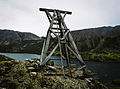 Vault Mine tramway tower (10752555545).jpg 2.168 × 1.600; 1,36 MB
-
 View from high point, Top of the World Highway (3903241793).jpg 3.264 × 2.448; 1,94 MB
-
 View of Ogilvie Mountains, Yukon, Canada (3903962238).jpg 3.264 × 2.448; 1,53 MB
-
 View of Ogilvie Mountains, Yukon, Canada (3903963128).jpg 3.264 × 2.448; 1,46 MB
-
 Wet mountain valley (Unsplash).jpg 5.760 × 3.840; 4,2 MB
-
 What Do We Have (Unsplash).jpg 3.456 × 5.184; 877 KB
-
 When you think explosives... (1189891108).jpg 1.600 × 1.200; 216 KB
-
 White Pass & Yukon Route, Royal Mail (15831169816).jpg 3.973 × 2.644; 3,49 MB
-
 Whitehorse to Kitwanga via Stewart Cassiar hwy (16014407009).jpg 4.768 × 3.179; 12,35 MB
-
 Whitehorse Wharf (6346301048).jpg 4.000 × 2.248; 737 KB
-
 Wildflowers Over Chadburn Lake (16671519567).jpg 2.832 × 4.256; 5,9 MB
-
 Woodpile (6885117855).jpg 6.805 × 5.104; 4,9 MB
-
 Wrecked Stearnwheeler near Dawson City - panoramio.jpg 3.872 × 2.592; 4,45 MB
-
 Yukon 1980 License Plate.jpg 1.507 × 787; 198 KB
-
 Yukon 1985 License Plate.jpg 1.464 × 760; 200 KB
-
 Yukon Commercial License Plate 1990.jpg 2.666 × 1.374; 1,32 MB
-
 Yukon Dawson City - panoramio - Stefan Aßmann.jpg 1.024 × 768; 440 KB
-
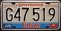
 Yukon Federal Government License Plate 1990.jpg 2.527 × 1.304; 696 KB
-
 Yukon fish -a.jpg 2.043 × 2.043; 1,04 MB
-
 Yukon Government License Plate 1990.jpg 2.688 × 1.391; 1,24 MB
-
 Yukon Köppen-no.svg 765 × 1.197; 840 KB
-
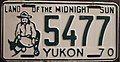 Yukon License Plate 1970 5477.jpg 1.501 × 781; 201 KB
-
 Yukon License Plate 1971 3448.jpg 1.498 × 778; 197 KB


.jpg)

.jpg)


.jpg)
.jpg)
.jpg)
.jpg)
.jpg)

.jpg)
.jpg)
.jpg)
.jpg)
.jpg)
.jpg)
.jpg)


.jpg)
.jpg)
.jpg)
.jpg)
.jpg)
.jpg)
.jpg)
.jpg)
.jpg)
.jpg)
.jpg)
.jpg)
.jpg)
.jpg)
.jpg)
.jpg)
.jpg)
.jpg)
.jpg)
.jpg)
.jpg)
.jpg)
.jpg)
.jpg)
.jpg)
.jpg)
.jpg)
.jpg)
.jpg)
.jpg)

.jpeg)
.jpg)

.jpg)
.jpg)
.jpg)
.jpg)
.jpg)
.jpg)
.jpg)
.jpg)
.jpg)
.jpg)
.jpg)
.jpg)
.jpg)
.jpg)
.jpg)
.jpg)
.jpeg)
.jpg)
.jpg)

.jpg)
.jpg)
.jpg)
.jpg)
.jpg)
.jpg)
.jpg)
.jpg)
.jpg)
.jpg)
.jpg)
.jpg)
.jpg)


.jpg)
.jpg)
_(2).jpg)
.jpg)
.jpg)

.jpg)
.jpeg)
.jpg)
.jpg)
.jpg)
.jpg)
.jpg)
.jpg)
.jpg)


.jpg)
.jpg)

.jpg)
.jpg)
.jpg)
_on_the_Yukon_River.jpg)
.jpg)
.jpg)
.jpg)

_(3898372747).jpg)
_(3899151744).jpg)
_(3899156564).jpg)
_(3899161898).jpg)


.jpg)
.jpg)
.jpeg)
.jpg)
.jpg)
.jpg)
.jpg)

.jpg)
.jpg)
.jpg)
.jpg)


.jpg)
.jpg)
.jpg)

.jpg)
.jpg)
.jpg)

.jpg)
.jpg)


.jpg)
.jpg)
.jpg)
.jpg)
.jpg)
.jpg)

.jpg)
.jpg)
.jpg)
.jpg)
.jpg)
.jpg)
.jpg)
.jpg)
.jpg)
.jpg)
.jpg)
.jpg)


.jpg)
_at_Campground_-_West_Dawson_-_Yukon_Territory_-_Canada.jpg)
.jpg)
.jpg)
.jpg)
.jpg)
.jpg)
.jpg)