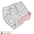
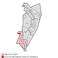
Category:Zandberg (Groningen-Drenthe)
Jump to navigation
Jump to search
| Object location | | View all coordinates using: OpenStreetMap |
|---|
village in the provinces of Groningen and Drenthe, the Netherlands   | |||||
| Upload media | |||||
| Instance of | |||||
|---|---|---|---|---|---|
| Location |
| ||||
 | |||||
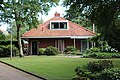
Media in category "Zandberg (Groningen-Drenthe)"
The following 4 files are in this category, out of 4 total.
-
-
-
 19-4-2017 Zandberg tuin 034.jpg 2,592 × 1,944; 869 KB
-
 Zandberg - Station.jpg 5,842 × 3,895; 7.12 MB


