Category:Zennor
Vai alla navigazione
Vai alla ricerca
civil parish in Cornwall, UK  | |||||
| Carica un file multimediale | |||||
| Istanza di | |||||
|---|---|---|---|---|---|
| Luogo | Cornwall, Cornovaglia, Sud Ovest dell'Inghilterra, Inghilterra | ||||
| sito web ufficiale | |||||
 | |||||
Sottocategorie
Questa categoria contiene le 21 sottocategorie indicate di seguito, su un totale di 21.
B
- Bosporthennis (2 F)
- Boswednack (3 F)
C
- Carn Galver Mine (24 F)
- The Carracks, Cornwall (25 F)
D
- John Davey (Cornish speaker) (2 F)
G
H
- Patrick Heron (2 F)
M
P
- Porthmeor (2 F)
Q
- Zennor Quoit (12 F)
T
- Tinner's Arms (3 F)
V
- Veor Cove (13 F)
W
Z
- Zennor War Memorial (3 F)
File nella categoria "Zennor"
Questa categoria contiene 200 file, indicati di seguito, su un totale di 678.
(pagina precedente) (pagina successiva)-
 3 Doors. - panoramio, 8 years later.jpg 3 024 × 4 032; 3,95 MB
-
 3 Doors. - panoramio.jpg 4 000 × 3 000; 5,32 MB
-
 300 going west on B3306 at Tremedda. - panoramio.jpg 3 648 × 2 056; 5,01 MB
-
 A border stream - geograph.org.uk - 5740466.jpg 480 × 640; 215 KB
-
 A long wait - geograph.org.uk - 2513974.jpg 640 × 449; 131 KB
-

-
 A steep climb - geograph.org.uk - 4183076.jpg 3 834 × 2 454; 5,82 MB
-
 A stream crossing on the coast path - geograph.org.uk - 1827267.jpg 640 × 480; 130 KB
-
 A view across to Carn Galver - geograph.org.uk - 4622962.jpg 1 600 × 1 200; 602 KB
-
 Above Porthmoina Cove - geograph.org.uk - 1840945.jpg 640 × 480; 102 KB
-
 Above River Cove - geograph.org.uk - 2526471.jpg 640 × 413; 187 KB
-
 Above Wicca Pool - geograph.org.uk - 1843112.jpg 640 × 480; 112 KB
-

-
 Approaching Zennor, 1960 - geograph.org.uk - 4575484.jpg 2 571 × 1 497; 1,33 MB
-
 Artefacts at Carn Galver - geograph.org.uk - 3669935.jpg 1 224 × 918; 548 KB
-
 At Zennor - geograph.org.uk - 4183092.jpg 4 000 × 2 664; 5,25 MB
-
 B3306 approaches Boswednack - geograph.org.uk - 3191599.jpg 3 016 × 1 994; 806 KB
-
 B3306 approaches Kerrowe Farm - geograph.org.uk - 3191590.jpg 2 923 × 2 044; 1,02 MB
-
 B3306 at Kerrowe Farm - geograph.org.uk - 1812712.jpg 640 × 480; 65 KB
-
 B3306 crosses a cattle grid - geograph.org.uk - 3192122.jpg 3 648 × 2 048; 1,01 MB
-
 B3306 crosses an unnamed stream - geograph.org.uk - 3192112.jpg 3 648 × 2 048; 1,3 MB
-
 B3306 heading west - geograph.org.uk - 5734219.jpg 640 × 480; 97 KB
-

-
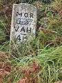
 B3306 milestone - Penzance 6 miles.jpg 3 024 × 4 032; 3,84 MB
-
 B3306 milestone - STIVS 6 miles.jpg 3 024 × 4 032; 3,36 MB
-
 B3306 milestone.jpg 3 024 × 4 032; 2,99 MB
-
 B3306 north of Tremedda Common - geograph.org.uk - 3190779.jpg 3 648 × 2 048; 1,26 MB
-
 B3306 passes the disused Carn Galver Mine - geograph.org.uk - 3192364.jpg 3 537 × 1 979; 1,01 MB
-
 B3306 south of Boscubben - geograph.org.uk - 3190768.jpg 3 648 × 2 048; 1,18 MB
-
 B3306 south of Trendrine Farm - geograph.org.uk - 3190755.jpg 2 546 × 2 048; 968 KB
-
 B3306 south of Zennor - geograph.org.uk - 3719802.jpg 1 056 × 793; 479 KB
-
 Beach at Porthzennor Cove to east Zennor Head - panoramio.jpg 960 × 1 280; 1,82 MB
-
 Beach below Tremadda Cliff - geograph.org.uk - 4079480.jpg 1 024 × 575; 170 KB
-
 Beetle near Carn Veslan (6847).jpg 4 288 × 2 848; 2,98 MB
-
 Bishop's Head and Foot - geograph.org.uk - 1353547.jpg 640 × 480; 113 KB
-
 Boarded up Cottage - geograph.org.uk - 3719690.jpg 1 056 × 793; 500 KB
-
 Boggy track on Lady Downs - geograph.org.uk - 4625525.jpg 4 896 × 3 672; 6,9 MB
-
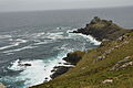
 Bosigran Cliff - geograph.org.uk - 2200993.jpg 1 024 × 768; 270 KB
-
 Bosigran Cliff to Gurnard Head (6854).jpg 4 288 × 2 848; 2,93 MB
-
 Boswednack over Porthglaze and Pendour Coves glimpse Zennor Head - panoramio.jpg 1 280 × 960; 2,02 MB
-
 Boulder above Porthzennor Cove - geograph.org.uk - 1839799.jpg 640 × 480; 106 KB
-
 Boundary Stone between Madron and Zennor (01).jpg 3 024 × 4 032; 5,63 MB
-
 Boundary Stone between Madron and Zennor (02).jpg 3 024 × 4 032; 4,42 MB
-
 Boundary Stone between Madron and Zennor (03).jpg 3 024 × 4 032; 5,33 MB
-
 Boundary wall on Gear Common - geograph.org.uk - 5520155.jpg 640 × 480; 88 KB
-
 Brook Cottage - geograph.org.uk - 144329.jpg 640 × 427; 65 KB
-
 Brook Cottage - geograph.org.uk - 4623028.jpg 1 600 × 1 200; 468 KB
-
 Building in Zennor (6779).jpg 4 288 × 2 848; 2,98 MB
-
 Building remains near Bosigran Cliff - geograph.org.uk - 2201002.jpg 1 024 × 768; 236 KB
-
 By Zennor - geograph.org.uk - 4078060.jpg 1 024 × 575; 271 KB
-
 Carn Cobba (6778).jpg 4 288 × 2 848; 2,93 MB
-
 Carn Galver - 1987 - geograph.org.uk - 2387212.jpg 1 514 × 2 270; 435 KB
-
 Carn Galver - 1987 - geograph.org.uk - 3252519.jpg 2 271 × 1 514; 435 KB
-
 Carn Galver Boundary Stone (1).jpg 2 793 × 3 060; 3,96 MB
-
 Carn Galver Boundary Stone (2).jpg 1 605 × 2 140; 1,67 MB
-
 Carn Galver Engine House - geograph.org.uk - 5834347.jpg 640 × 480; 64 KB
-
 Carn Galver Engine Houses - geograph.org.uk - 1961519.jpg 1 158 × 1 650; 627 KB
-

-
 Carn Galver from Carn Gloose (6820).jpg 4 288 × 2 848; 2,98 MB
-
 Carn Galver from Halldrine Cliff (6850).jpg 4 288 × 2 848; 3,07 MB
-
 Carn Galver from Porthmeor Cliff (6827).jpg 4 288 × 2 848; 3 MB
-
 Carn Galver Mine - 1987 - geograph.org.uk - 2387199.jpg 1 514 × 2 272; 314 KB
-
 Carn Galver mine - geograph.org.uk - 1812718.jpg 640 × 480; 58 KB
-
 Carn Galver Mine - geograph.org.uk - 3140092.jpg 640 × 424; 227 KB
-
 Carn Galver Mine - geograph.org.uk - 3140093.jpg 424 × 640; 241 KB
-
 Carn Galver Mine - geograph.org.uk - 6057260.jpg 3 264 × 2 448; 1,67 MB
-
 Carn Galver Mine from Bosigran Cliff (6851).jpg 4 288 × 2 848; 2,96 MB
-
 Carn Galver Mine in silhouette - geograph.org.uk - 5411603.jpg 640 × 461; 43 KB
-

-
 Carn Gloose - geograph.org.uk - 4440956.jpg 430 × 640; 90 KB
-
 Carn Veslan Cliff (6840).jpg 4 288 × 2 848; 3,03 MB
-
 Carnelloe Cliff - geograph.org.uk - 2526372.jpg 640 × 423; 217 KB
-
 Castle Rock - geograph.org.uk - 3022151.jpg 640 × 480; 70 KB
-

-
 Cattle on Lady Downs - geograph.org.uk - 4625529.jpg 4 896 × 3 672; 6,77 MB
-
 Cattle pasture near the Gurnard's Head Hotel - geograph.org.uk - 1974160.jpg 2 125 × 1 593; 1,62 MB
-
 Church path stile. - panoramio (1).jpg 3 648 × 2 056; 5,36 MB
-
 Chykembro Common - geograph.org.uk - 4879564.jpg 1 600 × 1 200; 234 KB
-
 Chykembro Common - geograph.org.uk - 912825.jpg 640 × 480; 242 KB
-
 Chykembro house - geograph.org.uk - 1483646.jpg 640 × 480; 80 KB
-
 Clapper bridge on coastal footpath - geograph.org.uk - 3468070.jpg 640 × 480; 196 KB
-
 Cliffs east of Porthglaze Cove (6805).jpg 4 288 × 2 848; 2,98 MB
-
 Cliffs east of Porthzennor Cove (6763).jpg 4 288 × 2 848; 2,97 MB
-
 Cliffs north of Porthmeor Point (6821).jpg 4 288 × 2 848; 2,98 MB
-
 Cliffs north of Porthmeor Point (6822).jpg 4 288 × 2 848; 3,02 MB
-
 Cliffs north of Porthmeor Point (6823).jpg 2 848 × 4 288; 2,92 MB
-
 Cliffs north of Porthmeor Point (6824).jpg 4 288 × 2 848; 2,95 MB
-
 Cliffs on Mussel Point - geograph.org.uk - 1827358.jpg 480 × 640; 120 KB
-
 Cliffs south of Porthmoina Cove (6858).jpg 4 288 × 2 848; 2,97 MB
-
 Cliffs west of Gurnard's Head (6814).jpg 4 288 × 2 848; 2,98 MB
-
 Cliffs west of Pendour Cove (6777).jpg 4 288 × 2 848; 2,94 MB
-
 Cliffs west of Porthmeor Cove (6826).jpg 4 288 × 2 848; 2,93 MB
-
 Cloam oven in Wayside Museum, Zennor.jpg 3 592 × 2 848; 5,57 MB
-
 Coast east of Mussel Point - geograph.org.uk - 3468105.jpg 640 × 480; 121 KB
-
 Coast north from River Cove - geograph.org.uk - 5740499.jpg 640 × 480; 211 KB
-
 Coast path above Pendour Cove - geograph.org.uk - 2200827.jpg 1 024 × 768; 271 KB
-
 Coast path above Robin's Rocks - geograph.org.uk - 1841032.jpg 640 × 480; 102 KB
-
 Coast path above Treen Cove - geograph.org.uk - 2200856.jpg 1 024 × 768; 234 KB
-
 Coast Path View Near St Ives - geograph.org.uk - 2940178.jpg 640 × 490; 139 KB
-
 Coast Path View Near Zennor - geograph.org.uk - 2941558.jpg 640 × 477; 135 KB
-
 Coast west of Carn Naun Point - geograph.org.uk - 5740260.jpg 640 × 480; 150 KB
-
 Coast west of Carn Naun Point - geograph.org.uk - 5740283.jpg 640 × 480; 137 KB
-
 Coastal Path at Zennor Head - geograph.org.uk - 5798567.jpg 1 024 × 768; 249 KB
-
 Coastline near Portmeor - geograph.org.uk - 2200928.jpg 1 024 × 768; 287 KB
-
 Coastline north-east of Zennor Head - geograph.org.uk - 2537138.jpg 640 × 480; 77 KB
-
 Coffen path stile. - panoramio.jpg 3 648 × 2 736; 5,95 MB
-
 Commando Ridge at Bosigran - geograph.org.uk - 3022144.jpg 640 × 480; 75 KB
-
 Converted Methodist chapel - Zennor - geograph.org.uk - 1807822.jpg 640 × 480; 140 KB
-
 Cornish coast from Porthmeor Cove - geograph.org.uk - 2200902.jpg 1 024 × 768; 217 KB
-
 Cornwall , Seal on The Carracks - geograph.org.uk - 4607847.jpg 4 198 × 2 789; 6,21 MB
-
 Cornwall , The Carracks - geograph.org.uk - 4607791.jpg 4 288 × 2 848; 6,27 MB
-
 Cornwall , The Carracks - geograph.org.uk - 4607916.jpg 4 288 × 2 848; 7,78 MB
-
 Cottage at Trevail Mill - geograph.org.uk - 2113273.jpg 640 × 480; 93 KB
-
 Cove Cottage and surrounding scenery - geograph.org.uk - 1811978.jpg 640 × 480; 81 KB
-
 Cove River - geograph.org.uk - 2526425.jpg 640 × 427; 186 KB
-
 Cow and calf - Treen - geograph.org.uk - 1811195.jpg 478 × 640; 89 KB
-
 Cows and their young - Treen - geograph.org.uk - 1811132.jpg 640 × 348; 47 KB
-
 Crags above Porthmeor Cliff - geograph.org.uk - 1841014.jpg 640 × 480; 108 KB
-
 Dairy at Zennor - geograph.org.uk - 2526343.jpg 640 × 427; 228 KB
-
 Devonian Metabasites - geograph.org.uk - 3713812.jpg 424 × 640; 285 KB
-
 Devonian Sediments on Gunards Head - geograph.org.uk - 3713809.jpg 640 × 424; 318 KB
-
 Dodder on gorse - geograph.org.uk - 4079452.jpg 1 280 × 719; 564 KB
-
 Dont stray from the path. - panoramio.jpg 4 000 × 2 248; 4,22 MB
-
 Doubler toward Tremedda. - panoramio.jpg 3 648 × 2 056; 5,08 MB
-
 Down Carn Cobba to Pendour Cove - panoramio.jpg 960 × 1 280; 2,18 MB
-
 Dry stone wall on Bosigran Cliff (6852).jpg 4 288 × 2 848; 2,99 MB
-
 Dry stone wall on Carn Veslan Cliff (6842).jpg 4 288 × 2 848; 3,05 MB
-
 Dry stone wall, Zennor - geograph.org.uk - 1839778.jpg 640 × 480; 141 KB
-
 Ebal Rocks from Zennor Head (6771).jpg 4 288 × 2 848; 3,16 MB
-
 Economy Cove (6708).jpg 4 288 × 2 848; 2,92 MB
-
 Economy Cove (6718).jpg 4 288 × 2 848; 2,95 MB
-
 En Route Towards Trendrine Hill - geograph.org.uk - 4488243.jpg 2 560 × 1 920; 3,06 MB
-
 En Route Towards Trendrine Hill - geograph.org.uk - 4488639.jpg 2 560 × 1 920; 3,32 MB
-

-
 Engine houses Carn Galver - geograph.org.uk - 5411600.jpg 640 × 480; 96 KB
-
 Everywhere south. - panoramio.jpg 4 000 × 2 248; 4,06 MB
-
 Farm beside the path from Zennor Head - geograph.org.uk - 912879.jpg 640 × 480; 267 KB
-
 Farm buildings at Trendrine Farm - geograph.org.uk - 3634008.jpg 640 × 480; 59 KB
-
 Farm buildings at Treveal - geograph.org.uk - 1526501.jpg 640 × 480; 92 KB
-
 Farm buildings at Wicca - geograph.org.uk - 1827620.jpg 640 × 480; 88 KB
-
 Farm buildings near Porthmeor Common - geograph.org.uk - 4622978.jpg 1 600 × 1 200; 389 KB
-

-
 Farm gate. - panoramio.jpg 4 000 × 2 248; 3,97 MB
-
 Fenceline near Gurnard's Head - geograph.org.uk - 1110266.jpg 640 × 427; 95 KB
-
 Field Path to - from St.Ives. - panoramio.jpg 3 648 × 2 736; 6,11 MB
-
 Fields near Porthmeor Common - geograph.org.uk - 4622982.jpg 1 600 × 1 200; 441 KB
-
 Fields near Treveal - geograph.org.uk - 1526495.jpg 640 × 480; 92 KB
-
 Fields near Zennor.jpg 3 576 × 2 580; 3,57 MB
-
 Flowers on Wicca Cliff (6731).jpg 4 288 × 2 848; 3,05 MB
-
 Foage Farm road. - panoramio.jpg 3 000 × 4 000; 5,06 MB
-
 Foage Farm stile. - panoramio.jpg 4 000 × 2 248; 4,03 MB
-
 Foage Farm wooden stile. - panoramio.jpg 4 000 × 2 248; 3,97 MB
-
 Foot of Treveal Cliff - geograph.org.uk - 5740689.jpg 640 × 480; 171 KB
-
 Foot of Treveal Cliff - geograph.org.uk - 5740697.jpg 640 × 480; 165 KB
-
 Footbridge above Porthmeor Cove - geograph.org.uk - 2200911.jpg 768 × 1 024; 278 KB
-
 Footbridge on coastal path - geograph.org.uk - 5740449.jpg 640 × 480; 238 KB
-
 Footpath SE Of Zennor Cliff - geograph.org.uk - 4489040.jpg 2 560 × 1 920; 2,35 MB
-
 Footpath sign above River Cove (6702).jpg 4 288 × 2 848; 3,08 MB
-
 Footpath steps. - panoramio.jpg 2 560 × 1 920; 3,1 MB
-
 Footpath to Gurnard's Head - geograph.org.uk - 3417257.jpg 640 × 480; 86 KB
-
 Footpath to Zennor - geograph.org.uk - 1843099.jpg 640 × 480; 107 KB
-
 Footpath to Zennor - geograph.org.uk - 899606.jpg 640 × 424; 105 KB
-
 Footpath to Zennor Head from Zennor Village - geograph.org.uk - 5798545.jpg 1 024 × 768; 256 KB
-
 Footpath towards Zennor - geograph.org.uk - 2526197.jpg 640 × 428; 202 KB
-
 Former chapel in Zennor - geograph.org.uk - 2200038.jpg 1 024 × 768; 199 KB
-
 Former Tin Mine - geograph.org.uk - 4291330.jpg 424 × 640; 93 KB
-
 Former Tin Mine - geograph.org.uk - 4291332.jpg 424 × 640; 55 KB
-
 Former Tin Mine - geograph.org.uk - 4291333.jpg 424 × 640; 100 KB
-
 Former Tin Mine - geograph.org.uk - 4291335.jpg 424 × 640; 92 KB
-
 Former Tin Mine - geograph.org.uk - 4291336.jpg 424 × 640; 85 KB
-
 Four Parish Stone, Cornwall.jpg 3 024 × 4 032; 6,51 MB
-

-
 Gala Rocks (6752).jpg 4 288 × 2 848; 2,96 MB
-
 Gala Rocks - geograph.org.uk - 47743.jpg 640 × 470; 89 KB
-
 Gala Rocks and Zennor Head (6748).jpg 4 288 × 2 848; 2,95 MB
-
 Gannet near the Carracks (6710).jpg 4 288 × 2 848; 2,93 MB
-
 Gannet near the Carracks (6711).jpg 4 288 × 2 848; 2,96 MB
-
 Gannet near the Carracks (6713).jpg 4 288 × 2 848; 2,99 MB
-
 Gear Common - geograph.org.uk - 3787306.jpg 640 × 480; 102 KB
-
 Gears in mill, Zennor.jpg 3 912 × 2 848; 5,63 MB
-
 German Walkers on path near Zennor Head - geograph.org.uk - 5798549.jpg 1 024 × 768; 309 KB
-
 Giant's Rock Zennor - geograph.org.uk - 2065074.jpg 620 × 465; 111 KB
-
 Giant's Rock. - panoramio.jpg 3 648 × 2 736; 6,28 MB
-
 Giant's Rock. Zennor. - panoramio.jpg 3 648 × 2 736; 5,44 MB
-
 Gorse on Bosigran Castle - geograph.org.uk - 2200959.jpg 1 024 × 768; 340 KB
-
 Granite building, Higher Tregerthen - geograph.org.uk - 4879281.jpg 1 600 × 960; 243 KB
-

-
 Grazing land near Treen - geograph.org.uk - 1841022.jpg 640 × 480; 102 KB
-
 Green path near Treveal - geograph.org.uk - 1543904.jpg 640 × 480; 125 KB
-
 Guide post near Zennor - old and new.jpg 3 024 × 4 032; 4,08 MB
-
 Guide post near Zennor.jpg 3 024 × 4 032; 4,06 MB
-
 Guide post to Penzance.jpg 3 024 × 4 032; 4,55 MB
-
 Gunard's Head - geograph.org.uk - 2200044.jpg 1 024 × 768; 228 KB
-
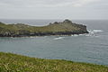 Gurnard's Head (6806).jpg 4 288 × 2 848; 2,95 MB
-
 Gurnard's Head (6813).jpg 4 288 × 2 848; 2,91 MB
-
 Gurnard's Head (6815).jpg 4 288 × 2 848; 2,97 MB
-
 Gurnard's Head (6818).jpg 4 288 × 2 848; 2,93 MB
-
 Gurnard's Head - geograph.org.uk - 1811941.jpg 640 × 480; 75 KB
-
 Gurnard's Head - geograph.org.uk - 2200876.jpg 1 024 × 768; 245 KB
-
 Gurnard's Head - geograph.org.uk - 4440957.jpg 430 × 640; 84 KB


.jpg)


.jpg)


.jpg)
.jpg)
.jpg)


.jpg)


.jpg)


.jpg)
.jpg)


.jpg)
.jpg)
.jpg)


.jpg)


.jpg)


.jpg)


.jpg)
.jpg)
.jpg)
.jpg)
.jpg)
.jpg)

.jpg)
.jpg)
.jpg)
.jpg)


.jpg)
.jpg)

.jpg)
.jpg)
.jpg)


.jpg)


.jpg)


.jpg)

.jpg)
.jpg)
.jpg)
.jpg)


.jpg)
.jpg)
.jpg)
.jpg)


