Commons:Wiki4Alps/Zug (district)

From Wikimedia Commons, the free media repository
Jump to navigation Jump to search

<< Wiki4Alps << Zug

List of the cultural heritage of the district of Zug in the Canton Zug[edit]

Map of Zug
Map of Zug

List of Monuments in the district of Zug in the Canton Zug.

Update: 15 April 2014

List[edit]

KGS-Nr Upload Foto   Object Other Cov. Cat. Type Address Town Coordinates
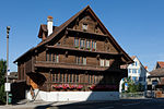
7287 Upload a file Bauernhaus Kirchmatt No images B G Kirchmattweg 1 Oberägeri
47° 08′ 01.21″ N, 8° 37′ 00.44″ E Kartographer map based on OpenStreetMap.View all coordinates using: OpenStreetMapinfo


7288 Upload a file Bauernhaus Obere Chrützbuech No images B G Oberkreuzbuche Oberägeri
47° 07′ 55.99″ N, 8° 37′ 47.03″ E Kartographer map based on OpenStreetMap.View all coordinates using: OpenStreetMapinfo


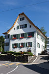
7289 Upload a file Ehemaliges Pfrundhaus Ehemaliges Pfrundhaus No images B G Hauptstrasse 7 Oberägeri
47° 08′ 04.42″ N, 8° 36′ 49.93″ E Kartographer map based on OpenStreetMap.View all coordinates using: OpenStreetMapinfo


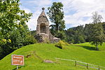
7292 Upload a file Kapelle St. Jost und Einsiedelei No images B G St. Jost Oberägeri
47° 08′ 01.03″ N, 8° 39′ 52.16″ E Kartographer map based on OpenStreetMap.View all coordinates using: OpenStreetMapinfo


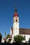
7291 Upload a file Katholische Kirche St. Peter und Paul mit Beinhaus St. Michael Katholische Kirche St. Peter und Paul mit Beinhaus St. Michael No images B G Morgartenstrasse Oberägeri
47° 08′ 04.74″ N, 8° 36′ 52.49″ E Kartographer map based on OpenStreetMap.View all coordinates using: OpenStreetMapinfo


7290 Upload a file Kirche St. Vit (1894) Kirche St. Vit (1894) No images B G Hauptseestrasse, Haslematt Oberägeri
47° 06′ 39.74″ N, 8° 38′ 34.58″ E Kartographer map based on OpenStreetMap.View all coordinates using: OpenStreetMapinfo


7293 Upload a file Schlachtdenkmal Morgarten (1908, Relief von Hermann Haller) Schlachtdenkmal Morgarten (1908, Relief von Hermann Haller) No images B K Hauptseestrasse Oberägeri
47° 06′ 24.84″ N, 8° 38′ 32.75″ E Kartographer map based on OpenStreetMap.View all coordinates using: OpenStreetMapinfo


7294 Upload a file Frühmittelalterliches Gräberfeld No images B F Seematt Oberägeri
47° 08′ 03.3″ N, 8° 36′ 48.17″ E Kartographer map based on OpenStreetMap.View all coordinates using: OpenStreetMapinfo


7295 Upload a file Zurlaubenhaus (1574, 17. und 19. Jh.) Zurlaubenhaus (1574, 17. und 19. Jh.) No images B G Mitteldorfstrasse 2 Oberägeri
47° 08′ 07.44″ N, 8° 36′ 47.34″ E Kartographer map based on OpenStreetMap.View all coordinates using: OpenStreetMapinfo


7316 Upload a file Bauernhaus Untere Lutischwand No images B G Lutischwand 2 Unterägeri
47° 07′ 13.44″ N, 8° 34′ 58.66″ E Kartographer map based on OpenStreetMap.View all coordinates using: OpenStreetMapinfo


7317 Upload a file Bauernhaus Wissenschwändi Bauernhaus Wissenschwändi No images B G Wissenschwändi 3 Unterägeri
47° 07′ 36.55″ N, 8° 34′ 26.65″ E Kartographer map based on OpenStreetMap.View all coordinates using: OpenStreetMapinfo


7318 Upload a file Katholische Kirche Heilige Familie Katholische Kirche Heilige Familie No images B G Alte Landstrasse Unterägeri
47° 08′ 17.66″ N, 8° 34′ 58.12″ E Kartographer map based on OpenStreetMap.View all coordinates using: OpenStreetMapinfo


7319 Upload a file Katholische Marienkirche (alte Pfarrkirche) Katholische Marienkirche (alte Pfarrkirche) No images B G Alte Landstrasse 100 Unterägeri
47° 08′ 20.15″ N, 8° 35′ 05.14″ E Kartographer map based on OpenStreetMap.View all coordinates using: OpenStreetMapinfo


7320 Upload a file Kapelle Heilige Dreifaltigkeit mit Einsiedelei Kapelle Heilige Dreifaltigkeit mit Einsiedelei No images B G Alte Landstrasse 20 Unterägeri
47° 08′ 15.86″ N, 8° 35′ 44.23″ E Kartographer map based on OpenStreetMap.View all coordinates using: OpenStreetMapinfo


11794 Upload a file Kapelle St. Antonius von Padua No images B G Geisswaldstrasse Walchwil
47° 06′ 20.09″ N, 8° 30′ 51.44″ E Kartographer map based on OpenStreetMap.View all coordinates using: OpenStreetMapinfo


7321 Upload a file Katholische Kirche St. Johannes der Täufer No images B G Kirchgasse Walchwil
47° 06′ 01.01″ N, 8° 30′ 52.74″ E Kartographer map based on OpenStreetMap.View all coordinates using: OpenStreetMapinfo


7322 Upload a file Reformierte Kirche (1963/64) Reformierte Kirche (1963/64) No images B G Waldeggweg Walchwil
47° 05′ 47.65″ N, 8° 31′ 04.87″ E Kartographer map based on OpenStreetMap.View all coordinates using: OpenStreetMapinfo