File:Cultural Regions of Virginia.png
Jump to navigation
Jump to search
No higher resolution available.
Cultural_Regions_of_Virginia.png (800 × 371 pixels, file size: 96 KB, MIME type: image/png)
Captions
Captions
Add a one-line explanation of what this file represents
Summary[edit]
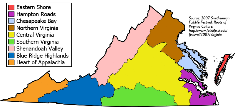
| Description | Color coded map of nine cultural regions of Virginia |
| Date | |
| Source | self-made, based on this map from 2007 Smithsonian Folklife Festival |
| Author | Patrickneil |
| Other versions | Map based on Image:Virginia map.png |

|
This map image could be re-created using vector graphics as an SVG file. This has several advantages; see Commons:Media for cleanup for more information. If an SVG form of this image is available, please upload it and afterwards replace this template with
{{vector version available|new image name}}.
It is recommended to name the SVG file “Cultural Regions of Virginia.svg”—then the template Vector version available (or Vva) does not need the new image name parameter. |
Licensing[edit]
| I, the copyright holder of this work, release this work into the public domain. This applies worldwide. In some countries this may not be legally possible; if so: I grant anyone the right to use this work for any purpose, without any conditions, unless such conditions are required by law. |
File history
Click on a date/time to view the file as it appeared at that time.
| Date/Time | Thumbnail | Dimensions | User | Comment | |
|---|---|---|---|---|---|
| current | 13:03, 7 April 2008 | | 800 × 371 (96 KB) | Patrickneil (talk | contribs) | |
| 15:33, 7 February 2008 |  | 800 × 393 (116 KB) | Patrickneil (talk | contribs) | ||
| 14:32, 6 February 2008 |  | 800 × 393 (117 KB) | Patrickneil (talk | contribs) | ||
| 14:20, 6 February 2008 |  | 800 × 397 (117 KB) | Patrickneil (talk | contribs) | ||
| 12:58, 6 February 2008 |  | 800 × 401 (117 KB) | Patrickneil (talk | contribs) | ||
| 12:21, 6 February 2008 |  | 800 × 401 (161 KB) | Patrickneil (talk | contribs) | {{Information |Description=Color coded map of nine cultural regions of Virgina |Source=self-made, based on [http://www.folklife.si.edu/resources/2007Festival/VA_Signs/SFF07_VA_Intro_Map.pdf this map] from [http://www.folklife.si.edu/festival/2007/Virginia |
You cannot overwrite this file.
File usage on Commons
There are no pages that use this file.
File usage on other wikis
The following other wikis use this file:
- Usage on en.wikipedia.org
- Virginia Conventions
- Category:Shenandoah Valley, Virginia geography stubs
- Category:Northern Virginia geography stubs
- Culture of Virginia
- Category:Central Virginia geography stubs
- Category:Chesapeake Bay, Virginia geography stubs
- Category:Hampton Roads, Virginia geography stubs
- Category:Southern Virginia geography stubs
- Wikipedia:Categories for discussion/Log/2014 July 28
- Category:Blue Ridge Highlands, Virginia geography stubs
- Category:Heart of Appalachia, Virginia geography stubs
- Usage on es.wikipedia.org
- Usage on it.wikipedia.org
- Usage on pt.wikipedia.org
- Usage on ro.wikipedia.org
- Categorie:Guvernatori ai statului Virginia
- Categorie:Virginia
- Listă de guvernatori ai statului Virginia, Statele Unite ale Americii
- Categorie:Oameni din Virginia
- Virginia
- Format:Virginia stat SUA
- Drapelul statului Virginia
- Richmond, Virginia
- Comitatul Albemarle, Virginia
- Langley, Virginia
- Categorie:Liste Virginia
- Comitatul Caroline, Virginia
- Comitatul Middlesex, Virginia
- Categorie:Comitatul Arlington, Virginia
- Listă de oameni din statul Virginia
- Colonia și Dominionul Virginia
- Commonwealth (Statele Unite)
- Categorie:Guvernul statului Virginia
- Categorie:Comitatul Albemarle, Virginia
- Listă de comitate din statul Virginia
- Categorie:Comitatul Accomack, Virginia
- Categorie:Comitatul York, Virginia
- Categorie:Comitatul Alleghany, Virginia
- Categorie:Comitatul Amelia, Virginia
- Categorie:Comitatul Amherst, Virginia
- Categorie:Comitatul Appomattox, Virginia
- Categorie:Comitatul Augusta, Virginia
- Categorie:Comitatul Bath, Virginia
- Categorie:Comitatul Bland, Virginia
- Listă de orașe din statul Virginia
- Comitatul Alleghany, Virginia
- Comitatul Tazewell, Virginia
- Categorie:Zone micropolitane din Virginia
- Categorie:Comitatul Wythe, Virginia
- Categorie:Comitatul Wise, Virginia
- Categorie:Zone metropolitane din Virginia
View more global usage of this file.