File:SFRYmap.PNG
Jump to navigation
Jump to search

Size of this preview: 800 × 600 pixels. Other resolutions: 320 × 240 pixels | 640 × 480 pixels | 1,024 × 768 pixels | 1,280 × 960 pixels | 1,600 × 1,200 pixels.
Original file (1,600 × 1,200 pixels, file size: 836 KB, MIME type: image/png)
Captions
Captions
Add a one-line explanation of what this file represents
Summary[edit]

|
This locator map image could be re-created using vector graphics as an SVG file. This has several advantages; see Commons:Media for cleanup for more information. If an SVG form of this image is available, please upload it and afterwards replace this template with
{{vector version available|new image name}}.
It is recommended to name the SVG file “SFRYmap.svg”—then the template Vector version available (or Vva) does not need the new image name parameter. |
Summary[edit]
| Description |
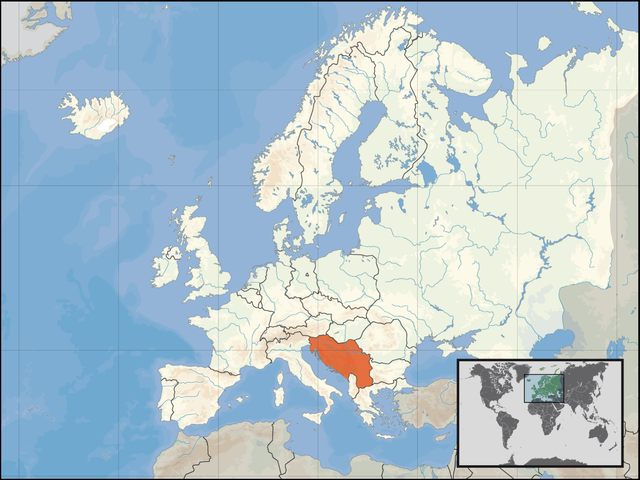
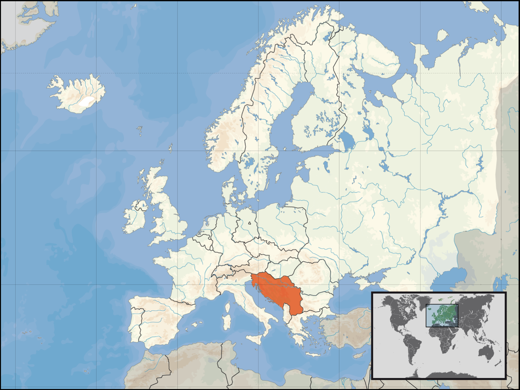
English: locator map for SFRY.
Deutsch: Lage des früheren Jugoslawiens. |
| Date | |
| Source | derived by the "Europe location" map series created by David Liuzzo |
| Author | Bože pravde |
| Other versions | Derivative works of this file: Italy Yugoslavia Locator.png |
This map is based on David Liuzzo's locator maps. As that maps are under the GFDL, this map is too.
Licensing[edit]

|
Permission is granted to copy, distribute and/or modify this document under the terms of the GNU Free Documentation License, Version 1.2 or any later version published by the Free Software Foundation; with no Invariant Sections, no Front-Cover Texts, and no Back-Cover Texts. A copy of the license is included in the section entitled GNU Free Documentation License. |
| This file is licensed under the Creative Commons Attribution-Share Alike 3.0 Unported license. | ||
| ||
| This licensing tag was added to this file as part of the GFDL licensing update. |
File history
Click on a date/time to view the file as it appeared at that time.
| Date/Time | Thumbnail | Dimensions | User | Comment | |
|---|---|---|---|---|---|
| current | 19:40, 14 March 2008 | | 1,600 × 1,200 (836 KB) | Lencer (talk | contribs) | Add West-Berlin, delete false river Havel/Spree |
| 12:48, 14 March 2008 |  | 1,600 × 1,200 (571 KB) | Kmusser (talk | contribs) | corrected internal German boundary | |
| 20:24, 18 August 2007 |  | 1,600 × 1,200 (531 KB) | B1mbo (talk | contribs) | Removed Soviet borders | |
| 22:19, 16 January 2007 |  | 1,600 × 1,200 (576 KB) | Bože pravde~commonswiki (talk | contribs) | newer version | |
| 04:04, 12 December 2006 |  | 800 × 600 (212 KB) | Bože pravde~commonswiki (talk | contribs) | This is a locator map for en:SFRY. This map is based off of David Liuzzo's locator map. As that map is under the GFDL, this map is too. ==Licensing== {{GFDL}} Category:Locator maps for countries [[Category:Maps of Yugosla |
You cannot overwrite this file.
File usage on Commons
The following 4 pages use this file:
File usage on other wikis
The following other wikis use this file:
- Usage on an.wikipedia.org
- Usage on ar.wikipedia.org
- Usage on cs.wikipedia.org
- Usage on de.wikipedia.org
- Usage on de.wikibooks.org
- Usage on de.wiktionary.org
- Usage on en.wikipedia.org
- Usage on eo.wikipedia.org
- Usage on fa.wikipedia.org
- Usage on fo.wikipedia.org
- Usage on gl.wikipedia.org
- Usage on is.wikipedia.org
- Usage on it.wikipedia.org
- Usage on ka.wikipedia.org
- Usage on lb.wikipedia.org
- Usage on li.wiktionary.org
- Usage on mk.wikipedia.org
- Usage on pl.wiktionary.org
- Usage on roa-rup.wikipedia.org
- Usage on ru.wikipedia.org
- Usage on sh.wikipedia.org
- Usage on simple.wikipedia.org
- Usage on sl.wikipedia.org
- Usage on sr.wikipedia.org
- Usage on sw.wikipedia.org
- Usage on tg.wikipedia.org
- Usage on uk.wikipedia.org
- Usage on www.wikidata.org
- Usage on yo.wikipedia.org