File:1593 Norden's map of Westminster surveyed and publ 1593 (1).jpg
1593_Norden's_map_of_Westminster_surveyed_and_publ_1593_(1).jpg (712 × 446 pixels, file size: 193 KB, MIME type: image/jpeg)
Captions
Captions
Summary[edit]
.jpg&action=edit§ion=1)
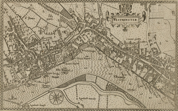
Norden's map of Westminster, surveyed and published 1593. From the Crace Collection at the British Library. The Strand, which is the main road on the right hand side of the map, was in its heyday as the favoured residence of the elite of the English aristocracy, and several of the major mansions located there are labelled on the map.
| Description | Norden's map of Westminster. | ||||
| Date | |||||
| Source | Crace Collection at the British Library. | ||||
| Author | Norden | ||||
| Permission (Reusing this file) |
|
||||
File history
Click on a date/time to view the file as it appeared at that time.
| Date/Time | Thumbnail | Dimensions | User | Comment | |
|---|---|---|---|---|---|
| current | 19:10, 16 February 2006 | | 712 × 446 (193 KB) | Merchbow~commonswiki (talk | contribs) | Norden's map of Westminster, surveyed and published 1593. From the Crace Collection at the British Library. Category:Maps of London category:City of Westminster |
You cannot overwrite this file.
File usage on Commons
There are no pages that use this file.
File usage on other wikis
The following other wikis use this file:
- Usage on de.wikipedia.org
- Usage on en.wikipedia.org
- Usage on es.wikipedia.org
- Usage on he.wikipedia.org
- Usage on ja.wikipedia.org
- Usage on nrm.wikipedia.org
- Usage on sco.wikipedia.org
- Usage on zh.wikipedia.org
.jpg&oldid=868608261)