File:1898 map of Charleston, South Carolina.jpeg
Jump to navigation
Jump to search
Size of this preview: 448 × 599 pixels. Other resolutions: 179 × 240 pixels | 359 × 480 pixels | 574 × 768 pixels | 765 × 1,024 pixels | 1,530 × 2,048 pixels | 2,807 × 3,756 pixels.
Original file (2,807 × 3,756 pixels, file size: 1.26 MB, MIME type: image/jpeg)
Captions
Captions
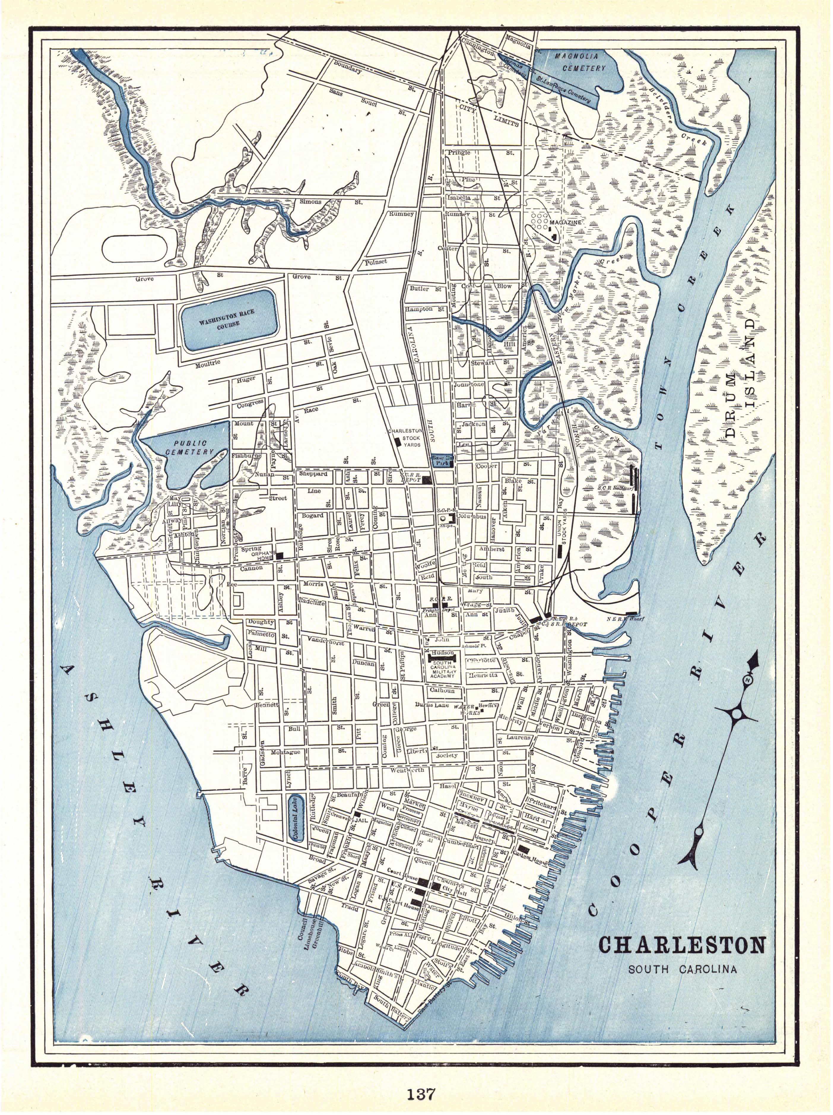
Map of Charleston, SC (1898)
Summary[edit]
| Description | "Charleston", from Cram's Universal Atlas, Geographical, Astronomical and Historical | |||||||||||||||||||
| Date | ||||||||||||||||||||
| Source | Historical Maps of Alabama collection, University of Alabama Department of Geography | |||||||||||||||||||
| Author |
|
|||||||||||||||||||
Licensing[edit]
|
The author died in 1928, so this work is in the public domain in its country of origin and other countries and areas where the copyright term is the author's life plus 95 years or fewer. This work is in the public domain in the United States because it was published (or registered with the U.S. Copyright Office) before January 1, 1929. | |
| This file has been identified as being free of known restrictions under copyright law, including all related and neighboring rights. | |
File history
Click on a date/time to view the file as it appeared at that time.
| Date/Time | Thumbnail | Dimensions | User | Comment | |
|---|---|---|---|---|---|
| current | 23:34, 17 December 2009 | | 2,807 × 3,756 (1.26 MB) | Spyder Monkey (talk | contribs) | {{Information |Description="Charleston", from Cram's ''Universal Atlas, Geographical, Astronomical and Historical'' |Source=[http://alabamamaps.ua.edu/historicalmaps/us_states/southcarolina/index2.html Historical Maps of Alabama collection], University of |
You cannot overwrite this file.
File usage on Commons
There are no pages that use this file.