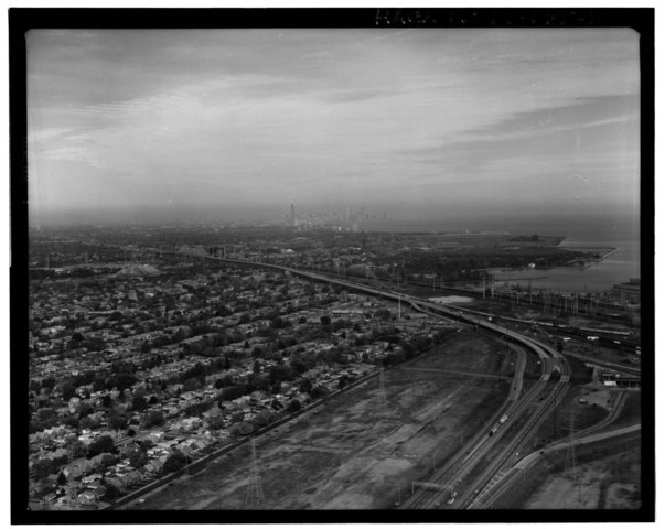
File:AERIAL VIEW, LOOKING NNW TOWARD CHICAGO LOOP, SHOWING BEGINNING OF SKYWAY AT INDIANA-ILLINOIS STATE LINE. - Chicago Skyway Toll Bridge, I-90, for 7.8 miles from South State HAER ILL, 16-CHIG, 138-1.tif
Jump to navigation
Jump to search

Size of this JPG preview of this TIF file: 753 × 600 pixels. Other resolutions: 301 × 240 pixels | 603 × 480 pixels | 964 × 768 pixels | 1,280 × 1,019 pixels | 2,560 × 2,039 pixels | 5,000 × 3,982 pixels.
Original file (5,000 × 3,982 pixels, file size: 18.99 MB, MIME type: image/tiff)
Captions
Captions
Add a one-line explanation of what this file represents
Summary[edit]
| AERIAL VIEW, LOOKING NNW TOWARD CHICAGO LOOP, SHOWING BEGINNING OF SKYWAY AT INDIANA-ILLINOIS STATE LINE. - Chicago Skyway Toll Bridge, I-90, for 7.8 miles from South State Street to Indiana state line, Chicago, Cook County, IL | ||||
|---|---|---|---|---|
| Photographer |
Lowe, Jet |
|||
| Title |
AERIAL VIEW, LOOKING NNW TOWARD CHICAGO LOOP, SHOWING BEGINNING OF SKYWAY AT INDIANA-ILLINOIS STATE LINE. - Chicago Skyway Toll Bridge, I-90, for 7.8 miles from South State Street to Indiana state line, Chicago, Cook County, IL |
|||
| Description |
Chicago Department of Public Works; DeLeuw, Cather and Company; Alfred Benesch and Associates; A. J. Boynton and Company; Consoer, Townsend and Associates; Hazelet and Erdal; Friedman-Kornacker Engineering Company; J. E. Greiner Company; H. W. Lochner and Company; Allied Structural Steel Company; U.S. Steel Corporation; Bethlehem Steel Company; Mount Vernon Bridge Company; Arcole Midwest Corporation; Kenny Construction Company; E. J. Albrecht Company; Robert R. Anderson Company; M. J. Boyle and Company; Consolidated Construction Company; J. M. Corbett Company; Hedges Construction Company; Paschen Contractors; Superior Concrete Construction Company; DeLony, Eric N, project manager; Chicago Department of Transportation, sponsor; Daley, Richard M, sponsor; Walker, Thomas R, sponsor; Kaderbek, S L, sponsor; Sears, Hannah, transmitter; Spivey, Justin M, historian; Lowe, Jet, photographer |
|||
| Depicted place | Illinois; Cook County; Chicago | |||
| Date | Documentation compiled after 1968; 1999 | |||
| Dimensions | 4 x 5 in. | |||
| Current location |
Library of Congress Prints and Photographs Division Washington, D.C. 20540 USA http://hdl.loc.gov/loc.pnp/pp.print |
|||
| Accession number |
HAER ILL, 16-CHIG, 138-1 |
|||
| Credit line |
|
|||
| Notes |
|
|||
| Source | https://www.loc.gov/pictures/item/il0824.photos.318296p | |||
| Permission (Reusing this file) |
|
|||

| Object location | | View this and other nearby images on: OpenStreetMap |
|---|
File history
Click on a date/time to view the file as it appeared at that time.
| Date/Time | Thumbnail | Dimensions | User | Comment | |
|---|---|---|---|---|---|
| current | 14:37, 17 July 2014 |  | 5,000 × 3,982 (18.99 MB) | Fæ (talk | contribs) | GWToolset: Creating mediafile for Fæ. HABS 16 July 2014 (1201:1400) |
You cannot overwrite this file.
File usage on Commons
The following page uses this file: