File:A large and particular plan of Shegnekto Bay, and the circumjacent country, with the forts and settlements of the Frenchtill dispossessd by the English in June 1755 (4231928858).jpg
Jump to navigation
Jump to search

Size of this preview: 800 × 579 pixels. Other resolutions: 320 × 232 pixels | 640 × 463 pixels | 1,024 × 741 pixels | 1,280 × 927 pixels | 2,000 × 1,448 pixels.
Original file (2,000 × 1,448 pixels, file size: 3.02 MB, MIME type: image/jpeg)
Captions
Captions
Add a one-line explanation of what this file represents
Summary[edit]
| Description |
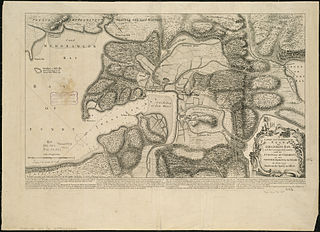
Zoom into this map at maps.bpl.org. Author: Jefferys, Thomas Publisher: Jefferys, Thomas Date: 1755 Location: Nova Scotia Dimension: 34x58cm Scale: [ca 1:102,000] Call Number: G3422.C45 1755 .J4x |
| Date | |
| Source | A large and particular plan of Shegnekto Bay, and the circumjacent country, with the forts and settlements of the French'till dispossess'd by the English in June 1755 |
| Author | http://maps.bpl.org |
| Other versions |
_(cropped).jpg)
.jpg&action=edit§ion=1)
Licensing[edit]
.jpg&action=edit§ion=2)
This file is licensed under the Creative Commons Attribution 2.0 Generic license.
- You are free:
- to share – to copy, distribute and transmit the work
- to remix – to adapt the work
- Under the following conditions:
- attribution – You must give appropriate credit, provide a link to the license, and indicate if changes were made. You may do so in any reasonable manner, but not in any way that suggests the licensor endorses you or your use.
| This image, originally posted to Flickr, was reviewed on 21 August 2013 by the administrator or reviewer File Upload Bot (Magnus Manske), who confirmed that it was available on Flickr under the stated license on that date. |
File history
Click on a date/time to view the file as it appeared at that time.
| Date/Time | Thumbnail | Dimensions | User | Comment | |
|---|---|---|---|---|---|
| current | 04:17, 21 August 2013 | | 2,000 × 1,448 (3.02 MB) | File Upload Bot (Magnus Manske) (talk | contribs) | Transferred from Flickr by User:tm |
You cannot overwrite this file.
File usage on Commons
The following page uses this file:
.jpg&oldid=868490587)