File:African continent-ru.svg
Jump to navigation
Jump to search

Size of this PNG preview of this SVG file: 635 × 600 pixels. Other resolutions: 254 × 240 pixels | 508 × 480 pixels | 813 × 768 pixels | 1,084 × 1,024 pixels | 2,169 × 2,048 pixels | 1,525 × 1,440 pixels.
Original file (SVG file, nominally 1,525 × 1,440 pixels, file size: 751 KB)
Captions
Captions
Add a one-line explanation of what this file represents
Summary[edit]
| Description |
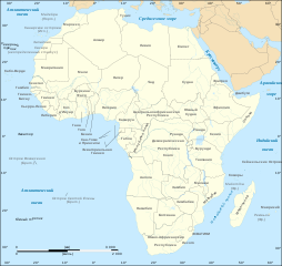
English: Political map of the African continent with Russian caption Lambert azimutal equal-area projection, WGS84 datum, standard meridian: 15°E, standard parallel: 0° Scale: 1:15,000,000 (accuracy: 3,75 km) |
| Date | 2008-03-16, updated 2011-07 |
| Source |
|
| Author |
|
| Permission (Reusing this file) |
GFDL or CC-BY-SA |
| Other versions |
[]
|


|
This SVG file contains embedded text that can be translated into your language, using any capable SVG editor, text editor or the SVG Translate tool. For more information see: About translating SVG files. |
Licensing[edit]

|
Permission is granted to copy, distribute and/or modify this document under the terms of the GNU Free Documentation License, Version 1.2 or any later version published by the Free Software Foundation; with no Invariant Sections, no Front-Cover Texts, and no Back-Cover Texts. A copy of the license is included in the section entitled GNU Free Documentation License. |
| This file is licensed under the Creative Commons Attribution-Share Alike 3.0 Unported license. | ||
| ||
| This licensing tag was added to this file as part of the GFDL licensing update. |
File history
Click on a date/time to view the file as it appeared at that time.
| Date/Time | Thumbnail | Dimensions | User | Comment | |
|---|---|---|---|---|---|
| current | 18:34, 6 December 2020 | | 1,525 × 1,440 (751 KB) | Sting (talk | contribs) | Swatziland => eSwatini |
| 21:08, 10 October 2011 |  | 1,525 × 1,440 (751 KB) | AlexanderKolpakov (talk | contribs) | {{Information |Description ={{en|1=Political map of the African continent with Russian caption Lambert azimutal equal-area projection, WGS84 datum, standard meridian: 15°E, standard parallel: 0° Scale: 1:15,000,000 (accuracy: 3,75 km)}} |Source |
You cannot overwrite this file.
File usage on Commons
The following 30 pages use this file:
- User:Magog the Ogre/Multilingual legend/2020 December 1-10
- Commons:Translation possible/En savoir plus
- File:Africa map blank.svg
- File:Africa map no countries.svg
- File:African continent-br.svg
- File:African continent-ca.svg
- File:African continent-cs.svg
- File:African continent-da.svg
- File:African continent-de.png
- File:African continent-de.svg
- File:African continent-en.svg
- File:African continent-es.svg
- File:African continent-fr.svg
- File:African continent-it.svg
- File:African continent-ka.svg
- File:African continent-ku.svg
- File:African continent-la.svg
- File:African continent-mk.svg
- File:African continent-nb.svg
- File:African continent-pl.png
- File:African continent-pl.svg
- File:African continent-pt.svg
- File:African continent-ru.svg
- File:African continent-uk.svg
- File:African continent-ur2.svg
- File:African continent-繁體中文.png
- File:African continent-繁體中文.svg
- File:African continent sr.svg
- File:Afrik kárttá smn.svg
- Template:Other versions/African continent
File usage on other wikis
The following other wikis use this file:
- Usage on ba.wikipedia.org
- Usage on be.wikipedia.org
- Usage on bxr.wikipedia.org
- Usage on ky.wikipedia.org
- Usage on lez.wikipedia.org
- Usage on ru.wikipedia.org
- Usage on xmf.wikipedia.org