File:Amman, Jordan.jpg
Jump to navigation
Jump to search

Size of this preview: 600 × 600 pixels. Other resolutions: 240 × 240 pixels | 480 × 480 pixels | 768 × 768 pixels | 1,024 × 1,024 pixels | 2,048 × 2,048 pixels | 3,000 × 3,000 pixels.
Original file (3,000 × 3,000 pixels, file size: 3.64 MB, MIME type: image/jpeg)
Captions
Captions
Add a one-line explanation of what this file represents
Summary[edit]
| Description |
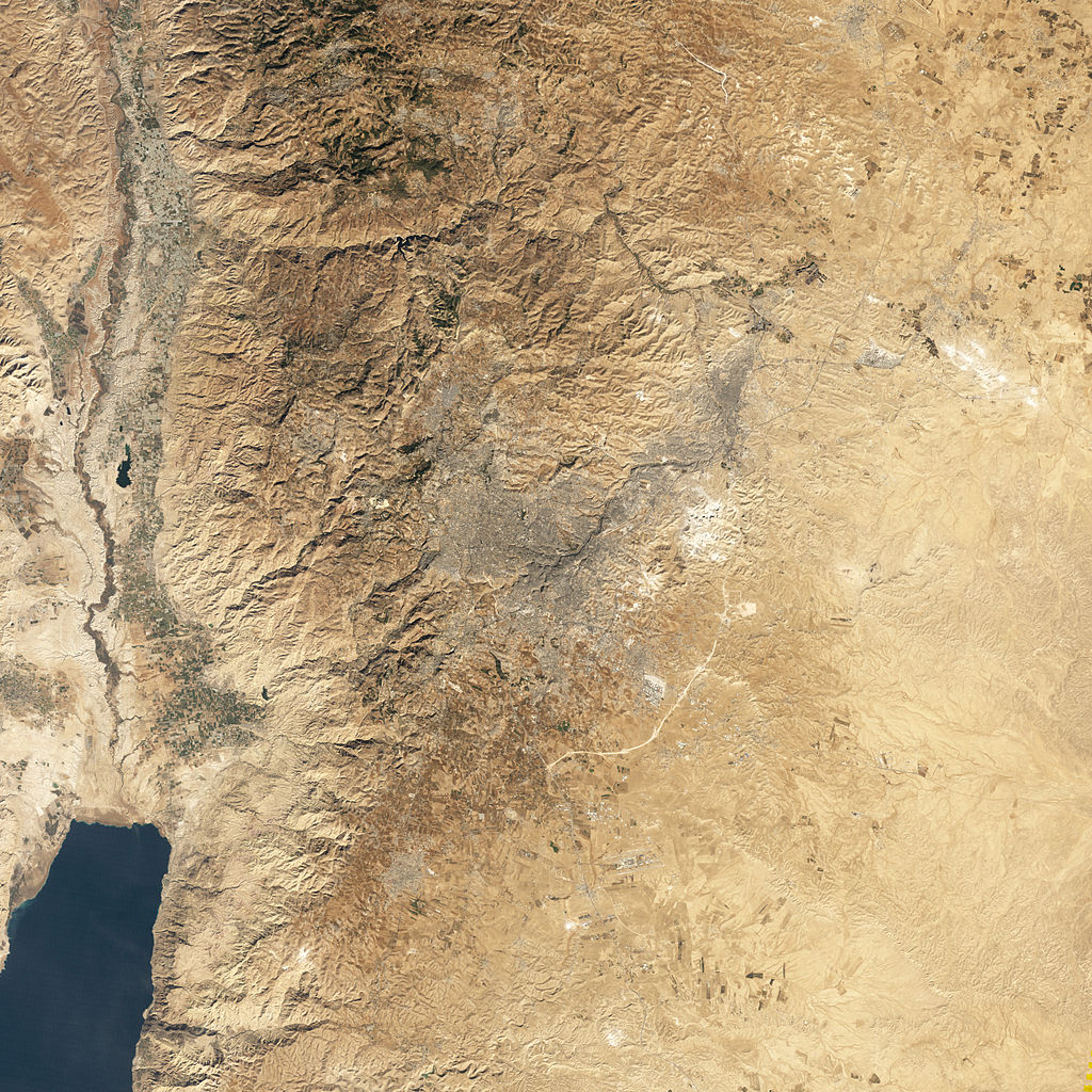
English: Natural-colour image of Amman, Jordan. The city forms a rough Vshape of gray. West of the city, the terrain is more rugged, with small valleys extending toward the Jordan River. Part of the Dead Sea appears south-west of Amman, and agricultural fields in the Jordan River Valley appear west of town. East of the city, the land is flatter. |
| Date | |
| Source | NASA Earth Observatory |
| Author | Jesse Allen |
| Permission (Reusing this file) |
Image captured by NASA’s Landsat 5 satellite. Landsat data provided by the United States Geological Survey. |
Licensing[edit]
| This file is in the public domain in the United States because it was solely created by NASA. NASA copyright policy states that "NASA material is not protected by copyright unless noted". (See Template:PD-USGov, NASA copyright policy page or JPL Image Use Policy.) | ||
 |
Warnings:
|
| Annotations | This image is annotated: View the annotations at Commons |
File history
Click on a date/time to view the file as it appeared at that time.
| Date/Time | Thumbnail | Dimensions | User | Comment | |
|---|---|---|---|---|---|
| current | 12:08, 16 May 2011 | | 3,000 × 3,000 (3.64 MB) | Originalwana (talk | contribs) | {{Information |Description ={{en|1=Natural-colour image of Amman, Jordan. The city forms a rough Vshape of gray. West of the city, the terrain is more rugged, with small valleys extending toward the Jordan River. Part |
You cannot overwrite this file.
File usage on Commons
The following page uses this file:
File usage on other wikis
The following other wikis use this file:
- Usage on ar.wikipedia.org
- Usage on fa.wikipedia.org