File:AroundShirakawaStationJp1975.jpg
Jump to navigation
Jump to search
Size of this preview: 600 × 600 pixels. Other resolutions: 240 × 240 pixels | 480 × 480 pixels | 768 × 768 pixels | 1,024 × 1,024 pixels | 1,280 × 1,280 pixels.
Original file (1,280 × 1,280 pixels, file size: 2.87 MB, MIME type: image/jpeg)
Captions
Captions
Add a one-line explanation of what this file represents
Summary[edit]
en[edit]
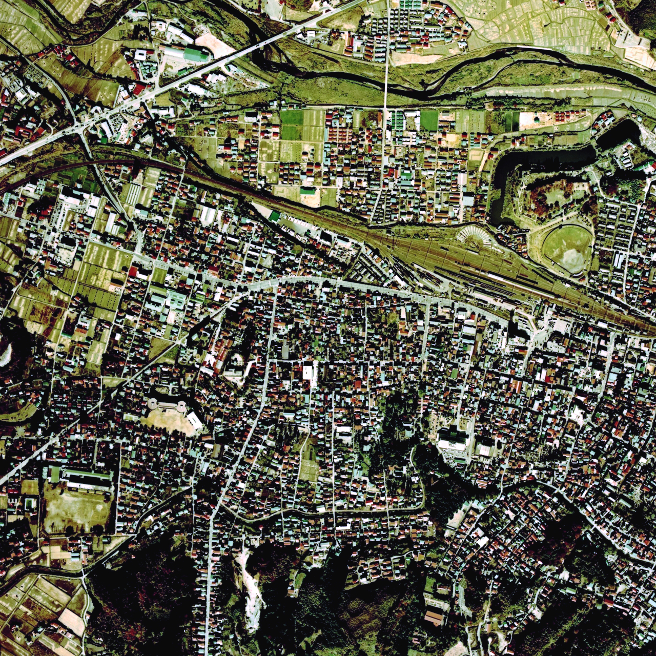
- Description: Aeral Photo around JNR Shirakawa Station,Shirakawa City,Fukushima Pref.,Japan
- Source: image from (Color Aerial Photo) archive copy at the Wayback Machine resized by Fuji-s
- Date: 1975
ja[edit]
- 説明: 福島県白河市の国鉄白河駅周辺の空中写真。
- 空中写真の北方向:

- 整理番号:CTO-75-33
- 撮影年度: 昭和50年度 (1975年度)
- 地区名:白河
- 撮影縮尺: 1/10000
- 地形図番号:NJ-54-23-14
- 撮影コース: C4B
- 写真番号: 15
- 空中写真の北方向:
- 出典: 国土画像情報 (カラー空中写真) archive copy at the Wayback Machineの写真をFuji-sにより編集
Licensing[edit]

|
The copyright holder of this file, the Ministry of Land, Infrastructure, Transport and Tourism of Japan, allows anyone to use it for any purpose, provided that the copyright holder is properly attributed. Redistribution, derivative work, commercial use, and all other use is permitted. |
Attribution:
Copyright © National Land Image Information (Color Aerial Photographs), Ministry of Land, Infrastructure, Transport and Tourism
|
 |
This image is copyrighted by the Ministry of Land, Infrastructure, Transport and Tourism of Japan. For terms of use, see the stipulation to use of National Land Information (in Japanese) and message from MLIT (in Japanese and English). When you display this image on an article, include the following phrase in the description: "Made based on National Land Image Information (Color Aerial Photographs), Ministry of Land, Infrastructure, Transport and Tourism".
|
File history
Click on a date/time to view the file as it appeared at that time.
| Date/Time | Thumbnail | Dimensions | User | Comment | |
|---|---|---|---|---|---|
| current | 05:23, 19 October 2017 | | 1,280 × 1,280 (2.87 MB) | Togabi (talk | contribs) | Color adjustment. |
| 09:53, 7 January 2007 |  | 1,280 × 1,280 (2.14 MB) | Fuji-s (talk | contribs) | == en == *'''Description:''' Aeral Photo around JNR Shirakawa Station,Shirakawa City,Fukushima Pref.,Japan *'''Source:''' image from [http://w3land.mlit.go.jp/WebGIS/ (Color Aerial Photo)] resized by Fuji-s *'''Date:''' 1975 == ja == *''' |
You cannot overwrite this file.
File usage on Commons
The following 3 pages use this file:
File usage on other wikis
The following other wikis use this file:
- Usage on ja.wikipedia.org