File:BLACK NEIGHBORHOOD ON CHICAGO'S WEST SIDE. THE WEST SIDE WAS HARD HIT BY RIOTS AND FIRES IN THE MID AND LATE 1960'S.... - NARA - 556170.tif
Original file (3,000 × 2,033 pixels, file size: 17.45 MB, MIME type: image/tiff)
Captions
Captions
Summary[edit]
| Author |
John H. White, 1945-, Photographer (NARA record: 4002141) |
||||||||||||||||||||||||||
| Record creator | Environmental Protection Agency. (12/02/1970 - ) | ||||||||||||||||||||||||||
| Title |
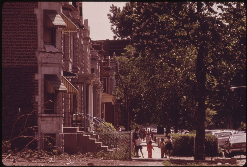
BLACK NEIGHBORHOOD ON CHICAGO'S WEST SIDE. THE WEST SIDE WAS HARD HIT BY RIOTS AND FIRES IN THE MID AND LATE 1960'S. THE 1970 CENSUS NOTED THAT 22 TO 29% OF THE AREA'S RESIDENTS LIVED BELOW THE OFFICIAL POVERTY LEVEL. BLACK BUSINESSMEN, HELPED BY FEDERAL FUNDING REACHED AGREEMENTS WITH NATIONAL FRANCHISES WHICH RESULTED IN PUMPING $20 MILLION IN JOBS FOR RESIDENTS BY 1974 |
||||||||||||||||||||||||||
| Depicted place |
Chicago (Cook county, Illinois, United States, North and Central America) inhabited place (41°51′N 87°39′W / 41.85°N 87.65°W; NARA geographical record) |
||||||||||||||||||||||||||
| Date | June 1973 | ||||||||||||||||||||||||||
| Collection |
|
||||||||||||||||||||||||||
| Record ID |
NAIL Control Number: NWDNS-412-DA-13718
|
||||||||||||||||||||||||||
| Source | U.S. National Archives and Records Administration | ||||||||||||||||||||||||||
| Other versions |
Please do not overwrite this file: any restoration work should be uploaded with a new name and linked in this page's "other versions=" parameter, so that this file represents the exact file found in the NARA catalog record to which it links. The metadata on this page was imported directly from NARA's catalog record; additional descriptive text may be added by Wikimedians to the template below with the "description=" parameter, but please do not modify the other fields.
|
||||||||||||||||||||||||||


Licensing[edit]
This file was provided to Wikimedia Commons by the National Archives and Records Administration as part of a cooperation project. The National Archives and Records Administration provides images depicting American and global history which are public domain or licensed under a free license.
|
This image (or other media) is a work of an Environmental Protection Agency employee, taken or made as part of that person's official duties. As works of the U.S. federal government, all EPA images are in the public domain.
|
||
File history
Click on a date/time to view the file as it appeared at that time.
| Date/Time | Thumbnail | Dimensions | User | Comment | |
|---|---|---|---|---|---|
| current | 08:12, 23 September 2011 |  | 3,000 × 2,033 (17.45 MB) | US National Archives bot (talk | contribs) | == {{int:filedesc}} == {{NARA-image-full |Title=BLACK NEIGHBORHOOD ON CHICAGO'S WEST SIDE. THE WEST SIDE WAS HARD HIT BY RIOTS AND FIRES IN THE MID AND LATE 1960'S. THE 1970 CENSUS NOTED THAT 22 TO 29% OF THE AREA'S RESIDENTS LIVED BELOW THE OFFICIAL POV |
You cannot overwrite this file.
File usage on Commons
The following 2 pages use this file: