File:BTKC.svg
Jump to navigation
Jump to search

Size of this PNG preview of this SVG file: 800 × 343 pixels. Other resolutions: 320 × 137 pixels | 640 × 274 pixels | 1,024 × 439 pixels | 1,280 × 548 pixels | 2,560 × 1,097 pixels | 1,580 × 677 pixels.
Original file (SVG file, nominally 1,580 × 677 pixels, file size: 784 KB)
Captions
Captions
Add a one-line explanation of what this file represents
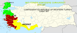
Not an official map: This map should not be considered official. It is just a proposal of an artist, not in any official use and purely fictional!
Summary[edit]
| Description |
Türkçe: BTKC siyasi haritası |
| Date | |
| Source | Own work |
| Author | Infestor |
| SVG development | This map was created with Adobe Illustrator. |
Licensing[edit]
Permission is granted to do what the fuck you want to with this document under the terms of the WTF Public License, Version 2.
|
File history
Click on a date/time to view the file as it appeared at that time.
| Date/Time | Thumbnail | Dimensions | User | Comment | |
|---|---|---|---|---|---|
| current | 20:24, 9 June 2018 | | 1,580 × 677 (784 KB) | JoKalliauer (talk | contribs) | removed invalid line-height="125%" |
| 00:19, 5 June 2018 |  | 1,580 × 677 (784 KB) | JoKalliauer (talk | contribs) | removed CDATA | |
| 23:08, 9 August 2012 |  | 1,579 × 677 (1.76 MB) | Infestor (talk | contribs) |
You cannot overwrite this file.
File usage on Commons
There are no pages that use this file.