File:Baist Seattle 1905 plate 3 - A - raw.jpg
Original file (2,592 × 1,944 pixels, file size: 746 KB, MIME type: image/jpeg)
Captions
Captions
Summary[edit]
| Description |
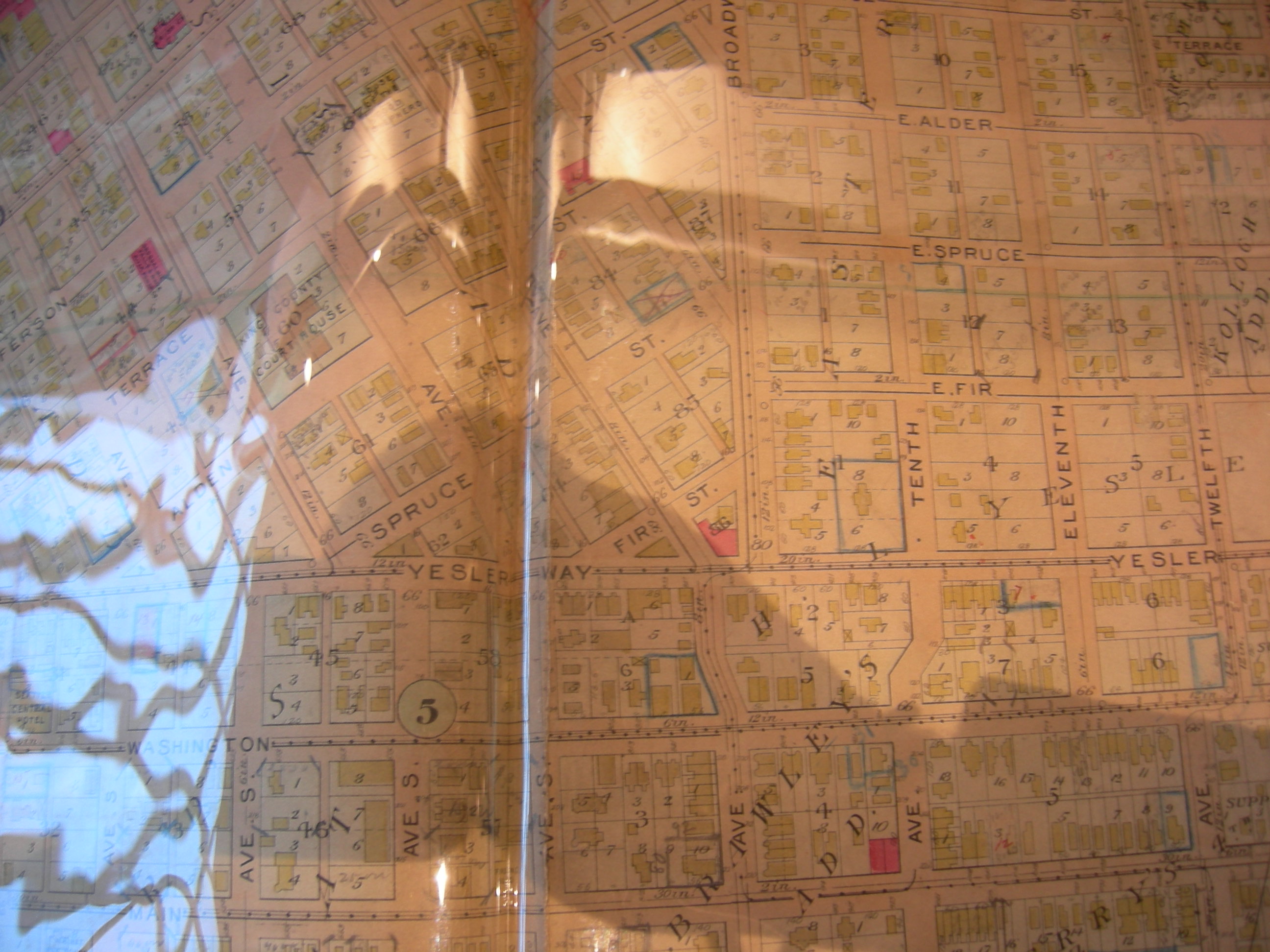
Part of plate 3, Baist's Real Estate Maps of Surveys of Seattle (1905). Shows detail of part of what is now Yesler Terrace, Harborview Hospital (upper left) Seattle. Interstate 5 now runs roughly along the left part of what is shown here. Near upper left would be Harborview Medical Center; much of the rest of this is now Yesler Terrace. Much of this is very differently arranged now: at the time of this map, Boren Avenue did not extend this far south, Terrace Street (and others) ran straight through from Downtown to Broadway; indeed, the downtown street grid continued uninterrupted into the aread covered by the upper left portion of this map. If you know the area today, then the still-extant firehouse at the corner of Terry and Alder (mislabeled "Alden" on this map) may help you get oriented. It's in pink, a bit left of Broadway and about an equal distance from the top of this image. This is a raw image of a plastic-covered document: some reflections and also some shadow. |
| Date | |
| Source | Plate 3, Baist's Real Estate Maps of Surveys of Seattle, G. Wm. Baist, Philadelphia, 1905 |
| Author | G. Wm. Baist Co. |
| Permission (Reusing this file) |
PD-US |
Licensing[edit]
This media file is in the public domain in the United States. This applies to U.S. works where the copyright has expired, often because its first publication occurred prior to January 1, 1929, and if not then due to lack of notice or renewal. See this page for further explanation.
|
 | |
 |
This image might not be in the public domain outside of the United States; this especially applies in the countries and areas that do not apply the rule of the shorter term for US works, such as Canada, Mainland China (not Hong Kong or Macao), Germany, Mexico, and Switzerland. The creator and year of publication are essential information and must be provided. See Wikipedia:Public domain and Wikipedia:Copyrights for more details.
|
File history
Click on a date/time to view the file as it appeared at that time.
| Date/Time | Thumbnail | Dimensions | User | Comment | |
|---|---|---|---|---|---|
| current | 01:32, 3 December 2007 | | 2,592 × 1,944 (746 KB) | Jmabel (talk | contribs) | == Summary == {{Information |Description=Part of plate 3, ''Baist's Real Estate Maps of Surveys of Seattle'' (1905). Shows detail of part of what is now Yesler Terrace, Harborview Hospital (upper left) Seattle. Interstate 5 now runs roughly along the left |
You cannot overwrite this file.
File usage on Commons
There are no pages that use this file.