File:Barn Pano(9467)-Relic38.jpg
Jump to navigation
Jump to search

Size of this preview: 800 × 246 pixels. Other resolutions: 320 × 98 pixels | 640 × 197 pixels | 1,024 × 315 pixels | 1,280 × 393 pixels | 2,560 × 786 pixels | 8,132 × 2,498 pixels.
Original file (8,132 × 2,498 pixels, file size: 8.14 MB, MIME type: image/jpeg)
Captions
Captions
Add a one-line explanation of what this file represents
| Description |
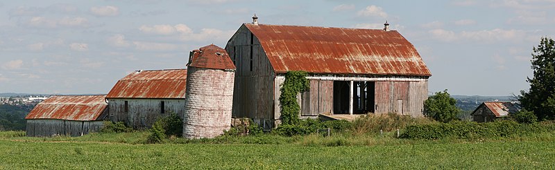
English: Barn near Newmarket, Ontario, Canada. Demolished in March, 2009.
Created from 4 images taken at 105mm, 1/100s, f14, ISO 100 Français : Une grange près de Newmarket en Ontario (Canada). Les bâtiments ont été détruits en mars 2009. Image obtenue en assemblant 4 clichés pris avec un objectif de 105 mm, et comme paramètres d'exposition 1/100s, f14, et ISO 100. |
| Date | |
| Source | Own work |
| Author | Relic38 |
| Permission (Reusing this file) |
I, the copyright holder of this work, hereby publish it under the following license: This file is licensed under the Creative Commons Attribution-Share Alike 3.0 Unported license.
Please leave a message if reused outside of Wiki projects. |
| Other versions |
|
|

-Relic38.jpg)
| Camera location | | View this and other nearby images on: OpenStreetMap |
|---|
-Relic38.jpg¶ms=044.079605_N_-079.486229_E_globe:Earth_type:camera_heading:112.50&language=en)
This image was created with Hugin.
This image has been assessed using the Quality image guidelines and is considered a Quality image.
|
File history
Click on a date/time to view the file as it appeared at that time.
| Date/Time | Thumbnail | Dimensions | User | Comment | |
|---|---|---|---|---|---|
| current | 04:24, 27 September 2009 | 8,132 × 2,498 (8.14 MB) | Relic38 (talk | contribs) | Wider Crop, minor curves adjustment, slightly more sharpening than previous (Unsharp mask, 1.0/.65/0.0). | |
| 03:38, 25 September 2009 | 7,584 × 2,477 (7.27 MB) | Relic38 (talk | contribs) | Restitched using Hugin, new crop | ||
| 02:13, 1 August 2008 | 8,568 × 2,534 (6.22 MB) | Relic38 (talk | contribs) | {{Information |Description={{en|1=Barn near Newmarket, Ontario, Canada <br>Created from 4 images taken at 105mm, 1/100s, f14, ISO 100}} |Source=Own work by uploader |Author=Relic38 |Date=July 29, 2008 |Permission={{self|cc-by-sa-3.0}}<br> |
You cannot overwrite this file.
File usage on Commons
The following 24 pages use this file:
- User:Relic38
- User:Ö/Best/2009
- User talk:Relic38
- Commons:Featured picture candidates/File:Barn Pano(9467)-Relic38.jpg
- Commons:Featured picture candidates/Log/October 2009
- Commons:Featured pictures/Places/Agriculture
- Commons:Featured pictures/chronological/2009-B
- Commons:Photo challenge/2017 - February - Barns
- Commons:Picture of the Year/2009/Galleries/2009-B
- Commons:Picture of the Year/2009/Galleries/All
- Commons:Picture of the Year/2009/Galleries/Index/14
- Commons:Picture of the Year/2009/Galleries/Index/Panoramas
- Commons:Picture of the Year/2009/Galleries/Panoramas
- Commons:Picture of the Year/2009/Galleries/Panoramas/2
- Commons:Picture of the Year/2009/Galleries/Table/200910
- Commons:Picture of the Year/2009/R1/File:Barn Pano(9467)-Relic38.jpg
- Commons:Picture of the Year/2009/Results/R1/ALL/Table
- Commons:Picture of the Year/2009/Results/R1/Panoramas
- Commons:Picture of the Year/2009/Results/R1/Panoramas/Table
- Commons:Quality images/Subject/Places/Man made structures/Buildings, Exterior/Part 1a
- Commons:Quality images candidates/Archives September 2009
- Commons talk:Quality images/Subject/Places/Man made structures
- File:Barn Pano (3072)-Relic38.jpg
- File:Barn Pano (3072)-Relic38 (cropped).jpg
-Relic38.jpg)
-Relic38.jpg)
-Relic38_(cropped).jpg)
File usage on other wikis
The following other wikis use this file:
- Usage on ca.wikipedia.org
- Usage on en.wikipedia.org
- Usage on es.wikipedia.org
- Usage on fr.wikipedia.org
- Usage on pl.wikipedia.org
- Usage on pnb.wikipedia.org
- Usage on ru.wikipedia.org
- Usage on vi.wikipedia.org
- Usage on zh.wikipedia.org
-Relic38.jpg)
-Relic38.jpg&oldid=845176798)