File:Bath-Haverhill Bridge - HAER NH-33 - 217742pu.jpg
Jump to navigation
Jump to search

Size of this preview: 800 × 581 pixels. Other resolutions: 320 × 233 pixels | 640 × 465 pixels | 1,024 × 744 pixels | 1,280 × 930 pixels | 2,560 × 1,860 pixels | 5,305 × 3,855 pixels.
Original file (5,305 × 3,855 pixels, file size: 8.92 MB, MIME type: image/jpeg)
Captions
Captions
Add a one-line explanation of what this file represents
Summary[edit]
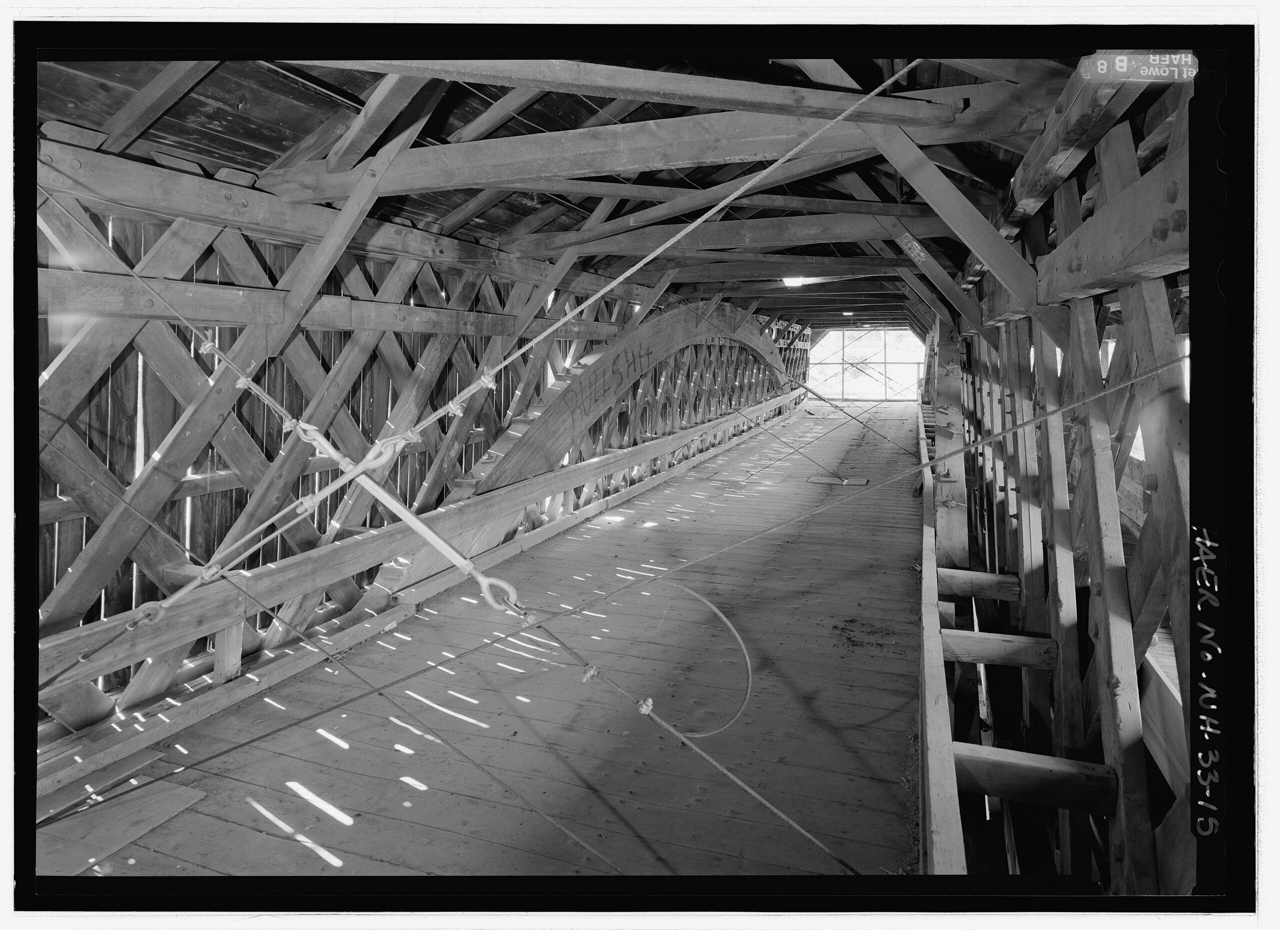
| Description | Bath-Haverhill Bridge, spanning the Ammonoosuc River, bypassed section of Ammanoosuc Street (SR 135), Woodsville, Grafton County, New Hampshire, USA. Built 1829. This image is part of the Historic American Engineering Record (HAER), created by the Library of Congress, and hence is in the public domain. Survey number: HAER NH-33. Jet Lowe, photographer, July 2003. See: https://www.loc.gov/pictures/item/nh0272/ | ||||
| Date | |||||
| Source | Daderot | ||||
| Author | Historic American Engineering Record (HAER), creator | ||||
| Permission (Reusing this file) |
|
Licensing[edit]
| This image or media file contains material based on a work of a National Park Service employee, created as part of that person's official duties. As a work of the U.S. federal government, such work is in the public domain in the United States. See the NPS website and NPS copyright policy for more information. |
|
File history
Click on a date/time to view the file as it appeared at that time.
| Date/Time | Thumbnail | Dimensions | User | Comment | |
|---|---|---|---|---|---|
| current | 00:01, 29 January 2012 | | 5,305 × 3,855 (8.92 MB) | Daderot (talk | contribs) |
You cannot overwrite this file.
File usage on Commons
There are no pages that use this file.