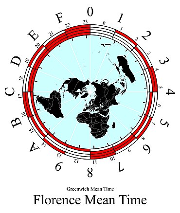
File:Beringcoordinates.jpg

Original file (4,391 × 5,201 pixels, file size: 1.75 MB, MIME type: image/jpeg)
Captions
Captions
 |
 |
| DescriptionBeringcoordinates.jpg |
Hexadecimal Geo coordinates |
| Source | Own work |
| Author | Watchduck |
| Public domainPublic domainfalsefalse |
| I, the copyright holder of this work, release this work into the public domain. This applies worldwide. In some countries this may not be legally possible; if so: I grant anyone the right to use this work for any purpose, without any conditions, unless such conditions are required by law. |
File history
Click on a date/time to view the file as it appeared at that time.
| Date/Time | Thumbnail | Dimensions | User | Comment | |
|---|---|---|---|---|---|
| current | 16:29, 7 February 2008 |  | 4,391 × 5,201 (1.75 MB) | Watchduck (talk | contribs) | {{Information |Description= |Source=eigene Arbeit |Date= |Author= Tilman Piesk |Permission= |other_versions= }} |
| 19:05, 6 February 2008 |  | 4,391 × 5,201 (1.75 MB) | Watchduck (talk | contribs) | {{Information |Description=hexadecimal geo coordinates corresponding with w:en:Hexadecimal time |Source=own work |Date=2008-Feb-06 |Author= Tilman Piesk |Permission=public domain |other_versions=- }} |
You cannot overwrite this file.
File usage on Commons
The following page uses this file:
Metadata
This file contains additional information such as Exif metadata which may have been added by the digital camera, scanner, or software program used to create or digitize it. If the file has been modified from its original state, some details such as the timestamp may not fully reflect those of the original file. The timestamp is only as accurate as the clock in the camera, and it may be completely wrong.
| _error | 0 |
|---|