File:Blank map of South Europe and North Africa.svg

From Wikimedia Commons, the free media repository

Jump to: navigation, search

Blank_map_of_South_Europe_and_North_Africa.svg(SVG file, nominally 2,050 × 1,213 pixels, file size: 330 KB)

Description
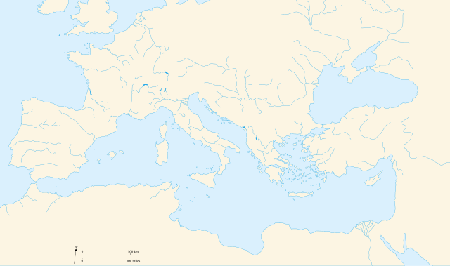
Français :
Carte vierge de l'Europe du Sud et du Bassin Méditerranée dans l'Antiquité
English:
Blank map of South Europe and North Africa at Antic period
Date

09/08/2007

Source

Own work

Author

historicair 23:27, 8 August 2007 (UTC)

Permission
(Reusing this image)
I, the copyright holder of this work, hereby publish it under the following licenses:
GNU head Permission is granted to copy, distribute and/or modify this document under the terms of the GNU Free Documentation License, Version 1.2 or any later version published by the Free Software Foundation; with no Invariant Sections, no Front-Cover Texts, and no Back-Cover Texts. A copy of the license is included in the section entitled "GNU Free Documentation License".

Afrikaans | Alemannisch | Aragonés | العربية | Asturianu | Беларуская | Беларуская (тарашкевіца) | Български | বাংলা | ইমার ঠার/বিষ্ণুপ্রিয়া মণিপুরী | Brezhoneg | Bosanski | Català | Cebuano | Česky | Dansk | Deutsch | Ελληνικά | English | Esperanto | Español | Eesti | Euskara | فارسی | Suomi | Français | Gaeilge | Galego | עברית | Hrvatski | Magyar | Հայերեն | Bahasa Indonesia | Ido | Íslenska | Italiano | 日本語 | ქართული | ភាសាខ្មែរ | 한국어 | Kurdî / كوردی | Latina | Lëtzebuergesch | Lietuvių | 文言 | Македонски | Bahasa Melayu | Malti | Nnapulitano | Plattdüütsch | Nederlands | ‪Norsk (nynorsk)‬ | ‪Norsk (bokmål)‬ | Occitan | Polski | Português | Română | Русский | Slovenčina | Slovenščina | Shqip | Српски / Srpski | Svenska | Kiswahili | తెలుగు | ไทย | Tagalog | Türkçe | Українська | اردو | Vèneto | Tiếng Việt | Volapük | Yorùbá | 中文 | ‪中文(简体)‬ | ‪中文(繁體)‬ | +/−

Creative Commons license
Creative Commons Attribution Creative Commons Share Alike
This file is licensed under the Creative Commons Attribution ShareAlike 3.0 License. In short: you are free to share and make derivative works of the file under the conditions that you appropriately attribute it, and that you distribute it only under a license identical to this one. Official license

This licensing tag was added to this file as part of the GFDL licensing update.


Alemannisch | Català | Česky | Deutsch | Deutsch (Sie-Form) | Ελληνικά | English | Español | Eesti | Suomi | Français | Հայերեն | Hrvatski | Italiano | 한국어 | Lietuvių | Македонски | Polski | Português | Português do Brasil | Русский | Svenska | ไทย | Vèneto | Tiếng Việt | +/−

Creative Commons license
Creative Commons Attribution Creative Commons Share Alike
This file is licensed under the Creative Commons Attribution ShareAlike 2.5, Attribution ShareAlike 2.0 and Attribution ShareAlike 1.0 License. In short: you are free to share and make derivative works of the file under the conditions that you appropriately attribute it, and that you distribute it only under a license identical to this one.

العربية | Български | Català | Česky | Dansk | Deutsch | Ελληνικά | English | Español | Eesti | Euskara | فارسی | Suomi | Français | Galego | עברית | Hrvatski | Հայերեն | Italiano | 日本語 | 한국어 | Lietuvių | Македонски | Plattdüütsch | Nederlands | Polski | Português | Română | Русский | Српски / Srpski | Svenska | தமிழ் | తెలుగు | ไทย | Türkçe | Vèneto | Tiếng Việt | 中文 | ‪中文(简体)‬ | ‪中文(繁體)‬ | +/−

You may select the license of your choice.
Graphic Lab

This map was improved or created by the Wikigraphists of the Graphic Lab (fr). You can propose images to clean up, improve, create or translate as well.


Deutsch | Deutsch (Sie-Form) | Ελληνικά | English | Esperanto | Suomi | Français | Հայերեն | Italiano | Magyar | Македонски | Plattdüütsch | Occitan | Polski | Português | Русский | Türkçe | Українська | +/−


Nuvola apps locale.png This SVG file uses embedded text that can be easily translated into your language. Learn more.

For SVG images, you can use this page to translate it into your language.


العربية | Català | Česky | Dansk | Deutsch | English | Esperanto | Español | Eesti | Suomi | Français | Galego | עברית | Hrvatski | Magyar | Հայերեն | Italiano | 日本語 | 한국어 | Lietuvių | Македонски | Plattdüütsch | Nederlands | ‪Norsk (nynorsk)‬ | ‪Norsk (bokmål)‬ | Polski | Português | Русский | Svenska | Українська | +/-

File history

Click on a date/time to view the file as it appeared at that time.

Date/TimeThumbnailDimensionsUserComment
current12:50, 9 August 2007Thumbnail for version as of 12:50, 9 August 20072,050×1,213 (330 KB)Historicair (Talk | contribs)
23:27, 8 August 2007Thumbnail for version as of 23:27, 8 August 20072,050×1,213 (211 KB)Historicair (Talk | contribs) ({{Information |Description={{fr}}Carte vierge de l'Europe du Sud et du Bassin Méditerranée {{en}}Blank map of South Europe and North Africa |Source=Own work |Date=09/08/2007 |Author=~~~~ |Permission={{self2|GFDL|cc-by-sa-2.5,2.0,1.0}} |other_versions= })

There are no pages on Wikimedia Commons that link to this file. Some pages on other Wikimedia projects may link to it.

Global file usage

The following other wikis use this file: